Esvres
Esvres, also called Esvres-sur-Indre, is a commune in the Indre-et-Loire department in central France.
Esvres-sur-Indre | |
|---|---|
.svg.png.webp) Coat of arms | |
Location of Esvres-sur-Indre 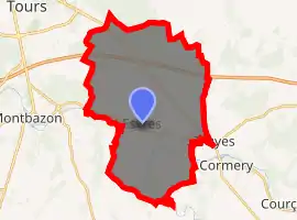
| |
 Esvres-sur-Indre  Esvres-sur-Indre | |
| Coordinates: 47°17′06″N 0°47′13″E | |
| Country | France |
| Region | Centre-Val de Loire |
| Department | Indre-et-Loire |
| Arrondissement | Tours |
| Canton | Monts |
| Government | |
| • Mayor (2014–2020) | Jean Christophe Gassot |
| Area 1 | 35.85 km2 (13.84 sq mi) |
| Population (2017-01-01)[1] | 6,010 |
| • Density | 170/km2 (430/sq mi) |
| Time zone | UTC+01:00 (CET) |
| • Summer (DST) | UTC+02:00 (CEST) |
| INSEE/Postal code | 37104 /37320 |
| Elevation | 52–96 m (171–315 ft) |
| 1 French Land Register data, which excludes lakes, ponds, glaciers > 1 km2 (0.386 sq mi or 247 acres) and river estuaries. | |
Population
The inhabitants are called Esvriens.
| Year | Pop. | ±% |
|---|---|---|
| 1793 | 1,588 | — |
| 1800 | 1,588 | +0.0% |
| 1806 | 1,779 | +12.0% |
| 1821 | 1,751 | −1.6% |
| 1831 | 1,739 | −0.7% |
| 1836 | 1,801 | +3.6% |
| 1841 | 1,820 | +1.1% |
| 1846 | 1,818 | −0.1% |
| 1851 | 1,833 | +0.8% |
| 1856 | 1,859 | +1.4% |
| 1861 | 1,871 | +0.6% |
| 1866 | 1,813 | −3.1% |
| 1872 | 1,776 | −2.0% |
| 1876 | 1,867 | +5.1% |
| 1881 | 1,808 | −3.2% |
| 1886 | 1,862 | +3.0% |
| 1891 | 1,770 | −4.9% |
| 1896 | 1,802 | +1.8% |
| 1901 | 1,765 | −2.1% |
| 1906 | 1,681 | −4.8% |
| 1911 | 1,637 | −2.6% |
| 1921 | 1,625 | −0.7% |
| 1926 | 1,543 | −5.0% |
| 1931 | 1,661 | +7.6% |
| 1936 | 1,681 | +1.2% |
| 1946 | 1,765 | +5.0% |
| 1954 | 1,955 | +10.8% |
| 1962 | 2,081 | +6.4% |
| 1968 | 2,473 | +18.8% |
| 1975 | 3,050 | +23.3% |
| 1982 | 4,160 | +36.4% |
| 1990 | 4,234 | +1.8% |
| 1999 | 4,278 | +1.0% |
| 2006 | 4,411 | +3.1% |
| 2009 | 4,481 | +1.6% |
References
- "Populations légales 2017". INSEE. Retrieved 6 January 2020.
| Wikimedia Commons has media related to Esvres. |
| Authority control |
|
|---|
This article is issued from Wikipedia. The text is licensed under Creative Commons - Attribution - Sharealike. Additional terms may apply for the media files.