Sainte-Catherine-de-Fierbois
Sainte-Catherine-de-Fierbois is a commune in the Indre-et-Loire department in central France.
Sainte-Catherine-de-Fierbois | |
|---|---|
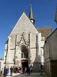
 The church of Sainte-Catherine, in Sainte-Catherine-de-Fierbois | |
.svg.png.webp) Coat of arms | |
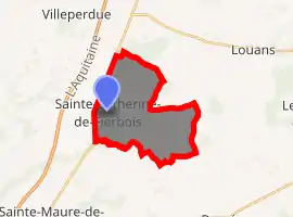
Location of Sainte-Catherine-de-Fierbois 
| |
 Sainte-Catherine-de-Fierbois  Sainte-Catherine-de-Fierbois | |
| Coordinates: 47°09′30″N 0°39′16″E | |
| Country | France |
| Region | Centre-Val de Loire |
| Department | Indre-et-Loire |
| Arrondissement | Tours |
| Canton | Sainte-Maure-de-Touraine |
| Government | |
| • Mayor (2008–2014) | Popelier Vincent |
| Area 1 | 15.49 km2 (5.98 sq mi) |
| Population (2017-01-01)[1] | 761 |
| • Density | 49/km2 (130/sq mi) |
| Time zone | UTC+01:00 (CET) |
| • Summer (DST) | UTC+02:00 (CEST) |
| INSEE/Postal code | 37212 /37800 |
| Elevation | 92–129 m (302–423 ft) |
| 1 French Land Register data, which excludes lakes, ponds, glaciers > 1 km2 (0.386 sq mi or 247 acres) and river estuaries. | |
It is a stop on the Way of St. James.[2]
Population
| Year | Pop. | ±% |
|---|---|---|
| 1793 | 507 | — |
| 1800 | 509 | +0.4% |
| 1806 | 543 | +6.7% |
| 1821 | 582 | +7.2% |
| 1831 | 556 | −4.5% |
| 1836 | 618 | +11.2% |
| 1841 | 610 | −1.3% |
| 1846 | 640 | +4.9% |
| 1851 | 694 | +8.4% |
| 1856 | 699 | +0.7% |
| 1861 | 667 | −4.6% |
| 1866 | 635 | −4.8% |
| 1872 | 596 | −6.1% |
| 1876 | 562 | −5.7% |
| 1881 | 570 | +1.4% |
| 1886 | 570 | +0.0% |
| 1891 | 574 | +0.7% |
| 1896 | 570 | −0.7% |
| 1901 | 618 | +8.4% |
| 1906 | 620 | +0.3% |
| 1911 | 657 | +6.0% |
| 1921 | 551 | −16.1% |
| 1926 | 542 | −1.6% |
| 1931 | 514 | −5.2% |
| 1936 | 510 | −0.8% |
| 1946 | 511 | +0.2% |
| 1954 | 506 | −1.0% |
| 1962 | 436 | −13.8% |
| 1968 | 499 | +14.4% |
| 1975 | 529 | +6.0% |
| 1982 | 484 | −8.5% |
| 1990 | 539 | +11.4% |
| 1999 | 611 | +13.4% |
| 2006 | 648 | +6.1% |
| 2009 | 657 | +1.4% |
References
- "Populations légales 2017". INSEE. Retrieved 6 January 2020.
- Cyrès, Groupe. "L'édito". Ste Catherine de Fierbois, Bienvenue sur le site de la Mairie de Sainte Catherine de Fierbois. Retrieved Sep 3, 2020.
This article is issued from Wikipedia. The text is licensed under Creative Commons - Attribution - Sharealike. Additional terms may apply for the media files.