Saint-Christophe-sur-le-Nais
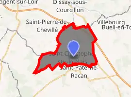
Saint-Christophe-sur-le-Nais is a commune in the Indre-et-Loire department in central France. It is situated on the border of the department of Sarthe, 30 km (19 mi) northwest of Tours.
Saint-Christophe-sur-le-Nais | |
|---|---|
.svg.png.webp) Coat of arms | |
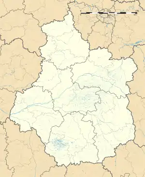
Location of Saint-Christophe-sur-le-Nais 
| |
 Saint-Christophe-sur-le-Nais  Saint-Christophe-sur-le-Nais | |
| Coordinates: 47°37′01″N 0°28′36″E | |
| Country | France |
| Region | Centre-Val de Loire |
| Department | Indre-et-Loire |
| Arrondissement | Chinon |
| Canton | Château-Renault |
| Government | |
| • Mayor (2008–2014) | Jean Poussin |
| Area 1 | 18.27 km2 (7.05 sq mi) |
| Population (2017-01-01)[1] | 1,127 |
| • Density | 62/km2 (160/sq mi) |
| Time zone | UTC+01:00 (CET) |
| • Summer (DST) | UTC+02:00 (CEST) |
| INSEE/Postal code | 37213 /37370 |
| Elevation | 52–127 m (171–417 ft) |
| 1 French Land Register data, which excludes lakes, ponds, glaciers > 1 km2 (0.386 sq mi or 247 acres) and river estuaries. | |
Geography
The railway linking Caen, Le Mans and Tours ensures a regular traffic for goods and passengers at the Saint-Paterne-Racan station located 2 km (1.2 mi) SE. There are daily buses to Tours. The river Escotais is full of fish and attracts many fishermen. The commune is 18.27 km2 (7.05 sq mi), 1.33 km2 (0.51 sq mi) are meadows, 16 km2 (6.2 sq mi) are farmlands including 14.09 km2 (5.44 sq mi) arable lands and 0.7 km2 (0.27 sq mi) of orchards are found.
History
The village was founded around the year 1000. It received fortifications in the 13th century. On the other side of the railway, the agglomerated part, Le Faubourg de Vienne had workmen of flourishing industries of the commune. Saint-Christophe-sur-le-Nais includes the presents of many underground cavities, many slopes that used to be covered with vines add the undeniable charm to the village.
Population
| Year | Pop. | ±% |
|---|---|---|
| 1793 | 1,607 | — |
| 1800 | 1,734 | +7.9% |
| 1806 | 1,560 | −10.0% |
| 1821 | 1,391 | −10.8% |
| 1831 | 1,522 | +9.4% |
| 1836 | 1,515 | −0.5% |
| 1841 | 1,504 | −0.7% |
| 1846 | 1,522 | +1.2% |
| 1851 | 1,392 | −8.5% |
| 1856 | 1,232 | −11.5% |
| 1861 | 1,234 | +0.2% |
| 1866 | 1,127 | −8.7% |
| 1872 | 1,079 | −4.3% |
| 1876 | 1,120 | +3.8% |
| 1881 | 1,108 | −1.1% |
| 1886 | 1,111 | +0.3% |
| 1891 | 1,141 | +2.7% |
| 1896 | 1,103 | −3.3% |
| 1901 | 1,054 | −4.4% |
| 1906 | 1,091 | +3.5% |
| 1911 | 1,065 | −2.4% |
| 1921 | 933 | −12.4% |
| 1926 | 910 | −2.5% |
| 1931 | 907 | −0.3% |
| 1936 | 891 | −1.8% |
| 1946 | 912 | +2.4% |
| 1954 | 916 | +0.4% |
| 1962 | 971 | +6.0% |
| 1968 | 1,022 | +5.3% |
| 1975 | 932 | −8.8% |
| 1982 | 877 | −5.9% |
| 1990 | 925 | +5.5% |
| 1999 | 965 | +4.3% |
| 2006 | 1,089 | +12.8% |
| 2009 | 1,098 | +0.8% |
In 1999, 20% of the population were under the age of 20.
Employment
The commune's unemployment rate ranges from 29% to 33%.