Veigné
Veigné is a commune in the Indre-et-Loire department in central France.
Veigné | |
|---|---|
_%C3%89glise_Saint-Maxent.JPG.webp) The church of Saint-Maxent, in Veigné | |
.svg.png.webp) Coat of arms | |
Location of Veigné 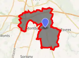
| |
 Veigné  Veigné | |
| Coordinates: 47°17′18″N 0°44′18″E | |
| Country | France |
| Region | Centre-Val de Loire |
| Department | Indre-et-Loire |
| Arrondissement | Tours |
| Canton | Monts |
| Government | |
| • Mayor (2008–2014) | Patrick Michaud |
| Area 1 | 26.58 km2 (10.26 sq mi) |
| Population (2017-01-01)[1] | 6,266 |
| • Density | 240/km2 (610/sq mi) |
| Time zone | UTC+01:00 (CET) |
| • Summer (DST) | UTC+02:00 (CEST) |
| INSEE/Postal code | 37266 /37250 |
| Elevation | 51–94 m (167–308 ft) |
| 1 French Land Register data, which excludes lakes, ponds, glaciers > 1 km2 (0.386 sq mi or 247 acres) and river estuaries. | |
Géography
Veigné is located next to the Indre River, a dozen kilometres from Tours.
Population
|
|
References
- "Populations légales 2017". INSEE. Retrieved 6 January 2020.
| Wikimedia Commons has media related to Veigné. |
| Authority control |
|---|
This article is issued from Wikipedia. The text is licensed under Creative Commons - Attribution - Sharealike. Additional terms may apply for the media files.