Jharsa
Jharsa is a village in Gurugram (city and tehsil) of Haryana State, India. It has a population of about 32,709; it is located 10 kilometres (6.2 mi) from the Gurugram city centre and 254 kilometres (158 mi) from the state's main city, Chandigarh.[1] It is surrounded by Mohyal Colony, Patel Nagar, Kirti Nagar, Sectors 15, 31, 32, 39, 40, 46, and Indra Colony.
Jharsa | |
|---|---|
Village | |
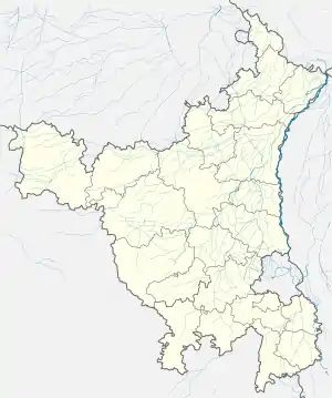 Jharsa Location in Haryana, India  Jharsa Jharsa (India) | |
| Coordinates: 28.444921°N 77.073627°E | |
| Country | |
| State | Haryana |
| Region | North India |
| District | Gurgaon |
| Government | |
| • Type | Local government |
| • Body | Municipal Corporation, Gurgaon |
| Languages | |
| • Official | Hindi Haryanvi |
| Time zone | UTC+5:30 (IST) |
| PIN | |
| ISO 3166 code | IN-HR |
| Vehicle registration | HR-26-XX-XXXX |
| Website | haryana |
History
The history of Jharsa dates back to medieval times. During the mughal and British colonial era, Jharsa was a paragana in Delhi subah, and Gurgaon was just a small village. The Report of a Tour in Eastern Rajputana in 1882-83,[2] published in 1885 by Alexander Cunningham (the then Director-General of the Archaeological Survey of India), mentions a stone pillar at Gurgaon of a local feudal lord "Durgga Naga" with the 3-line inscription "Samvat 729 or 928, Vaisakh badi 4, Durgga Naga lokatari bhuta", dating back to 672 or 871 AD. The paragana of Badshahpur-Jharsa was ruled by Begum Samru (b.1753 – d.1836), who built a palace for herself between Badshahpur and Jharsa.[3] Jharsa was the place of Samru's principal cantonment.[4] She built palaces at Sardhana, Chandni Chowk in Delhi and Jharsa; parts of her fort compound have been completely lost to encroachments.
Jharsa was taken over by the British in 1836 after Samru's death; they established a civil line at Jharsa, and a cavalry cantonment at nearby Hiyadatpur.[5]
A palace building located between Gurgaon and Jharsa village was used as the official residence and camp office of the district collector of Gurugram district. Built in Islamic style, the ruins of this palace survived till about 2008 in Gurgaon.[6]
Major Jean Etienne's tomb (also known as the "French Memorial of Jharsa") is the tomb of a Bordelais soldier in Begum Samru's army, presently located in a park at Mohyal colony in Jharsa of Sector-40 of Gurugram.[7][4][8] Etienne, born in 1746, served Begum Samru from 1786 until his death on 5 June 1821.[4] A restoration project for the tomb, to be undertaken by INTACH, was approved by the government in 2018.[8]
An idol of Sitla Mata in Gurugram, according to an 1882 land revenue settlement report, was brought there 400 years earlier (in the 15th century). Begum Samru claimed the offerings from the Sitla Mata temple of Gurugram during the Chaitra month, and the revenue from the offerings given to the deity during other months was distributed among prominent Jat zamindars of the area.[5] In 1818, Bharawas district was disbanded and Gurugram was made a new district, and in 1821, the Bharaswas cantonment was also moved to Hidayatpur in Gurugram.[9]
Several people from Jharsa took part in the Indian rebellion of 1857. Among them was Bhakhtawar Singh Thakran, a jagirdar who aided the Mughal emperor Bahadur Shah, and was caught and hanged by the British for doing so. His property was given by the British to a native of Badshahpur village, as a reward for help against the rebels.[10]
Geography
Location
Jharsa lies near the Aravalli Range, within the Gurugram city in the National Capital Region. Other villages in the vicinity are Wazirabad, Samaspur, Islampur, Silokhera, Tigra, Ghata, and Kanhai.[11]
Climate of Jharsa
| Climate data for Jharsa | |||||||||||||
|---|---|---|---|---|---|---|---|---|---|---|---|---|---|
| Month | Jan | Feb | Mar | Apr | May | Jun | Jul | Aug | Sep | Oct | Nov | Dec | Year |
| Average high °F (°C) | 70.0 (21.1) |
75.6 (24.2) |
86.0 (30.0) |
97.2 (36.2) |
103.3 (39.6) |
102.7 (39.3) |
95.2 (35.1) |
91.9 (33.3) |
93.0 (33.9) |
91.2 (32.9) |
82.9 (28.3) |
73.4 (23.0) |
88.5 (31.4) |
| Average low °F (°C) | 45.1 (7.3) |
50.2 (10.1) |
59.7 (15.4) |
70.7 (21.5) |
78.6 (25.9) |
82.9 (28.3) |
79.9 (26.6) |
78.6 (25.9) |
75.9 (24.4) |
67.1 (19.5) |
55.0 (12.8) |
46.8 (8.2) |
65.8 (18.8) |
| Average rainfall inches (mm) | 0.80 (20.3) |
0.59 (15.0) |
0.62 (15.8) |
0.26 (6.7) |
0.69 (17.5) |
2.16 (54.9) |
9.11 (231.5) |
10.19 (258.7) |
5.03 (127.8) |
1.43 (36.3) |
0.20 (5.0) |
0.31 (7.8) |
31.39 (797.3) |
| Average rainy days | 1.7 | 1.3 | 1.2 | 0.9 | 1.4 | 3.6 | 10.0 | 11.3 | 5.4 | 1.6 | 0.1 | 0.6 | 39.1 |
| Mean monthly sunshine hours | 213.9 | 217.5 | 238.7 | 261.0 | 263.5 | 198.0 | 167.4 | 176.7 | 219.0 | 269.7 | 246.0 | 217.0 | 2,688.4 |
Notable residents
The village has been home to many notable people and athletes. Some of them are:
- Pritam Rani Siwach, a former women's hockey team captain of India
- Virender Singh (Thakran) (Dheeraj Pahalwan), a wrestler who won a bronze medal in the Junior World Wrestling Championship and won a silver medal in Commonwealth Wrestling Championship in 1995.
- Muskan Thakran, who played at national-level lawn tennis and won three gold medals in Ahmedabad, Bangkok, and Pune, and two silver medals in Chandigarh from 2014 to 2018.
- Manjeet Thakran, an international bodybuilder and national powerlifter in 2014.
- Gautam Thakran, a world championship player of soft tennis, who played in South Korea in 2018.
- Pritam Rani Siwach, captain of the Indian women's hockey team in 2008
- Virender Thakran, railway wrestler, winner of a bronze medal in the 1991 World Wrestling Championships, Gold Medalist in the 1995 Commonwealth Games in Australia, and gold medalist in the 1995 SAF Games
- Bhuvi Thakran
See also
- List of National Parks & Wildlife Sanctuaries of Haryana, India
- List of Monuments of National Importance in Haryana
- List of State Protected Monuments in Haryana
- Indus-Sarasvati Valley Civilization sites in Haryana
- Haryana Tourism
References
- "Local information for Jharsa - Location coordinates (lat long) on map, businesses, tourist places, hotels & restaurants, user added information, local resources". Geolysis.com. Retrieved 1 January 2016.
- https://ia802604.us.archive.org/0/items/reportatourinea01cunngoog/reportatourinea01cunngoog.pdf
- Begum Samru Palace, Gurugram, Haryana Tourism.
- Hope for decrepit French memorial in Gurugram as official issues directions for restoration, Hindustan Times, Jun 2018.
- Gurugram plan a misdirected govt move from history to myth, Times of India.
- "A queen's magnificent church". The Indian Express. 2 September 2012.
- A 200-year-old memorial in Gurugram dedicated to the Begum who commanded an army
- 200-year-old memorial in Gurugram dedicated to the Begum who commanded an army, Hindustan Times, Jun 2018.
- Yashpal Gulia, 2012, Heritage of Haryana.
- Who's Who of Indian Martyrs, Vol. 3
- "Jharsa Gurgaon PinCode". citypincode.in. Retrieved 15 March 2014.
Gurgaon district topics | ||
|---|---|---|
| Cities and towns | 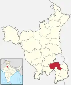 | |
| Monuments | ||
| Transport | ||
| Lok Sabha constituencies | ||
| Education | ||
| Economy | ||
| Leadership |
| ||||||||||||||
|---|---|---|---|---|---|---|---|---|---|---|---|---|---|---|---|
| Organisation |
| ||||||||||||||
| Personnel |
| ||||||||||||||
| Operations | |||||||||||||||
| Equipment |
| ||||||||||||||
| Other topics | |||||||||||||||
| |||||||||||||||
