Baubau
Baubau is a city in Southeast Sulawesi province, Indonesia. The city is located on the southwest coast of Buton island. Baubau attained city status on 21 June 2001, based on Indonesian Law Number 13, for the year 2001.
Baubau | |
|---|---|
| City of Baubau Kota Baubau | |
 Baubau as seen from the Buton Palace Fortress, with the island of Muna in the distance. | |
 Coat of arms | |
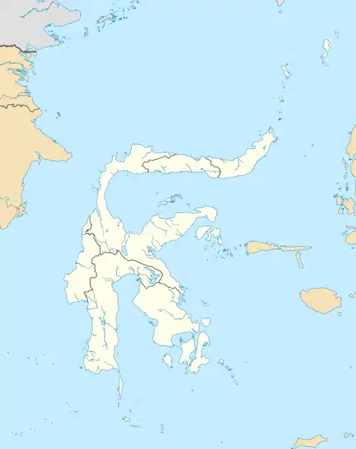
 Location within Southeast Sulawesi | |
| Coordinates: 5.46667°S 122.633°E | |
| Country | |
| Province | |
| Founded | 17 October 1541 |
| Government | |
| • Mayor | A.S. Tamrin |
| • Vice Mayor | La Ode Ahmad Monianse |
| Area | |
| • Total | 293.18 km2 (113.20 sq mi) |
| Population (2015) | |
| • Total | 154,877 |
| Time zone | UTC+8 (Indonesia Central Time) |
| Area code | (+62) 402 |
| Website | baubaukota.go.id |

The port of Murhum serves the city's sea transportation, with a ferry terminal operated by the Indonesian state-owned sealiner, Pelni.
History
During the fifteenth century (1401–1499), Baubau was the center of the Buton (or Wolio) kingdom. There were no historical records known from this kingdom, except from a description in the Nagarakretagama text, an Old Javanese eulogy written by Mpu Prapanca during the Majapahit Kingdom. Mpu Prapanca described a village called Buton, or Butuni, with its garden and irrigation system, and noted that there was a king who ruled in the area.
The kingdom of Buton was originally established by Mia Patamiana, a musketeer from a group of four, acting as a chieftain; the four musketeers were known as Sipanjonga, Simalui, Sitamanajo, and Sijawangkati, based on a historical record Semenanjung Tanah Melayu (or the Malay peninsula record) written in the thirteenth century. They arrived on the island and founded the village of Wolio, appointing small district leaders known as Limbo. Later, they united into the Kingdom of Buton and appointed Wa Kaa Kaa as the first queen in 1332; she was the wife of one of the descendants of a Majapahit ruler.
In 1542, the Kingdom of Buton transformed itself into sultanate when Islam entered the area. The first sultan of Buton was Lakilaponto, titled as Sultan Murhum Kaimuddin Khalifatul Khamis. The last sultan, the 38th, was Muhammad Falihi Kaimuddin in 1960.
Geography
Geographically, Baubau lies between lattitute 5.21°S–5.33°S and longitude 122.30°E–122.47°E, and is located in the southern part of Southeast Sulawesi region. Baubau is bordered to the north by the Buton Strait (between Buton Island and Muna Island), to the east by the Kapontori District, to the south by the Pasarwajo District and to the west by the Kadatua District. The area of the city is about 293 km2, with the sea area around 30 km2.
The topographical condition of Baubau mainly consists of mountains and hills. Long coasts and long hills stretch above the surrounding terrain with the variation of altitude between 0–100 meters above mean sea level. Baubau has a land slope between 8–30%.
Similar to other Indonesian cities, Baubau has tropical weather. The day and night temperatures vary from around 29°–33 °C during the daytime and 20°–29 °C during the nighttime. The ecosystems consist of rain forests, spiny forests, and desert.
Administration
The city is divided into eight districts (kecamatan), tabulated below with their areas and their populations at the 2010 Census[1] and according to the latest (as at 2015) official estimates.[2]
| Name | Area in km2 | Population Census 2010[3] | Population Estimate 2015[4] |
|---|---|---|---|
| Betoambari | 31.40 | 16,283 | 18,433 |
| Murhum | 6.09 | 19,261 | 21,793 |
| Batupoaro | 1.68 | 25,889 | 29,291 |
| Wolio | 33.56 | 37,974 | 42,862 |
| Kokalukuna | 16.85 | 16,736 | 18,929 |
| Sorawolio | 111.00 | 7,122 | 8,025 |
| Bungi | 59.20 | 7,096 | 8,030 |
| Lea-Lea | 33.40 | 6,630 | 7,514 |
The city was previously divided into just 4 districts; Betoambari (then including Murhum) had an area of 34.34 km2; Wolio (then including Kokalukuna) had an area of 26.77 km2; Sorawolio had an area of 82.25 km2; and Bungi (then including Lea-Lea) had an area of 76.64 km2. The most recent addition is Batupoaro, cut out of Murhum.
Demographics
The population of the city is 137,118 as of the decennial census 2010[5] which in 2015 has risen to an estimated 154,877, consisting mainly of the Butonese, Buginese, Moluccans, Javanese, and Sundanese people. It is the second largest city in the province after the capital, Kendari. The city's economy is mainly in the service industry, such as the hotel industry (30%) and trade (20%), principally sea trade, agriculture (20%), and coconut production, while the remainder is in the public transportation business. Baubau is also a major fishing center in Sulawesi for producing sea cucumber.
Transportation
Port Murhum serves the city, and is also the island's main access for transportation. Direct sea connections include Jakarta and Kendari. The following passenger ships of the Indonesian state-owned sealiner company PT Pelni serve Baubau: KM Bukit Siguntang, KM Ciremai, KM Dorolonda, KM Kelimutu, KM Sinabung, and KM Lambelu.[6]
The city is served by Betoambari Airport, where connections are available to Sultan Hasanuddin International Airport near Makassar, South Sulawesi.
See also
References
- Biro Pusat Statistik, Jakarta, 2011.
- Badan Pusat Statistik, Jakarta, 2016.
- Biro Pusat Statistik, Jakarta, 2011.
- Badan Pusat Statistik, Jakarta, 2016.
- "Archived copy" (PDF). Archived from the original (PDF) on 15 May 2011. Retrieved 25 April 2011.CS1 maint: archived copy as title (link)
- 2008 sailing schedule
External links
| Wikimedia Commons has media related to Baubau. |
Regencies and cities of Southeast Sulawesi | ||
|---|---|---|
Capital: Kendari | ||
| Regencies | ||
| Cities | ||
| 2,000,000 and more | |
|---|---|
| 1,000,000–1,999,999 | |
| 500,000–999,999 | |
| 200,000–499,999 | |