List of Recorded Texas Historic Landmarks (Grayson-Hudspeth)
The following is a partial list of Recorded Texas Historic Landmarks (RTHLs) arranged by county as designated by the Texas Historical Commission and local county historical commissions in Texas. This page includes RTHLs in the following counties: Grayson, Gregg, Grimes, Guadalupe, Hale, Hall, Hamilton, Hansford, Hardeman, Hardin, Harris, Harrison, Hartley, Haskell, Hays, Hemphill, Henderson, Hidalgo, Hill, Hockley, Hood, Hopkins, Houston, Howard, and Hudspeth.
| Anderson-Callahan • Cameron-Duval • Eastland-Gray • Grayson-Hudspeth • Hunt-Martin • Mason-Rusk • Sabine-Travis • Trinity-Zavala |
KEY
Landmarks with multiple historic designations are colored according to their highest designation within the following hierarchy.
| ⁕ Listed individually on the National Register of Historic Places (NRHP) as a National Historic Landmark |
| § Listed individually as or as part of a State Historic Site |
| # Listed individually as or as part of a State Antiquities Landmark |
Grayson County
| Registered Texas Historic Landmark | Image | Marker Number | Physical Address | Nearest city | Year designated | Location Description[1][2] |
|---|---|---|---|---|---|---|
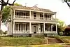
| Barron-Veazey House | 7337 | 104 W. Umphress St. | Van Alstyne | 1990 | 104 Umphress at Preston | |
| Bennett-Richardson House | 7339 | 125 Center St. | Whitesboro | 1992 | 125 Center St. at North St. | |
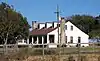
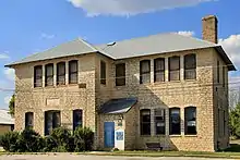
| Birthplace of Dwight D. Eisenhower |
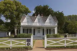 |
7359 | 609 S. Lamar Ave. | Denison | 1962 | Lamar at Day St. |
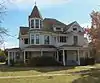
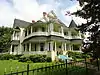
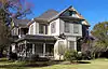
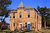
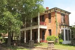
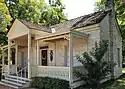
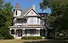
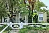
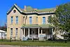
| Captain N. A. Birge House |
.jpg.webp) |
7342 | 727 W. Birge St. | Sherman | 1988 | 727 W. Birge at Woods St. |
| Carr-Taliaferro House | 7345 | 516 N. Grand Ave. | Sherman | 1978 | ||
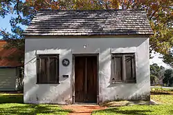
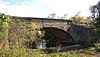
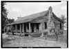
| Cold Springs Log Cabin School | 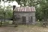 |
7352 | 111 R.C. Vaughan Dr. | Denison | 1977 | Loy Lake Park / Frontier Town, west side of US 75 |
| Davis-Ansley Log Cabin Home | 7354 | 111 R.C. Vaughan Dr. | Denison | 1976 | Loylake Park / Frontier Village, west side of US 75 | |
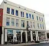
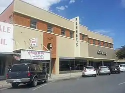
| E. M. Kohl Building |
.jpg.webp) |
7392 | 300 E. Main St. | Denison | 1976 | |
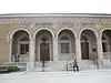
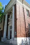
| Federal Building (United States Courthouse) |
.jpg.webp) |
11908 | 101 E. Pecan St. | Sherman | 1997 | |
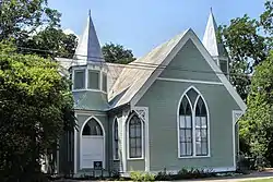
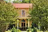
| First Presbyterian Church and Manse | .jpg.webp) |
7366 | 202 N. Blanton St. | Whitewright | 1994 | Blanton and Walnut St. |
| Friendship Methodist Church | 7373 | 293 N. Friendship Rd. | Sherman | 1967 | from Sherman, take SH 56 west about 2 mi. to Friendship Rd., go north .7 mi. to church | |
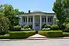
| Grayson College | .jpg.webp) |
7375 | 300 W. Cedar St. | Whitewright | 1965 | Grady St. between College and Cedar |
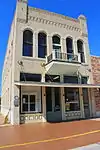
| Hall Furniture Building |
 |
13166 | 118 W. Lamar St. | Sherman | 2002 | Sherman, 118 W. Lamar |
| J. K. Miller House | 7407 | 1401 W. Walker St. | Denison | 1972 | 1401 W. Walker St. at Brown St. | |
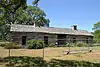
| Jesse Elvis Hendricks Log Cabin | 7384 | 111 R.C. Vaughan Dr. | Denison | 1983 | Loy Lake Park / Frontier Village, US 75 | |
| Kentuckytown Baptist Church | 7390 | 264 Kentucky Town Rd. | Whitewright | 1966 | on Kentucky Town Road, .25 mi. north of SH 11, 3 mi. west of Whitewright | |
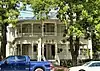
| Lone Star Masonic Lodge No. 403, A. F. & A. M. |
7396 | 115 S. Fannin Ave. | Denison | 1985 | 115 S. Fannin Ave. at Chesnut | |
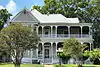
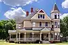
| Martindale-Lackey-Hudgins House | .jpg.webp) |
16389 | 331 W. Grand St. | Whitewright | 2010 | Southeast corner of Chapman St and W. Grand Ave. |
| Masonic Temple 1924 | 7404 | 201 E. Lamar St. | Sherman | 1988 | 201 E. Lamar St. at Walnut | |
| Mayes House | 16390 | 7 Ridgeway Cir. | Denison | 2010 | 7 Ridgeway Circle | |
| Metz House | 7406 | 506 S. Crockett St. | Sherman | 1976 | ||
| Odd Fellows Hall | 7414 | 109 N. Walnut St. | Sherman | 1965 | 109 N. Walnut at Houston St. | |
| Old Bass Home | 7338 | 111 R.C. Vaughan Dr. | Denison | 1968 | Loy Lake Park / Frontier Village, west side of US 75 | |
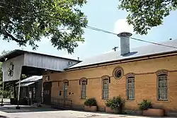
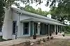
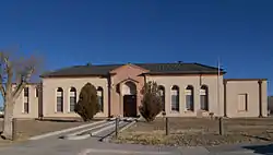
| Old Sherman Public Library |
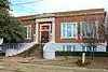 |
11538 | 301 S. Walnut St. | Sherman | 1986 | |
| Old Thompson Home | 11541 | 111 R.C. Vaughan Dr. | Denison | 1968 | at Loy Lake Park, Hwy 75 south and Loy Lake Road | |
| Pioneer Cotton Seed Oil Mill | 7419 | 1201 E. Pecan St. | Sherman | 1967 | ||
| Pool Manufacturing Company | 7420 | 1601 S. Montgomery St. | Sherman | 1967 | ||
| R. N. Younger Home | 11564 | 200 Center St. | Whitesboro | 1965 | ||
| Roberts House | 11526 | 915 S. Crockett St. | Sherman | 1993 | 915 S. Crockett St. at Spring St. | |
| Samuel E. and Mary C. Marshall House | .jpg.webp) |
12751 | 318 W. Walnut St. | Whitewright | 2001 | 318 W. Walnut St. |
| St. Luke's Church | 11529 | 431 W. Woodard St. | Denison | 1969 | Fannin at Woodard St. | |
| St. Mary's Catholic Church | 12710 | 727 S. Travis St. | Sherman | 2001 | 727 S. Travis | |
| St. Patrick's Catholic Church | 11531 | 314 N. Rusk Ave. | Denison | 1983 | ||
| St. Patrick's Catholic Church | 15233 | 314 N. Rusk Ave. | Denison | 1983 | ||
| The Fitzgerald Home | 7371 | 111 R.C. Vaughan Dr. | Denison | 1969 | Frontier Village | |
| Thomas V. Munson Home | 7411 | 530 W. Hanna St. | Denison | 1967 | 530 W. Hanna St. at Mirick St. | |
| Umphress-Taylor Home |
 |
11546 | 161 E. Paris St. | Van Alstyne | 1981 | 161 Paris at Preston |
| W. B. and Ella Munson Home | 17519 | 1127 W. Morton St. | Denison | 2013 | Northeast corner of the intersection of West Morton Street and North Perry Avenue | |
| Walnut Street Church of Christ | 11549 | 315 S. Walnut St. | Sherman | 1986 |
Gregg County
| Registered Texas Historic Landmark | Image | Marker Number | Physical Address | Nearest city | Year designated | Location Description[1][2] |
|---|---|---|---|---|---|---|
| Brown-Birdsong House | 9935 | 3406 Morrison St. | Longview | 1965 | Moved in May 2011 from 104 W. Whaley Street. Marker reported missing Oct. 2014. | |
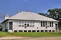
| Bumpus House | 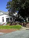 |
9936 | 116 W. Pacific Ave. | Gladewater | 1994 | House burned in 2014. Marker on display at Gladewater Museum. |
| Campbell "Honeymoon Home" | 9938 | 500 N. Second St. | Longview | 1963 | 500 N. Second St. at Magrill St. | |
| Dean-Keener-Crim House | 9943 | 101 E. Lantrip St. | Kilgore | 1975 | ||
| Dr. E. L. and Nannie Lewis Walker House | 13281 | 214 E. Commerce Ave. | Gladewater | 2004 | 214 E Commerce | |
| Dundee Angus Ranch Home, 1859 | 9945 | 3401 Dundee Rd. | Longview | 1964 | ||
| Early Teague Home | 10000 | 322 N. Teague St. | Longview | 1966 | ||
| Everett Building |
.jpg.webp) |
9948 | 214-216 N. Freedonia St. | Longview | 1983 | |
| F. L. Whaley House |
 |
10005 | 101 E. Whaley St. | Longview | 1964 | |
| Finch Family Home | 9949 | 2024 E. Cotton St. | Longview | 1967 | ||
| First Presbyterian Church | 9954 | 815 E. Main St. | Kilgore | 1989 | Main and Lawrence St. | |
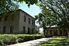
| Harmon General Hospital Chapel | 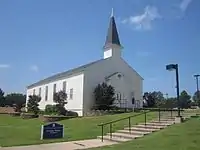 |
11918 | Harris Dr. S of Stegall Dr, LeTourneau University | Longview | 1997 | SW of intersection of Stegall and Harris |
| Judge J. N. Campbell Home | 9937 | 433 S. Center St. | Longview | 1965 | Marker in storage as of Oct. 2014. | |
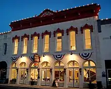
| Kilgore College Administration Building | .jpg.webp) |
9968 | 1101 S. Henderson Blvd. | Kilgore | 1990 | |
| Kilgore National Bank Building | 9971 | 118 S. Kilgore St. | Kilgore | 1991 | ||
| Kilgore Public Library | .jpg.webp) |
9972 | 301 N. Henderson Blvd. | Kilgore | 1990 | |
| Lewis-Bivins House | 11678 | 208 E. College St. | Longview | 1999 | 208 E. College St., Longview | |
| Longview Community Center | 9978 | 500 E. Whaley St. | Longview | 1994 | ||
| Longview Municipal Building and Central Fire Station | .jpg.webp) |
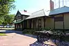
12759 | 100 E. Cotton St. | Longview | 2001 | 100 E. Cotton St. |
| Longview Train Depot | 17982 | 905 Pacific Ave. | Longview | 2014 | Building is located on the north side of Pacific Avenue, just off Mobberly Avenue immediately south of the Mobberly railroad underpass. The marker will be located on the building, either in the open-air waiting area or at the main entrance on the south side. | |
| Northcutt House |
 |
9985 | 313 S. Fredonia St. | Longview | 1982 | |
| Rembert-Harrison House |
 |
17733 | 316 S. Fredonia St. | Longview | 2013 | |
| Rock Springs Schoolhouse | 9991 | Old Kilgore Rd. N of Rock Springs Cemetery | Gladewater | 1966 | 4.5 mi. south of Gladewater on Old Kilgore Rd. (Old 135) by Rock Springs Cemetery | |
| St. Luke's United Methodist Church | .jpg.webp) |
9995 | 401 E. Main St. | Kilgore | 1986 | |
| Turner Home | 10001 | 503 E. Methvin St. | Longview | 1964 |
Grimes County
| Registered Texas Historic Landmark | Image | Marker Number | Physical Address | Nearest city | Year designated | Location Description[1][2] |
|---|---|---|---|---|---|---|
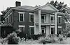
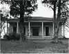
| Allen Home |
14266 | 440 Fanthorp St. | Anderson | 1965 | ||
| Anderson Baptist Church |
 |
8562 | 379 S. Main St. | Anderson | 1965 | |
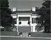
| B. B. Goodrich House |
.png.webp) |
8582 | 335 Fanthorp St. | Anderson | 1963 | 200 block of Fanthorp St., Anderson. |
| Bennett, Rueben, House |
14195 | Anderson | 1963 | |||
| Craig House | 14833 | 508 Holland St. | Navasota | 1977 | ||
| Evans House | 8572 | 412 Manley St. | Navasota | 1991 | ||
| First Presbyterian Church of Navasota | 8577 | 302 Nolan St. | Navasota | 1970 | Corner of Nolan and Holland Streets; Navasota. | |
| Foster Home | 8578 | 1015 E. Washington Ave. | Navasota | 1982 | ||
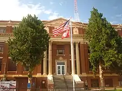
| Grimes County Courthouse |
 |
8585 | 100 S. Main St. | Anderson | 1965 | Courthouse, Anderson. |
| Henry Schumacher Home | 8614 | N end of Pierce Rd. | Navasota | 1974 | on private property - this house was moved to avoid demolition to a ranch owned by attorney John L. Pierce (NW of cemetery). *UTM coordinates are for new location of the structure.* | |
| Isham Davis Home | 8569 | 0.8 mi. W on CR 157 from CR 161 | Iola | 1965 | From Iola take FM 244 S approximately 4.3 miles to CR 162 (Lake Grove Cemetery Rd.) then E on CR 162 approximately 2 miles to CR 157; then N on CR 157 approximately .8 miles (structure is on a hilltop approximately 200 yards from road). | |
| James and Missouri Hurry House | 8591 | 1 mi. N on CR 216 from FM 149 | Richards | 1992 | from Richards, take FM 149 NE approx. 1 mi. to CR 216; then N on CR 216 approx. 1 mile. | |
| Jesse Youens Home | 8626 | 708 Holland St. | Navasota | 1967 | 708 Holland Street, Navasota | |
| Joseph Brooks Home | 8566 | 612 E. Washington Ave. | Navasota | 1981 | ||
| Leake Building |
8597 | 211 E. Washington Ave. | Navasota | 1978 | 211 E. Washington Avenue, Navasota. | |
| Lee Tabernacle Methodist Church | 8598 | 203 Teague St. | Navasota | 1995 | Corner of La Salle (Bus. SH 6) and Teague Street; Navasota. | |
| Miss Sally Thompson School Building |
8622 | 440 Fanthorp St. | Anderson | 1965 | 440 Fanthorp Street, Anderson | |
| Norwood House | 8605 | 307 Ketchum St. | Navasota | 1984 | 207 Ketchum, Navasota. | |
| Oakland Baptist Church |  |
8606 | S end of Railroad Ave. | Roans Prairie | 1967 | from the intersection of SH 90 and SH 30 in Roans Prairie go E on SH 30 approx. 100 yards, then S on Church Road approx. 200 yards; Roans Prairie. |
| Old First National Bank of Navasota |
8576 | 107 W. Washington Ave. | Navasota | 1981 | ||
| Plantersville Baptist Church | 8610 | 11555 Old Schoolhouse Rd. | Plantersville | 1967 | from the intersection of SH 105 and FM 1774 in Plantersville take FM 1774 south approximately .5 mile. | |
| Plantersville Baptist Church | 8611 | 11555 Old Schoolhouse Rd. | Plantersville | 1967 | From the intersection of SH 105 and FM 1774 in Stoneham take FM 1774 south about .5 mile to church. | |
| R. B. S. Foster Home |
 |
8579 | 7827 US 90 | Navasota | 1968 | from the intersection of SH 6 and SH 90 (East Navasota) take SH 90 approximately 1.5 miles. |
| Robert A. Horlock House | 8590 | 1215 E. Washington Ave. | Navasota | 1984 | 1215 E. Washington Ave., Navasota. | |
| Sangster House | 8613 | 1113 E. Washington Ave. | Navasota | 1974 | 1113 E. Washington Avenue, Navasota. | |
| Site of Piedmont Springs Resort |
8609 | 11.2 mi. N on FM 3096 from SH 6 | Navasota | 1967 | from the intersection of SH 6 and FM 3090 (Navasota) take FM 3096 north approx. 11.2 miles. | |
| St. Mary's Catholic Church | 12792 | 8227 CR 205 | Plantersville | 2001 | 8227 CR 205 | |
| Steele House |
 |
9408 | 217 Brewer St. | Navasota | 1974 | at the NE corner of Holland St. and Brewer St. |
| Steinhagen Log Cabin |
8617 | 201 Houston St. | Anderson | 1965 | Anderson Park on SH 90; Anderson | |
| Templeman House | 8620 | 1403 E. Washington Ave. | Navasota | 1987 | 1403 E. Washington Ave., Navasota. | |
| The Terrell House | 8621 | 412 E. Washington Ave. | Navasota | 1981 | SE corner of Old Millican Road and E. Washington Avenue, Navasota. |
Guadalupe County
| Registered Texas Historic Landmark | Image | Marker Number | Physical Address | Nearest city | Year designated | Location Description[1][2] |
|---|---|---|---|---|---|---|
| Andrew Herron Home |  |
43 | 906 W. Court St. | Seguin | 1962 | 906 Mill Road, one mile west of Courthouse on Highway 90A West **BUILDING GONE** |
| Andrew Neill Church House | 163 | 710 E. Court St. | Seguin | 1971 | 700 block of East Court Street, Seguin. | |
| Claiborne West Home | 899 | 11 mi. E on U.S. 90A | Seguin | 1962 | from Seguin take US 90A East 11 miles - house is located on highway | |
| Friedens Church | 2062 | 2555 Friedens Church Rd. | Geronimo | 1970 | from Seguin, take SH 123 about 4.5 miles. Turn left on county road, continue about 2 miles. Turn right onto county road, continue approximately 1 mile to church. | |
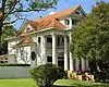
| George Francis Home (Dublin Plantation) |
.tif.jpg.webp) |
2152 | 3135 Cottonwood Creek Rd. | Kingsbury vicinity | 1968 | Private property near Cottonwood Creek Road. |
| Guadalupe High School | 2299 | 507 S. Camp St. | Seguin | 1962 | 300 block of South Austin Street, Seguin | |
| Hard Scrabble | 5 | 513 E. Nolte St. | Seguin | 1962 | 513 East Nolte (was Market) Street, Seguin | |
| Hollamon House-Erskine House |
 |
15370 | 902 N. Austin St. | Seguin | 1962 | |
| Hugo and Georgia Gibson House | 14010 | 308 S. Erkel Ave. | Seguin | 2007 | 308 S. Erkel Ave. | |
| Humphrey House |
2596 | 902 N. Austin St. | Seguin | 1962 | 902 North Austin Street, Seguin | |
| Joseph Sonka House | 2866 | 617 N. Guadalupe St. | Seguin | 1990 | 617 North Guadalupe Street, Seguin. | |
| Los Nogales |
 |
3128 | 415 S. River St. | Seguin | 1989 | |
| Moore House | 3458 | 703 Johnson Ave. | Seguin | 1981 | 703 Johnson Avenue, Seguin | |
| Sebastopol |
2016-3.jpg.webp) |
4627 | 704 Zorn St. | Seguin | 1991 | 704 Zorn Street, Seguin |
| St. Andrew's Episcopal Church | 5026 | 201 E. Nolte St. | Seguin | 1965 | at intersection of Nolte and Crockett streets, Seguin | |
| Sweet Home Vocational and Agricultural School |
 |
12565 | 3340 Sweet Home Rd. | Seguin | 2001 | |
| Tewes House |
 |
5236 | 8280 Linne Rd. | Marion | 1996 | 280 Linne Road, Seguin (correct address: 8280 Linne Road, 9.5 miles south of Marion) |
| The Women's Club Rooms |
.jpg.webp) |
5455 | 432 N. River St. | Seguin | 1962 | 432 River Street in Seguin |
Hale County
| Registered Texas Historic Landmark | Image | Marker Number | Physical Address | Nearest city | Year designated | Location Description[1][2] |
|---|---|---|---|---|---|---|
| Blasingame Home | 433 | 909 El Paso St. | Plainview | 1982 | ||
| First Baptist Church of Plainview | 1664 | 725 N. Austin St. | Plainview | 1990 | ||
| Gates Hall | 2112 | 701 N. Quincy St., Wayland Baptist University | Plainview | 1965 | Wayland Baptist College, Administration Building, SH 194, Plainview | |
| Montgomery Ward Building |
3445 | 113 W. Sixth St. | Plainview | 1982 |
Hall County
| Registered Texas Historic Landmark | Image | Marker Number | Physical Address | Nearest city | Year designated | Location Description[1][2] |
|---|---|---|---|---|---|---|
| First Presbyterian Church of Memphis | 1843 | 801 Robertson St. | Memphis | 1981 | 8th & Robertson Streets, Memphis | |
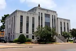
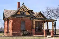
| Hall County Courthouse |
 |
2337 | 512 W. Main St. | Memphis | 2008 | 512 W. Main St |
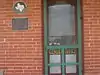
| Hotel Turkey |
.jpg.webp) |
2575 | 201 3rd St. | Turkey | 1985 | Intersecting of 3rd & Alexander Streets, Turkey; inside door of hotel |
| Shoe Bar Ranch Headquarters | 4688 | N of CR D near Lakeview | Memphis | 1962 | 12 miles west of Memphis, off S.H. 256 - NOT LOCATED. | |
| Turkey High School | 5569 | 700 Lyles St. | Turkey | 1986 | on Lyles Street, one block west of S.H. 70, next to City Hall |
Hamilton County
| Registered Texas Historic Landmark | Image | Marker Number | Physical Address | Nearest city | Year designated | Location Description[1][2] |
|---|---|---|---|---|---|---|
| Cole House | .jpg.webp) |
938 | 105 W. North St. | Hico | 1988 | 105 West North Street, Hico |
| Durham Ranch House | 1304 | CR 223 at CR 222 | Hamilton | 1962 | from Hamilton, take 281 north 1/2 mile from Town Square, go east on FM 2905 5.9 miles, go south on CR 9/10 mile to house on east side of road with stone gate entrance | |
| Francis Marion Graves Home | 2258 | 201 W. Ross St. | Hamilton | 1963 | 201 West Ross Street, Hamilton | |
| Hamilton County Courthouse |
 |
2347 | 102 N. Rice St. | Hamilton | 1967 | Courthouse lawn, Hamilton (JCT of U.S. 281 and SH 36) |
| Hamilton National Bank | 2350 | 101 E. Henry St. | Hamilton | 1966 | Northwest corner of Town Square (Courthouse Square)(corner of US 281 and East Henry), Hamilton | |
| J. G. Barbee House | 302 | S end CR 245 | Hico | 1963 | from Hico take Highway 6 east 8/10 miles turn south on first CR after Hico cemetery; proceed 1 7/10 miles south on CR, turn west on B sign onto CR 240, proceed 1 mile to house. | |
| Knights of Pythias Lodge Hall | 2968 | 110 W. Main St. | Hamilton | 1987 | 110 West Main Street, Hamilton | |
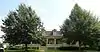
| Manning-Gordon-Henderson House | 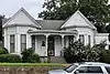 |
11925 | 121 S. Rice St. | Hamilton | 1999 | |
| Presbyterian Church | .jpg.webp) |
4113 | 600 N. Rice St. | Hamilton | 1967 | 600 North Rice Avenue (US 281 at Whitney) |
| Rock House Masonic Lodge | 4318 | 2.2 mi. S on CR 301 from SH 22 | Hamilton | 1963 | from Hamilton Eastern city limits take SH 22 east about 3.5 miles, turn south on CR 301 and proceed about 2.2 miles to site | |
| Saint Mary's Episcopal Church | 6375 | 120 W. Main St. | Hamilton | 1966 | 120 West Main Street, Hamilton | |
| St. Paul's Lutheran Church | 5074 | 1.5 mi. S on FM 3340 from FM 932 | Hamilton | 1989 | from Hamilton, 7 miles southeast on FM 932 towards Aleman, then 1.5 miles south on FM 3340. | |
| Twin Oaks | 5582 | 222 E. Baker St. | Hamilton | 1968 | end of Baker Street at Campbell Lane (in front of house), Hamilton 222 Baker Street (off US 281), Hamilton |
Hansford County
| Registered Texas Historic Landmark | Image | Marker Number | Physical Address | Nearest city | Year designated | Location Description[1][2] |
|---|---|---|---|---|---|---|
| Brandt Building | 489 | 201 Main St. | Spearman | 1980 | ||
| Hansford Cemetery | 2365 | SH 15/SH 207 6 miles (9.7 km) W of Spearman | Spearman | 1967 | from Spearman take SH 15/207 about 6 miles to cemetery | |
| Santa Fe Railroad Stationmaster's House | 4581 | 30 S. Townsend St. | Spearman | 1978 | ||
| Spearman Hotel | 5005 | 502 Davis St. | Spearman | 1967 |
Hardeman County
| Registered Texas Historic Landmark | Image | Marker Number | Physical Address | Nearest city | Year designated | Location Description[1][2] |
|---|---|---|---|---|---|---|
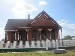
| Chillicothe First Methodist Church | 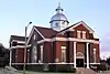 |
11926 | 301 Ave. J | Chillicothe | 1998 | |
| First Presbyterian Church of Quanah |
 |
1845 | 409 S. Main St. | Quanah | 1994 | 409 South Main Street, Suite 6 -Quanah |
| Hardeman County Courthouse |
.jpg.webp) |
12782 | 300 S. Main St. | Quanah | 2001 | 300 block of Main St. |
| Hardeman County Jail |
 |
2371 | 105 Green St. | Quanah | 1977 | Green Street |
| Medicine Mound Depot, 1910 | 3312 | 1802 E. 11th St. | Quanah | 1964 | Highway 287, Quanah at intersection of Highway 282 (SH 6) & Highway 297-Quanah | |
| Railroad Depot, Old |
 |
14376 | 100 Mercer St. | Quanah | 1964 | |
| Simpson Building |
12594 | 222 S. Main St. | Quanah | 2001 | ||
| Trinity Church of Quanah |  |
5558 | 500 DuBose St. | Quanah | 1976 | 500 DuBose Street, Quanah |
Hardin County
| Registered Texas Historic Landmark | Image | Marker Number | Physical Address | Nearest city | Year designated | Location Description[1][2] |
|---|---|---|---|---|---|---|
| Kirby-Hill House |
 |
11933 | 210 W. Main St. | Kountze | 1998 | |
| Silsbee Ice Plant | 11166 | 818 Ernest Ave. | Silsbee | 1991 | Corner of Ernest and S 4th St., Silsbee |
Harris County
| Registered Texas Historic Landmark | Image | Marker Number | Physical Address | Nearest city | Year designated | Location Description[1][2] |
|---|---|---|---|---|---|---|
| Forum of Civics |  |
10667 | 2503 Westheimer | Houston | 1964 | Westheimer at Kirby |
| Old Dyer House, 1890 | 11510 S. Garden | Missouri City | 1966 | |||
| Nichols-Rice-Cherry House | Houston | 1967 | 400 block McKinney, Sam Houston Heritage Park | |||
| St. Peter Church | 9022 Long Point Rd. | Houston | 1967 | 9022 Long Point Rd. at S. Campbell | ||
| San Felipe Cottage |  |
515 Allen Parkway | Houston | 1967 | in Heritage Park | |
| Pillot House |  |
Houston | 1967 | Sam Houston Heritage Park, 400 block McKinney | ||
| Kellum-Noble House | 212 Dallas Street | Houston | 1967 | The Heritage Society at Sam Houston Park | ||
| Annunciation Church |  |
Houston | 1969 | 600 block of Crawford & Texas | ||
| Griffin Memorial House | Tomball | 1969 | 400 block of Pine St. | |||
| Cedar Bayou Masonic Lodge No. 321, A. F. & A. M. | 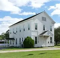 |
2850 Ferry Road | Baytown | 1970 | ||
| Hall of Cedar Bayou Masonic Lodge No. 321, A. F. & A. M. | |
2850 Ferry Rd. | Baytown | 1970 | ||
| Sweeney, Coombs, and Fredericks Building | 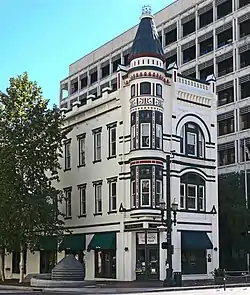 |
301 Main St. | Houston | 1974 | ||
| Houston Cotton Exchange and Board of Trade | 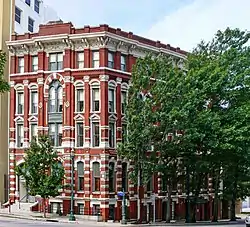 |
202 Travis St. | Houston | 1974 | 202 Travis St. at Franklin | |
| W. L. Foley Building | 214-18 Travis Street | Houston | 1978 | |||
| McGhee Elementary School Building | Channelview | 1979 | Crockett and 1st St., behind de Zavala Elementary School | |||
| John Milroy House | 1102 Heights Blvd. | Houston | 1979 | |||
| Heritage Presbyterian Church | 7934 SH 6 | Houston | 1980 | 7 mi. N. of IH-10W | ||
| Hogg Building |  |
401 Louisiana St. | Houston | 1981 | ||
| Kennedy Bakery | 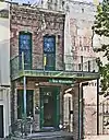 |
813 Congress | Houston | 1981 | ||
| Rose Hill Methodist Church Building | 21014 Rose Hill Church Rd. | Tomball | 1982 | off FM 2920 about 5 mi. west of Tomball in the Rose Hill community | ||
| The Sheridan Apartments | 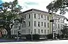 |
802-804 McGowen St. | Houston | 1984 | ||
| Wunsche Bros. Saloon and Hotel | 103 Midway | Spring | 1984 | next to railroad tracks | ||
| Merchants and Manufacturers Building | 1 Main St. | Houston | 1984 | U. of Houston Downtown | ||
| Ezekial and Mary Jane Miller House | 304 Hawthorne | Houston | 1984 | |||
| Auditorium Hotel |  |
710 Texas Avenue | Houston | 1984 | ||
| DePelchin Faith Home | 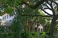 |
2700 Albany at Drew | Houston | 1984 | ||
| Arthur B. Cohn House | 1711 Rusk | Houston | 1985 | |||
| Trinity Episcopal Church | 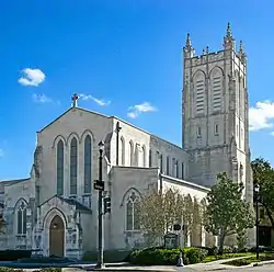 |
3404 S. Main | Houston | 1986 | ||
| Rose Hill United Methodist Church | 21014 Rose Hill Church Rd. | Tomball | 1987 | of FM 2920 about 5 mi. west of Tomball in the Rose Hill community | ||
| St. Nicholas Catholic Church | 2508 Clay St. | Houston | 1987 | |||
| Houston Fire Station No. 7 | 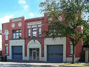 |
2403 Milam St. | Houston | 1988 | ||
| Clayton House | 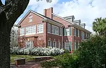 |
5300 Caroline | Houston | 1988 | ||
| Baytown Post Office | 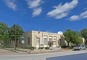 |
220 W. Defee | Baytown | 1988 | ||
| Saint Joseph's Catholic Church | Houston | 1989 | ||||
| Fondren Mansion | 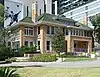 |
3410 Montrose Blvd. | Houston | 1989 | ||
| Holcombe House | 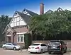 |
1905 Holcombe Blvd. | Houston | 1991 | east of medical center now called "The Hospice" | |
| David Barker House | 121 E. 16th St. | Houston | 1991 | |||
| Houston Light Guard Armory | 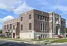 |
3816 Caroline | Houston | 1991 | ||
| Wade and Mamie Irvin House |  |
431 Bayridge Rd. | Morgan's Point | 1991 | ||
| Baker-Jones House | 22 Courtlandt Place | Houston | 1991 | |||
| K'Nesseth Israel Synagogue | Baytown | 1991 | Commerce and Sterling St. | |||
| John M. Dorrance House | 9 Courtlandt Place | Houston | 1991 | |||
| West Mansion | 3301 NASA Rd. 1 | Webster | 1993 | Razed Nov. 2019 | ||
| Autry House, Rice University | 6265 Main St. | Houston | 1994 | |||
| Antioch Missionary Baptist Church | 600 Clay Street | Houston | 1994 | |||
| Thomas J. and Mary Donoghue House | 17 Courtlandt Place | Houston | 1994 | |||
| Moore Log House | 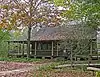 |
440 Wilchester Blvd. | Houston | 1996 | House/marker is in Edith L. Moore Nature Sanctuary, approx. three tenths mile west of Sam Houston Toll way; park entrance via United Methodist Church parking lot off of Memorial Drive; fence on west parking lot boundary marks sanctuary, gate mid-way along | |
| J. W. Garrow House | 19 Courtlandt Place | Houston | 1997 | |||
| James Judson and Lena Carter Carroll House | 16 Courtlandt Place | Houston | 1997 | |||
| Pioneer Memorial Log House | 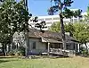 |
1510 N. MacGregor | Houston | 1997 | Hermann Park | |
| Rutherford B. H. Yates, Sr., House | 1314 Andrews St. | Houston | 1998 | |||
| Bryan-Chapman House | 15 Courtlandt Place | Houston | 1998 | |||
| Ned A. & Linda S. Eppes House | 5322 Institute Lane | Houston | 1998 | |||
| Dr. Penn B. and Annie A. Thornton House | 327 W. 16th St. | Houston | 1998 | |||
| Minchen House | 1753 North Blvd. | Houston | 1999 | |||
| Sessums & Virginia Cleveland House | 8 Courtlandt Place | Houston | 1999 | |||
| Third Church of Christ, Scientist | 5516 Almeda Rd. | Houston | 1999 | |||
| Houston Heights City Hall and Fire Station | 107 W. 12th St. | Houston | 2001 | 107 W. 12th St. | ||
| Link-Lee House | 3800 Montrose Blvd. | Houston | 2001 | |||
| Harper House | 319 Hawthorne St. | Houston | 2001 | |||
| Benjamin Apartments | 1218 Webster St. | Houston | 2001 | |||
| Anderson House | 3925 Del Monte | Houston | 2001 | |||
| First Evangelical Church | 1300 Holman | Houston | 2002 | 1300 Holman | ||
| Blue Triangle Branch, Y. W. C. A. Building | 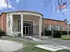 |
3005 McGowen | Houston | 2002 | 3005 McGowen | |
| F.C.L. and Emilie Neuhaus House | 6 Courtlandt Place | Houston | 2002 | #6 Courtlandt Place, Houston | ||
| Julia Ideson Building | 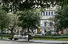 |
13888 | 500 McKinney | Houston | 2003 | |
| Magnolia Brewery Building | 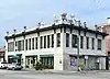 |
715 Franklin | Houston | 2003 | 715 Franklin | |
| Hugo Victor Neuhaus, Jr. House | 2910 Lazy Ln | Houston | 2005 | |||
| Angelo and Lillian Minella House | 6328 Brookside Dr | Houston | 2006 | 6328 Brookside Dr | ||
| Kleb Family House | Tomball | 2006 | south of Draper Road and west of Mueschke Road | |||
| Gulf Building | 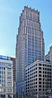 |
712 Main and 711 Travis | Houston | 2007 | 712 Main and 711 Travis | |
| Matthews-Johnson House | 1835 Cortlandt St | Houston | 2008 | |||
| Farnsworth & Chambers Building | 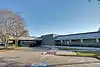 |
2999 South Wayside Drive | Houston | 2009 | ||
| Magnolia Park City Hall and Central Fire Station | 7301 Avenue F | Houston | 2009 | 7301 Avenue F | ||
| Harris County 1910 Courthouse | 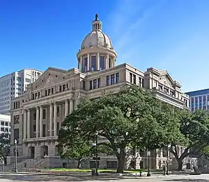 |
301 Fannin | Houston | 2010 | ||
| James L. Autry House | 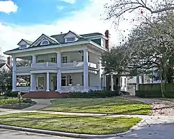 |
5 Courtlandt Place | Houston | 2010 | Houston, 5 Courtlandt Place | |
| Jones-Hunt House | 24 Courtlandt Place | Houston | 2010 | |||
| Hidalgo Park Quiosco | 7000 Ave. Q | Houston | 2010 | |||
| John and Bessie Parker House | 2 Courtlandt Place | Houston | 2011 | |||
| Myer-Hall House | 4 Courtlandt Place | Houston | 2011 | |||
| W. T. Carter, Jr., House | 18 Courtlandt Place | Houston | 2011 | |||
| Robert E. Lee High School | 1809 Market Street | Baytown | 2011 | Baytown, 1809 Market Street | ||
| Sylvan Beach Pavilion | 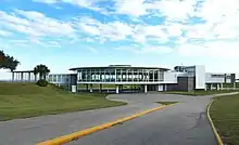 |
554 North Bayshore | La Porte | 2011 | La Porte, 554 North Bayshore | |
| Underwood and Clara Nazro House | 25 Courtlandt Place | Houston | 2012 | Houston, 25 Courtlandt Place | ||
| Gov. John B. Connally, Jr. Home | 2411 River Oaks Blvd. | Houston | 2012 | 3 miles from central business district | ||
| Dr. John H. Foster House | 320 Branard Street | Houston | 2012 | northeast corner of Branard and Bute | ||
| Isaiah P. Walker House | 3534 Miramar Dr | Shoreacres | 2012 | LT 7 & LT 10 & N 20 FT OF LT 11 & E 40 FT OF LT 16 & TR 7A BLK 10 SHOREACRES | ||
| A. M. Armand House | 110 Stratford | Houston | 2013 | |||
| W. T. Carter, Sr. House | 14 Courtlandt Place | Houston | 2014 | 14 Courtlandt Place | ||
| Edwin and Daphne Neville House | 11 Courtlandt Place | Houston | 2014 | 11 Courtlandt Place, Houston |
Harrison County
| Registered Texas Historic Landmark | Image | Marker Number | Physical Address | Nearest city | Year designated | Location Description[1][2] |
|---|---|---|---|---|---|---|
| Adams House | 10134 | 1502 S. Washington Ave. | Marshall | 1979 | ||
| Albert & Katie Van Hook House | 11978 | 303 S. Washington Ave. | Marshall | 1999 | ||
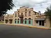
| Arnot House |
.jpg.webp) |
10138 | 306 W. Houston St. | Marshall | 1980 | |
| Dr. Samuel Floyd Vaughan Home | 10224 | 1.5 mi. N on FM 134 | Jonesville | 1985 | on FM 134 about 1.5 mi. N of Jonesville | |
| Ebenezer Methodist Church | 10153 | 908 Whetstone St. | Marshall | 1967 | ||
| Edgemont |
 |
10155 | 4448 FM 3379 | Marshall | 1981 | Old Longview Rd, 3 mi W of Marshall |
| Elks Building | 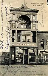 |
18717 | 212 N. Washington Ave. | Marshall | 2017 | |
| First Methodist Church |
.jpg.webp) |
10157 | 300 E. Houston St. | Marshall | 1965 | |
| First Presbyterian Church | .jpg.webp) |
10158 | 310 N. Fulton St. | Marshall | 1963 | corner of N Fulton at W Burleson |
| Fraley-Garland House | 10161 | 700 E. Rusk St. | Marshall | 1986 | ||
| Fry-Barry House |
.jpg.webp) |
10162 | 314 W. Austin St. | Marshall | 1962 | |
| Ginocchio-Cook-Pedison House |
.jpg.webp) |
10163 | 615 N. Washington Ave. | Marshall | 1973 | |
| Ginocchio Hotel and Restaurant |
.jpg.webp) |
10164 | 705 N. Washington Ave. | Marshall | 1971 | |
| Hagerty-Harris House |
 |
10169 | 505 E. Rusk St. | Marshall | 1977 | |
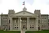
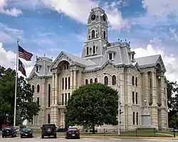
| Harrison County Courthouse |
.jpg.webp) |
10177 | 1 Peter Whetstone Sq. | Marshall | 1965 | |
| Home of William Thomas Scott | 10212 | FM 1998 at CR 2123 | Scottsville | 1963 | ||
| John Barry Henderson Home | .jpg.webp) |
10179 | 6265 N. U.S. 59 | Marshall | 1965 | about 5 miles N of Marshall on US 59 |
| Judge J. B. Williamson House |
 |
10230 | 411 FM 449 | Marshall | 1964 | |
| Key Log Cabin | 15034 | 301 Henley Perry Dr. | Marshall | 1965 | ||
| LaGrone's Chapel | 10183 | CR 3600 at FM 2208 | Hallsville | 1973 | Noonday Rd, 8 mi. N of Hallsville | |
| Magnolia Hall |
 |
10205 | 303 N. Columbus St. | Marshall | 1968 | |
| Marshall Hall | .jpg.webp) |
17692 | East Texas Baptist University, 1 Tiger Dr. | Marshall | 2013 | |
| Pierce House |
.jpg.webp) |
15076 | 303 N. Columbus St. | Marshall | 1968 | |
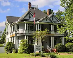
| Starr Family Home |
.jpg.webp) |
10187 | 407 W. Travis St. | Marshall | 1986 | |
| Texas & Pacific Depot |
.jpg.webp) |
10219 | 800 N. Washington Ave. | Marshall | 1985 | |
| The Allen House |
.jpg.webp) |
10135 | 610 N. Washington Ave. | Marshall | 1977 | |
| The Belle Fry Gaines House |
 |
10139 | 313 W. Austin St. | Marshall | 1978 | |
| The Gregg-Furrh-Elder House | 10167 | 407 W. Rusk St. | Marshall | 1973 | ||
| The Hochwald House |
.jpg.webp) |
10180 | 211 W. Grand Ave. | Marshall | 1979 | |
| The Turner House |
.jpg.webp) |
10222 | 406 S. Washington Ave. | Marshall | 1979 | |
| Todd-McKay-Wheat House | 12802 | 506 W. Burleson St. | Marshall | 2002 | 506 W. Burleson | |
| Trammel's Trace Cabin | 10220 | 301 Henley Perry Dr. | Marshall | 1965 | ||
| Ware Home | 10225 | E of Blocker Rd. N of FM 2625 | Marshall | 1963 | on Old Blocker Rd., off SH 31 (about 2.5 mi. W), about 9 mi. SE of Marshall | |
| Weisman-Hirsch House |
.jpg.webp) |
10226 | 313 S. Washington Ave. | Marshall | 1979 | |
| Whetstone-Lancaster House | 15998 | 302 E. Travis St. | Marshall | 2009 | ||
| Wigfall House | 10228 | 510 W. Burleson St. | Marshall | 1979 | ||
| William Bates Anderson Home | 10137 | 691 FM 968 | Marshall | 1963 | 8 mi. W off US 80 on Gum Springs Rd. | |
| William Patillo House |
10202 | 510 N. Bolivar St. | Marshall | 1965 | ||
| Woodley House | 10233 | 2063 Woodley Rd. | Marshall | 1988 | 12 mi. SE of Marshall on SH 31, then 2 mi. W on Woodley Rd. (CR 1313) |
Hartley County
| Registered Texas Historic Landmark | Image | Marker Number | Physical Address | Nearest city | Year designated | Location Description[1][2] |
|---|---|---|---|---|---|---|
| Channing United Methodist Church | 11980 | 719 Denver Ave. | Channing | 1964 | corner Denver & 8th Street, Channing | |
| First Hartley County Jail | 1727 | 10th Street | Hartley | 1966 | 10th Street, near public school -Hartley | |
| Hartley County Courthouse |
_Channing%252C_Texas.jpg.webp) |
2400 | 900 Main St. | Channing | 1987 | corner 9th & Railroad, Channing |
| XIT General Office |
 |
5916 | 517 Railroad Ave | Channing | 1994 | 517 Railroad Avenue, Channing |
| XIT Ranch Headquarters |
 |
14556 | 517 Railroad Ave. | Channing | 1964 |
Haskell County
| Registered Texas Historic Landmark | Image | Marker Number | Physical Address | Nearest city | Year designated | Location Description[1][2] |
|---|---|---|---|---|---|---|
| J. U. Fields Home | 2664 | 401 N. Ave. E | Haskell | 1963 | ||
| Old Railroad Depot | 3787 | Bus. US 277 S of Haskell | Haskell | 1968 | S city limits,Haskell |
Hays County
| Registered Texas Historic Landmark | Image | Marker Number | Physical Address | Nearest city | Year designated | Location Description[1][2] |
|---|---|---|---|---|---|---|
| Alexander Gates & Lillian Johnson Thomas House |
11985 | 809 Belvin St. | San Marcos | 1997 | ||
| Augusta Hofheinz House |
 |
10282 | 1104 W. Hopkins St. | San Marcos | 1992 | |
| Basil Dailey House | 10255 | 411 W. San Antonio St. | San Marcos | 1963 | ||
| Beverly Hutchison House |
 |
10283 | 400 N. Lyndon B. Johnson Dr. | San Marcos | 1968 | |
| Blanco Chapel | 10238 | 3 mi. W on Cypress Rd. | Kyle | 1965 | About three miles west of Kyle off Lime Kiln Road (CR 225). On private land. | |
| Buda Christian Church | 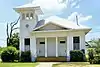 |
10241 | 200 N. San Marcos St. | Buda | 1986 | |
| Bunton Branch Bridge |
 |
17342 | CR 210 over Bunton Branch | Kyle | 2012 | .2 miles northwest of IH 35 |
| Burleson Home |
10244 | 1200 Lime Kiln Rd. | San Marcos | 1965 | from Old Post Rd., take Lime Kiln Rd. north approx. 1.5 mi. to private entrance | |
| Burleson Homestead | 10245 | Ed J.L. Green Dr. in the Meadows Center for Water and the Environment | San Marcos | 1967 | in Aquarena Springs Park (SWTSU) | |
| Caldwell-Kone-Hyatt House | 10247 | 618 W. Hutchison St. | San Marcos | 1975 | ||
| Carpenter Log Home | 10250 | 3840 RM 967 | Buda | 1977 | from Buda take RR 967 west approx 4 miles to private gate entrance (cabin on private property) | |
| Cemetery Chapel |
 |
10321 | Chapel Way at Evening Star Dr. in San Marcos City Cemetery | San Marcos | 1973 | from Courthouse take RR 12 approx. 1.2 miles north (chapel near center rear section of San Marcos Cemetery) |
| Charles Cock Home |
 |
10252 | 400 E. Hopkins St. | San Marcos | 1968 | |
| Claiborne Kyle Log House |
 |
10291 | W end, Claiborne-Kyle House Rd. | Kyle | 1982 | from Kyle take Old Stagecoach Rd. SW approx. 4 miles |
| Cora Jackman Donalson House |
.jpg.webp) |
15989 | 200 S. Sledge St. | Kyle | 2009 | |
| Cumberland Presbyterian Church (Fort Street Presbyterian Church) |
 |
12730 | 516 W. Hopkins St. | San Marcos | 2001 | 516 W. Hopkins |
| Czichos House | 10254 | Wayside Dr. | Wimberley | 1965 | in Pioneer Town Resort; in Wimberley take River Road 1 mi. west of RR 12 | |
| Dripping Springs Academy |
 |
10261 | 103 Old Fitzhugh Rd. | Dripping Springs | 1968 | on Old Fitzhugo Rd. approx. 1 block north of Mercer St. |
| Eli T. Merriman Home | 10302 | N. C.M. Allen Pkwy. in Veramendi Plaza | San Marcos | 1965 | in Aquarena Springs Park, Texana Village | |
| Ezekiel Nance Home | 10306 | 2.5 mi. W on Nance Mill Rd. | Kyle | 1965 | according to CHC, this marker is located: 2.5 miles west of Kyle on Nance Mill Rd. | |
| Farmers Union Gin Company |
 |
10264 | 120 W. Grove St. | San Marcos | 1981 | at the corner of Grove and Hill St. |
| First United Methodist Church |
 |
10271 | 129 W. Hutchison St. | San Marcos | 1970 | |
| Fisher Hall |
15508 | 1132 Belvin St. | San Marcos | 1970 | ||
| George Henry Talmadge Home |
10330 | 802 Belvin St. | San Marcos | 1978 | ||
| George Thomas McGehee House |
10295 | 727 Belvin St. | San Marcos | 1975 | ||
| Goforth-Harris House |
 |
14892 | 401 N. Comanche St. | San Marcos | 2008 | |
| Heard-Baker House |
 |
10281 | 620 W. San Antonio St. | San Marcos | 1986 | |
| Ike Wood House |
 |
10339 | 227 N. Mitchell Ave. | San Marcos | 1978 | |
| J. H. Barbee House | 18012 | 220 N. Johnson Ave. | San Marcos | 2014 | 220 N Johnson at the corner of Belvin | |
| James C. Lane House |
 |
16422 | 306 Wimberley Sq. | Wimberley | 2010 | |
| James Lafayette and Eliza Pitts Malone House | 10299 | 1236 Belvin St. | San Marcos | 1996 | ||
| John F. McGehee Home |
10296 | 832 Belvin St. | San Marcos | 1973 | ||
| John Matthew Cape House |
 |
10249 | 316 W. Hopkins St. | San Marcos | 1985 | |
| John R. Dobie House |
 |
10257 | 282 Old Kyle Rd. | Wimberley | 1990 | approx. 150 yds. north of town square on Old Kyle Rd. |
| Joseph B. Rogers House | 10317 | 4 mi. E on RM 967 | Driftwood | 1975 | take RR 967 E approx. 4 miles | |
| Joseph W. Earnest Home |
10263 | 833 Belvin St. | San Marcos | 1979 | ||
| Julia Ann Ragsdale Home | 10315 | 306 E. Summit Dr. | Wimberley | 1976 | take RR 12 N to Summit Dr.; then east on Summit Dr. approx. .5 miles to Gumbert Ranch (private property) | |
| Kone-Cliett House |
 |
10286 | 724 Burleson St. | San Marcos | 1986 | |
| Kone-Yarbrough House |
10287 | 903 Belvin St. | San Marcos | 1977 | ||
| Lloyd Gideon Johnson House |
 |
10285 | 1030 Belvin St. | San Marcos | 1982 | |
| Marshall-Chapman Home |
 |
10300 | 500 Mercer St. | Dripping Springs | 1976 | |
| McElroy-Severn House (Stagecoach House and Onion Creek Post Office) |
 |
17245 | 808 N. Main St. | Buda | 2012 | 150 feet north of Loop 4 (Main Street), one mile west of IH 35 |
| Miss Lillie Dobie's House | 18537 | 450 River Rd. | Wimberley | 2016 | ||
| O. T. Brown Home |
10239 | 716 Belvin St. | San Marcos | 1981 | ||
| Old D. A. Young Building | 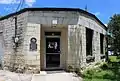 |
10340 | 108 S. Burleson St. | Kyle | 1968 | nw corner of S. Burleson and Miller |
| Old Fish Hatchery Office Building | 10275 | 206 N. C.M. Allen Pkwy. | San Marcos | 1982 | ||
| Old Main |
 |
10307 | 250 Old Main Dr., Texas State University | San Marcos | 1963 | |
| Old Storey Home | 10329 | 702 Burleson St. | San Marcos | 1970 | ||
| Ragsdale-Jackman-Yarbrough House |
 |
10316 | 621 W. San Antonio St. | San Marcos | 1972 | |
| Robert Early McKie House | 10297 | 613 Lindsey St. | San Marcos | 1989 | ||
| Robert Hixon Belvin Home |
10236 | 730 Belvin St. | San Marcos | 1974 | ||
| Rylander-Kyle House |
.jpg.webp) |
17244 | 711 W. San Antonio St. | San Marcos | 2012 | San Marcos, 711 W. San Antonio Street |
| Sanders-Grosgebauer House | 10326 | 827 W. San Antonio St. | San Marcos | 1992 | ||
| Southside School | 16941 | 518 S. Guadalupe St. | San Marcos | 2011 | Northwest corner of Lee and LBJ Streets | |
| The Calaboose | 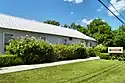 |
10246 | 200 W. Martin Luther King, Jr. Dr. | San Marcos | 1990 | corner of Martin Luther King and Fredericksburg |
| Wimberley-Hughes House | 18536 | 14050-B RR 12 | Wimberley | 2016 |
Hemphill County
| Registered Texas Historic Landmark | Image | Marker Number | Physical Address | Nearest city | Year designated | Location Description[1][2] |
|---|---|---|---|---|---|---|
| First National Bank of Canadian | 1793 | 200 E. Main St. | Canadian | 1970 | 200 E. Main Street, Canadian | |
| Hemphill County Jail | 2434 | 401 E. Purcell Ave. | Canadian | 1970 | Courthouse Square, Main & 5th Street, Canadian | |
| Historic Cottonwood -(133 yards east to site of) | 2494 | NE of Lake Marvin on CR L | Canadian | 1969 | from Canadian, drive north on U.S. 60, turn right onto FM 2266, about 12 miles to Lake Marvin, turn left at fork at Lake Marvin entrance, at .7 mile turn to right down dirt road, continue .3 mile to marker site | |
| Jones Mansion | 2846 | 604 E. Main St. | Canadian | 1982 | 6th & Main Streets, Canadian | |
| R. Dick Bussell | 4147 | Courthouse Sq. facing E. Main St. | Canadian | 1967 | at Courthouse, Main & 5th Street, Canadian | |
| The Former Canadian Hospital | 5336 | 700 E. Elsie Ave. | Canadian | 1970 | at intersection of 7th & Elsie Street, Canadian | |
| W. C. T. U. Building | 5668 | 500 E. Main St. | Canadian | 1965 | 500 Main Street, Canadian |
Henderson County
| Registered Texas Historic Landmark | Image | Marker Number | Physical Address | Nearest city | Year designated | Location Description[1][2] |
|---|---|---|---|---|---|---|
| 1925 Henderson County Jail | .jpg.webp) |
16722 | 201 E. Larkin St. | Athens | 2011 | Athens, 201 E. Larkin |
| Coleman, Nat P., Home | 15047 | Athens | 1962 | |||
| Faulk-Gauntt Building |
.jpg.webp) |
10352 | 217 N. Prarieville St. | Athens | 1981 | |
| Henderson County Courthouse | .jpg.webp) |
13831 | 100 E. Tyler St. | Athens | 2003 | Henderson County Courthouse grounds |
| Meredith Campground and Tabernacle | 10367 | CR 3901 W of CR 3900 | Athens | 1991 | take SH 19 9 miles north to CR 3900; go west and north 3 mi. to CR 3901; go west on CR 3901 to marker | |
| Pioneer Oak | 10372 | 217 N. Prarieville St. | Athens | 1967 | Hwy. 175 E, marker in the museum | |
| Wofford, Bush W., Home (RELOCATED) | 15379 | 1601 Patterson Rd. | Athens | 1962 |
Hidalgo County
| Registered Texas Historic Landmark | Image | Marker Number | Physical Address | Nearest city | Year designated | Location Description[1][2] |
|---|---|---|---|---|---|---|
| American Legion Hall | 150 | 316 S. Main St. | Donna | 1964 | 316 S. Main | |
| Buell School | 558 | 218 E. Juarez Ave. | Pharr | 1990 | 218 E. Juarez, Pharr | |
| Casa de Palmas |
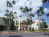 |
747 | 101 N. Main St. | McAllen | 1979 | 101 N Main St. |
| Cortez Hotel |
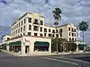 |
13091 | 260 S. Texas Blvd. | Weslaco | 2004 | 260 S Texas Ave |
| D. Guerra & Sons Store | 15838 | 100 S. 17th St. | McAllen | 2009 | SE corner of Austin & S 17th | |
| Don Florencio Saenz Homestead |
1245 | CR 1702 | Toluca Ranch | 1965 | at Toluca Ranch: from intersection of US 281 and FM 1015, go S on FM 1015 about 0.8 mi., then take Rancho Toluca Road E 0.27 mi. to palm tree lined lane, then go S 0.25 mi. | |
| Donna Central Elementary School | 1252 | 316 N. Main St. | Donna | 1990 | Main Street at Scobey Avenue, Donna | |
| Edinburg Junior College Auditorium | 1389 | 415 W. University Dr. | Edinburg | 1989 | N. Seventh and McIntyre, Edinburg | |
| Former Hidalgo Post Office |
1948 | 117 E. Flora Ave. | Hidalgo | 1965 | First & Flora Streets, Hidalgo | |
| Gregg Wood Home |
2278 | 1215 Doherty Ave. | Mission | 1984 | 1215 Doherty, Mission | |
| John Closner Home | 2773 | 200 N. Closner Blvd. | Edinburg | 1966 | Bus. US 281, Hildago Co. Museum, Edinburg | |
| Kiwanis Club of Pharr | 2961 | 302 W. Park Ave. | Pharr | 1981 | 302 W. Park,Pharr | |
| La Loma Ranch Headquarters | 2996 | 10 mi. N on US 281 | Edinburg vicinity | 1963 | from Edinburg, go 10 miles north on Hwy 281. (no access-private) | |
| La Lomita Chapel |
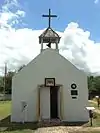 |
2997 | La Lomita Park 5 mi. S of town off FM 1016 | Mission | 1964 | from Mission, take FM 1016 south about 5 miles to La Lomita Park |
| Lamar Junior High School | 15858 | 1009 N. 10th St. | McAllen | 2009 | ||
| M. & J. Nelson Building |
 |
14036 | 300-308 S. Main St. | McAllen | 2007 | 300 Main St |
| McAllen Post Office | 3272 | 301 S. Main St. | McAllen | 1986 | 351 South Main Street, McAllen | |
| Mercedes City Hall | 3342 | 323 S. Ohio Ave. | Mercedes | 1994 | 323 South Ohio Street, Mercedes | |
| Old Hidalgo County Courthouse |
 |
3745 | 2 E. Flora Ave. | Hidalgo | 1964 | First and Flora, Hidalgo |
| Old Hidalgo County Jail |
|
3744 | 1 E. Esperanza Ave. | Hidalgo | 1984 | First and Flora |
| Old Hidalgo County Jail | 3746 | 121 E. McIntyre St. | Edinburg | 1966 | Museum of South Texas History | |
| Our Lady of Guadalupe Catholic Church | 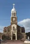 |
3883 | 620 N. Dunlap Ave. | Mission | 1990 | 6th Dunlap Streets, Mission |
| Paris Gum Factory | 17235 | 609 W. Bus. US 83 | McAllen | 2012 | Southeast corner Business Highway 83 and West Sixth Street | |
| Percy Herman House | 18215 | 520 N. 15th St. | McAllen | 2015 | West side of property along 15th Street where the street sidewalk and entry sidewalk intersect. If facing the house the marker would sit in the grass at the northeast corner of the sidewalk intersections. | |
| Rio Theater |
 |
4272 | 516 Doherty Ave. | Mission | 1982 | 516 Doherty, Mission |
| Saint Joseph's Church |
4458 | CR 1702 | Toluca Ranch | 1965 | at Toluca Ranch; from intersection of US 281 and FM 1015 go S on FM 1015 about 0.8 mi., then take Rancho Toluca Road E 0.27 mi. to palm tree lined lane, then go S 0.25 mi. | |
| Sam and Marjorie Miller House |
 |
12950 | 707 N. 15th St. | McAllen | 2002 | |
| San Juan Hotel |  |
4543 | 125 W. Fifth St. | San Juan | 1985 | 125 West 5th Street (Business 83), San Juan |
| San Juan Plantation | 4544 | Doffin Canal Rd. 0.25 mi. W of Stewart Rd. | San Juan | 1964 | from San Juan, take FM 2557 south to Highway 281, about 5.5 miles and continue south on County Road for .5 miles to Loval Road, then go west about .25 miles | |
| Shary Building |
4661 | 900 Doherty Ave. | Mission | 1997 | ||
| Skaggs House | 4945 | 1027 S. Texas Blvd. | Weslaco | 1993 | 1027 S. Texas Ave., Weslaco | |
| Southern Pacific Depot | 4986 | 100 S. Bicentennial Blvd. | McAllen | 1986 | 100 S. Bicentennial, McAllen | |
| Southern Pacific Depot | 4987 | 602 W. University Dr. | Edinburg | 1986 | 602 University, Edinburg | |
| St. Joseph's Church |
7171 | CR 1702 | Toluca Lake | 1965 | ||
| The Border Theater |
 |
12060 | 905 N. Conway Ave. | Mission | 1997 | |
| Weslaco City Hall | 5755 | 500 S. Kansas Ave. | Weslaco | 1978 | Weslaco City Hall, 500 S. Kansas Ave., Weslaco | |
| Weslaco High School | 14484 | S. Iowa Ave. between E. Sixth St. and E. Seventh St. | Weslaco | 2008 | S. Iowa St. at 7th St. |
Hill County
| Registered Texas Historic Landmark | Image | Marker Number | Physical Address | Nearest city | Year designated | Location Description[1][2] |
|---|---|---|---|---|---|---|
| Abbott House |
 |
67 | 133 Corsicana St. | Hillsboro | 1986 | |
| Bond's Alley | 449 | Bisects 100 blk W. Elm St. to W. Gould St. | Hillsboro | 1969 | southside of Courthouse Square, go west Elm, Hillsboro | |
| Brin House |
511 | 109 Corsicana St. | Hillsboro | 1981 | 109 Corsicana, Hillsboro | |
| Carver Homestead | 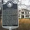 |
16729 | 1127 E. Jefferson Ave. | Whitney | 2011 | 1127 East Jefferson Avenue |
| Condor House | 1021 | 307 Bois D'Arc Ave. | Hubbard | 1984 | 307 Bois D'Arc, Hubbard | |
| Davis Home |
 |
1175 | 130 Corsicana St. | Hillsboro | 1965 | 130 Corsicana, Hillsboro |
| Files, F. Marion, Home | 14839 | 6 mi. E on FM 66 | Itasca | 1966 | FM 66, 6 mi E of Itasca | |
| First Methodist Church of Hubbard | 1760 | 208 NW Second St. | Hubbard | 1991 | 208 North 2nd Street west, Hubbard | |
| Gebhardt Bakery |
 |
2115 | 119 E. Franklin St. | Hillsboro | 1983 | 119 East Franklin Street, Hillsboro |
| George L. and Roxie Brooks Porter Home |
13212 | 400 Corsicana St. | Hillsboro | 2004 | 400 Corsicana St | |
| Hill County Courthouse |
 |
2481 | 1 N. Waco St. | Hillsboro | 1964 | Waco and Franklin, Courthouse Square, Hillsboro |
| Hill County Jail |
 |
2482 | 120 N. Waco St. | Hillsboro | 1981 | 120 North Waco, Hillsboro |
| Hillsboro Post Office Building |
 |
2488 | 118 S. Waco St. | Hillsboro | 1982 | 115 south Waco, Hillsboro |
| Hubbard High School | 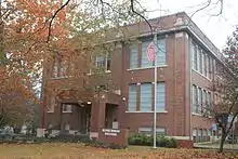 |
17693 | 300 NW Sixth St. | Hubbard | 2013 | |
| Itasca Railroad Depot | .jpg.webp) |
2661 | 105 Wampus Cat Dr. | Itasca | 1982 | at Itasca Museum, Hooks Street, on east side of Itasca |
| J. T. Baker House |
2684 | Near NE end of CR 1127 | Blum | 1990 | 2 miles northeast of Blum, via caliche road from BJ Towing | |
| J. W. Park Home | .jpg.webp) |
2688 | 206 N. Wesley St. | Itasca | 1986 | 206 North Wesley Street, Itasca |
| Katy Depot |
 |
2906 | 115 N. Covington St. | Hillsboro | 1981 | North Covington Street, just north of courthouse square, Hillsboro |
| Lumpkin House |
3146 | 418 E. Franklin St. | Hillsboro | 1973 | 418 East Franklin, Hillsboro | |
| McDaniel Family Home | 3289 | 400 NW Third St. | Hubbard | 1969 | Maple and North 3rd west, Hubbard. Marker reported missing Oct. 2008. | |
| McKinnon - Anderson House |
3299 | 205 Corsicana St. | Hillsboro | 1971 | 205 Corsicana, Hillsboro | |
| Old G. D. Tarlton House |
2088 | 211 N. Pleasant St. | Hillsboro | 1972 | 211 North Pleasant Street, Hillsboro | |
| Peoria Cumberland Presbyterian Church | 3986 | 120 N. Waco St. facing E. Paschal St. behind Old Jail | Hillsboro | 1963 | at Hill Co. Cell Block Museum 120 North Waco, Hillsboro | |
| Pioneer Bank Building |
 |
4023 | 68 W. Elm St. | Hillsboro | 1966 | on square, Covington and Elm streets, Hillsboro |
| Rigsby Home | 4266 | NE corner NW Seventh St. at Cactus Ave. | Hubbard | 1964 | Cactus Avenue and 7th, Hubbard | |
| St. Mary's Episcopal Church |
5062 | 200 N. Abbott St. | Hillsboro | 1987 | 200 North Abbott Street, Hillsboro | |
| Taylor, J.A., Home (MARKER GONE) | 14363 | Blum | 1965 | |||
| Turner House |
 |
5573 | 3 mi. E on FM 934 | Itasca | 1965 | from Itasca take FM 934 about miles to house, on north side of road on Private Property |
Hockley County
There are currently no Recorded Texas Historic Landmarks listed within the county.
Hood County
| Registered Texas Historic Landmark | Image | Marker Number | Physical Address | Nearest city | Year designated | Location Description[1][2] |
|---|---|---|---|---|---|---|
| Aston House | 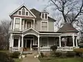 |
221 | 221 E. Bridge St. | Granbury | 1978 | |
| Aston-Landers Building |
.jpg.webp) |
222 | 113 E. Bridge St. | Granbury | 1974 | |
| Baker-Carmichael House |
.jpg.webp) |
15016 | 226 E. Pearl St. | Granbury | 1996 | |
| Baker-Doyle Building |
.jpg.webp) |
283 | 132 N. Houston St. | Granbury | 1988 | |
| Baker-Rylee Building and Town Square Service Station |
.jpg.webp) |
284 | 100 N. Crockett St. | Granbury | 1986 | |
| Bowden Kennon House | 473 | 505 W. Doyle St. | Granbury | 1984 | ||
| Cresson School | 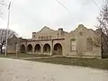 |
13144 | 9304 Pittsburgh St. | Cresson | 2003 | Cresson, 9304 Pittsburgh Street |
| Daniel-Harris Home | .jpg.webp) |
1169 | 403 W. Bridge St. | Granbury | 1981 | |
| Daniel House | 1166 | 107 E. Bluff St. | Granbury | 1981 | ||
| David L. Nutt Home | 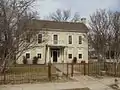 |
1172 | 319 E. Bridge St. | Granbury | 1966 | |
| Dr. William and Eunice Walker House | .jpg.webp) |
12077 | 315 W. Bridge St. | Granbury | 1998 | |
| E. A. Hannaford Building |
.jpg.webp) |
12078 | 130 N. Houston St. | Granbury | 1999 | |
| E. A. Hannaford House | .jpg.webp) |
1313 | 126 S. Lambert St. | Granbury | 1988 | |
| First National Bank |
.jpg.webp) |
6250 | 101 E. Bridge St. | Granbury | 1972 | |
| First Presbyterian Church of Granbury | .jpg.webp) |
1837 | 309 W. Bridge St. | Granbury | 1974 | |
| Former Acton Masonic Lodge Hall | .jpg.webp) |
1945 | 3600 Fall Creek Hwy. | Acton | 1975 | FM 167 Acton near south city limits |
| Glenn Brothers Building |
.jpg.webp) |
2190 | 109 E. Bridge St. | Granbury | 1974 | |
| Gordon Home | .jpg.webp) |
2229 | 308 E. Pearl St. | Granbury | 1983 | |
| Granbury Light Plant | .jpg.webp) |
2243 | 401 E. Ewell St. | Granbury | 1994 | Corner of East Ewell and North Brazos streets |
| Granbury Opera House |
 |
2245 | 133 E. Pearl St. | Granbury | 1977 | |
| Granbury Railroad Depot | .jpg.webp) |
2246 | 109 E. Ewell St. | Granbury | 1984 | |
| Hardware and Tin Shop |
.jpg.webp) |
2375 | 107 E. Bridge St. | Granbury | 1974 | |
| Harris Building | .jpg.webp) |
2389 | 123-127 E. Pearl St. | Granbury | 1978 | 114-118 East Pearl Street, Granbury |
| Haynes-Burns-Ewell Building |
.jpg.webp) |
2412 | 105 E. Pearl St. | Granbury | 1976 | |
| Holderness-Aiken House | .jpg.webp) |
2508 | 321 W. Bridge St. | Granbury | 1975 | |
| Hood County Courthouse |
.jpg.webp) |
2552 | 100 E. Pearl St. | Granbury | 1970 | 100th block of Pearl Street, Granbury Courthouse lawn |
| Hood County Jailhouse |
.jpg.webp) |
2553 | 208 N. Crockett St. | Granbury | 1970 | |
| J.D. and Georgia Brown House | 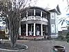 |
2672 | 118 W. Bluff St. | Granbury | 1994 | |
| J.F. and J. Nutt Building |
.jpg.webp) |
2676 | 119 E. Bridge St. | Granbury | 1970 | |
| John W. Bull Stone House | 2818 | Deep Down Rd. SW of Paluxy near Erath County line | Granbury vicinity | 1970 | from Granbury, take FM 51 south about 14.5 miles to FM 205 west and turn southwest immediately onto CR. Follow CR about 2.7 miles southwest then take gravel road south about 1/10 miles. | |
| Lees-Bryan House | .jpg.webp) |
6260 | 121 W. Bluff St. | Granbury | 1985 | |
| Smith-Savage House | 6261 | 826 Thorp Springs Rd. | Granbury | 1986 | ||
| The Fair |
.jpg.webp) |
5331 | 115 E. Bridge St. | Granbury | 1974 | |
| Thrash-Landers-Hiner House | .jpg.webp) |
5479 | 201 W. Pearl St. | Granbury | 1994 | |
| Tolar Tabernacle | .jpg.webp) |
15946 | 104 Donley St. | Tolar | 2009 | |
| W. D. and Essie Gafford House | 12623 | 361 S. Caddo St. | Lipan | 2001 | 1 mile south of Lipan on FM 1189 | |
| Wright-Henderson-Duncan House |
.jpg.webp) |
5913 | 703 Spring St. | Granbury | 1978 | Spring Street and SH 144, near FM 51, Granbury |
Hopkins County
| Registered Texas Historic Landmark | Image | Marker Number | Physical Address | Nearest city | Year designated | Location Description[1][2] |
|---|---|---|---|---|---|---|
| Ashcroft House | .jpg.webp) |
18771 | 333 College St. | Sulphur Springs | 2017 | |
| Hopkins County Courthouse |
.jpg.webp) |
7315 | 118 Church St. | Sulphur Springs | 1975 |
Houston County
| Registered Texas Historic Landmark | Image | Marker Number | Physical Address | Nearest city | Year designated | Location Description[1][2] |
|---|---|---|---|---|---|---|
| A. E. Gossett Home | 10961 | 1.7 mi. E on SH 21 | Crockett | 1964 | from Crokett take SH 21 east about 1.7 miles | |
| Augusta Union Church | 11228 | CR 1675 S of FM 227 | Grapeland | 1990 | 9 mi. E of Grapeland on FM 227 to Augusta, 0.2 mi. S on CR 1675 | |
| C. R. Rich Building | 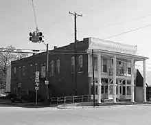 |
11234 | 100 S. Commerce St. | Lovelady | 1985 | southeast corner of SH 19 and FM 1280 |
| Cannon-Stanton House | 11218 | 138 S. Grace St. | Crockett | 1989 | 138 South Grace, Crockett | |
| Daniel-Merriwether House | 17740 | 712 Julia St. | Kennard | 2013 | From SH 7 east in the City of Kennard, take a left on Julia Street and go .2 tenths of a mi. The street dead ends at the Daniel-Rowe House. | |
| Downes-Aldrich House |
 |
11095 | 206 N. Seventh St. | Crockett | 1972 | corner of Milam and 7th in Crockett |
| Early Bank Building | 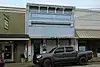 |
11096 | 505 E. Goliad Ave. | Crockett | 1972 | 505 E. Goliad in Crockett |
| First Christian Church of Grapeland |  |
11127 | 213 N. Market St. | Grapeland | 1972 | |
| Henry Allen Pennington House | 11223 | CR 2245 N of FM 227 | Grapeland | 1985 | 7 miles west of Grapeland on FM 227, then north on CR 2245 | |
| House Built by A. T. Monroe | 11210 | 707 E. Houston Ave. | Crockett | 1962 | 707 E. Houston. Also known as George W. Crook Home. 1969 RTHL marker for Monroe-Crook House on same site. | |
| Houston County Courthouse |
 |
12422 | 401 E. Houston Ave. | Crockett | 2000 | Houston County Courthouse grounds |
| Monroe-Crook House |
 |
11211 | 707 E. Houston Ave. | Crockett | 1969 | 707 E. Houston. 1965 marker for A. T. Monroe House on same site. |
| Newton-Norris House | 11220 | 902 E. Goliad Ave. | Crockett | 1990 | ||
| Patton-Buchanan Building | 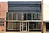 |
11221 | 311 E. Goliad Ave. | Crockett | 1982 | 311 East Goliad, Crockett |
| Spence-Chamberlain House | 8810 | 717 E. Houston Ave. | Crockett | 1994 | 717 E. Houston Ave. | |
| Spinks-Mayes Building | 11192 | 312 E. Houston Ave. | Crockett | 1982 | corner of West Houston Ave. and North 4th in Crockett | |
| W.V. McConnell Building | 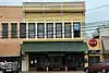 |
11238 | 113 S. Fourth St. | Crockett | 1982 | 113 4th Street, west side of courthouse aquare |
| William Preston and Rebecca Kate Conner House | 12087 | 609 CR 1175 | Ratcliff | 1997 | 1 mi. N of Ratcliff on Fm 227; 2 mi. N on CR 1165; .5 mi. E on CR 1170; .5 mi. N on CR 1175 (Forest Road 511) |
Howard County
| Registered Texas Historic Landmark | Image | Marker Number | Physical Address | Nearest city | Year designated | Location Description[1][2] |
|---|---|---|---|---|---|---|
| First Permanent Building in Big Spring | 1808 | 121 N. Main S. | Big Spring | 1962 | 121 Main Street, Big Spring | |
| Potton House |
 |
4100 | 200 S. Gregg St. | Big Spring | 1976 | 200 Gregg Street, Big Spring |
| Settles Hotel |
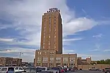 |
13722 | 200 E. Third St. | Big Spring | 1987 | 200 E Third. Marker reported not on building Dec. 2006. |
| St. Thomas Catholic Church | 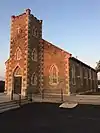 |
5084 | 605 N. Main St. | Big Spring | 1988 | 605 North Main Street, Big Spring |
Hudspeth County
| Registered Texas Historic Landmark | Image | Marker Number | Physical Address | Nearest city | Year designated | Location Description[1][2] |
|---|---|---|---|---|---|---|
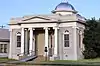
| Fort Hancock Mercantile | 1989 | 1425 Knox Ave. | Fort Hancock | 1980 | Building is located on SH Spur 148 at railroad tracks Ft. Hancock | |
| Hudspeth County Courthouse |
 |
2591 | 201 W. Millican St. | Sierra Blanca | 1962 | located 3 blocks N. of Business IH-10 and just west of FM 1111, Sierra Blanca |
| Sierra Blanca Methodist Church | 4694 | 108 N. Sierra Blanca Ave. | Sierra Blanca | 1968 | located 2 blocks N. of Business IH-10 on FM 1111 N., Sierra Blanca |
See also
| Anderson-Callahan • Cameron-Duval • Eastland-Gray • Grayson-Hudspeth • Hunt-Martin • Mason-Rusk • Sabine-Travis • Trinity-Zavala |
References
- E-Mail Correspondence with History Programs Division, Texas Historical Commission, date stamped 1:21 PM, November 28, 2016, and Excel Spreadsheet of RTHL markers accompanying e-mail correspondence. Available from editor upon request.
- "Home - Atlas: Texas Historical Commission". atlas.thc.state.tx.us. Retrieved 2016-11-28. All data from the spreadsheet cited at Ref 1 can be reproduced using the Texas Historical Commission's digital atlas at this link. Search by state or county for RTHL markers only.
External links
![]() Media related to Recorded Texas Historic Landmarks at Wikimedia Commons
Media related to Recorded Texas Historic Landmarks at Wikimedia Commons

This article is issued from Wikipedia. The text is licensed under Creative Commons - Attribution - Sharealike. Additional terms may apply for the media files.