Hemphill County, Texas
Hemphill County is a county located in the U.S. state of Texas. As of the 2010 census, its population was 3,807.[1] The county seat and only incorporated community in the county is Canadian.[2] The county was created in 1876 and organized in 1887.[3] It is named for John Hemphill, a judge and Confederate congressman.[4] Hemphill County is one of six[5] prohibition, or entirely dry, counties in the state of Texas.
Hemphill County | |
|---|---|
 Hemphill County Courthouse in Canadian | |
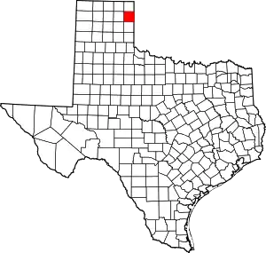 Location within the U.S. state of Texas | |
 Texas's location within the U.S. | |
| Coordinates: 35°50′N 100°17′W | |
| Country | |
| State | |
| Founded | 1887 |
| Named for | John Hemphill |
| Seat | Canadian |
| Largest city | Canadian |
| Area | |
| • Total | 912 sq mi (2,360 km2) |
| • Land | 906 sq mi (2,350 km2) |
| • Water | 5.9 sq mi (15 km2) 0.6%% |
| Population (2010) | |
| • Total | 3,807 |
| • Density | 4.2/sq mi (1.6/km2) |
| Time zone | UTC−6 (Central) |
| • Summer (DST) | UTC−5 (CDT) |
| Congressional district | 13th |
| Website | www |


History
Early history
For the 200 years leading up to 1875, nomadic Indian tribes representing the Apache, Comanche, Kiowa, and others roamed the Panhandle following the huge bison (buffalo) herds. In search for an alternate route to California through Santa Fe, New Mexico, Josiah Gregg (1840), and Captain Randolph B. Marcy (1845) surveyed trails that crossed Hemphill County, following the south bank of the Canadian River.
The 1874–75 Red River War was an effort by the United States Army to force the Indians of the Southern Plains to move to Indian Territory in present-day Oklahoma. Two major battles took place in what would become Hemphill County: the Battle of Lyman's Wagon Train and the Battle of Buffalo Wallow.
On April 12, 1879, Wheeler County became the first organized county in the Panhandle, with 14 other unorganized counties attached to it, one of which was Hemphill County. Hemphill County was organized in July 1887.
Influence of Santa Fe Railroad
In 1886, the Southern Kansas Railway Company, a Santa Fe subsidiary, began to build a rail line into the Panhandle of Texas. The tracks entered Hemphill County during 1887 and further encouraged settlement in the area, creating three town sites: Mendota, Canadian, and Glazier.
In 1907, Canadian was designated a division point by the Santa Fe, a factor which brought diversification to the previously ranching economy of the area. The Santa Fe influence remained very strong until the mid-1950s, when the railway moved its employees to Amarillo.
Meanwhile, Hemphill County was roughly the midway point of two smaller lines, the Clinton, Oklahoma, and Western Railroad Company and the Clinton-Oklahoma-Western Railroad Company of Texas, which by the late 1920s, collectively linked Clinton, Oklahoma, with Pampa, Texas.[6]
Oil production
During the 1970s, the county grew due to a rapid expansion of oil production. Though oil was discovered in the county in 1955, production remained relatively small because the technology had not yet progressed to efficiently capture the very deep reserves known to exist. By 1974, oil production had reached 999,000 barrels (158,800 m3) and more than 1,891,000 bbl (300,600 m3) in 1978. In 2000, about 505,000 bbl (80,300 m3) of oil and more than 8 billion cubic feet of natural gas were produced in the county, but the future looked very bright.

Geography
According to the U.S. Census Bureau, the county has a total area of 912 sq mi (2,360 km2), of which 906 sq mi (2,350 km2) are land and 5.9 sq mi (15 km2) (0.6%) are covered by water.[7]
Major highways
 U.S. Highway 60
 U.S. Highway 83
 State Highway 33
Adjacent counties
- Lipscomb County (north)
- Ellis County, Oklahoma (northeast)
- Roger Mills County, Oklahoma (southeast)
- Wheeler County (south)
- Roberts County (west)
- Gray County (southwest)
National protected area
Demographics
| Historical population | |||
|---|---|---|---|
| Census | Pop. | %± | |
| 1880 | 149 | — | |
| 1890 | 519 | 248.3% | |
| 1900 | 815 | 57.0% | |
| 1910 | 3,170 | 289.0% | |
| 1920 | 4,280 | 35.0% | |
| 1930 | 4,637 | 8.3% | |
| 1940 | 4,170 | −10.1% | |
| 1950 | 4,123 | −1.1% | |
| 1960 | 3,185 | −22.8% | |
| 1970 | 3,084 | −3.2% | |
| 1980 | 5,304 | 72.0% | |
| 1990 | 3,720 | −29.9% | |
| 2000 | 3,351 | −9.9% | |
| 2010 | 3,807 | 13.6% | |
| 2019 (est.) | 3,819 | [8] | 0.3% |
| U.S. Decennial Census[9] 1850–2010[10] 2010–2014[1] | |||
As of the census[11] of 2000, 3,351 people, 1,280 households, and 948 families resided in the county. The population density was four people per square mile (1/km2). The 1,548 housing units averaged two per square mile (1/km2). The racial makeup of the county was 87.65% White, 1.55% Black or African American, 0.72% Native American, 0.27% Asian, 0.03% Pacific Islander, 8.48% from other races, and 1.31% from two or more races. About 15.6% of the population were Hispanic or Latino of any race.
Of the 1,280 households, 32.70% had children under the age of 18 living with them, 65.20% were married couples living together, 5.90% had a female householder with no husband present, and 25.90% were not families. About 24.40% of all households were made up of individuals, and 12.00% had someone living alone who was 65 years of age or older. The average household size was 2.50 and the average family size was 2.98.
In the county, the population was distributed as 28.00% under the age of 18, 6.50% from 18 to 24, 25.30% from 25 to 44, 25.40% from 45 to 64, and 14.70% who were 65 years of age or older. The median age was 39 years. For every 100 females, there were 101.30 males. For every 100 females age 18 and over, there were 92.20 males.
The median income for a household in the county was $35,456, and for a family was $42,036. Males had a median income of $31,154 versus $19,423 for females. The per capita income for the county was $16,929. About 10.90% of families and 12.60% of the population were below the poverty line, including 16.70% of those under age 18 and 12.80% of those age 65 or over.
Politics
| Year | Republican | Democratic | Third parties |
|---|---|---|---|
| 2020 | 86.4% 1,486 | 12.0% 206 | 1.6% 28 |
| 2016 | 85.8% 1,462 | 10.6% 181 | 3.6% 61 |
| 2012 | 86.0% 1,298 | 12.7% 192 | 1.3% 19 |
| 2008 | 85.7% 1,345 | 13.8% 216 | 0.6% 9 |
| 2004 | 84.0% 1,380 | 15.6% 257 | 0.4% 6 |
| 2000 | 81.6% 1,203 | 17.0% 251 | 1.4% 20 |
| 1996 | 68.6% 986 | 23.9% 344 | 7.5% 108 |
| 1992 | 58.2% 989 | 28.2% 479 | 13.7% 232 |
| 1988 | 68.6% 1,170 | 30.9% 527 | 0.5% 8 |
| 1984 | 79.8% 1,650 | 20.0% 413 | 0.2% 4 |
| 1980 | 64.7% 1,152 | 33.3% 592 | 2.0% 36 |
| 1976 | 54.4% 858 | 44.8% 707 | 0.8% 13 |
| 1972 | 81.4% 942 | 18.5% 214 | 0.1% 1 |
| 1968 | 53.8% 699 | 30.8% 400 | 15.5% 201 |
| 1964 | 46.4% 563 | 53.5% 649 | 0.1% 1 |
| 1960 | 71.7% 847 | 28.2% 333 | 0.1% 1 |
| 1956 | 60.7% 620 | 39.2% 401 | 0.1% 1 |
| 1952 | 60.2% 892 | 39.8% 590 | |
| 1948 | 17.1% 201 | 79.0% 930 | 4.0% 47 |
| 1944 | 24.0% 274 | 69.3% 792 | 6.7% 77 |
| 1940 | 16.4% 170 | 83.6% 868 | |
| 1936 | 10.7% 121 | 88.9% 1,008 | 0.4% 5 |
| 1932 | 12.6% 133 | 87.3% 918 | 0.1% 1 |
| 1928 | 60.7% 489 | 39.3% 317 | |
| 1924 | 26.0% 167 | 63.0% 405 | 11.0% 71 |
| 1920 | 37.3% 253 | 61.5% 417 | 1.2% 8 |
| 1916 | 20.9% 141 | 73.5% 496 | 5.6% 38 |
| 1912 | 11.6% 61 | 59.3% 312 | 29.1% 153 |
See also
References
- "State & County QuickFacts". United States Census Bureau. Archived from the original on August 6, 2011. Retrieved December 17, 2013.
- "Find a County". National Association of Counties. Archived from the original on 2011-05-31. Retrieved 2011-06-07.
- "Texas: Individual County Chronologies". Texas Atlas of Historical County Boundaries. The Newberry Library. 2008. Retrieved May 24, 2015.
- Gannett, Henry (1905). The Origin of Certain Place Names in the United States. Govt. Print. Off. pp. 154.
- "TABC Local Option Elections". Retrieved 2018-07-29.
- "Clinton-Oklahoma-Western Railroad". tshaonline.org. Retrieved April 27, 2013.
- "2010 Census Gazetteer Files". United States Census Bureau. August 22, 2012. Retrieved April 28, 2015.
- "Population and Housing Unit Estimates". United States Census Bureau. May 24, 2020. Retrieved May 27, 2020.
- "U.S. Decennial Census". United States Census Bureau. Retrieved April 28, 2015.
- "Texas Almanac: Population History of Counties from 1850–2010" (PDF). Texas Almanac. Retrieved April 28, 2015.
- "U.S. Census website". United States Census Bureau. Retrieved 2011-05-14.
- Leip, David. "Dave Leip's Atlas of U.S. Presidential Elections". uselectionatlas.org. Retrieved 2018-07-25.
External links
- Hemphill County from the Handbook of Texas Online
- Canadian Chamber of Commerce
- Hemphill County Profile from the Texas Association of Counties
- River Valley Pioneer Museum
- The Citadelle Art Foundation
- Canadian Independent School District
- The Canadian Record
Places adjacent to Hemphill County, Texas | ||||||||||
|---|---|---|---|---|---|---|---|---|---|---|
| ||||||||||
Municipalities and communities of Hemphill County, Texas, United States | ||
|---|---|---|
| City | Hemphill County map | |
| Unincorporated communities | ||
| ||

| Authority control |
|---|