Texas State Highway 6
State Highway 6 (SH 6) runs from the Red River, the Texas–Oklahoma boundary, to northwest of Galveston, where it is known as the Old Galveston Highway. In Sugar Land and Missouri City, it is known as Alvin-Sugarland Road and runs perpendicular to I-69/US 59. In the Houston area, it runs north to FM 1960, then northwest along US Highway 290 to Hempstead, and south to Westheimer Road and Addicks, and is known as Addicks Satsuma Road. In the Bryan–College Station area, it is known as the Earl Rudder Freeway. In Hearne, it is known as Market Street. In Calvert, it is known as Main Street. For most of its length, SH 6 is not a limited-access road.
| ||||
|---|---|---|---|---|
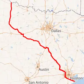
SH 6 highlighted in red | ||||
| Route information | ||||
| Maintained by TxDOT | ||||
| Length | 476.4 mi[1] (766.7 km) | |||
| Existed | April 4, 1917–present | |||
| Major junctions | ||||
| South end | ||||
| North end | ||||
| Highway system | ||||
| ||||

In 1997, the Texas Legislature designated SH 6 as the Texas Korean War Veterans Memorial Highway.[2]
History
Historic routes

State Highway 6 was one of the original 25 state highways proposed on June 21, 1917, overlying the King of Trails Highway.[3] From 1919, the routing mostly followed present-day U.S. Highway 75 from Oklahoma to Dallas, then U.S. Highway 77 to Waco.
Current routes
On August 21, 1923, SH 6 was extended along the eastern Gulf Division branch of State Highway 2 to keep SH 2 from having two separate highways with the same number.[4] In 1926, US 75 and US 77 were overlaid on northern SH 6 from Waco northward through the Dallas area to Denison, and US 75 was overlaid on the section from Houston to Galveston. In 1935, US 290 was overlaid on the section from Hempstead to Houston. While the routes were marked concurrently, the concurrent SH 6 kept its numbering until September 26, 1939, when SH 6 was truncated to the Gulf Division routing ending at Waco. It was rerouted south from Hempstead to Galveston, replacing SH 242 and SH 38.

On September 26, 1945, the roadway was extended northwest to Breckenridge over SH 67, continuing northwest to near Throckmorton along SH 157, which was decommissioned. That same day, the section in southeast Texas between Hempstead and Sugar Land was cancelled, as it was redundant with the new Farm to Market Road 359. On August 20, 1952, the route was truncated on the north side, ending near Breckenridge. This section was transferred to U.S. Highway 183. On September 26, 1967, SH 6 was rerouted to bypass Bremond, with the old route through Bremond transferred to SH 14 and FM 46. On November 1, 1968, the section between Hempstead and Sugar Land was re-established, as it was routed along U.S. Highway 290 until it reached Farm to Market Road (FM) 1960, then replacing FM 1960 southward to where the southern branch of SH 6 intersected to what is now Interstate 69/U.S. Highway 59 in Sugar Land. That portion of FM 1960 from 290 to then Highway 90 at Addicks was built in the 1950s, replacing and rerouting some of what was known as Jackrabbit Road. In the early 1970s, the northern section underwent a massive rerouting due to realignments of numerous U.S. and state routes. On August 4, 1971, the section from Breckenridge south to Eastland was redesignated as State Highway 69. SH 6 was instead rerouted west along U.S. Highway 80 to Cisco, then replaced U.S. Highway 380 northwest to near Old Glory. The route was again extended on July 31, 1975, replacing State Highway 283 between Old Glory and Stamford northward to the Texas/Oklahoma border, completing the current routing of SH 6. The old route of SH 6 was transferred to new SH 283. On October 27, 1989, a section from US 90A to McKeever Road (McKeever Bypass) was added.[1]
A spur, SH 6A was designated on August 1, 1928 from SH 6 to Texas City.[5] On March 19, 1930, this route was renumbered as State Highway 146.
In June 2016, a section of the highway in Eastland County between Cisco and Albany was destroyed due to major flooding.[6]
Route description

SH 6 begins at an intersection with Interstate 45 and SH 3 in Bayou Vista, and proceeds to the northwest, paralleling the ATSF railroad tracks. The highway makes a mostly straight line through Galveston, Brazoria, and Fort Bend Counties, passing through the city of Alvin. As the highway traverses through Sugar Land, it makes a turn to the north after passing intersections with Interstate 69/US Route 59 and Alternate US Route 90. The highway continues north into western Harris County, reaching the Westpark Tollway and Interstate 10. It then intersects US Route 290 in CyFair, joining it as they travel to the northwest, thus finishing a large routing around the southern and western portions of Houston. The route continues northwest with US 290 as a limited-access highway. At Hockley, the highway veers to the right, forking from an old alignment of the highway, and bypassing the cities of Waller and Hempstead to the north. At Hempstead, it splits from US 290 and turns northward into Grimes County, where it bypasses the city of Navasota, while Business SH 6 passes through town. The highway then turns northwest again, crossing into Brazos County. The highway starts another bypass here, going around the Bryan/College Station area to the northeast, while the business route goes through these cities. On the northeast side of Bryan, the highway meets US Route 190, and they travel together to the northwest out of the region. SH 6 splits with US 190 in the town of Hearne, but joins US Route 79 before that route splits to the northeast about a mile north of town. SH 6 then continues northwest, traveling through lesser populated farmlands, before approaching Waco. Before entering Waco, it turns southeast on State Loop 340, and bypasses Waco to the south. It reaches an intersection with Interstate 35, and then turns to the northwest again, crossing over Lake Waco. The highway continues northwest and west through more farmland regions in Central Texas, before reaching an intersection with Interstate 20 just south of Eastland. The route briefly turns west, traveling along the former route of US Route 80, before turning back to the northwest at Cisco. As it continues, it is briefly concurrent with US Routes 180 and 277 in northcentral Texas. Just northwest of Stamford, the highway makes its final turn to the north at an intersection with SH 283. The highway then travels through sparsely populated areas of Haskell, Knox, Foard, and Hardeman Counties before ending north of Quanah at the Red River, where it meets Oklahoma State Highway 6.
Major intersections
| County | Location | mi[7] | km | Destinations | Notes | ||
|---|---|---|---|---|---|---|---|
| Galveston | La Marque | 0.0 | 0.0 | I-45 exit 7B | |||
| Hitchcock | 4.9 | 7.9 | |||||
| 5.9 | 9.5 | ||||||
| Santa Fe | 9.2 | 14.8 | southern end of FM 646 concurrency | ||||
| 9.7 | 15.6 | northern end of FM 646 concurrency | |||||
| 11.2 | 18.0 | ||||||
| Brazoria | Alvin | 18.7 | 30.1 | interchange | |||
| 19.6 | 31.5 | ||||||
| 19.8 | 31.9 | ||||||
| Manvel | 27.0 | 43.5 | |||||
| 29.8 | 48.0 | interchange | |||||
| Fort Bend | Arcola | 33.9 | 54.6 | interchange | |||
| Missouri City | 37.0 | 59.5 | Fort Bend Parkway Toll Road north | interchange | |||
| 41.6 | 66.9 | ||||||
| Sugar Land | 45.7 | 73.5 | I-69/US 59 exit 109; interchange | ||||
| 47.0 | 75.6 | University Boulevard | interchange | ||||
| 47.8 | 76.9 | interchange | |||||
| Harris | Houston | 54.3 | 87.4 | interchange | |||
| 56.3 | 90.6 | ||||||
| 59.7 | 96.1 | I-10 exit 751 | |||||
| 66.3 | 106.7 | ||||||
| 69.1 | 111.2 | Hempstead Highway / Jackrabbit Road | interchange | ||||
| 69.6 | 112.0 | interchange; south end of US 290 overlap; no access to FM 1960 | |||||
| see US 290 | |||||||
| Waller | Hempstead | 101.1 | 162.7 | interchange; north end of US 290 overlap | |||
| Howth | 104.6 | 168.3 | |||||
| | 107.4 | 172.8 | |||||
| Grimes | | 112.3 | 180.7 | ||||
| | 114.1 | 183.6 | |||||
| | 114.8 | 184.8 | |||||
| | 117.1 | 188.5 | interchange; no northbound entrance | ||||
| Navasota | 119.4 | 192.2 | interchange | ||||
| 120.6 | 194.1 | interchange | |||||
| 122.0 | 196.3 | interchange | |||||
| 123.6 | 198.9 | interchange; southbound exit and northbound entrance | |||||
| Brazos | | 124.4 | 200.2 | interchange; south end of freeway | |||
| | 128.6 | 207.0 | Westward Ho | ||||
| | 131.5 | 211.6 | |||||
| | 133.5 | 214.8 | Texas World Speedway | ||||
| College Station | 135.6 | 218.2 | Nantucket Drive | no direct northbound exit | |||
| 136.1 | 219.0 | ||||||
| 137.4 | 221.1 | Barron Road | |||||
| 138.8 | 223.4 | Access to College Station Medical Center | |||||
| 139.7 | 224.8 | ||||||
| 140.0 | 225.3 | ||||||
| 142.0 | 228.5 | Southwest Parkway / Raintree Drive | |||||
| 142.1 | 228.7 | ||||||
| 143.1 | 230.3 | ||||||
| Bryan | 144.2 | 232.1 | Access to St. Joseph Regional Health Center | ||||
| 145.7 | 234.5 | ||||||
| 146.5 | 235.8 | Old Reliance Road / MLK Jr. Street | |||||
| 147.9 | 238.0 | South end of US 190 concurrency | |||||
| 149.6 | 240.8 | ||||||
| 150.5 | 242.2 | Woodville Road | |||||
| 151.5 | 243.8 | Department of Public Safety | southbound exit only | ||||
| 152.5 | 245.4 | no northbound exit | |||||
| 153.0 | 246.2 | interchange; north end of freeway | |||||
| Brazos–Robertson county line | Benchley | 155.3 | 249.9 | interchange | |||
| Robertson | | 162.6 | 261.7 | ||||
| Hearne | 167.9 | 270.2 | interchange; north end of US 190 overlap; south end of US 79 overlap | ||||
| 169.5 | 272.8 | ||||||
| | 169.8 | 273.3 | interchange; north end of US 79 overlap | ||||
| Calvert | 176.5 | 284.0 | south end of FM 1644 overlap | ||||
| 176.6 | 284.2 | north end of FM 1644 overlap | |||||
| 177.0 | 284.9 | ||||||
| | 180.2 | 290.0 | |||||
| Bremond | 186.7 | 300.5 | |||||
| 187.0 | 300.9 | ||||||
| 188.6 | 303.5 | ||||||
| Falls | 191.0 | 307.4 | |||||
| | 192.6 | 310.0 | |||||
| Reagan | 194.7 | 313.3 | interchange | ||||
| Marlin | 201.3 | 324.0 | interchange | ||||
| 203.6 | 327.7 | interchange | |||||
| 204.9 | 329.8 | interchange | |||||
| 206.0 | 331.5 | interchange | |||||
| | 209.3 | 336.8 | |||||
| Perry | 212.2 | 341.5 | |||||
| McLennan | Riesel | 216.4 | 348.3 | ||||
| | 219.8 | 353.7 | interchange | ||||
| | 221.8 | 357.0 | |||||
| | 223.4 | 359.5 | |||||
| Waco | 226.7 | 364.8 | interchange; south end of Loop 340 overlap | ||||
| | 227.9 | 366.8 | Frontage Road | interchange; southbound exit and northbound entrance | |||
| Waco | 228.2 | 367.3 | interchange | ||||
| 229.6 | 369.5 | 12th Street | interchange | ||||
| Robinson | 231.7 | 372.9 | interchange | ||||
| 232.9 | 374.8 | south end of freeway; I-35 exit 330, access to Hillcrest Baptist Medical Center | |||||
| Waco | 234.4 | 377.2 | no direct northbound exit (signed at I-35) | ||||
| 234.6 | 377.6 | Beverly Drive | no southbound exit | ||||
| 235.4 | 378.8 | ||||||
| 236.0 | 379.8 | North end of Loop 340 concurrency, access to Providence Medical Center | |||||
| 236.4 | 380.4 | Access to Providence Medical Center | |||||
| 237.5 | 382.2 | ||||||
| 238.3 | 383.5 | Lake Waco, Midway Park | |||||
| 239.7 | 385.8 | Lake Waco, Speegleville Park | |||||
| | 241.5 | 388.7 | Speegleville Road | ||||
| | 243.2 | 391.4 | interchange; north end of freeway | ||||
| | 244.9 | 394.1 | |||||
| Bosque | Valley Mills | 256.0 | 412.0 | ||||
| 256.2 | 412.3 | ||||||
| | 256.8 | 413.3 | |||||
| | 259.2 | 417.1 | |||||
| | 263.6 | 424.2 | |||||
| Clifton | 267.5 | 430.5 | |||||
| 268.4 | 431.9 | ||||||
| | 271.3 | 436.6 | |||||
| Meridian | 278.5 | 448.2 | |||||
| Iredell | 291.6 | 469.3 | |||||
| | 292.1 | 470.1 | |||||
| Hamilton | Hico | 301.0 | 484.4 | ||||
| 301.3 | 484.9 | South end of US 281 concurrency | |||||
| Erath | | 305.8 | 492.1 | North end of US 281 concurrency | |||
| Alexander | 313.4 | 504.4 | |||||
| Dublin | 321.6 | 517.6 | |||||
| 321.7 | 517.7 | South end of FM 219 concurrency | |||||
| 322.2 | 518.5 | North end of FM 219 concurrency | |||||
| | 323.8 | 521.1 | Interchange | ||||
| Comanche | | 329.2 | 529.8 | ||||
| De Leon | 334.2 | 537.8 | South end of SH 16 concurrency | ||||
| 334.8 | 538.8 | North end of SH 16 concurrency | |||||
| Eastland | Gorman | 344.3 | 554.1 | ||||
| 344.8 | 554.9 | south end of FM 8 overlap | |||||
| 345.2 | 555.5 | north end of FM 8 overlap | |||||
| | 349.0 | 561.7 | |||||
| | 354.4 | 570.4 | |||||
| Carbon | 355.4 | 572.0 | |||||
| Punkin Center | 358.6 | 577.1 | |||||
| | 362.5 | 583.4 | I-20 exit 340 | ||||
| Eastland | 364.7 | 586.9 | |||||
| 365.5 | 588.2 | ||||||
| | 368.9 | 593.7 | |||||
| Cisco | 374.2 | 602.2 | south end of US 183 Truck overlap | ||||
| 374.4 | 602.5 | north end of US 183 Truck overlap; south end of US 183 overlap | |||||
| 374.6 | 602.9 | North end of US 183 concurrency | |||||
| | 376.9 | 606.6 | |||||
| | 382.7 | 615.9 | |||||
| Callahan | | 389.9 | 627.5 | ||||
| Shackelford | Moran | 392.7 | 632.0 | ||||
| 393.0 | 632.5 | ||||||
| Sedwick | 397.6 | 639.9 | |||||
| | 406.7 | 654.5 | |||||
| Albany | 408.2 | 656.9 | South end of US 180 / US 283 concurrency | ||||
| 408.7 | 657.7 | North end of US 283 concurrency | |||||
| | 415.8 | 669.2 | interchange | ||||
| | 426.7 | 686.7 | North end of US 180 concurrency | ||||
| | 429.0 | 690.4 | |||||
| Jones | Lueders | 430.2 | 692.3 | ||||
| | South end of FM 600 concurrency | ||||||
| Avoca | North end of FM 600 concurrency | ||||||
| | |||||||
| | |||||||
| Stamford | |||||||
| South end of US 277 Bus. concurrency; traffic circle around U.S. Post Office | |||||||
| Haskell | interchange; north end of US 277 Bus. overlap; south end of SH 283 overlap | ||||||
| | North end of SH 283 concurrency | ||||||
| | |||||||
| | |||||||
| Rule | |||||||
| | south end of FM 2407 overlap | ||||||
| | north end of FM 2407 overlap | ||||||
| Rochester | |||||||
| O'Brien | |||||||
| Knox | Knox City | ||||||
| | |||||||
| | |||||||
| Benjamin | |||||||
| | South end of FM 1756 concurrency | ||||||
| | North end of FM 1756 concurrency | ||||||
| Foard | | ||||||
| | |||||||
| | |||||||
| | |||||||
| Crowell | |||||||
| | |||||||
| Hardeman | | ||||||
| | |||||||
| Quanah | |||||||
| south end of Spur 133 overlap | |||||||
| north end of Spur 133 overlap | |||||||
| | |||||||
| | |||||||
| | Oklahoma state line (Red River bridge) | ||||||
1.000 mi = 1.609 km; 1.000 km = 0.621 mi
| |||||||
Business routes
SH 6 has four business routes.
Marlin business loop
| |
|---|---|
| Location | Marlin |
| Length | 5.328 mi[8] (8.575 km) |
| Existed | 1990–present |

Business State Highway 6-N (formerly Loop 23) is a business loop that runs from SH 6 near Marlin in central Texas. The road was bypassed on November 30, 1978 by SH 6 and designated Loop 23. The road was redesignated as Business SH 6-N on June 21, 1990.[9][8]
Reagan business loop
| |
|---|---|
| Location | Reagan |
| Existed | 2015–present |
Business State Highway 6-P is a business loop that runs near Reagan. The road was bypassed on June 25, 2015 by SH 6 when it was rerouted west.[10]
Bryan-College Station business loop
| |
|---|---|
| Location | Bryan-College Station |
| Length | 12.477 mi[11] (20.080 km) |
| Existed | 1990–present |

Business State Highway 6-R (formerly Loop 507) is a business loop that runs through Bryan and College Station. The route runs on Texas Avenue in both cities. The route, created in 1972 when SH 6 was routed further north and east, is 12.5 miles (20.1 km) long.[11] The road was redesignated as Business SH 6-R on June 21, 1990. It serves as the eastern boundary of Texas A&M University.
Navasota business loop
| |
|---|---|
| Location | Navasota |
| Length | 6.316 mi[12] (10.165 km) |
| Existed | 1990–present |

Business State Highway 6-S (formerly Loop 508) is a business loop that runs through Navasota on La Salle Avenue. The route was created in 1972 when SH 6 was rerouted further north and east around town; it is 6.3 miles (10.1 km). The road was redesignated as Business SH 6-S on June 21, 1990.[12]
References
- Transportation Planning and Programming Division (n.d.). "State Highway No. 6". Highway Designation Files. Texas Department of Transportation. Retrieved March 15, 2008.
- Transportation Code, § 225.034. Acts 1997, 75th Leg., eff. May 5, 1997.
- Texas State Highway Department. "Minute Orders of the June 21, 1917 Meeting of the Texas State Highway Department" (PDF). Austin, TX. Retrieved October 29, 2019.
- Texas State Highway Department. "Minute Orders of the August 21, 1923 Meeting of the Texas State Highway Department" (PDF). Austin, TX. Retrieved October 29, 2019.
- Texas State Highway Department. "Minute Orders of the August 1, 1928 Meeting of the Texas State Highway Department" (PDF). Austin, TX. Retrieved October 29, 2019.
- Axford, William (June 3, 2016). "Part of Highway 6 in Eastland County disappears after rain". The Houston Chronicle. Retrieved October 29, 2019.
- Google Maps, "Google Maps". Retrieved August 30, 2019.
- Transportation Planning and Programming Division (n.d.). "Business State Highway No. 6-N". Highway Designation Files. Texas Department of Transportation.
- Transportation Planning and Programming Division (n.d.). "State Highway Loop No. 23". Highway Designation Files. Texas Department of Transportation.
- Transportation Planning and Programming Division (n.d.). "Business State Highway No. 6-P". Highway Designation Files. Texas Department of Transportation.
- Transportation Planning and Programming Division (n.d.). "Business State Highway No. 6-R". Highway Designation Files. Texas Department of Transportation.
- Transportation Planning and Programming Division (n.d.). "Business State Highway No. 6-S". Highway Designation Files. Texas Department of Transportation.
External links
| Wikimedia Commons has media related to Texas State Highway 6. |
 Geographic data related to Texas State Highway 6 at OpenStreetMap