Hardeman County, Texas
Hardeman County (/ˈhɑːrdɪmən/ HAR-di-mən) is a county located in the U.S. state of Texas. As of the 2010 census, its population was 4,139.[1] The county seat and largest city is Quanah.[2] The county was created in 1858 and later organized in 1884.[3] It is named for two brothers, Bailey Hardeman and Thomas Jones Hardeman,[4] early Texas politicians and legislators. Hardeman County was one of 46 prohibition or entirely dry counties in the state of Texas until November 2006, when voters approved referendums to permit the legal sale of alcoholic beverages for on- and off-premises consumption.
Hardeman County | |
|---|---|
.jpg.webp) The Hardeman County Courthouse in Quanah | |
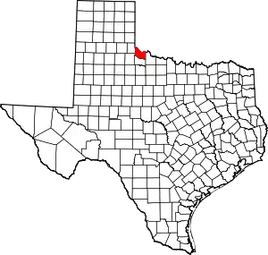 Location within the U.S. state of Texas | |
 Texas's location within the U.S. | |
| Coordinates: 34°17′N 99°45′W | |
| Country | |
| State | |
| Founded | 1884 |
| Seat | Quanah |
| Largest city | Quanah |
| Area | |
| • Total | 697 sq mi (1,810 km2) |
| • Land | 695 sq mi (1,800 km2) |
| • Water | 1.8 sq mi (5 km2) 0.3%% |
| Population (2010) | |
| • Total | 4,139 |
| • Density | 6.0/sq mi (2.3/km2) |
| Time zone | UTC−6 (Central) |
| • Summer (DST) | UTC−5 (CDT) |
| Congressional district | 13th |
Republican Drew Springer, Jr., a businessman from Muenster in Cooke County, has since January 2013 represented Hardeman County in the Texas House of Representatives.[5]
Geography
According to the U.S. Census Bureau, the county has a total area of 697 sq mi (1,810 km2), of which 695 sq mi (1,800 km2) are land and 1.8 sq mi (4.7 km2) (0.3%) are covered by water.[6]
The Prairie Dog Town Fork Red River joins with Buck Creek in the northwestern corner of the county to form the Red River, which flows east to form the northern border of the county, separating it from Oklahoma.[7]
Hardeman County is the northernmost county in Texas that is not part of the Texas Panhandle.
Major highways
Adjacent counties
- Harmon County, Oklahoma (north)
- Jackson County, Oklahoma (northeast)
- Wilbarger County (east)
- Foard County (south)
- Cottle County (southwest)
- Childress County (west)
Demographics
| Historical population | |||
|---|---|---|---|
| Census | Pop. | %± | |
| 1880 | 50 | — | |
| 1890 | 3,904 | 7,708.0% | |
| 1900 | 3,634 | −6.9% | |
| 1910 | 11,213 | 208.6% | |
| 1920 | 12,487 | 11.4% | |
| 1930 | 14,532 | 16.4% | |
| 1940 | 11,073 | −23.8% | |
| 1950 | 10,212 | −7.8% | |
| 1960 | 8,275 | −19.0% | |
| 1970 | 6,795 | −17.9% | |
| 1980 | 6,368 | −6.3% | |
| 1990 | 5,283 | −17.0% | |
| 2000 | 4,724 | −10.6% | |
| 2010 | 4,139 | −12.4% | |
| 2019 (est.) | 3,933 | [8] | −5.0% |
| U.S. Decennial Census[9] 1850–2010[10] 2010–2014[1] | |||
As of the census[11] of 2000, 4,724 people, 1,943 households, and 1,319 families were residing in the county. The population density was 7 people per mi2 (3/km2). The 2,358 housing units averaged 3 per mi2 (1/km2). The racial makeup of the county was 85.41% White, 4.83% African American, 0.76% Native American, 0.30% Asian, 7.09% from other races, and 1.61% from two or more races. About 14.50% of the population were Hispanic or Latino of any race.
Of the 1,943 households, 29.90% had children under the age of 18 living with them, 54.70% were married couples living together, 10.40% had a female householder with no husband present, and 32.10% were not families. About 29.50% of all households were made up of individuals, and 18.00% had someone living alone who was 65 years of age or older. The average household size was 2.40, and the average family size was 2.97.
In the county, the population distribution was 25.40% under the age of 18, 7.50% from 18 to 24, 22.60% from 25 to 44, 24.30% from 45 to 64, and 20.20% who were 65 years of age or older. The median age was 41 years. For every 100 females, there were 89.40 males. For every 100 females age 18 and over, there were 85.20 males.
The median income for a household in the county was $28,312, and for a family was $33,325. Males had a median income of $26,683 versus $18,566 for females. The per capita income for the county was $16,824. About 14.60% of families and 17.80% of the population were below the poverty line, including 26.00% of those under age 18 and 13.40% of those age 65 or over.
Economy
Georgia-Pacific operates a gypsum plant in the small community of Acme, located 6 miles (9.7 km) west of Quanah on U.S. Highway 287.
Attractions
- Copper Breaks State Park, which is operated by the Texas Parks and Wildlife Department, is located in far southern Hardeman County near the Pease River just off State Highway 6, about 12 miles (19 km) south of Quanah. The park features a portion of the state Texas Longhorn herd.
- Lake Pauline is located off U.S. Highway 287, 6 miles (9.7 km) east of Quanah.
Communities
Cities
- Chillicothe
- Quanah (county seat)
Unincorporated communities
- Goodlett
Ghost towns
- Acme
- Medicine Mound
Politics
Hardeman County formerly leaned Democratic, however in recent years it has swung to become solidly Republican.
| Year | Republican | Democratic | Third parties |
|---|---|---|---|
| 2016 | 79.8% 1,207 | 16.5% 249 | 3.8% 57 |
| 2012 | 78.7% 1,176 | 20.2% 302 | 1.1% 17 |
| 2008 | 75.2% 1,199 | 23.4% 373 | 1.4% 23 |
| 2004 | 71.3% 1,214 | 28.2% 480 | 0.5% 8 |
| 2000 | 62.7% 976 | 36.4% 566 | 1.0% 15 |
| 1996 | 39.8% 610 | 49.0% 750 | 11.2% 171 |
| 1992 | 31.7% 614 | 49.3% 954 | 19.0% 368 |
| 1988 | 42.7% 855 | 57.1% 1,143 | 0.2% 3 |
| 1984 | 57.0% 1,238 | 42.7% 927 | 0.4% 8 |
| 1980 | 46.5% 1,056 | 51.7% 1,174 | 1.9% 43 |
| 1976 | 36.2% 805 | 63.1% 1,403 | 0.8% 17 |
| 1972 | 68.3% 1,357 | 30.9% 614 | 0.8% 16 |
| 1968 | 34.3% 873 | 44.9% 1,145 | 20.8% 531 |
| 1964 | 27.5% 697 | 72.5% 1,835 | |
| 1960 | 55.4% 1,472 | 44.5% 1,182 | 0.0% 1 |
| 1956 | 46.5% 1,119 | 53.2% 1,281 | 0.4% 9 |
| 1952 | 55.7% 1,571 | 44.0% 1,242 | 0.3% 8 |
| 1948 | 11.4% 226 | 83.7% 1,654 | 4.9% 96 |
| 1944 | 10.3% 223 | 80.8% 1,756 | 8.9% 194 |
| 1940 | 12.9% 362 | 87.1% 2,453 | |
| 1936 | 9.4% 207 | 90.2% 1,991 | 0.5% 10 |
| 1932 | 6.8% 145 | 93.0% 1,985 | 0.2% 5 |
| 1928 | 59.4% 1,333 | 40.6% 910 | |
| 1924 | 18.2% 256 | 78.1% 1,099 | 3.8% 53 |
| 1920 | 19.0% 252 | 73.0% 967 | 7.9% 105 |
| 1916 | 8.1% 94 | 80.7% 932 | 11.2% 129 |
| 1912 | 3.4% 36 | 79.2% 843 | 17.5% 186 |
See also
References
- "State & County QuickFacts". United States Census Bureau. Archived from the original on October 18, 2011. Retrieved December 17, 2013.
- "Find a County". National Association of Counties. Retrieved 2011-06-07.
- "Texas: Individual County Chronologies". Texas Atlas of Historical County Boundaries. The Newberry Library. 2008. Retrieved May 24, 2015.
- Gannett, Henry (1905). The Origin of Certain Place Names in the United States. Govt. Print. Off. pp. 149.
- "State Rep. Springer announces district tour July 30". Lubbock Avalanche-Journal, July 16, 2013. Retrieved July 18, 2013.
- "2010 Census Gazetteer Files". United States Census Bureau. August 22, 2012. Retrieved April 28, 2015.
- "Secondary Streams of Texas". Texas Almanac. Texas State Historical Association. Retrieved 2015-05-05.
Red River, Prairie Dog Town Fork
- "Population and Housing Unit Estimates". United States Census Bureau. May 24, 2020. Retrieved May 27, 2020.
- "U.S. Decennial Census". United States Census Bureau. Retrieved April 28, 2015.
- "Texas Almanac: Population History of Counties from 1850–2010" (PDF). Texas Almanac. Retrieved April 28, 2015.
- "U.S. Census website". United States Census Bureau. Retrieved 2011-05-14.
- Leip, David. "Dave Leip's Atlas of U.S. Presidential Elections". uselectionatlas.org. Retrieved 2018-07-25.
External links
| Wikimedia Commons has media related to Hardeman County, Texas. |
- Texas Cooperative Extension, Hardeman County office
- Texas School Districts: School Districts in Hardeman County
- Hardeman County from the Handbook of Texas Online
- Hardeman County profile from the Texas Association of Counties
- Historic Hardeman County materials, hosted by the Portal to Texas History.
- Thomas Jones Hardeman at Find a Grave
- Bailey Hardeman at Find a Grave
Places adjacent to Hardeman County, Texas | ||||||||||
|---|---|---|---|---|---|---|---|---|---|---|
| ||||||||||
Municipalities and communities of Hardeman County, Texas, United States | ||
|---|---|---|
| Cities | Hardeman County map | |
| Ghost towns |
| |
| ||
