Guadalupe County, Texas
Guadalupe County (/ˌɡwɑːdəˈlʊpiː/,[1] Spanish pronunciation: [gwaðaˈlupe]) is a county located in the U.S. state of Texas. As of the 2010 census, its population was 131,533.[2] The county seat is Seguin.[3] The county was founded in 1846 and is named after Guadalupe River.
Guadalupe County | |
|---|---|
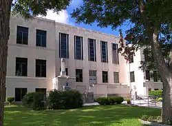 The Guadalupe County Courthouse in Seguin | |
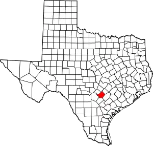 Location within the U.S. state of Texas | |
 Texas's location within the U.S. | |
| Coordinates: 29°35′N 97°57′W | |
| Country | |
| State | |
| Founded | 1846 |
| Named for | Guadalupe River |
| Seat | Seguin |
| Largest city | New Braunfels |
| Area | |
| • Total | 715 sq mi (1,850 km2) |
| • Land | 711 sq mi (1,840 km2) |
| • Water | 3.5 sq mi (9 km2) 0.5%% |
| Population (2010) | |
| • Total | 131,533 |
| • Density | 185/sq mi (71/km2) |
| Time zone | UTC−6 (Central) |
| • Summer (DST) | UTC−5 (CDT) |
| Congressional district | 15th |
| Website | www |


Guadalupe County is part of the San Antonio metropolitan statistical area.
History
Indigenous paleo-Indian hunter-gatherers were the first inhabitants of the area, thousands of years before European colonization. Later, historic Indian tribes settled in the area, including Tonkawa, Karankawa, Kickapoo, Lipan Apache, and Comanche.[4]
In 1689, Alonso de Leon named the Guadalupe River for Spain in honor of Our Lady of Guadalupe.
In 1806, French army officer José de la Baume, who later joined the Spanish army, was rewarded for his services to Spain with title to 27,000 acres (11,000 ha) of Texas land, the original El Capote Ranch. The grant was reaffirmed by the Republic of Mexico after it achieved independence.[5]
Following Mexico's independence from Spain, Anglo-Americans from the United States settled in Texas in 1821, and claimed Mexican citizenship. In 1825, Guadalupe County was part of Green DeWitt's petition for a land grant to establish a colony in Texas, which was approved by the Mexican government. From 1827 to 1835, 22 families settled the area as part of DeWitt's colony.[4]
Following Texas' gaining independence from Mexico (1836), 33 Gonzales Rangers and Republic veterans established Seguin. Founded as Walnut Springs in 1838, the settlement's name was changed to Seguin the next year to honor Juan Nepomuceno Seguín, who had fought for independence.[6]
In 1840, the Virginian Michael Erskine acquired the El Capote Ranch[7] for use as a cattle ranch. In 1842, the Republic of Texas organized Guadalupe County as a judicial county. The Texas Supreme Court declared judicial counties to be unconstitutional. In 1845, Prince Carl of Solms-Braunfels secured title to 1,265 acres (512 ha) of the Veramendi grant in the northern part of the former judicial county.[4]
Following the annexation of Texas by the United States (1845), Prussian immigrant August Wilhelm Schumann arrived on the Texas coast aboard the SS Franziska in 1846, and purchased 188 acres (76 ha) in Guadalupe County. Shortly thereafter, the state legislature established the present county from parts of Bexar and Gonzales Counties.[4]
In 1846, during the war between the United States and Mexico, a wagon train of German immigrant settlers bought Guadalupe land from August Schumann. The following year, the town of Schumannsville was established by German immigrants and named after him.[4] Numerous German immigrants entered Texas at Galveston following the revolutions of 1848 in German states, settling in Guadalupe County and central Texas. After their own struggles, they tended to oppose slavery.
The last Indian raid into the area was made by the Kickapoo in 1855.[4]
By 1860, 1,748 slaves of African descent were in the county, generally brought in from the South by slaveholder migrants. In 1861, the people of the county voted 314–22 in favor of secession from the Union. Guadalupe County sent several troops to fight for the Confederate States Army. Following the end of the Civil War and the emancipation of the slaves (1865), a Freedmen's Bureau office opened in 1866 in Seguin to supervise work contracts between former slaves and area farmers.[8] Together, German Americans and African Americans joined the Republican Party, leading Guadalupe County to be a reliably Republican one into the 20th century,[9] even after the state disfranchisement of African Americans in 1901 by imposition of a poll tax.[10]
By 1876, the Galveston, Harrisburg and San Antonio Railway reached Seguin. It was completed as far as San Antonio the following year.[11] By 1880, ethnic Germans accounted for 40% of the county population. Tenant farming and sharecropping accounted for the operation of 25% of the county's farms. By 1910, immigrants from Mexico accounted for about 11% of the country’s population.
In 1929, oil was discovered at the Darst Creek oilfield.[12] By 1930, tenant farming and sharecropping comprised 64% of the county's farms.
Over the next five decades, the economy changed markedly, as the area became more urbanized and less dependent on agriculture. By 1982, professional and related services, manufacturing, and wholesale and retail trade involved nearly 60% of the workforce in the area.[4]
Geography
According to the U.S. Census Bureau, the county has a total area of 715 square miles (1,850 km2), of which 711 square miles (1,840 km2) are land and 3.5 square miles (9.1 km2) (0.5%) are covered by water.[13]
Major highways
.svg.png.webp) Interstate 10
Interstate 10.svg.png.webp) Interstate 35
Interstate 35 U.S. Highway 90
 U.S. Highway 90 Alternate
 State Highway 46
 State Highway 123
 State Highway 130
Adjacent counties
- Hays County (north)
- Caldwell County (northeast)
- Gonzales County (southeast)
- Wilson County (south)
- Bexar County (southwest)
- Comal County (northwest)
Demographics
| Historical population | |||
|---|---|---|---|
| Census | Pop. | %± | |
| 1850 | 1,511 | — | |
| 1860 | 5,444 | 260.3% | |
| 1870 | 7,282 | 33.8% | |
| 1880 | 12,202 | 67.6% | |
| 1890 | 15,217 | 24.7% | |
| 1900 | 21,385 | 40.5% | |
| 1910 | 24,913 | 16.5% | |
| 1920 | 27,719 | 11.3% | |
| 1930 | 28,925 | 4.4% | |
| 1940 | 25,596 | −11.5% | |
| 1950 | 25,392 | −0.8% | |
| 1960 | 29,017 | 14.3% | |
| 1970 | 33,554 | 15.6% | |
| 1980 | 46,708 | 39.2% | |
| 1990 | 64,873 | 38.9% | |
| 2000 | 89,023 | 37.2% | |
| 2010 | 131,533 | 47.8% | |
| 2019 (est.) | 166,847 | [14] | 26.8% |
| U.S. Decennial Census[15] 1850–2010[16] 2010–2019[2] | |||
As of the census[17] of 2000, 89,023 people, 30,900 households, and 23,823 families were residing in the county. The population density was 125 people/sq mi (48/km2). The 33,585 housing units average 47/sq mi (18/km2). The racial makeup of the county was 77.65% White, 5.01% African American, 0.55% Native American, 0.87% Asian, 12.86% from other races, and 3.07% from two or more races. About 33.21% of the population were Hispanics or Latinos of any race.
Of the 30,900 households, 38.30% had children under 18 living with them, 61.60% were married couples living together, 11.20% had a female householder with no husband present, and 22.90% were not families. About 18.90% of all households were made up of individuals, and 7.60% had someone living alone who was 65 or older. The average household size was 2.83, and the average family size was 3.23.
In the county, the age distribution was 28.50% under 18, 9.00% from 18 to 24, 29.10% from 25 to 44, 22.20% from 45 to 64, and 11.30% who were 65 or older. The median age was 35 years. For every 100 females, there were 97.00 males. For every 100 females age 18 and over, there were 94.30 males.
The median income for a household was $43,949, and for a family was $49,645. Males had a median income of $32,450 versus $23,811 for females. The per capita income for the county was $18,430. About 7.30% of families and 9.80% of the population were below the poverty line, including 13.30% of those under age 18 and 9.50% of those 65 or over.
Education
School districts
Colleges and universities
Texas Lutheran University has about 1,400 students. It is affiliated with the Evangelical Lutheran Church in America. It was ranked number three among the best west regional universities by U.S. News & World Report in 2013. Texas Lutheran is now a member of the Southern Collegiate Athletic Conference, NCAA Division III, with Austin College, Colorado College, Centenary College of Louisiana, Schreiner University, Southwestern University, Trinity University, and the University of Dallas.
Communities
Cities (multiple counties)
- Cibolo (a small portion in Bexar County)
- New Braunfels (mostly in Comal County as well as its seat)
- San Marcos (mostly in Hays County and a small part in Caldwell County)
- Schertz (partly in Bexar and Comal Counties)
- Selma (partly in Bexar and Comal Counties)
- Universal City (mostly in Bexar County)
Cities
- Kingsbury
- Marion
- New Berlin
- Santa Clara
- Seguin (county seat)
- Staples
Census-designated places
Other unincorporated communities
Ghost town
Politics
Although not to the same extent as Gillespie or Kendall Counties, Guadalupe is a strongly Republican county that possessed strong GOP leanings even during the Solid South era due to its Texas German heritage. The only Democratic Presidential candidate to carry Guadalupe County since 1940 has been Hill Country native Lyndon B. Johnson during his 1964 landslide; it was one of seven Lone Star State counties to vote for Thomas E. Dewey in 1944 and one of eight to do so in 1948. The only Democrat to reach 40% of the county’s vote since 1968 has been Jimmy Carter in 1976.
Although Al Smith did win the county in 1928 due to anti-Prohibition sentiment,[18] unlike nearby Bandera County, Guadalupe had even leaned Republican before Warren G. Harding's 1920 landslide, voting Republican in every election between 1896 and 1924 except the divided 1912 contest.[19]
| Year | Republican | Democratic | Third parties |
|---|---|---|---|
| 2020 | 61.3% 47,553 | 37.1% 28,805 | 1.5% 1,261 |
| 2016 | 63.0% 36,632 | 31.6% 18,391 | 5.3% 3,100 |
| 2012 | 66.7% 33,117 | 31.7% 15,744 | 1.5% 765 |
| 2008 | 64.9% 30,869 | 34.0% 16,156 | 1.1% 535 |
| 2004 | 72.8% 28,208 | 26.6% 10,290 | 0.7% 254 |
| 2000 | 70.3% 21,499 | 27.2% 8,311 | 2.5% 757 |
| 1996 | 58.4% 14,254 | 33.1% 8,079 | 8.5% 2,070 |
| 1992 | 46.8% 10,818 | 28.4% 6,567 | 24.8% 5,735 |
| 1988 | 64.4% 13,265 | 34.5% 7,111 | 1.1% 233 |
| 1984 | 73.8% 14,382 | 26.0% 5,060 | 0.2% 46 |
| 1980 | 64.2% 9,901 | 32.7% 5,049 | 3.1% 478 |
| 1976 | 52.3% 6,766 | 46.8% 6,054 | 0.9% 115 |
| 1972 | 70.8% 8,287 | 29.1% 3,404 | 0.1% 7 |
| 1968 | 47.6% 4,332 | 38.8% 3,529 | 13.6% 1,241 |
| 1964 | 37.4% 2,731 | 62.5% 4,568 | 0.1% 9 |
| 1960 | 53.9% 3,657 | 45.9% 3,116 | 0.2% 14 |
| 1956 | 66.9% 4,296 | 32.7% 2,099 | 0.5% 30 |
| 1952 | 65.2% 4,396 | 34.6% 2,330 | 0.2% 14 |
| 1948 | 51.0% 2,502 | 43.2% 2,119 | 5.9% 287 |
| 1944 | 58.9% 2,556 | 36.5% 1,583 | 4.7% 204 |
| 1940 | 53.1% 2,473 | 46.8% 2,182 | 0.1% 6 |
| 1936 | 29.9% 1,266 | 69.9% 2,962 | 0.2% 9 |
| 1932 | 15.5% 691 | 84.3% 3,751 | 0.2% 9 |
| 1928 | 43.5% 1,442 | 56.4% 1,872 | 0.1% 4 |
| 1924 | 40.5% 1,657 | 20.3% 831 | 39.2% 1,601 |
| 1920 | 56.9% 1,839 | 17.3% 560 | 25.8% 833 |
| 1916 | 68.4% 1,812 | 31.3% 830 | 0.3% 8 |
| 1912 | 38.7% 1,065 | 41.0% 1,128 | 20.3% 558 |
Government
Guadalupe County is run by a commissioners court presided by the county judge. The court has four members elected for two-year terms. The commissioners are elected by and represent individual districts. The county judge is elected through a county-wide at-large election.
See also
References
- https://texasalmanac.com/sites/default/files/images/topics/TownPronunciationGuide.pdf
- "State & County QuickFacts". United States Census Bureau. Archived from the original on October 18, 2011. Retrieved December 16, 2013.
- "Find a County". National Association of Counties. Archived from the original on 2011-05-31. Retrieved 2011-06-07.
- Smyrl, Vivian Elizabeth. "Guadalupe County, Texas". Handbook of Texas Online. Texas State Historical Association. Retrieved 13 December 2010.
- Texas Historical Marker, El Capote Ranch Archived 2011-09-28 at the Wayback Machine
- Gesick, John. "Seguin, Texas". Handbook of Texas Online. Texas State Historical Association. Retrieved 13 December 2010.
- Perry, Ann; Smith, Deborah; Simons, Helen; Hoyt, Catheriine A (1996). A Guide to Hispanic Texas. University of Texas Press. p. 204. ISBN 978-0-292-77709-5.
- Harper Jr, Cecil. "Freedman's Bureau". Handbook of Texas Online. Texas State Historical Association. Retrieved 13 December 2010.
- Kesselus, Ken (2002). Alvin Wirtz, The Senator, LBJ, and LCRA. Austin: Eakin Press. ISBN 1-57168-688-6.
- "Nixon v. Condon. Disfranchisement of the Negro in Texas", The Yale Law Journal, Vol. 41, No. 8, June 1932, p. 1212, accessed 21 March 2008
- Longhorn Chapter of the N.H.R.S. "Seguin and The Railroad". Texas transportation Museum, San Antonio. Archived from the original on 4 May 2009. Retrieved 13 December 2010.
- Smith, Julie Cauble. "Darst Creek Oilfield". Handbook of Texas Online. Texas State Historical Association. Retrieved 13 December 2010.
- "2010 Census Gazetteer Files". United States Census Bureau. August 22, 2012. Retrieved April 27, 2015.
- "Population and Housing Unit Estimates". United States Census Bureau. May 24, 2020. Retrieved May 27, 2020.
- "U.S. Decennial Census". United States Census Bureau. Retrieved April 27, 2015.
- "Texas Almanac: Population History of Counties from 1850–2010" (PDF). Texas Almanac. Retrieved April 27, 2015.
- "U.S. Census website". United States Census Bureau. Retrieved 2011-05-14.
- Key, V.O. junior; Southern Politics in State and Nation; p. 276 ISBN 087049435X
- Menendez, Albert J.; The Geography of Presidential Elections in the United States, 1868-2004, pp. 306-311 ISBN 0786422173
- Leip, David. "Dave Leip's Atlas of U.S. Presidential Elections". uselectionatlas.org. Retrieved 2018-07-25.
- "Obituary for Donald L. Schraub at Tres Hewell Mortuary". www.treshewell.com. Retrieved 2018-06-23.
- "Mike Wiggins - Ballotpedia". Retrieved 2018-06-23.
- "Larry Jones (Guadalupe County) - Ballotpedia". Retrieved 2018-06-23.
External links
- Guadalupe County government's website
- Guadalupe County from the Handbook of Texas Online
Places adjacent to Guadalupe County, Texas | ||||||||||
|---|---|---|---|---|---|---|---|---|---|---|
| ||||||||||
Municipalities and communities of Guadalupe County, Texas, United States | ||
|---|---|---|
| Cities | Guadalupe County map | |
| CDPs |
| |
| Other unincorporated places |
| |
| Ghost towns |
| |
| Footnotes | ‡This populated place also has portions in an adjacent county or counties | |
| ||

| Authority control |
|---|