List of United Kingdom locations: Eat-Ee

This is part of the list of United Kingdom locations: a gazetteer of place names in the United Kingdom showing each place's locality and geographical coordinates.
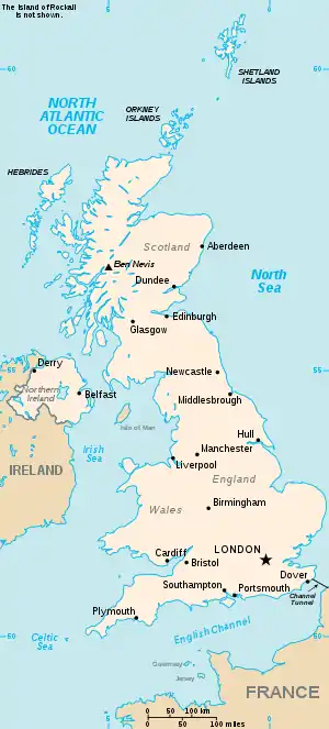
The United Kingdom

Ea (continued)

Eat-Eaz

Location Locality Coordinates
(links to map & photo sources)
OS grid
reference
Eathorpe Warwickshire 52.31°N 01.42°W / 52.31; -01.42 SP3969
Eaton (Heywood) Shropshire 52.50°N 02.73°W / 52.50; -02.73 SO5090
Eaton (Bishop's Castle) Shropshire 52.49°N 02.92°W / 52.49; -02.92 SO3789
Eaton Herefordshire 52.21°N 02.73°W / 52.21; -02.73 SO5058
Eaton Oxfordshire 51.72°N 01.36°W / 51.72; -01.36 SP4403
Eaton Nottinghamshire 53.29°N 00.93°W / 53.29; -00.93 SK7178
Eaton (Rushton, Cheshire West) Cheshire 53.16°N 02.64°W / 53.16; -02.64 SJ5763
Eaton (Cheshire East) Cheshire 53.18°N 02.21°W / 53.18; -02.21 SJ8665
Eaton Leicestershire 52.85°N 00.82°W / 52.85; -00.82 SK7929
Eaton Norfolk 52.60°N 01.26°E / 52.60; 01.26 TG2106
Eaton Bishop Herefordshire 52.03°N 02.81°W / 52.03; -02.81 SO4438
Eaton Bray Bedfordshire 51.87°N 00.59°W / 51.87; -00.59 SP9720
Eaton Constantine Shropshire 52.65°N 02.60°W / 52.65; -02.60 SJ5906
Eaton Ford Cambridgeshire 52.22°N 00.28°W / 52.22; -00.28 TL1760
Eaton Hall Cheshire 53.13°N 02.88°W / 53.13; -02.88 SJ4160
Eaton Hastings Oxfordshire 51.67°N 01.63°W / 51.67; -01.63 SU2597
Eaton Mascott Shropshire 52.64°N 02.69°W / 52.64; -02.69 SJ5305
Eaton Socon Cambridgeshire 52.21°N 00.30°W / 52.21; -00.30 TL1659
Eaton upon Tern Shropshire 52.80°N 02.52°W / 52.80; -02.52 SJ6523
Eau Brink Norfolk 52.71°N 00.33°E / 52.71; 00.33 TF5816
Eau Withington Herefordshire 52.07°N 02.67°W / 52.07; -02.67 SO5442
Eaval Western Isles 57.97°N 06.98°W / 57.97; -06.98 NB057091
Eaves Lancashire 53.83°N 02.75°W / 53.83; -02.75 SD507373
Eaves Green Solihull 52.43°N 01.63°W / 52.43; -01.63 SP2582
Eavestone North Yorkshire 54.10°N 01.66°W / 54.10; -01.66 SE2268

Eb

Location Locality Coordinates
(links to map & photo sources)
OS grid
reference
Ebberly Hill Devon 50.95°N 04.03°W / 50.95; -04.03 SS5719
Ebberston North Yorkshire 54.22°N 00.63°W / 54.22; -00.63 SE8982
Ebbesbourne Wake Wiltshire 51.01°N 02.01°W / 51.01; -02.01 ST9924
Ebblake Dorset 50.86°N 01.85°W / 50.86; -01.85 SU1007
Ebbw Vale Blaenau Gwent 51.77°N 03.21°W / 51.77; -03.21 SO1609
Ebchester Durham 54.89°N 01.84°W / 54.89; -01.84 NZ1055
Ebdon North Somerset 51.37°N 02.92°W / 51.37; -02.92 ST3664
Ebernoe West Sussex 51.03°N 00.61°W / 51.03; -00.61 SU9727
Ebford Devon 50.67°N 03.44°W / 50.67; -03.44 SX9887
Ebley Gloucestershire 51.73°N 02.26°W / 51.73; -02.26 SO8204
Ebnal Cheshire 53.02°N 02.76°W / 53.02; -02.76 SJ4948
Ebnall Herefordshire 52.21°N 02.77°W / 52.21; -02.77 SO4758
Ebreywood Shropshire 52.74°N 02.68°W / 52.74; -02.68 SJ5417
Ebrington Gloucestershire 52.05°N 01.73°W / 52.05; -01.73 SP1840

Ec

Location Locality Coordinates
(links to map & photo sources)
OS grid
reference
Ecchinswell Hampshire 51.32°N 01.28°W / 51.32; -01.28 SU5059
Ecclefechan Dumfries and Galloway 55.05°N 03.26°W / 55.05; -03.26 NY1974
Eccle Riggs Cumbria 54.26°N 03.21°W / 54.26; -03.21 SD2186
Eccles Kent 51.31°N 00.48°E / 51.31; 00.48 TQ7360
Eccles Scottish Borders 55.66°N 02.38°W / 55.66; -02.38 NT7641
Eccles Salford 53.47°N 02.34°W / 53.47; -02.34 SJ7798
Ecclesall Sheffield 53.35°N 01.52°W / 53.35; -01.52 SK3284
Ecclesfield Sheffield 53.44°N 01.47°W / 53.44; -01.47 SK3594
Eccleshall Staffordshire 52.85°N 02.25°W / 52.85; -02.25 SJ8329
Eccleshill Bradford 53.82°N 01.74°W / 53.82; -01.74 SE1736
Ecclesmachan West Lothian 55.94°N 03.52°W / 55.94; -03.52 NT0573
Eccles on Sea Norfolk 52.80°N 01.55°E / 52.80; 01.55 TG4029
Eccles Road Norfolk 52.47°N 00.95°E / 52.47; 00.95 TM0190
Eccleston St Helens 53.44°N 02.78°W / 53.44; -02.78 SJ4895
Eccleston Lancashire 53.64°N 02.74°W / 53.64; -02.74 SD5117
Eccleston Cheshire 53.15°N 02.89°W / 53.15; -02.89 SJ4062
Eccleston Park Knowsley 53.43°N 02.79°W / 53.43; -02.79 SJ4793
Eccliffe Dorset 51.02°N 02.30°W / 51.02; -02.30 ST7925
Eccup Leeds 53.87°N 01.57°W / 53.87; -01.57 SE2842
Echt Aberdeenshire 57.13°N 02.44°W / 57.13; -02.44 NJ7305
Eckford Scottish Borders 55.52°N 02.47°W / 55.52; -02.47 NT7026
Eckfordmoss Scottish Borders 55.51°N 02.47°W / 55.51; -02.47 NT7025
Eckington Worcestershire 52.06°N 02.11°W / 52.06; -02.11 SO9241
Eckington Derbyshire 53.30°N 01.37°W / 53.30; -01.37 SK4279
Eckington Corner East Sussex 50.86°N 00.14°E / 50.86; 00.14 TQ5109
Ecklands Barnsley 53.51°N 01.68°W / 53.51; -01.68 SE2102
Eckworthy Devon 50.93°N 04.27°W / 50.93; -04.27 SS4017
Ecton Northamptonshire 52.25°N 00.79°W / 52.25; -00.79 SP8263
Ecton Staffordshire 53.11°N 01.86°W / 53.11; -01.86 SK0958
Ecton Brook Northamptonshire 52.25°N 00.81°W / 52.25; -00.81 SP8162

Ed

Location Locality Coordinates
(links to map & photo sources)
OS grid
reference
Edale Derbyshire 53.36°N 01.82°W / 53.36; -01.82 SK1285
Edale End Derbyshire 53.37°N 01.76°W / 53.37; -01.76 SK1686
Eday Orkney Islands 59.17°N 02.78°W / 59.17; -02.78 HY553318
Edbrook Somerset 51.15°N 03.10°W / 51.15; -03.10 ST2340
Edburton West Sussex 50.88°N 00.25°W / 50.88; -00.25 TQ2311
Edderside Cumbria 54.79°N 03.40°W / 54.79; -03.40 NY1045
Edderton Highland 57.82°N 04.17°W / 57.82; -04.17 NH7184
Eddington Berkshire 51.41°N 01.51°W / 51.41; -01.51 SU3469
Eddington Kent 51.36°N 01.13°E / 51.36; 01.13 TR1867
Eddleston Scottish Borders 55.71°N 03.21°W / 55.71; -03.21 NT2447
Eddlewood South Lanarkshire 55.75°N 04.05°W / 55.75; -04.05 NS7153
Eddystone Rocks Devon 50.17°N 04.28°W / 50.17; -04.28 SX373329
Edenbridge Kent 51.19°N 00.05°E / 51.19; 00.05 TQ4446
Edenfield Lancashire 53.65°N 02.31°W / 53.65; -02.31 SD7918
Edenhall Cumbria 54.68°N 02.68°W / 54.68; -02.68 NY5632
Edenham Lincolnshire 52.77°N 00.42°W / 52.77; -00.42 TF0621
Eden Mount Cumbria 54.19°N 02.92°W / 54.19; -02.92 SD4078
Eden Park Bromley 51.39°N 00.04°W / 51.39; -00.04 TQ3668
Edensor Derbyshire 53.21°N 01.62°W / 53.21; -01.62 SK2569
Edenthorpe Doncaster 53.54°N 01.08°W / 53.54; -01.08 SE6106
Edentown Cumbria 54.90°N 02.95°W / 54.90; -02.95 NY3957
Eden Vale Cumbria 54.42°N 02.97°W / 54.42; -02.97 NY3704
Eden Vale Durham 54.72°N 01.34°W / 54.72; -01.34 NZ4237
Edern Gwynedd 52.92°N 04.57°W / 52.92; -04.57 SH2739
Edford Somerset 51.23°N 02.47°W / 51.23; -02.47 ST6748
Edgarley Somerset 51.13°N 02.70°W / 51.13; -02.70 ST5138
Edgbaston Birmingham 52.45°N 01.92°W / 52.45; -01.92 SP0584
Edgcote Northamptonshire 52.11°N 01.27°W / 52.11; -01.27 SP5047
Edgcott Somerset 51.12°N 03.65°W / 51.12; -03.65 SS8438
Edgcott Buckinghamshire 51.89°N 01.02°W / 51.89; -01.02 SP6722
Edgcumbe Cornwall 50.15°N 05.19°W / 50.15; -05.19 SW7233
Edge Gloucestershire 51.77°N 02.23°W / 51.77; -02.23 SO8409
Edge Shropshire 52.66°N 02.90°W / 52.66; -02.90 SJ3908
Edgebolton Shropshire 52.78°N 02.63°W / 52.78; -02.63 SJ5721
Edge End Gloucestershire 51.81°N 02.59°W / 51.81; -02.59 SO5913
Edge End Lancashire 53.78°N 02.42°W / 53.78; -02.42 SD7232
Edgefield Norfolk 52.86°N 01.10°E / 52.86; 01.10 TG0934
Edgefield Street Norfolk 52.85°N 01.10°E / 52.85; 01.10 TG0933
Edge Fold Bolton 53.55°N 02.45°W / 53.55; -02.45 SD7006
Edge Fold Lancashire 53.65°N 02.42°W / 53.65; -02.42 SD7218
Edge Green Norfolk 52.42°N 00.99°E / 52.42; 00.99 TM0485
Edge Green Wigan 53.48°N 02.61°W / 53.48; -02.61 SJ5999
Edge Green Cheshire 53.04°N 02.77°W / 53.04; -02.77 SJ4850
Edge Hill Warwickshire 52.57°N 01.66°W / 52.57; -01.66 SP2398
Edgehill Warwickshire 52.12°N 01.46°W / 52.12; -01.46 SP3747
Edge Hill Liverpool 53.39°N 02.96°W / 53.39; -02.96 SJ3689
Edgeley Stockport 53.39°N 02.18°W / 53.39; -02.18 SJ8889
Edge Mount Sheffield 53.43°N 01.59°W / 53.43; -01.59 SK2793
Edgerley Shropshire 52.75°N 02.97°W / 52.75; -02.97 SJ3418
Edgerston Scottish Borders 55.39°N 02.50°W / 55.39; -02.50 NT6811
Edgerton Kirklees 53.64°N 01.80°W / 53.64; -01.80 SE1317
Edgeside Lancashire 53.69°N 02.25°W / 53.69; -02.25 SD8322
Edgeworth Gloucestershire 51.75°N 02.08°W / 51.75; -02.08 SO9406
Edginswell Devon 50.48°N 03.58°W / 50.48; -03.58 SX8866
Edgiock Worcestershire 52.23°N 01.95°W / 52.23; -01.95 SP0360
Edgmond Shropshire 52.76°N 02.41°W / 52.76; -02.41 SJ7219
Edgmond Marsh Shropshire 52.77°N 02.43°W / 52.77; -02.43 SJ7120
Edgton Shropshire 52.45°N 02.91°W / 52.45; -02.91 SO3885
Edgware Barnet 51.61°N 00.28°W / 51.61; -00.28 TQ1992
Edgwick Coventry 52.42°N 01.50°W / 52.42; -01.50 SP3481
Edgworth Lancashire 53.64°N 02.39°W / 53.64; -02.39 SD7416
Edham Scottish Borders 55.62°N 02.43°W / 55.62; -02.43 NT7337
Edial Staffordshire 52.67°N 01.89°W / 52.67; -01.89 SK0708
Edinample Stirling 56.36°N 04.28°W / 56.36; -04.28 NN5922
Edinbane Highland 57.47°N 06.43°W / 57.47; -06.43 NG3451
Edinburgh City of Edinburgh 55.94°N 03.17°W / 55.94; -03.17 NT2773
Edingale Staffordshire 52.70°N 01.69°W / 52.70; -01.69 SK2112
Edingley Nottinghamshire 53.08°N 01.01°W / 53.08; -01.01 SK6655
Edingthorpe Norfolk 52.83°N 01.44°E / 52.83; 01.44 TG3232
Edingthorpe Green Norfolk 52.82°N 01.42°E / 52.82; 01.42 TG3131
Edington Somerset 51.14°N 02.88°W / 51.14; -02.88 ST3839
Edington Wiltshire 51.27°N 02.11°W / 51.27; -02.11 ST9253
Edingworth Somerset 51.27°N 02.93°W / 51.27; -02.93 ST3553
Edistone Devon 50.96°N 04.50°W / 50.96; -04.50 SS2421
Edithmead Somerset 51.23°N 02.97°W / 51.23; -02.97 ST3249
Edith Weston Rutland 52.63°N 00.62°W / 52.63; -00.62 SK9305
Edlaston Derbyshire 52.97°N 01.74°W / 52.97; -01.74 SK1742
Edlesborough Buckinghamshire 51.86°N 00.59°W / 51.86; -00.59 SP9719
Edlingham Northumberland 55.36°N 01.82°W / 55.36; -01.82 NU1108
Edlington Lincolnshire 53.22°N 00.15°W / 53.22; -00.15 TF2371
Edmondsham Dorset 50.89°N 01.91°W / 50.89; -01.91 SU0611
Edmondsley Durham 54.83°N 01.64°W / 54.83; -01.64 NZ2349
Edmondstown Rhondda, Cynon, Taff 51.60°N 03.44°W / 51.60; -03.44 ST0090
Edmondthorpe Leicestershire 52.74°N 00.74°W / 52.74; -00.74 SK8517
Edmonston South Lanarkshire 55.66°N 03.48°W / 55.66; -03.48 NT0742
Edmonton Cornwall 50.51°N 04.87°W / 50.51; -04.87 SW9672
Edmonton Enfield 51.61°N 00.08°W / 51.61; -00.08 TQ3392
Edmundbyers Durham 54.84°N 01.98°W / 54.84; -01.98 NZ0150
Ednaston Derbyshire 52.96°N 01.65°W / 52.96; -01.65 SK2341
Edney Common Essex 51.71°N 00.38°E / 51.71; 00.38 TL6504
Edradynate Perth and Kinross 56.64°N 03.82°W / 56.64; -03.82 NN8852
Edrom Scottish Borders 55.78°N 02.28°W / 55.78; -02.28 NT8255
Edstaston Shropshire 52.87°N 02.72°W / 52.87; -02.72 SJ5131
Edstone Warwickshire 52.24°N 01.75°W / 52.24; -01.75 SP1761
Edvin Loach Herefordshire 52.21°N 02.49°W / 52.21; -02.49 SO6658
Edwalton Nottinghamshire 52.90°N 01.12°W / 52.90; -01.12 SK5935
Edwardstone Suffolk 52.04°N 00.82°E / 52.04; 00.82 TL9442
Edwardsville Rhondda, Cynon, Taff 51.65°N 03.33°W / 51.65; -03.33 ST0896
Edwinstowe Nottinghamshire 53.18°N 01.07°W / 53.18; -01.07 SK6266
Edworth Bedfordshire 52.05°N 00.22°W / 52.05; -00.22 TL2241
Edwyn Ralph Herefordshire 52.21°N 02.52°W / 52.21; -02.52 SO6457
Edzell Angus 56.80°N 02.65°W / 56.80; -02.65 NO6068
This article is issued from Wikipedia. The text is licensed under Creative Commons - Attribution - Sharealike. Additional terms may apply for the media files.