List of United Kingdom locations: Is-Ix

This is part of the list of United Kingdom locations: a gazetteer of place names in the United Kingdom showing each place's locality and geographical coordinates.
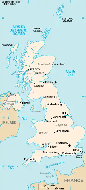
The United Kingdom

Is

Location Locality Coordinates
(links to map & photo sources)
OS grid
reference
Isabella Pit Northumberland 55.11°N 01.53°W / 55.11; -01.53 NZ3080
Isallt Bach Isle of Anglesey 53.27°N 04.62°W / 53.27; -04.62 SH2579
Isauld Highland 58.56°N 03.77°W / 58.56; -03.77 NC9765
Isay Highland 57.51°N 06.64°W / 57.51; -06.64 NG219565
Isbister Shetland Islands 60.34°N 00.96°W / 60.34; -00.96 HU5763
Isbister Orkney Islands 59.04°N 03.06°W / 59.04; -03.06 HY3918
Isbister Shetland Islands 60.59°N 01.32°W / 60.59; -01.32 HU3790
Isbister Orkney Islands 59.08°N 03.29°W / 59.08; -03.29 HY2623
Isbister Holm Shetland Islands 60.35°N 00.90°W / 60.35; -00.90 HU603642
Isbourne Gloucestershire 51.98°N 01.95°W / 51.98; -01.95 SP029319
Ise Northamptonshire 52.41°N 00.89°W / 52.41; -00.89 SP751806
Isel Cumbria 54.68°N 03.32°W / 54.68; -03.32 NY1533
Isfield East Sussex 50.93°N 00.06°E / 50.93; 00.06 TQ4517
Isham Northamptonshire 52.34°N 00.70°W / 52.34; -00.70 SP8873
Isington Hampshire 51.17°N 00.89°W / 51.17; -00.89 SU7742
Isla Moray 57.54°N 02.90°W / 57.54; -02.90 NJ460513
Isla Angus 56.70°N 03.22°W / 56.70; -03.22 NO250578
Island Carr North Lincolnshire 53.54°N 00.50°W / 53.54; -00.50 SE9906
Island Davaar Argyll and Bute 55.42°N 05.54°W / 55.42; -05.54 NR759201
Island Macaskin Argyll and Bute 56.13°N 05.56°W / 56.13; -05.56 NR789992
Island of Raasay Highland 57.41°N 06.05°W / 57.41; -06.05 NG568429
Island of Rona Highland 57.54°N 05.97°W / 57.54; -05.97 NG624575
Island of Stroma Highland 58.68°N 03.12°W / 58.68; -03.12 ND349775
Islands Common Cambridgeshire 52.23°N 00.27°W / 52.23; -00.27 TL1861
Islands of Fleet Dumfries and Galloway 54.82°N 04.22°W / 54.82; -04.22 NX571495
Islay Argyll and Bute 55.76°N 06.23°W / 55.76; -06.23 NR348608
Isle Somerset 50.94°N 02.89°W / 50.94; -02.89 ST371168
Isle Abbotts Somerset 50.97°N 02.92°W / 50.97; -02.92 ST3520
Isle Brewers Somerset 50.98°N 02.91°W / 50.98; -02.91 ST3621
Isleham Cambridgeshire 52.33°N 00.40°E / 52.33; 00.40 TL6474
Isle Martin Highland 57.94°N 05.22°W / 57.94; -05.22 NH093993
Isle of Arran North Ayrshire 55.58°N 05.23°W / 55.58; -05.23 NR960366
Isle of Axholme North Lincolnshire 53.54°N 00.82°W / 53.54; -00.82 SE7806
Isle of Bute Argyll and Bute 55.84°N 05.10°W / 55.84; -05.10 NS056655
Isle of Danna Argyll and Bute 55.94°N 05.69°W / 55.94; -05.69 NR697784
Isle of Dogs Lewisham 51.48°N 00.02°W / 51.48; -00.02 TQ3778
Isle of Ewe Highland 57.83°N 05.61°W / 57.83; -05.61 NG852881
Isle of Grain Kent 51.44°N 00.68°E / 51.44; 00.68 TQ868757
Isle of Lewis Western Isles 58.15°N 06.67°W / 58.15; -06.67 NB250282
Isle of Man Isle of Man 54.25°N 04.47°W / 54.25; -04.47 SC386873
Isle of Man Dumfries and Galloway 55.05°N 03.56°W / 55.05; -03.56 NY0075
Isle of May Fife 56.18°N 02.55°W / 56.18; -02.55 NT654990
Isle of Mull Argyll and Bute 56.42°N 05.88°W / 56.42; -05.88 NM603329
Isle of Nibon Shetland Islands 60.43°N 01.46°W / 60.43; -01.46 HU297727
Isle of Noss Shetland Islands 60.14°N 01.02°W / 60.14; -01.02 HU545401
Isle of Portland Dorset 50.54°N 02.43°W / 50.54; -02.43 SY690720
Isle of Purbeck Dorset 50.63°N 02.03°W / 50.63; -02.03 SY974818
Isle of Sheppey Kent 51.41°N 00.80°E / 51.41; 00.80 TQ948717
Isle of Skye Highland 57.38°N 06.26°W / 57.38; -06.26 NG439410
Isle of Stenness Shetland Islands 60.47°N 01.62°W / 60.47; -01.62 HU205764
Isle of Thanet Kent 51.35°N 01.39°E / 51.35; 01.39 TR361676
Isle of West Burrafirth Shetland Islands 60.31°N 01.55°W / 60.31; -01.55 HU248585
Isle of Whithorn Dumfries and Galloway 54.69°N 04.37°W / 54.69; -04.37 NX4736
Isle of Wight Isle of Wight 50.67°N 01.29°W / 50.67; -01.29 SZ496869
Isleornsay Highland 57.14°N 05.82°W / 57.14; -05.82 NG6912
Isle Ristol Highland 58.04°N 05.43°W / 58.04; -05.43 NB971111
Isles of Scilly Isles of Scilly 49.92°N 06.29°W / 49.92; -06.29 SV917119
Islesteps Dumfries and Galloway 55.03°N 03.62°W / 55.03; -03.62 NX9672
Isleworth Hounslow 51.46°N 00.34°W / 51.46; -00.34 TQ1575
Isley Walton Leicestershire 52.82°N 01.37°W / 52.82; -01.37 SK4225
Islington 51.53°N 00.11°W / 51.53; -00.11 TQ3184
IslingtonShropshire 52.77°N 02.38°W / 52.77; -02.38 SJ7420
Islip Northamptonshire 52.40°N 00.56°W / 52.40; -00.56 SP9879
Islip Oxfordshire 51.82°N 01.24°W / 51.82; -01.24 SP5214
Islivig Western Isles 58.12°N 07.11°W / 58.12; -07.11 NA9927
Isombridge Shropshire 52.71°N 02.57°W / 52.71; -02.57 SJ6113
Istead Rise Kent 51.40°N 00.34°E / 51.40; 00.34 TQ6370
Isycoed Wrexham 53.04°N 02.89°W / 53.04; -02.89 SJ4050

It

Location Locality Coordinates
(links to map & photo sources)
OS grid
reference
Itchen Warwickshire 52.30°N 01.41°W / 52.30; -01.41 SP399681
Itchen City of Southampton 50.89°N 01.37°W / 50.89; -01.37 SU4411
Itchen Hampshire 50.97°N 01.34°W / 50.97; -01.34 SU464199
Itchen Abbas Hampshire 51.08°N 01.24°W / 51.08; -01.24 SU5332
Itchen Stoke Hampshire 51.08°N 01.21°W / 51.08; -01.21 SU5532
Itchingfield West Sussex 51.04°N 00.38°W / 51.04; -00.38 TQ1328
Itchington South Gloucestershire 51.57°N 02.50°W / 51.57; -02.50 ST6586
Ithon Powys 52.43°N 03.35°W / 52.43; -03.35 SO077830
Itteringham Norfolk 52.82°N 01.17°E / 52.82; 01.17 TG1430
Itteringham Common Norfolk 52.81°N 01.18°E / 52.81; 01.18 TG1529
Itton Monmouthshire 51.65°N 02.73°W / 51.65; -02.73 ST4995
Itton Common Monmouthshire 51.66°N 02.75°W / 51.66; -02.75 ST4896

Iv

Location Locality Coordinates
(links to map & photo sources)
OS grid
reference
Ivegill Cumbria 54.77°N 02.91°W / 54.77; -02.91 NY4143
Ivel Hertfordshire 52.02°N 00.13°W / 52.02; -00.13 TL278374
Ivelet North Yorkshire 54.36°N 02.10°W / 54.36; -02.10 SD9397
Iver Buckinghamshire 51.51°N 00.51°W / 51.51; -00.51 TQ0381
Iver Heath Buckinghamshire 51.53°N 00.53°W / 51.53; -00.53 TQ0283
Iverley Staffordshire 52.42°N 02.19°W / 52.42; -02.19 SO8781
Iveston Durham 54.84°N 01.79°W / 54.84; -01.79 NZ1350
Ivinghoe Buckinghamshire 51.83°N 00.63°W / 51.83; -00.63 SP9416
Ivinghoe Aston Buckinghamshire 51.85°N 00.62°W / 51.85; -00.62 SP9518
Ivington Herefordshire 52.19°N 02.77°W / 52.19; -02.77 SO4756
Ivybridge Devon 50.38°N 03.92°W / 50.38; -03.92 SX6356
Ivy Chimneys Essex 51.68°N 00.09°E / 51.68; 00.09 TL4500
Ivychurch Kent 51.00°N 00.87°E / 51.00; 00.87 TR0227
Ivy Cross Dorset 51.00°N 02.20°W / 51.00; -02.20 ST8623
Ivy Hatch Kent 51.26°N 00.26°E / 51.26; 00.26 TQ5854
Ivy Todd Norfolk 52.64°N 00.79°E / 52.64; 00.79 TF8909

Iw

Location Locality Coordinates
(links to map & photo sources)
OS grid
reference
Iwade Kent 51.37°N 00.71°E / 51.37; 00.71 TQ8967
Iwerne Courtney (Shroton) Dorset 50.90°N 02.21°W / 50.90; -02.21 ST8512
Iwerne Minster Dorset 50.92°N 02.20°W / 50.92; -02.20 ST8614
Iwood North Somerset 51.36°N 02.79°W / 51.36; -02.79 ST4563

Ix

Location Locality Coordinates
(links to map & photo sources)
OS grid
reference
Ixworth Suffolk 52.29°N 00.81°E / 52.29; 00.81 TL9270
Ixworth Thorpe Suffolk 52.31°N 00.80°E / 52.31; 00.80 TL9172
This article is issued from Wikipedia. The text is licensed under Creative Commons - Attribution - Sharealike. Additional terms may apply for the media files.