List of United Kingdom locations: Kip-Kz

This is part of the list of United Kingdom locations: a gazetteer of place names in the United Kingdom showing each place's locality and geographical coordinates.
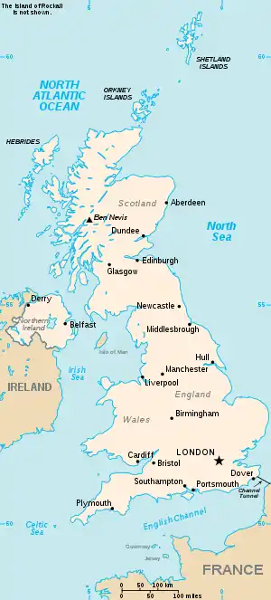
The United Kingdom

Kip–Kiv

Location Locality Coordinates
(links to map & photo sources)
OS grid
reference
Kip Hill Durham 54.87°N 01.68°W / 54.87; -01.68 NZ2053
Kiplin North Yorkshire 54.36°N 01.58°W / 54.36; -01.58 SE2797
Kiplingcotes East Riding of Yorkshire 53.90°N 00.60°W / 53.90; -00.60 SE9245
Kippax Leeds 53.76°N 01.37°W / 53.76; -01.37 SE4130
Kippen Stirling 56.12°N 04.17°W / 56.12; -04.17 NS6594
Kippford Dumfries and Galloway 54.86°N 03.82°W / 54.86; -03.82 NX8354
Kippilaw Scottish Borders 55.54°N 02.73°W / 55.54; -02.73 NT5428
Kippilaw Mains Scottish Borders 55.55°N 02.73°W / 55.55; -02.73 NT5429
Kipping's Cross Kent 51.12°N 00.34°E / 51.12; 00.34 TQ6439
Kippington Kent 51.26°N 00.17°E / 51.26; 00.17 TQ5254
Kirbister Orkney Islands 58.94°N 03.11°W / 58.94; -03.11 HY3607
Kirbister Orkney Islands 59.00°N 03.32°W / 59.00; -03.32 HY2414
Kirbuster Orkney Islands 59.10°N 03.25°W / 59.10; -03.25 HY2825
Kirby Isle of Man 54.15°N 04.51°W / 54.15; -04.51 SC3676
Kirby Bedon Norfolk 52.59°N 01.36°E / 52.59; 01.36 TG2805
Kirby Bellars Leicestershire 52.74°N 00.94°W / 52.74; -00.94 SK7117
Kirby Cane Norfolk 52.48°N 01.48°E / 52.48; 01.48 TM3793
Kirby Corner Warwickshire 52.38°N 01.57°W / 52.38; -01.57 SP2976
Kirby Cross Essex 51.83°N 01.22°E / 51.83; 01.22 TM2220
Kirby Fields Leicestershire 52.62°N 01.23°W / 52.62; -01.23 SK5203
Kirby Green Norfolk 52.49°N 01.49°E / 52.49; 01.49 TM3794
Kirby Grindalythe North Yorkshire 54.09°N 00.62°W / 54.09; -00.62 SE9067
Kirby Hill North Yorkshire 54.44°N 01.80°W / 54.44; -01.80 NZ1306
Kirby Hill North Yorkshire 54.06°N 01.40°W / 54.06; -01.40 SE3886
Kirby Knowle North Yorkshire 54.27°N 01.29°W / 54.27; -01.29 SE4687
Kirby-le-Soken Essex 51.84°N 01.22°E / 51.84; 01.22 TM2221
Kirby Misperton North Yorkshire 54.20°N 00.82°W / 54.20; -00.82 SE7779
Kirby Muxloe Leicestershire 52.63°N 01.24°W / 52.63; -01.24 SK5104
Kirby Row Norfolk 52.47°N 01.48°E / 52.47; 01.48 TM3792
Kirby Sigston North Yorkshire 54.34°N 01.37°W / 54.34; -01.37 SE4194
Kirby Underdale East Riding of Yorkshire 54.01°N 00.78°W / 54.01; -00.78 SE8058
Kirby Wiske North Yorkshire 54.25°N 01.43°W / 54.25; -01.43 SE3784
Kirdford West Sussex 51.02°N 00.56°W / 51.02; -00.56 TQ0126
Kirkabister Shetland Islands 60.30°N 01.11°W / 60.30; -01.11 HU4958
Kirkabister Shetland Islands 60.37°N 01.13°W / 60.37; -01.13 HU4866
Kirkaig Highland 58.12°N 05.27°W / 58.12; -05.27 NC074194
Kirkandrews Dumfries and Galloway 54.80°N 04.19°W / 54.80; -04.19 NX5948
Kirkandrews-on-Eden Cumbria 54.91°N 03.01°W / 54.91; -03.01 NY3558
Kirkapol Argyll and Bute 56.52°N 06.81°W / 56.52; -06.81 NM0447
Kirkaton Shetland Islands 60.80°N 00.80°W / 60.80; -00.80 HP6514
Kirkbampton Cumbria 54.89°N 03.09°W / 54.89; -03.09 NY3056
Kirkbean Dumfries and Galloway 54.91°N 03.60°W / 54.91; -03.60 NX9759
Kirkborough Cumbria 54.71°N 03.47°W / 54.71; -03.47 NY0536
Kirk Bramwith Doncaster 53.59°N 01.07°W / 53.59; -01.07 SE6111
Kirkbride Cumbria 54.89°N 03.21°W / 54.89; -03.21 NY2256
Kirkbridge North Yorkshire 54.30°N 01.61°W / 54.30; -01.61 SE2590
Kirkburn East Riding of Yorkshire 53.98°N 00.50°W / 53.98; -00.50 SE9855
Kirkburn Scottish Borders 55.63°N 03.12°W / 55.63; -03.12 NT2938
Kirkburton Kirklees 53.60°N 01.71°W / 53.60; -01.71 SE1912
Kirkby North Yorkshire 54.44°N 01.18°W / 54.44; -01.18 NZ5306
Kirkby Knowsley 53.47°N 02.89°W / 53.47; -02.89 SJ4198
Kirkby Lincolnshire 53.41°N 00.40°W / 53.41; -00.40 TF0692
Kirkby Fenside Lincolnshire 53.13°N 00.02°W / 53.13; -00.02 TF3261
Kirkby Fleetham North Yorkshire 54.34°N 01.57°W / 54.34; -01.57 SE2894
Kirkby Green Lincolnshire 53.09°N 00.38°W / 53.09; -00.38 TF0857
Kirkby Hill North Yorkshire 54.10°N 01.42°W / 54.10; -01.42 SE3868
Kirkby-in-Ashfield Nottinghamshire 53.09°N 01.25°W / 53.09; -01.25 SK5056
Kirkby-in-Furness Cumbria 54.22°N 03.19°W / 54.22; -03.19 SD2282
Kirkby la Thorpe Lincolnshire 52.99°N 00.37°W / 52.99; -00.37 TF0945
Kirkby Lonsdale Cumbria 54.19°N 02.59°W / 54.19; -02.59 SD6178
Kirkby Malham North Yorkshire 54.04°N 02.16°W / 54.04; -02.16 SD8961
Kirkby Mallory Leicestershire 52.59°N 01.33°W / 52.59; -01.33 SK4500
Kirkby Malzeard North Yorkshire 54.16°N 01.64°W / 54.16; -01.64 SE2374
Kirkby Mills North Yorkshire 54.25°N 00.92°W / 54.25; -00.92 SE7085
Kirkbymoorside North Yorkshire 54.26°N 00.94°W / 54.26; -00.94 SE6986
Kirkby on Bain Lincolnshire 53.14°N 00.14°W / 53.14; -00.14 TF2462
Kirkby Overblow North Yorkshire 53.93°N 01.51°W / 53.93; -01.51 SE3249
Kirkby Stephen Cumbria 54.46°N 02.35°W / 54.46; -02.35 NY7708
Kirkby Thore Cumbria 54.61°N 02.57°W / 54.61; -02.57 NY6325
Kirkby Underwood Lincolnshire 52.83°N 00.41°W / 52.83; -00.41 TF0727
Kirkby Wharfe North Yorkshire 53.85°N 01.24°W / 53.85; -01.24 SE5040
Kirkby Woodhouse Nottinghamshire 53.08°N 01.26°W / 53.08; -01.26 SK4954
Kirkcaldy Fife 56.10°N 03.17°W / 56.10; -03.17 NT2791
Kirkcambeck Cumbria 55.00°N 02.73°W / 55.00; -02.73 NY5368
Kirkcolm Dumfries and Galloway 54.96°N 05.09°W / 54.96; -05.09 NX0268
Kirkconnel Dumfries and Galloway 55.38°N 04.00°W / 55.38; -04.00 NS7312
Kirkcowan Dumfries and Galloway 54.91°N 04.62°W / 54.91; -04.62 NX3261
Kirkcudbright Dumfries and Galloway 54.82°N 04.05°W / 54.82; -04.05 NX6850
Kirkdale Liverpool 53.43°N 02.99°W / 53.43; -02.99 SJ3493
Kirk Deighton North Yorkshire 53.94°N 01.40°W / 53.94; -01.40 SE3950
Kirk Ella East Riding of Yorkshire 53.74°N 00.45°W / 53.74; -00.45 TA0229
Kirkfieldbank South Lanarkshire 55.66°N 03.81°W / 55.66; -03.81 NS8643
Kirkforthar Feus Fife 56.22°N 03.16°W / 56.22; -03.16 NO2804
Kirkgunzeon Dumfries and Galloway 54.97°N 03.78°W / 54.97; -03.78 NX8666
Kirkgunzeon Burn Dumfries and Galloway 54.99°N 03.77°W / 54.99; -03.77 NX867678
Kirk Hallam Derbyshire 52.95°N 01.33°W / 52.95; -01.33 SK4540
Kirkham North Yorkshire 54.07°N 00.88°W / 54.07; -00.88 SE7365
Kirkham Lancashire 53.78°N 02.88°W / 53.78; -02.88 SD4232
Kirkhamgate Wakefield 53.69°N 01.56°W / 53.69; -01.56 SE2922
Kirk Hammerton North Yorkshire 53.98°N 01.29°W / 53.98; -01.29 SE4655
Kirkhams Bury 53.54°N 02.28°W / 53.54; -02.28 SD8105
Kirkharle Northumberland 55.13°N 01.98°W / 55.13; -01.98 NZ0182
Kirkheaton Northumberland 55.08°N 01.98°W / 55.08; -01.98 NZ0177
Kirkheaton Kirklees 53.65°N 01.72°W / 53.65; -01.72 SE1818
Kirkhill Highland 57.47°N 04.41°W / 57.47; -04.41 NH5545
Kirkhill Angus 56.73°N 02.52°W / 56.73; -02.52 NO6860
Kirkhill Midlothian 55.82°N 03.23°W / 55.82; -03.23 NT2360
Kirkhill West Lothian 55.93°N 03.49°W / 55.93; -03.49 NT0772
Kirkhill East Renfrewshire 55.76°N 04.31°W / 55.76; -04.31 NS5555
Kirkholt Rochdale 53.59°N 02.16°W / 53.59; -02.16 SD8911
Kirkhope Scottish Borders 55.49°N 02.98°W / 55.49; -02.98 NT3823
Kirkhouse Cumbria 54.92°N 02.68°W / 54.92; -02.68 NY5659
Kirkibost Highland 57.17°N 06.07°W / 57.17; -06.07 NG5417
Kirkibost Island Western Isles 57.55°N 07.42°W / 57.55; -07.42 NF757647
Kirkinner Dumfries and Galloway 54.82°N 04.46°W / 54.82; -04.46 NX4251
Kirkintilloch East Dunbartonshire 55.93°N 04.16°W / 55.93; -04.16 NS6573
Kirk Ireton Derbyshire 53.04°N 01.61°W / 53.04; -01.61 SK2650
Kirkland Dumfries and Galloway 55.19°N 03.88°W / 55.19; -03.88 NX8090
Kirkland Cumbria 54.54°N 03.43°W / 54.54; -03.43 NY0717
Kirkland Cumbria 54.68°N 02.55°W / 54.68; -02.55 NY6432
Kirkland Cumbria 54.82°N 03.15°W / 54.82; -03.15 NY2648
Kirkland, Fife Fife 56.18°N 03.03°W / 56.18; -03.03 NO3600
Kirkland Dam Fife 56.18°N 03.04°W / 56.18; -03.04 NO3500
Kirkland Guards Cumbria 54.74°N 03.27°W / 54.74; -03.27 NY1840
Kirk Langley Derbyshire 52.93°N 01.58°W / 52.93; -01.58 SK2838
Kirkleatham Redcar and Cleveland 54.58°N 01.08°W / 54.58; -01.08 NZ5921
Kirklees Bury 53.60°N 02.33°W / 53.60; -02.33 SD7812
Kirklevington Stockton-on-Tees 54.47°N 01.35°W / 54.47; -01.35 NZ4209
Kirkley Suffolk 52.45°N 01.72°E / 52.45; 01.72 TM5391
Kirklington North Yorkshire 54.22°N 01.52°W / 54.22; -01.52 SE3181
Kirklington Nottinghamshire 53.10°N 01.00°W / 53.10; -01.00 SK6757
Kirklinton Cumbria 54.99°N 02.89°W / 54.99; -02.89 NY4367
Kirkliston City of Edinburgh 55.95°N 03.41°W / 55.95; -03.41 NT1274
Kirkmaiden Dumfries and Galloway 54.68°N 04.91°W / 54.68; -04.91 NX1236
Kirk Merrington Durham 54.67°N 01.59°W / 54.67; -01.59 NZ2631
Kirkmichael South Ayrshire 55.33°N 04.61°W / 55.33; -04.61 NS3408
Kirk Michael Isle of Man 54.27°N 04.59°W / 54.27; -04.59 SC3190
Kirkmichael Perth and Kinross 56.72°N 03.50°W / 56.72; -03.50 NO0860
Kirkmichael Mains Dumfries and Galloway 55.16°N 03.55°W / 55.16; -03.55 NY0187
Kirkmuirhill South Lanarkshire 55.66°N 03.92°W / 55.66; -03.92 NS7943
Kirknewton Northumberland 55.56°N 02.14°W / 55.56; -02.14 NT9130
Kirknewton West Lothian 55.88°N 03.42°W / 55.88; -03.42 NT1167
Kirkney Aberdeenshire 57.37°N 02.81°W / 57.37; -02.81 NJ5132
Kirk of Shotts North Lanarkshire 55.83°N 03.85°W / 55.83; -03.85 NS8462
Kirkoswald South Ayrshire 55.32°N 04.77°W / 55.32; -04.77 NS2407
Kirkoswald Cumbria 54.76°N 02.70°W / 54.76; -02.70 NY5541
Kirkpatrick, Scotland Dumfries and Galloway 55.19°N 03.72°W / 55.19; -03.72 NX9090
Kirkpatrick Durham Dumfries and Galloway 55.01°N 03.90°W / 55.01; -03.90 NX7870
Kirkpatrick-Fleming Dumfries and Galloway 55.01°N 03.14°W / 55.01; -03.14 NY2770
Kirk Sandall Doncaster 53.55°N 01.08°W / 53.55; -01.08 SE6107
Kirksanton Cumbria 54.20°N 03.33°W / 54.20; -03.33 SD1380
Kirkshaw North Lanarkshire 55.84°N 04.04°W / 55.84; -04.04 NS7263
Kirk Smeaton North Yorkshire 53.63°N 01.23°W / 53.63; -01.23 SE5116
Kirkstall Leeds 53.81°N 01.60°W / 53.81; -01.60 SE2635
Kirkstead Scottish Borders 55.50°N 03.17°W / 55.50; -03.17 NT2624
Kirkstyle Highland 58.63°N 03.13°W / 58.63; -03.13 ND3472
Kirkthorpe Wakefield 53.67°N 01.45°W / 53.67; -01.45 SE3620
Kirkton Highland 57.95°N 04.04°W / 57.95; -04.04 NH7998
Kirkton Highland 57.41°N 05.48°W / 57.41; -05.48 NG9141
Kirkton Scottish Borders 55.40°N 02.72°W / 55.40; -02.72 NT5413
Kirkton Dumfries and Galloway 55.11°N 03.61°W / 55.11; -03.61 NX9781
Kirkton Angus 56.52°N 02.97°W / 56.52; -02.97 NO4037
Kirkton Stirling 56.16°N 04.40°W / 56.16; -04.40 NN5100
Kirkton Aberdeenshire 57.31°N 02.59°W / 57.31; -02.59 NJ6425
Kirkton Fife 56.41°N 03.03°W / 56.41; -03.03 NO3625
Kirkton Angus 56.60°N 02.94°W / 56.60; -02.94 NO4246
Kirkton West Lothian 55.87°N 03.55°W / 55.87; -03.55 NT0366
Kirkton Fife 56.06°N 03.23°W / 56.06; -03.23 NT2386
Kirkton Angus 56.56°N 02.60°W / 56.56; -02.60 NO6342
Kirkton Highland 57.28°N 05.60°W / 57.28; -05.60 NG8327
Kirktonhill Renfrewshire 55.93°N 04.59°W / 55.93; -04.59 NS3874
Kirkton of Auchterhouse Angus 56.53°N 03.07°W / 56.53; -03.07 NO3438
Kirkton of Auchterless Aberdeenshire 57.45°N 02.48°W / 57.45; -02.48 NJ7141
Kirkton of Craig Angus 56.68°N 02.49°W / 56.68; -02.49 NO7055
Kirkton of Culsalmond Aberdeenshire 57.37°N 02.60°W / 57.37; -02.60 NJ6432
Kirkton of Cults Fife 56.26°N 03.06°W / 56.26; -03.06 NO3409
Kirkton of Durris Aberdeenshire 57.05°N 02.38°W / 57.05; -02.38 NO7796
Kirkton of Glenbuchat Aberdeenshire 57.22°N 03.04°W / 57.22; -03.04 NJ3715
Kirkton of Glenisla Angus 56.72°N 03.29°W / 56.72; -03.29 NO2160
Kirkton of Kingoldrum Angus 56.67°N 03.09°W / 56.67; -03.09 NO3354
Kirkton of Largo (Upper Largo) Fife 56.21°N 02.93°W / 56.21; -02.93 NO4203
Kirkton of Lethendy Perth and Kinross 56.56°N 03.41°W / 56.56; -03.41 NO1342
Kirkton of Lude Perth and Kinross 56.79°N 03.80°W / 56.79; -03.80 NN9068
Kirkton of Maryculter Aberdeenshire 57.08°N 02.24°W / 57.08; -02.24 NO8599
Kirkton of Menmuir Angus 56.76°N 02.77°W / 56.76; -02.77 NO5364
Kirkton of Monikie Angus 56.53°N 02.79°W / 56.53; -02.79 NO5138
Kirkton of Oyne Aberdeenshire 57.31°N 02.53°W / 57.31; -02.53 NJ6825
Kirkton of Rayne Aberdeenshire 57.36°N 02.51°W / 57.36; -02.51 NJ6930
Kirkton of Skene Aberdeenshire 57.15°N 02.33°W / 57.15; -02.33 NJ8007
Kirkton of Tough Aberdeenshire 57.20°N 02.64°W / 57.20; -02.64 NJ6113
Kirktoun East Ayrshire 55.62°N 04.52°W / 55.62; -04.52 NS4140
Kirktown (Peterhead) Aberdeenshire 57.50°N 01.80°W / 57.50; -01.80 NK1246
Kirktown (of St Fergus) Aberdeenshire 57.54°N 01.85°W / 57.54; -01.85 NK0951
Kirktown of Alvah Aberdeenshire 57.62°N 02.55°W / 57.62; -02.55 NJ6760
Kirktown of Deskford Moray 57.63°N 02.83°W / 57.63; -02.83 NJ5061
Kirkton of Fetteresso Aberdeenshire 56.95°N 02.24°W / 56.95; -02.24 NO8585
Kirktown of Mortlach Moray 57.43°N 03.13°W / 57.43; -03.13 NJ3239
Kirkurd Scottish Borders 55.68°N 03.40°W / 55.68; -03.40 NT1244
Kirkwall Orkney Islands 58.97°N 02.95°W / 58.97; -02.95 HY4510
Kirkwhelpington Northumberland 55.15°N 02.01°W / 55.15; -02.01 NY9984
Kirkwood Dumfries and Galloway 55.06°N 03.37°W / 55.06; -03.37 NY1275
Kirkwood North Lanarkshire 55.84°N 04.06°W / 55.84; -04.06 NS7163
Kirk Yetholm Scottish Borders 55.54°N 02.28°W / 55.54; -02.28 NT8228
Kirmington North Lincolnshire 53.58°N 00.33°W / 53.58; -00.33 TA1011
Kirmond le Mire Lincolnshire 53.41°N 00.22°W / 53.41; -00.22 TF1892
Kirn Argyll and Bute 55.95°N 04.91°W / 55.95; -04.91 NS1877
Kirriemuir Angus 56.66°N 03.01°W / 56.66; -03.01 NO3853
Kirstead Green Norfolk 52.52°N 01.37°E / 52.52; 01.37 TM2997
Kirtle Dumfries and Galloway 55.10°N 03.15°W / 55.10; -03.15 NY265791
Kirtlebridge Dumfries and Galloway 55.03°N 03.20°W / 55.03; -03.20 NY2372
Kirtleton Dumfries and Galloway 55.10°N 03.16°W / 55.10; -03.16 NY2680
Kirtle Water Dumfries and Galloway 55.07°N 03.18°W / 55.07; -03.18 NY244762
Kirtling Cambridgeshire 52.17°N 00.45°E / 52.17; 00.45 TL6856
Kirtling Green Suffolk 52.16°N 00.45°E / 52.16; 00.45 TL6855
Kirtlington Oxfordshire 51.86°N 01.28°W / 51.86; -01.28 SP4919
Kirtomy Highland 58.53°N 04.16°W / 58.53; -04.16 NC7463
Kirton Suffolk 52.00°N 01.30°E / 52.00; 01.30 TM2739
Kirton Lincolnshire 52.92°N 00.06°W / 52.92; -00.06 TF3038
Kirton Nottinghamshire 53.21°N 00.96°W / 53.21; -00.96 SK6969
Kirton Campus West Lothian 55.87°N 03.55°W / 55.87; -03.55 NT0366
Kirton End Lincolnshire 52.94°N 00.09°W / 52.94; -00.09 TF2840
Kirton Holme Lincolnshire 52.95°N 00.12°W / 52.95; -00.12 TF2641
Kirton in Lindsey North Lincolnshire 53.47°N 00.60°W / 53.47; -00.60 SK9398
Kiskin Cumbria 54.26°N 03.39°W / 54.26; -03.39 SD0986
Kislingbury Northamptonshire 52.22°N 00.99°W / 52.22; -00.99 SP6959
Kitbridge Devon 50.82°N 02.99°W / 50.82; -02.99 ST3003
Kitchenroyd Kirklees 53.57°N 01.65°W / 53.57; -01.65 SE2309
Kitebrook Oxfordshire 51.97°N 01.65°W / 51.97; -01.65 SP2431
Kite Green Warwickshire 52.29°N 01.76°W / 52.29; -01.76 SP1666
Kite Hill Isle of Wight 50.72°N 01.22°W / 50.72; -01.22 SZ5592
Kites Hardwick Warwickshire 52.30°N 01.31°W / 52.30; -01.31 SP4768
Kit Hill Dorset 50.97°N 02.22°W / 50.97; -02.22 ST8419
Kitlye Gloucestershire 51.73°N 02.16°W / 51.73; -02.16 SO8904
Kit's Coty Kent 51.32°N 00.49°E / 51.32; 00.49 TQ7461
Kitt Green Wigan 53.54°N 02.68°W / 53.54; -02.68 SD5505
Kittisford Somerset 50.99°N 03.32°W / 50.99; -03.32 ST0722
Kittle Swansea 51.58°N 04.06°W / 51.58; -04.06 SS5789
Kitts End Hertfordshire 51.66°N 00.20°W / 51.66; -00.20 TQ2498
Kitt's Green Birmingham 52.48°N 01.78°W / 52.48; -01.78 SP1587
Kitt's Moss Stockport 53.35°N 02.18°W / 53.35; -02.18 SJ8884
Kittwhistle Dorset 50.82°N 02.86°W / 50.82; -02.86 ST3903
Kittybrewster City of Aberdeen 57.15°N 02.13°W / 57.15; -02.13 NJ9207
Kitwood Hampshire 51.09°N 01.05°W / 51.09; -01.05 SU6633
Kivernoll Herefordshire 51.98°N 02.78°W / 51.98; -02.78 SO4632
Kiveton Park Rotherham 53.34°N 01.26°W / 53.34; -01.26 SK4983

Kn

Location Locality Coordinates
(links to map & photo sources)
OS grid
reference
Knaik Perth and Kinross 56.26°N 03.88°W / 56.26; -03.88 NN836097
Knaith Nottinghamshire 53.34°N 00.76°W / 53.34; -00.76 SK8284
Knaith Park Lincolnshire 53.35°N 00.73°W / 53.35; -00.73 SK8485
Knaphill Surrey 51.31°N 00.62°W / 51.31; -00.62 SU9658
Knapp Hampshire 51.00°N 01.43°W / 51.00; -01.43 SU4023
Knapp Perth and Kinross 56.46°N 03.17°W / 56.46; -03.17 NO2831
Knapp Somerset 51.02°N 02.99°W / 51.02; -02.99 ST3025
Knapp Wiltshire 51.02°N 01.97°W / 51.02; -01.97 SU0225
Knapp Hill Dorset 51.04°N 02.21°W / 51.04; -02.21 ST8527
Knapthorpe Nottinghamshire 53.11°N 00.89°W / 53.11; -00.89 SK7458
Knaptoft Leicestershire 52.49°N 01.08°W / 52.49; -01.08 SP6289
Knapton York 53.96°N 01.14°W / 53.96; -01.14 SE5652
Knapton Norfolk 52.85°N 01.41°E / 52.85; 01.41 TG3034
Knapton Green Herefordshire 52.16°N 02.82°W / 52.16; -02.82 SO4452
Knapwell Cambridgeshire 52.24°N 00.05°W / 52.24; -00.05 TL3362
Knaresborough North Yorkshire 54.00°N 01.46°W / 54.00; -01.46 SE3557
Knarie Burn Dumfries and Galloway 55.09°N 03.92°W / 55.09; -03.92 NX770791
Knarsdale Northumberland 54.87°N 02.51°W / 54.87; -02.51 NY6753
Knarston Orkney Islands 59.06°N 03.22°W / 59.06; -03.22 HY3020
Knatts Valley Kent 51.32°N 00.23°E / 51.32; 00.23 TQ5661
Knaven Aberdeenshire 57.47°N 02.18°W / 57.47; -02.18 NJ8943
Knave's Ash Kent 51.33°N 01.14°E / 51.33; 01.14 TR1964
Knaves Green Suffolk 52.24°N 01.10°E / 52.24; 01.10 TM1265
Knavesmire York 53.93°N 01.11°W / 53.93; -01.11 SE5849
Knayton North Yorkshire 54.27°N 01.34°W / 54.27; -01.34 SE4387
Knebworth Hertfordshire 51.86°N 00.18°W / 51.86; -00.18 TL2520
Knedlington East Riding of Yorkshire 53.74°N 00.89°W / 53.74; -00.89 SE7328
Knee Brook Gloucestershire 52.01°N 01.70°W / 52.01; -01.70 SP205356
Kneep Western Isles 58.21°N 06.95°W / 58.21; -06.95 NB0936
Kneesall Nottinghamshire 53.16°N 00.95°W / 53.16; -00.95 SK7064
Kneesworth Cambridgeshire 52.07°N 00.04°W / 52.07; -00.04 TL3444
Kneeton Nottinghamshire 53.00°N 00.94°W / 53.00; -00.94 SK7146
Knelston Swansea 51.57°N 04.22°W / 51.57; -04.22 SS4688
Knenhall Staffordshire 52.93°N 02.12°W / 52.93; -02.12 SJ9237
Knettishall Suffolk 52.38°N 00.89°E / 52.38; 00.89 TL9780
Knightacott Devon 51.13°N 03.94°W / 51.13; -03.94 SS6439
Knightcote Warwickshire 52.18°N 01.43°W / 52.18; -01.43 SP3954
Knightcott North Somerset 51.32°N 02.89°W / 51.32; -02.89 ST3859
Knightley Staffordshire 52.82°N 02.28°W / 52.82; -02.28 SJ8125
Knightley Dale Staffordshire 52.80°N 02.28°W / 52.80; -02.28 SJ8123
Knighton Devon 50.32°N 04.08°W / 50.32; -04.08 SX5249
Knighton Dorset 50.89°N 02.55°W / 50.89; -02.55 ST6111
Knighton Poole, Dorset 50.77°N 01.94°W / 50.77; -01.94 SZ0497
Knighton City of Leicester 52.60°N 01.13°W / 52.60; -01.13 SK5901
Knighton Oxfordshire 51.58°N 01.59°W / 51.58; -01.59 SU2887
Knighton Powys 52.34°N 03.05°W / 52.34; -03.05 SO2872
Knighton Shropshire 52.95°N 02.41°W / 52.95; -02.41 SJ7240
Knighton Somerset 51.18°N 03.16°W / 51.18; -03.16 ST1944
Knighton Wiltshire 51.43°N 01.58°W / 51.43; -01.58 SU2971
Knighton Worcestershire 52.20°N 01.95°W / 52.20; -01.95 SP0356
Knighton Fields City of Leicester 52.60°N 01.13°W / 52.60; -01.13 SK5901
Knighton on Teme Worcestershire 52.32°N 02.54°W / 52.32; -02.54 SO6370
Knightor Cornwall 50.37°N 04.77°W / 50.37; -04.77 SX0356
Knightsbridge Gloucestershire 51.93°N 02.16°W / 51.93; -02.16 SO8926
Knightsbridge Royal Borough of Kensington and Chelsea 51.49°N 00.17°W / 51.49; -00.17 TQ2779
Knight's End Cambridgeshire 52.52°N 00.06°E / 52.52; 00.06 TL4094
Knights Enham Hampshire 51.23°N 01.48°W / 51.23; -01.48 SU3648
Knight's Hill Lambeth 51.44°N 00.10°W / 51.44; -00.10 TQ3273
Knightsmill Cornwall 50.58°N 04.72°W / 50.58; -04.72 SX0780
Knightsridge West Lothian 55.90°N 03.53°W / 55.90; -03.53 NT0469
Knightswood City of Glasgow 55.89°N 04.36°W / 55.89; -04.36 NS5269
Knightwick Worcestershire 52.19°N 02.41°W / 52.19; -02.41 SO7255
Knill Herefordshire 52.23°N 03.04°W / 52.23; -03.04 SO2960
Knipe Fold Cumbria 54.38°N 03.01°W / 54.38; -03.01 SD3499
Knipoch Argyll and Bute 56.35°N 05.48°W / 56.35; -05.48 NM8523
Knipton Leicestershire 52.87°N 00.78°W / 52.87; -00.78 SK8231
Knitsley Durham 54.82°N 01.83°W / 54.82; -01.83 NZ1148
Kniveton Derbyshire 53.04°N 01.70°W / 53.04; -01.70 SK2050
Knock Moray 57.55°N 02.77°W / 57.55; -02.77 NJ5452
Knock Cumbria 54.63°N 02.51°W / 54.63; -02.51 NY6727
Knockan Highland 58.04°N 05.03°W / 58.04; -05.03 NC2110
Knockan Argyll and Bute 56.32°N 06.20°W / 56.32; -06.20 NM4023
Knockan Aberdeenshire 57.02°N 03.28°W / 57.02; -03.28 NO2293
Knockandhu Moray 57.29°N 03.31°W / 57.29; -03.31 NJ2123
Knockando Moray 57.45°N 03.35°W / 57.45; -03.35 NJ1941
Knockarthur Highland 58.02°N 04.11°W / 58.02; -04.11 NC7506
Knockbog Moray 57.57°N 02.78°W / 57.57; -02.78 NJ5354
Knockbreck Highland 57.54°N 06.58°W / 57.54; -06.58 NG2660
Knockbrex Dumfries and Galloway 54.81°N 04.21°W / 54.81; -04.21 NX5849
Knockdown Gloucestershire 51.59°N 02.24°W / 51.59; -02.24 ST8388
Knockenbaird Aberdeenshire 57.35°N 02.61°W / 57.35; -02.61 NJ6329
Knockenkelly North Ayrshire 55.49°N 05.10°W / 55.49; -05.10 NS0427
Knockentiber East Ayrshire 55.61°N 04.55°W / 55.61; -04.55 NS3939
Knockerdown Derbyshire 53.05°N 01.65°W / 53.05; -01.65 SK2351
Knockfarrel Highland 57.58°N 04.51°W / 57.58; -04.51 NH5058
Knockglass Highland 58.54°N 03.63°W / 58.54; -03.63 ND0563
Knockglass Dumfries and Galloway 54.87°N 05.05°W / 54.87; -05.05 NX0458
Knockhall Kent 51.44°N 00.28°E / 51.44; 00.28 TQ5974
Knockholt Kent 51.31°N 00.12°E / 51.31; 00.12 TQ4859
Knockin Shropshire 52.79°N 02.99°W / 52.79; -02.99 SJ3322
Knockin Heath Shropshire 52.78°N 02.96°W / 52.78; -02.96 SJ3521
Knockinlaw East Ayrshire 55.61°N 04.51°W / 55.61; -04.51 NS4239
Knockintorran Western Isles 57.57°N 07.47°W / 57.57; -07.47 NF7367
Knocklaw Northumberland 55.30°N 01.90°W / 55.30; -01.90 NU0601
Knockline Western Isles 57.57°N 07.45°W / 57.57; -07.45 NF7467
Knockmill Kent 51.32°N 00.25°E / 51.32; 00.25 TQ5761
Knockrome Argyll and Bute 55.87°N 05.91°W / 55.87; -05.91 NR5571
Knocksharry Isle of Man 54.23°N 04.65°W / 54.23; -04.65 SC2785
Knodishall Suffolk 52.19°N 01.53°E / 52.19; 01.53 TM4261
Knole Somerset 51.02°N 02.74°W / 51.02; -02.74 ST4825
Knollbury Monmouthshire 51.58°N 02.82°W / 51.58; -02.82 ST4388
Knoll Green Somerset 51.14°N 03.10°W / 51.14; -03.10 ST2339
Knolls Green Cheshire 53.30°N 02.30°W / 53.30; -02.30 SJ8079
Knoll Top North Yorkshire 54.08°N 01.71°W / 54.08; -01.71 SE1965
Knolton Shropshire 52.93°N 02.93°W / 52.93; -02.93 SJ3738
Knolton Bryn Wrexham 52.94°N 02.93°W / 52.94; -02.93 SJ3739
Knook Wiltshire 51.16°N 02.10°W / 51.16; -02.10 ST9341
Knossington Leicestershire 52.66°N 00.81°W / 52.66; -00.81 SK8008
Knotbury Staffordshire 53.20°N 01.98°W / 53.20; -01.98 SK0168
Knott Highland 57.49°N 06.37°W / 57.49; -06.37 NG3853
Knott-End-on-Sea Lancashire 53.92°N 02.99°W / 53.92; -02.99 SD3548
Knotting Bedfordshire 52.25°N 00.53°W / 52.25; -00.53 TL0063
Knotting Green Bedfordshire 52.24°N 00.53°W / 52.24; -00.53 TL0062
Knottingley Wakefield 53.70°N 01.25°W / 53.70; -01.25 SE4923
Knott Lanes Oldham 53.50°N 02.12°W / 53.50; -02.12 SD9201
Knott Oak Somerset 50.92°N 02.89°W / 50.92; -02.89 ST3714
Knotts Lancashire 53.97°N 02.36°W / 53.97; -02.36 SD7653
Knotty Ash Liverpool 53.41°N 02.90°W / 53.41; -02.90 SJ4091
Knotty Corner Devon 51.00°N 04.26°W / 51.00; -04.26 SS4125
Knotty Green Buckinghamshire 51.61°N 00.65°W / 51.61; -00.65 SU9392
Knowbury Shropshire 52.36°N 02.63°W / 52.36; -02.63 SO5774
Knowe, Scotland Dumfries and Galloway 55.00°N 04.64°W / 55.00; -04.64 NX3171
Knowefield Cumbria 54.90°N 02.93°W / 54.90; -02.93 NY4057
Knowes East Lothian 55.98°N 02.62°W / 55.98; -02.62 NT6177
Knowesgate Northumberland 55.15°N 02.03°W / 55.15; -02.03 NY9885
Knowes of Elrick Aberdeenshire 57.56°N 02.67°W / 57.56; -02.67 NJ6053
Knowetop North Lanarkshire 55.77°N 03.99°W / 55.77; -03.99 NS7555
Knowl Bank Staffordshire 53.03°N 02.34°W / 53.03; -02.34 SJ7749
Knowle Devon 51.12°N 04.15°W / 51.12; -04.15 SS4938
Knowle Devon 50.79°N 03.73°W / 50.79; -03.73 SS7801
Knowle Devon 50.85°N 03.42°W / 50.85; -03.42 ST0007
Knowle Devon 50.63°N 03.34°W / 50.63; -03.34 SY0582
Knowle Shropshire 52.35°N 02.60°W / 52.35; -02.60 SO5973
Knowle Solihull 52.38°N 01.73°W / 52.38; -01.73 SP1876
Knowle Somerset 51.14°N 02.95°W / 51.14; -02.95 ST3339
Knowle Wiltshire 51.33°N 01.77°W / 51.33; -01.77 SU1660
Knowle City of Bristol 51.42°N 02.57°W / 51.42; -02.57 ST6070
Knowle Fields Worcestershire 52.21°N 01.94°W / 52.21; -01.94 SP0457
Knowlegate Shropshire 52.35°N 02.60°W / 52.35; -02.60 SO5973
Knowle Green Surrey 51.41°N 00.50°W / 51.41; -00.50 TQ0470
Knowle Green Lancashire 53.83°N 02.56°W / 53.83; -02.56 SD6338
Knowle Grove Solihull 52.37°N 01.75°W / 52.37; -01.75 SP1775
Knowle Hill Surrey 51.38°N 00.59°W / 51.38; -00.59 SU9866
Knowle Park Bradford 53.85°N 01.92°W / 53.85; -01.92 SE0540
Knowlesands Shropshire 52.51°N 02.41°W / 52.51; -02.41 SO7291
Knowles Hill Devon 50.52°N 03.62°W / 50.52; -03.62 SX8571
Knowle St Giles Somerset 50.89°N 02.93°W / 50.89; -02.93 ST3411
Knowl Green Essex 52.03°N 00.59°E / 52.03; 00.59 TL7841
Knowl Hill Berkshire 51.50°N 00.81°W / 51.50; -00.81 SU8279
Knowlton Dorset 50.88°N 01.97°W / 50.88; -01.97 SU0210
Knowlton Kent 51.23°N 01.26°E / 51.23; 01.26 TR2853
Knowl Wall Staffordshire 52.94°N 02.22°W / 52.94; -02.22 SJ8539
Knowl Wood Calderdale 53.69°N 02.10°W / 53.69; -02.10 SD9322
Knowsley Knowsley 53.44°N 02.85°W / 53.44; -02.85 SJ4395
Knowsthorpe Leeds 53.78°N 01.53°W / 53.78; -01.53 SE3132
Knowstone Devon 50.99°N 03.68°W / 50.99; -03.68 SS8223
Knox Bridge Kent 51.13°N 00.54°E / 51.13; 00.54 TQ7840
Knoxes Reef Northumberland 55.62°N 01.65°W / 55.62; -01.65 NU217367
Knoydart Highland 57.06°N 05.56°W / 57.06; -05.56 NG842027
Knucklas Powys 52.35°N 03.10°W / 52.35; -03.10 SO2574
Knuston Northamptonshire 52.28°N 00.63°W / 52.28; -00.63 SP9366
Knutsford Cheshire 53.29°N 02.37°W / 53.29; -02.37 SJ7578
Knutton Staffordshire 53.02°N 02.25°W / 53.02; -02.25 SJ8347
Knuzden Brook Lancashire 53.73°N 02.44°W / 53.73; -02.44 SD7127
Knypersley Staffordshire 53.10°N 02.18°W / 53.10; -02.18 SJ8856

Kr

Location Locality Coordinates
(links to map & photo sources)
OS grid
reference
Krumlin Calderdale 53.65°N 01.92°W / 53.65; -01.92 SE0518

Ku

Location Locality Coordinates
(links to map & photo sources)
OS grid
reference
Kuggar Cornwall 50.00°N 05.18°W / 50.00; -05.18 SW7216

Ky

Location Locality Coordinates
(links to map & photo sources)
OS grid
reference
Kyle North Yorkshire 54.03°N 01.22°W / 54.03; -01.22 SE510600
Kyleakin Highland 57.26°N 05.73°W / 57.26; -05.73 NG7526
Kyle of Lochalsh Highland 57.27°N 05.71°W / 57.27; -05.71 NG7627
Kylepark South Lanarkshire 55.82°N 04.09°W / 55.82; -04.09 NS6961
Kylerhea Highland 57.21°N 05.67°W / 57.21; -05.67 NG7820
Kylesku Highland 58.25°N 05.03°W / 58.25; -05.03 NC2233
Kylestrome Highland 58.25°N 05.05°W / 58.25; -05.05 NC2134
Kym Bedfordshire 52.30°N 00.39°W / 52.30; -00.39 TL094684
Kym Cambridgeshire 52.26°N 00.32°W / 52.26; -00.32 TL141648
Kymin Herefordshire 52.10°N 02.61°W / 52.10; -02.61 SO5845
Kymin Monmouthshire 51.80°N 02.69°W / 51.80; -02.69 SO5212
Kynaston Herefordshire 51.93°N 02.67°W / 51.93; -02.67 SO5427
Kynaston Shropshire 52.77°N 02.96°W / 52.77; -02.96 SJ3520
Kynnersley Shropshire 52.74°N 02.49°W / 52.74; -02.49 SJ6716
Kyre Worcestershire 52.26°N 02.55°W / 52.26; -02.55 SO6263
Kyre Green Worcestershire 52.25°N 02.58°W / 52.25; -02.58 SO6062
Kyre Park Worcestershire 52.26°N 02.55°W / 52.26; -02.55 SO6263
Kyrewood Worcestershire 52.29°N 02.58°W / 52.29; -02.58 SO6067
This article is issued from Wikipedia. The text is licensed under Creative Commons - Attribution - Sharealike. Additional terms may apply for the media files.