List of United Kingdom locations: Pe-Pen

This is part of the list of United Kingdom locations: a gazetteer of place names in the United Kingdom showing each place's locality and geographical coordinates.
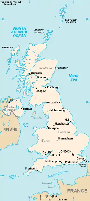
The United Kingdom

Pe

Pea

Location Locality Coordinates
(links to map & photo sources)
OS grid
reference
Peacehaven East Sussex 50.79°N 00.00°E / 50.79; 00.00 TQ4101
Peacehaven HeightsEast Sussex 50.78°N 00.01°E / 50.78; 00.01 TQ4200
Peacemarsh Dorset 51.04°N 02.28°W / 51.04; -02.28 ST8027
Peak Dale Derbyshire 53.28°N 01.86°W / 53.28; -01.86 SK0976
Peak Forest Derbyshire 53.30°N 01.83°W / 53.30; -01.83 SK1179
Peak Hill Lincolnshire 52.72°N 00.13°W / 52.72; -00.13 TF2616
Peakirk Cambridgeshire 52.63°N 00.28°W / 52.63; -00.28 TF1606
Pean Highland 56.96°N 05.32°W / 56.96; -05.32 NM982908
Pean Hill Kent 51.31°N 01.01°E / 51.31; 01.01 TR1062
Pear Ash Somerset 51.07°N 02.35°W / 51.07; -02.35 ST7531
Pearson's Green Kent 51.16°N 00.41°E / 51.16; 00.41 TQ6943
Peartree Hertfordshire 51.79°N 00.20°W / 51.79; -00.20 TL2412
Pear Tree City of Derby 52.89°N 01.48°W / 52.89; -01.48 SK3533
Peartree Green Essex 51.65°N 00.29°E / 51.65; 00.29 TQ5998
Peartree Green Herefordshire 51.98°N 02.59°W / 51.98; -02.59 SO5932
Peartree Green City of Southampton 50.89°N 01.38°W / 50.89; -01.38 SU4311
Peartree Green Surrey 51.12°N 00.58°W / 51.12; -00.58 SU9937
Peas Acre Bradford 53.86°N 01.84°W / 53.86; -01.84 SE1041
Peasedown St John Bath and North East Somerset 51.31°N 02.43°W / 51.31; -02.43 ST7057
Peasehill Derbyshire 53.03°N 01.40°W / 53.03; -01.40 SK4049
Peaseland Green Norfolk 52.70°N 01.03°E / 52.70; 01.03 TG0516
Peasemore Berkshire 51.49°N 01.35°W / 51.49; -01.35 SU4577
Peasenhall Suffolk 52.26°N 01.44°E / 52.26; 01.44 TM3569
Pease Pottage West Sussex 51.07°N 00.21°W / 51.07; -00.21 TQ2532
Peas Hill Cambridgeshire 52.55°N 00.06°E / 52.55; 00.06 TL4097
Peaslake Surrey 51.18°N 00.45°W / 51.18; -00.45 TQ0844
Peasley Cross St Helens 53.43°N 02.72°W / 53.43; -02.72 SJ5293
Peasmarsh East Sussex 50.97°N 00.66°E / 50.97; 00.66 TQ8723
Peasmarsh Surrey 51.20°N 00.58°W / 51.20; -00.58 SU9946
Peasmarsh Somerset 50.90°N 02.94°W / 50.90; -02.94 ST3412
Peathill Aberdeenshire 57.68°N 02.11°W / 57.68; -02.11 NJ9366
Peat Inn Fife 56.27°N 02.88°W / 56.27; -02.88 NO4509
Peatling Magna Leicestershire 52.52°N 01.13°W / 52.52; -01.13 SP5992
Peatling Parva Leicestershire 52.49°N 01.14°W / 52.49; -01.14 SP5889
Peaton Shropshire 52.45°N 02.69°W / 52.45; -02.69 SO5384
Peatonstrand Shropshire 52.45°N 02.69°W / 52.45; -02.69 SO5384

Peb

Location Locality Coordinates
(links to map & photo sources)
OS grid
reference
Pebmarsh Essex 51.96°N 00.69°E / 51.96; 00.69 TL8533
Pebsham East Sussex 50.84°N 00.49°E / 50.84; 00.49 TQ7608
Pebworth Worcestershire 52.11°N 01.81°W / 52.11; -01.81 SP1346

Pec

Location Locality Coordinates
(links to map & photo sources)
OS grid
reference
Pecket Well Calderdale 53.75°N 02.01°W / 53.75; -02.01 SD9929
Peckforton Cheshire 53.09°N 02.70°W / 53.09; -02.70 SJ5356
Peckham Southwark 51.46°N 00.07°W / 51.46; -00.07 TQ3476
Peckham Bush Kent 51.21°N 00.37°E / 51.21; 00.37 TQ6649
Peckingell Wiltshire 51.46°N 02.10°W / 51.46; -02.10 ST9374
Pecking Mill Somerset 51.13°N 02.53°W / 51.13; -02.53 ST6337
Peckleton Leicestershire 52.59°N 01.32°W / 52.59; -01.32 SK4600

Ped

Location Locality Coordinates
(links to map & photo sources)
OS grid
reference
Pedair-ffordd Powys 52.80°N 03.32°W / 52.80; -03.32 SJ1124
Pedham Norfolk 52.65°N 01.44°E / 52.65; 01.44 TG3312
Pedlars End Essex 51.73°N 00.21°E / 51.73; 00.21 TL5306
Pedlar's Rest Shropshire 52.45°N 02.76°W / 52.45; -02.76 SO4884
Pedlinge Kent 51.07°N 01.03°E / 51.07; 01.03 TR1335
Pedmore Dudley 52.43°N 02.13°W / 52.43; -02.13 SO9182
Pednor Bottom Buckinghamshire 51.71°N 00.65°W / 51.71; -00.65 SP9303
Pednormead End Buckinghamshire 51.69°N 00.62°W / 51.69; -00.62 SP9501
Pedwell Somerset 51.12°N 02.83°W / 51.12; -02.83 ST4236

Pee

Location Locality Coordinates
(links to map & photo sources)
OS grid
reference
Peebles Scottish Borders 55.64°N 03.19°W / 55.64; -03.19 NT2540
Peel Scottish Borders 55.60°N 02.90°W / 55.60; -02.90 NT4335
Peel Lancashire 53.77°N 02.98°W / 53.77; -02.98 SD3531
Peel Burn Scottish Borders 55.27°N 02.64°W / 55.27; -02.64 NY594983
Peel Common Hampshire 50.81°N 01.19°W / 50.81; -01.19 SU5702
Peel Green Salford 53.46°N 02.39°W / 53.46; -02.39 SJ7497
Peel Hall Manchester 53.37°N 02.25°W / 53.37; -02.25 SJ8387
Peel Hill Lancashire 53.78°N 02.98°W / 53.78; -02.98 SD3533
Peel Park South Lanarkshire 55.75°N 04.23°W / 55.75; -04.23 NS6054
Peene Kent 51.09°N 01.11°E / 51.09; 01.11 TR1837
Peening Quarter Kent 51.02°N 00.67°E / 51.02; 00.67 TQ8828

Peg

Location Locality Coordinates
(links to map & photo sources)
OS grid
reference
Pegal Burn Orkney Islands 58.84°N 03.27°W / 58.84; -03.27 ND266962
Peggs Green Leicestershire 52.74°N 01.39°W / 52.74; -01.39 SK4117
Pegsdon Bedfordshire 51.95°N 00.37°W / 51.95; -00.37 TL1230
Pegswood Northumberland 55.17°N 01.65°W / 55.17; -01.65 NZ2287
Pegwell Kent 51.32°N 01.38°E / 51.32; 01.38 TR3664

Pei

Location Locality Coordinates
(links to map & photo sources)
OS grid
reference
Peinaha Highland 57.53°N 06.31°W / 57.53; -06.31 NG4258
Peinchorran Highland 57.32°N 06.12°W / 57.32; -06.12 NG5233
Peiness Highland 57.43°N 06.30°W / 57.43; -06.30 NG4246
Peinlich Highland 57.53°N 06.32°W / 57.53; -06.32 NG4158
Peinmore Highland 57.44°N 06.30°W / 57.44; -06.30 NG4248
Peinmore Highland 57.38°N 06.19°W / 57.38; -06.19 NG4840

Pel

Location Locality Coordinates
(links to map & photo sources)
OS grid
reference
Pelaw Gateshead 54.95°N 01.56°W / 54.95; -01.56 NZ2862
Pelcomb Pembrokeshire 51.82°N 05.01°W / 51.82; -05.01 SM9218
Pelcomb Bridge Pembrokeshire 51.81°N 05.00°W / 51.81; -05.00 SM9317
Pelcomb Cross Pembrokeshire 51.81°N 05.03°W / 51.81; -05.03 SM9117
Peldon Essex 51.80°N 00.87°E / 51.80; 00.87 TL9816
Pelhamfield Isle of Wight 50.72°N 01.17°W / 50.72; -01.17 SZ5892
Pell Green East Sussex 51.06°N 00.33°E / 51.06; 00.33 TQ6432
Pellon Calderdale 53.72°N 01.89°W / 53.72; -01.89 SE0725
Pelsall Walsall 52.62°N 01.97°W / 52.62; -01.97 SK0203
Pelsall Wood Walsall 52.62°N 01.98°W / 52.62; -01.98 SK0103
Pelton County Durham 54.87°N 01.61°W / 54.87; -01.61 NZ2553
Pelton Fell County Durham 54.85°N 01.61°W / 54.85; -01.61 NZ2551
Pelutho Cumbria 54.82°N 03.37°W / 54.82; -03.37 NY1249
Pelynt Cornwall 50.36°N 04.53°W / 50.36; -04.53 SX2055

Pem

Location Locality Coordinates
(links to map & photo sources)
OS grid
reference
Pemberton Carmarthenshire 51.67°N 04.12°W / 51.67; -04.12 SN5300
Pemberton Wigan 53.53°N 02.68°W / 53.53; -02.68 SD5504
Pembles Cross Kent 51.19°N 00.68°E / 51.19; 00.68 TQ8847
Pembrey Carmarthenshire 51.68°N 04.28°W / 51.68; -04.28 SN4201
Pembridge Herefordshire 52.21°N 02.89°W / 52.21; -02.89 SO3958
Pembroke (Penfro) Pembrokeshire 51.67°N 04.92°W / 51.67; -04.92 SM9801
Pembroke Dock (Doc Penfro) Pembrokeshire 51.68°N 04.95°W / 51.68; -04.95 SM9603
Pembroke Ferry Pembrokeshire 51.69°N 04.93°W / 51.69; -04.93 SM9704
Pembury Kent 51.13°N 00.31°E / 51.13; 00.31 TQ6240
Pempwell Cornwall 50.55°N 04.30°W / 50.55; -04.30 SX3775

Pena-Peng

Location Locality Coordinates
(links to map & photo sources)
OS grid
reference
Penallt Monmouthshire 51.78°N 02.69°W / 51.78; -02.69 SO5210
Pen-allt Herefordshire 51.96°N 02.63°W / 51.96; -02.63 SO5729
Penally Pembrokeshire 51.65°N 04.73°W / 51.65; -04.73 SS1199
Penalum Pembrokeshire 51.65°N 04.73°W / 51.65; -04.73 SS1199
Penare Cornwall 50.22°N 04.81°W / 50.22; -04.81 SW9940
Penarlâg Flintshire 53.17°N 03.03°W / 53.17; -03.03 SJ3165
Penarron Powys 52.48°N 03.28°W / 52.48; -03.28 SO1388
Penarth The Vale Of Glamorgan 51.43°N 03.18°W / 51.43; -03.18 ST1871
Penbeagle Cornwall 50.19°N 05.50°W / 50.19; -05.50 SW5039
Pen-bedw Pembrokeshire 52.02°N 04.62°W / 52.02; -04.62 SN2039
Penbedw Flintshire 53.20°N 03.25°W / 53.20; -03.25 SJ1668
Penberth Cornwall 50.04°N 05.63°W / 50.04; -05.63 SW4022
Penbidwal Monmouthshire 51.89°N 02.97°W / 51.89; -02.97 SO3322
Penbodlas Gwynedd 52.86°N 04.55°W / 52.86; -04.55 SH2833
Pen-bont Rhydybeddau Ceredigion 52.42°N 03.95°W / 52.42; -03.95 SN6783
Penboyr Carmarthenshire 51.99°N 04.40°W / 51.99; -04.40 SN3536
Pen Brush Pembrokeshire 52.01°N 05.07°W / 52.01; -05.07 SM888397
Penbryn Ceredigion 52.14°N 04.50°W / 52.14; -04.50 SN2952
Penbwchdy Pembrokeshire 51.99°N 05.08°W / 51.99; -05.08 SM884372
Pencader Carmarthenshire 52.00°N 04.27°W / 52.00; -04.27 SN4436
Pencaenewydd Gwynedd 52.93°N 04.38°W / 52.93; -04.38 SH4040
Pencaerau Neath Port Talbot 51.63°N 03.82°W / 51.63; -03.82 SS7495
Pen-caer-fenny Swansea 51.63°N 04.14°W / 51.63; -04.14 SS5295
Pencaitland East Lothian 55.90°N 02.89°W / 55.90; -02.89 NT4468
Pencarnisiog Isle of Anglesey 53.22°N 04.47°W / 53.22; -04.47 SH3573
Pencarreg Carmarthenshire 52.08°N 04.14°W / 52.08; -04.14 SN5345
Pencarrow Cornwall 50.60°N 04.68°W / 50.60; -04.68 SX1082
Penceiliogi Carmarthenshire 51.67°N 04.12°W / 51.67; -04.12 SN5300
Pencelli Powys 51.91°N 03.32°W / 51.91; -03.32 SO0925
Penclawdd Swansea 51.63°N 04.11°W / 51.63; -04.11 SS5495
Penclegyr Pembrokeshire 51.94°N 05.18°W / 51.94; -05.18 SM811322
Pencoed Bridgend 51.51°N 03.51°W / 51.51; -03.51 SS9581
Pencombe Herefordshire 52.16°N 02.60°W / 52.16; -02.60 SO5952
Pen-common Neath Port Talbot 51.76°N 03.59°W / 51.76; -03.59 SN9008
Pencoys Cornwall 50.19°N 05.25°W / 50.19; -05.25 SW6838
Pencraig Herefordshire 51.87°N 02.64°W / 51.87; -02.64 SO5620
Pencraig Isle of Anglesey 53.24°N 04.30°W / 53.24; -04.30 SH4675
Pencraig Powys 52.83°N 03.42°W / 52.83; -03.42 SJ0427
Pencroesoped Monmouthshire 51.75°N 03.00°W / 51.75; -03.00 SO3107
Pencuke Cornwall 50.71°N 04.60°W / 50.71; -04.60 SX1694
Pendas Fields Leeds 53.81°N 01.43°W / 53.81; -01.43 SE3735
Pendeen Cornwall 50.14°N 05.66°W / 50.14; -05.66 SW3834
Pendeen Watch Cornwall 50.16°N 05.66°W / 50.16; -05.66 SW382357
Pendeford Wolverhampton 52.61°N 02.16°W / 52.61; -02.16 SJ8902
Penderyn Rhondda, Cynon, Taff 51.76°N 03.53°W / 51.76; -03.53 SN9408
Pendine Carmarthenshire 51.74°N 04.56°W / 51.74; -04.56 SN2308
Pendlebury Salford 53.50°N 02.33°W / 53.50; -02.33 SD7801
Pendleton Lancashire 53.84°N 02.38°W / 53.84; -02.38 SD7539
Pendleton Salford 53.48°N 02.28°W / 53.48; -02.28 SJ8199
Pendle Water Lancashire 53.84°N 02.21°W / 53.84; -02.21 SD859391
Pendock Worcestershire 51.98°N 02.32°W / 51.98; -02.32 SO7832
Pendoggett Cornwall 50.57°N 04.79°W / 50.57; -04.79 SX0279
Pendomer Somerset 50.88°N 02.68°W / 50.88; -02.68 ST5210
Pendoylan The Vale Of Glamorgan 51.47°N 03.35°W / 51.47; -03.35 ST0676
Pendre Powys 51.95°N 03.39°W / 51.95; -03.39 SO0429
Pendre Bridgend 51.51°N 03.58°W / 51.51; -03.58 SS9081
Pendre Gwynedd 52.57°N 04.08°W / 52.57; -04.08 SH5900
Pendrift Cornwall 50.53°N 04.68°W / 50.53; -04.68 SX1074
Penegoes Powys 52.58°N 03.81°W / 52.58; -03.81 SH7700
Penelewey Cornwall 50.21°N 05.07°W / 50.21; -05.07 SW8140
Penenden Heath Kent 51.28°N 00.52°E / 51.28; 00.52 TQ7657
Penffordd Pembrokeshire 51.86°N 04.80°W / 51.86; -04.80 SN0722
Penfro Pembrokeshire 51.67°N 04.92°W / 51.67; -04.92 SM9801
Pengam Caerphilly 51.66°N 03.23°W / 51.66; -03.23 ST1597
Penge Croydon 51.41°N 00.07°W / 51.41; -00.07 TQ3470
Pengegon Cornwall 50.20°N 05.28°W / 50.20; -05.28 SW6639
Pengelly Cornwall 50.61°N 04.72°W / 50.61; -04.72 SX0783
Pengenffordd Powys 51.96°N 03.20°W / 51.96; -03.20 SO1730
Pengersick Cornwall 50.10°N 05.38°W / 50.10; -05.38 SW5828
Pen-gilfach Gwynedd 53.12°N 04.15°W / 53.12; -04.15 SH5661
Pengold Cornwall 50.71°N 04.65°W / 50.71; -04.65 SX1394
Pengorffwysfa Isle of Anglesey 53.40°N 04.31°W / 53.40; -04.31 SH4692
Pengover Green Cornwall 50.45°N 04.43°W / 50.45; -04.43 SX2765
Penguithal Herefordshire 51.87°N 02.72°W / 51.87; -02.72 SO5020
Pengwern Denbighshire 53.27°N 03.48°W / 53.27; -03.48 SJ0176

Penh-Penm

Location Locality Coordinates
(links to map & photo sources)
OS grid
reference
Penhale Cornwall 50.37°N 04.95°W / 50.37; -04.95 SW9057
Penhale Cornwall 50.01°N 05.22°W / 50.01; -05.22 SW6918
Penhale Jakes Cornwall 50.10°N 05.35°W / 50.10; -05.35 SW6028
Penhale Point Cornwall 50.38°N 05.14°W / 50.38; -05.14 SW762587
Penhallick Cornwall 50.21°N 05.26°W / 50.21; -05.26 SW6740
Penhallick Cornwall 50.02°N 05.12°W / 50.02; -05.12 SW7618
Penhallow Cornwall 50.31°N 05.14°W / 50.31; -05.14 SW7651
Penhalurick Cornwall 50.19°N 05.22°W / 50.19; -05.22 SW7038
Penhalvean Cornwall 50.18°N 05.20°W / 50.18; -05.20 SW7137
Penhelig Gwynedd 52.54°N 04.03°W / 52.54; -04.03 SN6296
Penhill Devon 51.07°N 04.11°W / 51.07; -04.11 SS5233
Penhill Swindon 51.59°N 01.78°W / 51.59; -01.78 SU1588
Penhow City of Newport 51.60°N 02.83°W / 51.60; -02.83 ST4290
Penhurst East Sussex 50.91°N 00.40°E / 50.91; 00.40 TQ6916
Penicuik Midlothian 55.82°N 03.23°W / 55.82; -03.23 NT2360
Peniel Carmarthenshire 51.89°N 04.28°W / 51.89; -04.28 SN4324
Peniel Denbighshire 53.14°N 03.45°W / 53.14; -03.45 SJ0362
Penifiler Highland 57.39°N 06.19°W / 57.39; -06.19 NG4841
Peninver Argyll and Bute 55.45°N 05.56°W / 55.45; -05.56 NR7524
Penisa'r Waun Gwynedd 53.14°N 04.16°W / 53.14; -04.16 SH5563
Penistone Barnsley 53.52°N 01.63°W / 53.52; -01.63 SE2403
Penketh Cheshire 53.37°N 02.66°W / 53.37; -02.66 SJ5687
Penkhull City of Stoke-on-Trent 52.99°N 02.21°W / 52.99; -02.21 SJ8644
Penknap Wiltshire 51.24°N 02.21°W / 51.24; -02.21 ST8549
Penkridge Staffordshire 52.71°N 02.11°W / 52.71; -02.11 SJ9213
Penlan Swansea 51.64°N 03.96°W / 51.64; -03.96 SS6496
Pen-Lan-mabws Pembrokeshire 51.91°N 05.08°W / 51.91; -05.08 SM8829
Penley Wrexham 52.95°N 02.87°W / 52.95; -02.87 SJ4140
Penley Shropshire 52.94°N 02.87°W / 52.94; -02.87 SJ4139
Penllech Gwynedd 52.87°N 04.64°W / 52.87; -04.64 SH2234
Penllergaer Swansea 51.66°N 04.01°W / 51.66; -04.01 SS6198
Penllwyn Caerphilly 51.64°N 03.20°W / 51.64; -03.20 ST1795
Penllyn The Vale Of Glamorgan 51.47°N 03.48°W / 51.47; -03.48 SS9776
Pen-llyn Isle of Anglesey 53.30°N 04.47°W / 53.30; -04.47 SH3582
Pen-lon Isle of Anglesey 53.15°N 04.36°W / 53.15; -04.36 SH4264
Penmachno Conwy 53.03°N 03.80°W / 53.03; -03.80 SH7950
Penmaen Caerphilly 51.66°N 03.18°W / 51.66; -03.18 ST1897
Penmaen Swansea 51.57°N 04.12°W / 51.57; -04.12 SS5388
Penmaenan Conwy 53.25°N 03.93°W / 53.25; -03.93 SH7175
Penmaenmawr Conwy 53.26°N 03.93°W / 53.26; -03.93 SH7176
Penmaenpool Gwynedd 52.74°N 03.94°W / 52.74; -03.94 SH6918
Penmaen Rhos Conwy 53.28°N 03.69°W / 53.28; -03.69 SH8778
Penmark The Vale Of Glamorgan 51.40°N 03.36°W / 51.40; -03.36 ST0568
Penmarth Cornwall 50.17°N 05.22°W / 50.17; -05.22 SW7035
Penmayne Cornwall 50.54°N 04.90°W / 50.54; -04.90 SW9476
Pen Mill Somerset 50.94°N 02.62°W / 50.94; -02.62 ST5616
Penmon Isle of Anglesey 53.29°N 04.05°W / 53.29; -04.05 SH6380
Penmorfa Ceredigion 52.14°N 04.48°W / 52.14; -04.48 SN3052
Penmorfa Gwynedd 52.93°N 04.17°W / 52.93; -04.17 SH5440
Penmynydd Isle of Anglesey 53.24°N 04.24°W / 53.24; -04.24 SH5074

Penn

Location Locality Coordinates
(links to map & photo sources)
OS grid
reference
Penn Dorset 50.75°N 02.93°W / 50.75; -02.93 SY3495
Penn Wolverhampton 52.56°N 02.16°W / 52.56; -02.16 SO8996
Penn Buckinghamshire 51.62°N 00.68°W / 51.62; -00.68 SU9193
Pennal Gwynedd 52.58°N 03.93°W / 52.58; -03.93 SH6900
Pennan Aberdeenshire 57.67°N 02.26°W / 57.67; -02.26 NJ8465
Pennance Cornwall 50.21°N 05.21°W / 50.21; -05.21 SW7140
Pennant Powys 52.55°N 03.66°W / 52.55; -03.66 SN8797
Pennant Ceredigion 52.24°N 04.18°W / 52.24; -04.18 SN5163
Pennant Conwy 53.11°N 03.68°W / 53.11; -03.68 SH8759
Pennar Pembrokeshire 51.67°N 04.96°W / 51.67; -04.96 SM9502
Pennard Swansea 51.57°N 04.07°W / 51.57; -04.07 SS5688
Pennar Park Pembrokeshire 51.67°N 04.98°W / 51.67; -04.98 SM9402
Penn Bottom Buckinghamshire 51.63°N 00.67°W / 51.63; -00.67 SU9294
Pennerley Shropshire 52.58°N 02.96°W / 52.58; -02.96 SO3599
Pennington Hampshire 50.74°N 01.56°W / 50.74; -01.56 SZ3194
Pennington Cumbria 54.18°N 03.13°W / 54.18; -03.13 SD2677
Pennington Wigan 53.48°N 02.52°W / 53.48; -02.52 SJ6599
Pennington Green Wigan 53.54°N 02.59°W / 53.54; -02.59 SD6106
Pennorth Powys 51.92°N 03.29°W / 51.92; -03.29 SO1126
Penn Street Buckinghamshire 51.65°N 00.67°W / 51.65; -00.67 SU9296
Pennsylvania Devon 50.73°N 03.53°W / 50.73; -03.53 SX9294
Pennsylvania South Gloucestershire 51.45°N 02.37°W / 51.45; -02.37 ST7473
Penny Bridge Cumbria 54.23°N 03.06°W / 54.23; -03.06 SD3183
Pennycross Devon 50.39°N 04.15°W / 50.39; -04.15 SX4757
Pennygate Norfolk 52.74°N 01.46°E / 52.74; 01.46 TG3422
Penny Green Derbyshire 53.26°N 01.19°W / 53.26; -01.19 SK5475
Penny Hill Calderdale 53.65°N 01.91°W / 53.65; -01.91 SE0618
Penny Hill Lincolnshire 52.81°N -00.00°E / 52.81; -00.00TF3526
PennylandsLancashire 53.54°N 02.80°W / 53.54; -02.80 SD4706
Pennymoor Devon 50.88°N 03.62°W / 50.88; -03.62 SS8611
Pennypot Kent 51.06°N 01.05°E / 51.06; 01.05 TR1434
Penny's Green Norfolk 52.54°N 01.16°E / 52.54; 01.16 TM1599
Pennytinney Cornwall 50.55°N 04.81°W / 50.55; -04.81 SX0177
Pennywell Sunderland 54.88°N 01.45°W / 54.88; -01.45 NZ3555

Peno-Pens

Location Locality Coordinates
(links to map & photo sources)
OS grid
reference
Pen-onn The Vale Of Glamorgan 51.41°N 03.36°W / 51.41; -03.36 ST0569
Penparc Ceredigion 52.10°N 04.61°W / 52.10; -04.61 SN2148
Penparc Pembrokeshire 51.93°N 05.14°W / 51.93; -05.14 SM8431
Penparcau Ceredigion 52.39°N 04.08°W / 52.39; -04.08 SN5880
Penpedairheol Caerphilly 51.66°N 03.24°W / 51.66; -03.24 ST1497
Penpedairheol Monmouthshire 51.72°N 02.97°W / 51.72; -02.97 SO3303
Penperlleni Monmouthshire 51.73°N 02.98°W / 51.73; -02.98 SO3204
Penpethy Cornwall 50.64°N 04.71°W / 50.64; -04.71 SX0886
Penpillick Cornwall 50.37°N 04.70°W / 50.37; -04.70 SX0856
Penplas Carmarthenshire 51.82°N 04.39°W / 51.82; -04.39 SN3517
Penpol Cornwall 50.21°N 05.07°W / 50.21; -05.07 SW8139
Penpoll Cornwall 50.35°N 04.61°W / 50.35; -04.61 SX1454
Penponds Cornwall 50.20°N 05.32°W / 50.20; -05.32 SW6339
Penpont Cornwall 50.53°N 04.71°W / 50.53; -04.71 SX0874
Penpont Dumfries and Galloway 55.22°N 03.82°W / 55.22; -03.82 NX8494
Penprysg Bridgend 51.52°N 03.50°W / 51.52; -03.50 SS9682
Penquit Devon 50.37°N 03.91°W / 50.37; -03.91 SX6454
Penrallt Powys 52.46°N 03.54°W / 52.46; -03.54 SN9586
Penrallt Gwynedd 52.88°N 04.42°W / 52.88; -04.42 SH3735
Penrhiw Caerphilly 51.61°N 03.09°W / 51.61; -03.09 ST2491
Penrhiwceiber Rhondda, Cynon, Taff 51.66°N 03.37°W / 51.66; -03.37 ST0597
Pen-Rhiw-fawr Neath Port Talbot 51.78°N 03.82°W / 51.78; -03.82 SN7411
Penrhiwgarreg Blaenau Gwent 51.72°N 03.14°W / 51.72; -03.14 SO2104
Penrhiwgoch Carmarthenshire 51.84°N 04.10°W / 51.84; -04.10 SN5518
Penrhiw-llan Ceredigion 52.04°N 04.39°W / 52.04; -04.39 SN3641
Penrhiw-pal Ceredigion 52.07°N 04.42°W / 52.07; -04.42 SN3445
Penrhiwtyn Neath Port Talbot 51.63°N 03.82°W / 51.63; -03.82 SS7495
Penrhos Gwynedd 52.89°N 04.48°W / 52.89; -04.48 SH326354
Penrhos Herefordshire 52.19°N 03.01°W / 52.19; -03.01 SO3156
Penrhos Monmouthshire 51.79°N 02.85°W / 51.79; -02.85 SO4111
Penrhos Powys 51.78°N 03.74°W / 51.78; -03.74 SN8011
Penrhos Isle of Anglesey 53.29°N 04.59°W / 53.29; -04.59 SH2781
Pen-rhos Wrexham 53.06°N 03.07°W / 53.06; -03.07 SJ2853
Penrhosfeilw Isle of Anglesey 53.28°N 04.67°W / 53.28; -04.67 SH2280
Penrhos-garnedd Gwynedd 53.20°N 04.17°W / 53.20; -04.17 SH5570
Penrhyd Lastra Isle of Anglesey 53.39°N 04.37°W / 53.39; -04.37 SH4291
Penrhyn Bay Conwy 53.31°N 03.77°W / 53.31; -03.77 SH8281
Penrhyn Castle Pembrokeshire 52.10°N 04.71°W / 52.10; -04.71 SN1449
Penrhyn-coch Ceredigion 52.43°N 04.00°W / 52.43; -04.00 SN6484
Penrhyndeudraeth Gwynedd 52.93°N 04.06°W / 52.93; -04.06 SH6139
Penrhyn Llyn Gwynedd 52.88°N 04.56°W / 52.88; -04.56 SH275347
Penrhyn Mawr Gwynedd 52.85°N 04.71°W / 52.85; -04.71 SH171320
Penrhyn Mawr Isle of Anglesey 53.29°N 04.67°W / 53.29; -04.67 SH215804
Penrhyn side Conwy 53.31°N 03.78°W / 53.31; -03.78 SH8181
Penrhys Rhondda, Cynon, Taff 51.64°N 03.44°W / 51.64; -03.44 ST0095
Penrice Swansea 51.56°N 04.18°W / 51.56; -04.18 SS4987
Penrith Cumbria 54.66°N 02.76°W / 54.66; -02.76 NY5130
Penrose Cornwall 50.49°N 05.00°W / 50.49; -05.00 SW8770
Penrose Cornwall 50.55°N 04.71°W / 50.55; -04.71 SX0876
Penrose Hill Cornwall 50.08°N 05.31°W / 50.08; -05.31 SW6326
Penruddock Cumbria 54.63°N 02.90°W / 54.63; -02.90 NY4227
Penryn Cornwall 50.16°N 05.11°W / 50.16; -05.11 SW7834
Pensarn Carmarthenshire 51.84°N 04.30°W / 51.84; -04.30 SN4119
Pensarn Conwy 53.28°N 03.57°W / 53.28; -03.57 SH9578
Pensax Worcestershire 52.31°N 02.41°W / 52.31; -02.41 SO7269
Pensby Wirral 53.33°N 03.11°W / 53.33; -03.11 SJ2683
Penselwood Somerset 51.07°N 02.35°W / 51.07; -02.35 ST7531
Pensford Bath and North East Somerset 51.36°N 02.54°W / 51.36; -02.54 ST6263
Pensham Worcestershire 52.09°N 02.08°W / 52.09; -02.08 SO9444
Penshaw Sunderland 54.87°N 01.50°W / 54.87; -01.50 NZ3253
Penshurst Kent 51.16°N 00.17°E / 51.16; 00.17 TQ5243
Pensilva Cornwall 50.49°N 04.41°W / 50.49; -04.41 SX2969
Pensnett Dudley 52.49°N 02.13°W / 52.49; -02.13 SO9189
Penston East Lothian 55.93°N 02.89°W / 55.93; -02.89 NT4472
Penstone Devon 50.78°N 03.74°W / 50.78; -03.74 SS7700
Penstraze Cornwall 50.27°N 05.15°W / 50.27; -05.15 SW7546

Pent-Penz

Location Locality Coordinates
(links to map & photo sources)
OS grid
reference
Pentewan Cornwall 50.28°N 04.79°W / 50.28; -04.79 SX0147
Pentiken Shropshire 52.43°N 03.16°W / 52.43; -03.16 SO2183
Pentir Gwynedd 53.17°N 04.14°W / 53.17; -04.14 SH5766
Pentire Cornwall 50.40°N 05.11°W / 50.40; -05.11 SW7961
Pentire Point Cornwall 50.58°N 04.92°W / 50.58; -04.92 SW934804
Pentirvin Shropshire 52.60°N 02.99°W / 52.60; -02.99 SJ3301
Pentland Skerries Orkney Islands 58.67°N 02.91°W / 58.67; -02.91 ND469766
Pentlepoir Pembrokeshire 51.71°N 04.73°W / 51.71; -04.73 SN1105
Pentlow Essex 52.06°N 00.63°E / 52.06; 00.63 TL8144
Pentlow Street Essex 52.07°N 00.65°E / 52.07; 00.65 TL8245
Pentney Norfolk 52.68°N 00.54°E / 52.68; 00.54 TF7213
Penton Corner Hampshire 51.21°N 01.52°W / 51.21; -01.52 SU3346
Penton Grafton Hampshire 51.22°N 01.54°W / 51.22; -01.54 SU3247
Penton Mewsey Hampshire 51.22°N 01.52°W / 51.22; -01.52 SU3347
Pentonville Islington 51.53°N 00.11°W / 51.53; -00.11 TQ3183
Pentowin Carmarthenshire 51.83°N 04.48°W / 51.83; -04.48 SN2918
Pentraeth Isle of Anglesey 53.27°N 04.22°W / 53.27; -04.22 SH5278
Pentrapeod Caerphilly 51.70°N 03.17°W / 51.70; -03.17 SO1901
Pentre Powys 52.52°N 03.07°W / 52.52; -03.07 SO2792
Pentre Powys 52.46°N 03.38°W / 52.46; -03.38 SO0686
Pentre Carmarthenshire 51.76°N 04.17°W / 51.76; -04.17 SN5010
Pentre Rhondda, Cynon, Taff 51.65°N 03.50°W / 51.65; -03.50 SS9696
Pentre Flintshire 53.15°N 03.13°W / 53.15; -03.13 SJ2463
Pentre Flintshire 53.12°N 03.13°W / 53.12; -03.13 SJ2459
Pentre Flintshire 53.16°N 03.24°W / 53.16; -03.24 SJ1764
Pentre Flintshire 53.19°N 03.01°W / 53.19; -03.01 SJ3267
Pentre Wrexham 52.95°N 03.07°W / 52.95; -03.07 SJ2840
Pentre Denbighshire 53.11°N 03.28°W / 53.11; -03.28 SJ1458
Pentre Shropshire 52.92°N 03.01°W / 52.92; -03.01 SJ3237
Pentre Wrexham 52.96°N 03.02°W / 52.96; -03.02 SJ3141
Pentre Shropshire 52.82°N 03.14°W / 52.82; -03.14 SJ2326
Pentre Powys 52.81°N 03.41°W / 52.81; -03.41 SJ0525
Pentre Powys 52.70°N 03.25°W / 52.70; -03.25 SJ1513
Pentre Shropshire 52.74°N 02.94°W / 52.74; -02.94 SJ3617
Pentre Powys 52.63°N 03.12°W / 52.63; -03.12 SJ2405
Pentrebach Carmarthenshire 51.98°N 03.71°W / 51.98; -03.71 SN8233
Pentre-bach Powys 51.98°N 03.60°W / 51.98; -03.60 SN9033
Pentrebach Rhondda, Cynon, Taff 51.59°N 03.32°W / 51.59; -03.32 ST0889
Pentrebach Swansea 51.72°N 04.02°W / 51.72; -04.02 SN6005
Pentrebach Merthyr Tydfil 51.71°N 03.36°W / 51.71; -03.36 SO0603
Pentrebane Cardiff 51.49°N 03.26°W / 51.49; -03.26 ST1278
Pentre Berw Isle of Anglesey 53.22°N 04.29°W / 53.22; -04.29 SH4772
Pentre-bont Conwy 53.05°N 03.89°W / 53.05; -03.89 SH7352
Pentre Broughton Wrexham 53.06°N 03.04°W / 53.06; -03.04 SJ3052
Pentre Bychan Wrexham 53.01°N 03.04°W / 53.01; -03.04 SJ3047
Pentre-cefn Shropshire 52.83°N 03.14°W / 52.83; -03.14 SJ2327
Pentre-celyn Denbighshire 53.06°N 03.28°W / 53.06; -03.28 SJ1453
Pentrechwyth Swansea 51.63°N 03.92°W / 51.63; -03.92 SS6795
Pentre Cilgwyn Wrexham 52.91°N 03.16°W / 52.91; -03.16 SJ2236
Pentre-clawdd Shropshire 52.88°N 03.05°W / 52.88; -03.05 SJ2932
Pentre-coed Shropshire 52.93°N 02.96°W / 52.93; -02.96 SJ3538
Pentre-cwrt Carmarthenshire 52.01°N 04.36°W / 52.01; -04.36 SN3838
Pentre Dolau Honddu Powys 52.07°N 03.47°W / 52.07; -03.47 SN9943
Pentre-dwr Swansea 51.64°N 03.89°W / 51.64; -03.89 SS6996
Pentredwr Denbighshire 53.00°N 03.20°W / 53.00; -03.20 SJ1946
Pentrefelin Ceredigion 52.12°N 04.03°W / 52.12; -04.03 SN6149
Pentrefelin Carmarthenshire 51.88°N 04.05°W / 51.88; -04.05 SN5923
Pentrefelin Isle of Anglesey 53.40°N 04.36°W / 53.40; -04.36 SH4392
Pentrefelin Denbighshire 52.97°N 03.19°W / 52.97; -03.19 SJ2043
Pentrefelin Conwy 53.24°N 03.80°W / 53.24; -03.80 SH8074
Pentrefelin Gwynedd 52.92°N 04.20°W / 52.92; -04.20 SH5239
Pentre-Ffwrndan Flintshire 53.24°N 03.12°W / 53.24; -03.12 SJ2572
Pentrefoelas Conwy 53.04°N 03.68°W / 53.04; -03.68 SH8751
Pentref-y-groes Caerphilly 51.67°N 03.17°W / 51.67; -03.17 ST1998
Pentre Galar Pembrokeshire 51.94°N 04.66°W / 51.94; -04.66 SN1731
Pentre-Gwenlais Carmarthenshire 51.82°N 04.03°W / 51.82; -04.03 SN6016
Pentre Gwynfryn Gwynedd 52.82°N 04.09°W / 52.82; -04.09 SH5927
Pentre Halkyn Flintshire 53.23°N 03.20°W / 53.23; -03.20 SJ2072
Pentre Halkyn Flintshire 53.23°N 03.21°W / 53.23; -03.21 SJ1972
Pentreheyling Shropshire 52.52°N 03.12°W / 52.52; -03.12 SO2493
Pentre Hodre Shropshire 52.37°N 03.00°W / 52.37; -03.00 SO3276
Pentre Isaf Conwy 53.19°N 03.69°W / 53.19; -03.69 SH8768
Pentre Llanrhaeadr Denbighshire 53.14°N 03.37°W / 53.14; -03.37 SJ0862
Pentre Llifior Powys 52.57°N 03.27°W / 52.57; -03.27 SO1498
Pentrellwyn Ceredigion 52.05°N 04.32°W / 52.05; -04.32 SN4142
Pentre-llwyn-llwyd Powys 52.17°N 03.52°W / 52.17; -03.52 SN9654
Pentre-llyn-cymmer Conwy 53.05°N 03.53°W / 53.05; -03.53 SH9752
Pentre Maelor Wrexham 53.03°N 02.94°W / 53.03; -02.94 SJ3749
Pentre Meyrick The Vale Of Glamorgan 51.46°N 03.49°W / 51.46; -03.49 SS9675
Pentre-newydd Shropshire 52.91°N 03.10°W / 52.91; -03.10 SJ2636
Pentre-poeth City of Newport 51.56°N 03.06°W / 51.56; -03.06 ST2686
Pentre-Poeth Carmarthenshire 51.68°N 04.17°W / 51.68; -04.17 SN5001
Pentre-Poid Torfaen 51.71°N 03.07°W / 51.71; -03.07 SO2602
Pentre'r beirdd Powys 52.70°N 03.21°W / 52.70; -03.21 SJ1813
Pentre'r-felin Powys 51.95°N 03.58°W / 51.95; -03.58 SN9130
Pentre'r-felin Denbighshire 53.17°N 03.33°W / 53.17; -03.33 SJ1165
Pentre'r Felin Conwy 53.20°N 03.79°W / 53.20; -03.79 SH8069
Pentre-ty-gwyn Carmarthenshire 52.00°N 03.73°W / 52.00; -03.73 SN8135
Pentre-uchaf Conwy 53.27°N 03.69°W / 53.27; -03.69 SH8777
Pentreuchaf Gwynedd 52.92°N 04.45°W / 52.92; -04.45 SH3539
Pentrich Derbyshire 53.06°N 01.43°W / 53.06; -01.43 SK3852
Pentridge Dorset 50.95°N 01.95°W / 50.95; -01.95 SU0317
Pentrisil Pembrokeshire 51.97°N 04.82°W / 51.97; -04.82 SN0634
Pen-twyn Carmarthenshire 51.77°N 04.08°W / 51.77; -04.08 SN5611
Pentwyn Cardiff 51.52°N 03.15°W / 51.52; -03.15 ST2081
Pen-twyn Caerphilly 51.69°N 03.15°W / 51.69; -03.15 SO2000
Pentwyn Merthyr Tydfil 51.72°N 03.30°W / 51.72; -03.30 SO1004
Pen-twyn Torfaen 51.72°N 03.07°W / 51.72; -03.07 SO2603
Pentwyn Berthlwyd Merthyr Tydfil 51.65°N 03.30°W / 51.65; -03.30 ST1096
Pentwyn-mawr Caerphilly 51.65°N 03.17°W / 51.65; -03.17 ST1996
Pentyrch Cardiff 51.52°N 03.29°W / 51.52; -03.29 ST1082
Pentywyn Carmarthenshire 51.74°N 04.56°W / 51.74; -04.56 SN2308
Pen-Uchar Plwyf Flintshire 53.23°N 03.24°W / 53.23; -03.24 SJ1772
Penwartha Cornwall 50.32°N 05.16°W / 50.32; -05.16 SW7552
Penwartha Coombe Cornwall 50.32°N 05.14°W / 50.32; -05.14 SW7652
Penweathers Cornwall 50.24°N 05.08°W / 50.24; -05.08 SW8043
Penwhapple Burn South Ayrshire 55.25°N 04.79°W / 55.25; -04.79 NX223987
Penwhapple Reservoir South Ayrshire 55.23°N 04.73°W / 55.23; -04.73 NX265969
Penwhirn Burn Dumfries and Galloway 54.98°N 04.93°W / 54.98; -04.93 NX126692
Penwhirn Reservoir Dumfries and Galloway 54.98°N 04.93°W / 54.98; -04.93 NX121692
Penwithick Cornwall 50.37°N 04.78°W / 50.37; -04.78 SX0256
Penwood Hampshire 51.34°N 01.36°W / 51.34; -01.36 SU4461
Penwortham Lane Lancashire 53.72°N 02.71°W / 53.72; -02.71 SD5326
Penwyllt Powys 51.82°N 03.67°W / 51.82; -03.67 SN8515
Pen-y-Ball Top Flintshire 53.26°N 03.24°W / 53.26; -03.24 SJ1775
Pen-y-banc Carmarthenshire 51.86°N 04.28°W / 51.86; -04.28 SN4321
Penybanc Carmarthenshire 51.78°N 04.01°W / 51.78; -04.01 SN6111
Pen-y-bank Caerphilly 51.71°N 03.28°W / 51.71; -03.28 SO1103
Penybedd Carmarthenshire 51.69°N 04.30°W / 51.69; -04.30 SN4102
Penybont Ceredigion 52.47°N 04.03°W / 52.47; -04.03 SN6288
Penybont Powys 52.26°N 03.30°W / 52.26; -03.30 SO1164
Pen-y-bont Carmarthenshire 51.91°N 04.47°W / 51.91; -04.47 SN3027
Pen-y-Bont Blaenau Gwent 51.73°N 03.14°W / 51.73; -03.14 SO2105
Pen-y-bont Gwynedd 52.83°N 04.07°W / 52.83; -04.07 SH6028
Pen-y-bont ar Ogwr 51.50°N 03.58°W / 51.50; -03.58SS9080
Pen-y-bont Llanerch EmrysPowys 52.79°N 03.17°W / 52.79; -03.17 SJ2123
Pen-y-Bryn Pembrokeshire 52.04°N 04.67°W / 52.04; -04.67 SN1742
Penybryn Caerphilly 51.65°N 03.25°W / 51.65; -03.25 ST1396
Pen-y-Bryn Gwynedd 52.91°N 04.24°W / 52.91; -04.24 SH4938
Pen-y-Bryn Shropshire 52.93°N 03.01°W / 52.93; -03.01 SJ3238
Pen-y-bryn Wrexham 52.98°N 03.10°W / 52.98; -03.10 SJ2644
Pen-y-bryn Powys 52.62°N 03.24°W / 52.62; -03.24 SJ1604
Pen-y-bryn Gwynedd 52.75°N 03.94°W / 52.75; -03.94 SH6919
Pen-y-cae Powys 51.80°N 03.68°W / 51.80; -03.68 SN8413
Pen-y-cae Bridgend 51.52°N 03.58°W / 51.52; -03.58 SS9082
Pen-y-cae Neath Port Talbot 51.58°N 03.77°W / 51.58; -03.77 SS7789
Penycae Wrexham 52.99°N 03.08°W / 52.99; -03.08 SJ2745
Pen-y-cae-mawr Monmouthshire 51.65°N 02.85°W / 51.65; -02.85 ST4195
Penycaerau Gwynedd 52.81°N 04.68°W / 52.81; -04.68 SH1927
Pen-y-cefn Flintshire 53.26°N 03.33°W / 53.26; -03.33 SJ1175
Pen-y-clawdd Monmouthshire 51.75°N 02.79°W / 51.75; -02.79 SO4507
Pen-y-coed Shropshire 52.79°N 03.08°W / 52.79; -03.08 SJ2723
Penycwm Pembrokeshire 51.86°N 05.12°W / 51.86; -05.12 SM8523
Pen-y-Darren Merthyr Tydfil 51.75°N 03.37°W / 51.75; -03.37 SO0507
Penydre Swansea 51.70°N 03.89°W / 51.70; -03.89 SN6902
Pen-y-fai Carmarthenshire 51.68°N 04.18°W / 51.68; -04.18 SN4901
Pen-y-fai Bridgend 51.52°N 03.60°W / 51.52; -03.60 SS8982
Pen-y-fan Monmouthshire 51.74°N 02.68°W / 51.74; -02.68 SO5305
Pen-y-fan Carmarthenshire 51.67°N 04.15°W / 51.67; -04.15 SS5199
Penyfeidr Pembrokeshire 51.89°N 05.09°W / 51.89; -05.09 SM8726
Pen-y-felin Flintshire 53.21°N 03.27°W / 53.21; -03.27 SJ1569
Pen-y-ffordd Flintshire 53.31°N 03.30°W / 53.31; -03.30 SJ1381
Pen-y-ffordd Denbighshire 53.29°N 03.47°W / 53.29; -03.47 SJ0278
Penyffordd Flintshire 53.14°N 03.04°W / 53.14; -03.04 SJ3061
Penyffridd Gwynedd 53.08°N 04.24°W / 53.08; -04.24 SH5056
Pen y Foel Powys 52.78°N 03.09°W / 52.78; -03.09 SJ2621
Pen-y-garn Ceredigion 52.45°N 04.02°W / 52.45; -04.02 SN6285
Pen-y-garn Carmarthenshire 51.96°N 04.07°W / 51.96; -04.07 SN5731
Penygarn Torfaen 51.70°N 03.04°W / 51.70; -03.04 SO2801
Pen-y-garnedd Isle of Anglesey 53.26°N 04.20°W / 53.26; -04.20 SH5376
Penygarnedd Powys 52.79°N 03.33°W / 52.79; -03.33 SJ1023
Penygelli Powys 52.51°N 03.29°W / 52.51; -03.29 SO1291
Penygraig Rhondda, Cynon, Taff 51.60°N 03.46°W / 51.60; -03.46 SS9991
Pen-y-graig Gwynedd 52.86°N 04.67°W / 52.86; -04.67 SH2033
Penygraigwen Isle of Anglesey 53.35°N 04.34°W / 53.35; -04.34 SH4487
Penygroes Pembrokeshire 51.986°N 04.688°W / 51.986; -04.688 SN1535
Pen-y-groes Carmarthenshire 51.79°N 04.06°W / 51.79; -04.06 SN5813
Penygroes Gwynedd 53.05°N 04.29°W / 53.05; -04.29 SH4653
Pen-y-groeslon Gwynedd 52.83°N 04.65°W / 52.83; -04.65 SH2130
Pen-y-lan City of Newport 51.55°N 03.08°W / 51.55; -03.08 ST2585
Pen-y-lan The Vale Of Glamorgan 51.47°N 03.45°W / 51.47; -03.45 SS9976
Penylan Cardiff 51.49°N 03.16°W / 51.49; -03.16 ST1978
Pen-y-maes Flintshire 53.27°N 03.21°W / 53.27; -03.21 SJ1976
Penymynydd Flintshire 53.15°N 03.04°W / 53.15; -03.04 SJ3062
Pen-y-Park Herefordshire 52.08°N 03.06°W / 52.08; -03.06 SO2744
Penyraber Pembrokeshire 51.99°N 04.98°W / 51.99; -04.98 SM9537
Pen-yr-englyn Rhondda, Cynon, Taff 51.66°N 03.53°W / 51.66; -03.53 SS9497
Pen-yr-heol Monmouthshire 51.79°N 02.82°W / 51.79; -02.82 SO4311
Penyrheol Torfaen 51.68°N 03.04°W / 51.68; -03.04 ST2899
Penyrheol Caerphilly 51.58°N 03.24°W / 51.58; -03.24 ST1488
Pen-yr-heol Bridgend 51.52°N 03.55°W / 51.52; -03.55 SS9282
Penyrheol Swansea 51.67°N 04.05°W / 51.67; -04.05 SS5899
Pen-y-rhiw Rhondda, Cynon, Taff 51.58°N 03.35°W / 51.58; -03.35 ST0688
Penysarn Isle of Anglesey 53.38°N 04.33°W / 53.38; -04.33 SH4590
Pen-y-stryt Denbighshire 53.05°N 03.20°W / 53.05; -03.20 SJ1951
Penywaun Rhondda, Cynon, Taff 51.72°N 03.49°W / 51.72; -03.49 SN9704
Pen-y-wern Shropshire 52.39°N 03.03°W / 52.39; -03.03 SO3078
Penzance Cornwall 50.11°N 05.55°W / 50.11; -05.55 SW4630
This article is issued from Wikipedia. The text is licensed under Creative Commons - Attribution - Sharealike. Additional terms may apply for the media files.