List of United Kingdom locations: Cl-Cn
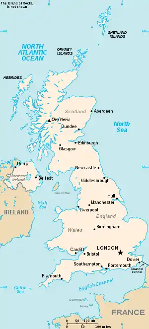
This is part of the list of United Kingdom locations: a gazetteer of place names in the United Kingdom showing each place's locality and geographical coordinates.

The United Kingdom
Cl
Clab-Clap
Clar
Clas-Clau
Clav-Clax
| Location | Locality | Coordinates (links to map & photo sources) |
OS grid reference |
| Clavelshay | Somerset | 51.07°N 03.07°W | ST2531 |
| Claverdon | Warwickshire | 52.27°N 01.72°W | SP1964 |
| Claverham | North Somerset | 51.39°N 02.80°W | ST4466 |
| Claverhambury | Essex | 51.70°N 00.02°E | TL4003 |
| Clavering | Essex | 51.95°N 00.13°E | TL4731 |
| Claverley | Shropshire | 52.53°N 02.31°W | SO7993 |
| Claverton | Bath and North East Somerset | 51.37°N 02.31°W | ST7864 |
| Claverton Down | Bath and North East Somerset | 51.36°N 02.33°W | ST7763 |
| Clawdd-coch | The Vale Of Glamorgan | 51.48°N 03.36°W | ST0577 |
| Clawdd-newydd | Denbighshire | 53.05°N 03.37°W | SJ0852 |
| Clawdd Poncen | Denbighshire | 52.98°N 03.38°W | SJ0744 |
| Clawthorpe | Cumbria | 54.18°N 02.72°W | SD5377 |
| Clawton | Devon | 50.76°N 04.34°W | SX3599 |
| Claxby (by Normanby) | Lincolnshire | 53.43°N 00.33°W | TF1194 |
| Claxby (St Andrew) | Lincolnshire | 53.21°N 00.17°E | TF4571 |
| Claxton | Norfolk | 52.57°N 01.43°E | TG3303 |
| Claxton | North Yorkshire | 54.03°N 00.94°W | SE6960 |
Clay
Cle
Cli
Clo
Clu
| Location | Locality | Coordinates (links to map & photo sources) |
OS grid reference |
| Clubmoor | Liverpool | 53.43°N 02.93°W | SJ3893 |
| Clubworthy | Cornwall | 50.70°N 04.45°W | SX2792 |
| Cluddley | Shropshire | 52.68°N 02.54°W | SJ6310 |
| Clun | Shropshire | 52.41°N 03.03°W | SO3080 |
| Clunbury | Shropshire | 52.41°N 02.92°W | SO3780 |
| Clunderwen | Carmarthenshire | 51.83°N 04.73°W | SN1219 |
| Clune | Highland | 57.30°N 04.00°W | NH7925 |
| Clunes | Highland | 56.94°N 04.96°W | NN2088 |
| Clungunford | Shropshire | 52.39°N 02.89°W | SO3978 |
| Clunie | Perth and Kinross | 56.57°N 03.46°W | NO1043 |
| Clunton | Shropshire | 52.42°N 02.98°W | SO3381 |
| Cluny | Fife | 56.14°N 03.22°W | NT2495 |
| Clutton | Cheshire | 53.08°N 02.80°W | SJ4654 |
| Clutton | Bath and North East Somerset | 51.32°N 02.54°W | ST6259 |
| Clutton Hill | Bath and North East Somerset | 51.32°N 02.53°W | ST6359 |
Clw
| Location | Locality | Coordinates (links to map & photo sources) |
OS grid reference |
| Clwt-y-bont | Gwynedd | 53.13°N 04.13°W | SH5762 |
| Clwydyfagwyr | Merthyr Tydfil | 51.74°N 03.42°W | SO0206 |
Cly
| Location | Locality | Coordinates (links to map & photo sources) |
OS grid reference |
| Clydach | Monmouthshire | 51.81°N 03.13°W | SO2213 |
| Clydach | Swansea | 51.69°N 03.91°W | SN6801 |
| Clydach Terrace | Blaenau Gwent | 51.80°N 03.19°W | SO1813 |
| Clydach Vale | Rhondda, Cynon, Taff | 51.62°N 03.48°W | SS9793 |
| Clydebank | Renfrewshire | 55.89°N 04.41°W | NS4970 |
| Clyffe Pypard | Wiltshire | 51.48°N 01.90°W | SU0776 |
| Clynder | Argyll and Bute | 56.01°N 04.82°W | NS2484 |
| Clyne | Neath Port Talbot | 51.68°N 03.73°W | SN8000 |
| Clynnog fawr | Gwynedd | 53.01°N 04.37°W | SH4149 |
| Clyro | Powys | 52.07°N 03.15°W | SO2143 |
| Clyst Honiton | Devon | 50.72°N 03.44°W | SX9893 |
| Clyst Hydon | Devon | 50.80°N 03.37°W | ST0301 |
| Clyst St George | Devon | 50.68°N 03.44°W | SX9888 |
| Clyst St Lawrence | Devon | 50.79°N 03.39°W | ST0200 |
| Clyst St Mary | Devon | 50.70°N 03.46°W | SX9791 |
Cn
| Location | Locality | Coordinates (links to map & photo sources) |
OS grid reference |
| Cnoc Amhlaigh | Western Isles | 58.24°N 06.17°W | NB5536 |
| Cnoc an t-Solais | Western Isles | 58.27°N 06.31°W | NB4740 |
| Cnoc Ard | Western Isles | 58.49°N 06.24°W | NB5364 |
| Cnocbreac | Argyll and Bute | 55.88°N 06.09°W | NR4473 |
| Cnoc Mairi | Western Isles | 58.21°N 06.42°W | NB4034 |
| Cnoc nan Gobhar | Western Isles | 58.21°N 06.37°W | NB4333 |
| Cnwch Coch | Ceredigion | 52.35°N 03.95°W | SN6775 |
This article is issued from Wikipedia. The text is licensed under Creative Commons - Attribution - Sharealike. Additional terms may apply for the media files.