List of tripoints
This is a list of all three-country tripoints on land or internal waters. Many of the coordinates listed below are only approximate.
List
Africa
America
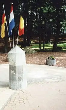
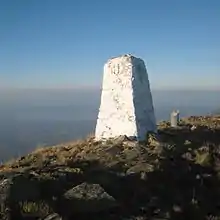
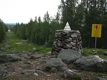
| Name / description | Country 1 | Country 2 | Country 3 | Coordinates | Region | Image |
|---|---|---|---|---|---|---|
| Zapaleri | 22°48′30″S 67°10′40″W | South | 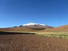 | |||
| Hito Esmeralda | 22°14′S 62°39′W | South | ||||
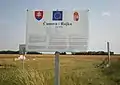
| Triple Frontier | 25°35′33″S 54°35′37″W | South |  | |||
| Brazilian Island | 30°11′S 57°36′W | South | ||||
| Aguas Turbias | 17°48′47″N 89°8′54″W | Central | ||||
| 20°10′S 58°10′W | South | |||||
| Assis Brasil / Iñapari / Bolpebra | 10°56′27″S 69°34′1″W | South | ||||
| Visviri | 17°30′S 69°29′W | South | ||||
| Tres Fronteras | 04°13′00″S 69°56′00″W | South | ||||
| 1°14′N 66°51′W | South | |||||
| 2°20′N 54°33′W | South | |||||
| 1°57′N 56°29′W | South | |||||
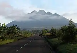
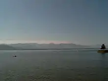
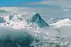
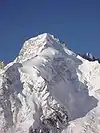
| Monte Roraima | 5°11′N 60°46′W | South |  | |||
| 0°7′S 75°15′W | South | |||||
| Cerro de Montecristo | 14°25′18″N 89°21′2″W | Central |
Asia
Europe


.jpg.webp)


See also
| Wikimedia Commons has media related to International tripoints. |
- List of tripoints of England
References
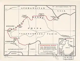
- 阿富汗 (in Chinese). State Ethnic Affairs Commission. 6 July 2004. Archived from the original on 4 December 2008.
中阿边界{...}南起中、巴、阿3国交界处的5587山峰,沿穆斯塔格山脉分水岭北行至克克拉去考勒峰。
- Kamoludin Abdullaev (2018). Historical Dictionary of Tajikistan (3 ed.). Rowman & Littlefield. p. 92. ISBN 9781538102527 – via Google Books.
CHINA-TAJIK BORDER.{...}This mountainous boundary runs along the Sarikol mountain range in eastern Tajikistan, reaching in Pamir the Afghan border at the Povalo-Shveikovskogo peak (5,543 meters above sea level).
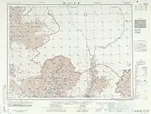
- "NJ 43 Su-fu [U.S.S.R., China, Afghanistan, Pakistan, State of Jammu and Kashmir] Series 1301, Edition 5-AMS". Washington, D. C.: Army Map Service. March 1967 – via Perry–Castañeda Library Map Collection.
Pik Povalo-Shveikovskogo
- 中华人民共和国和阿富汗王国边界条约. 22 November 1963 – via Wikisource.
到高程为5698米的克克拉去考勒峰(阿方图称波万洛什维科夫斯基峰)。
- "China Report Political, Sociological and Military Affaris No. 363" (PDF). United States Joint Publications Research Service. 18 November 1982. p. 1. Retrieved 11 January 2020 – via Defense Technical Information Center.
If we open up the Atlas of the People's Republic of China we will find that the region of the Pamir, the western extremity of Xinjiang, from the Wuzibieli [Uzbel] Pass1 to the south down to the Kekelaqukaole Peak (which the Soviet Russians call "Pavel Shveikovsky Peak") is designated as a not limited area.
- As known in Syria التنف
- Protocol between the Government of the Russian Federation, the Government of Mongolia, and the Government of the People's Republic of China, describing the eastern junction point of the borders of the three states Archived 2018-02-15 at the Wayback Machine (in Russian)
- Protocol describing the western junction point of the borders of the PRC, RF, and PRM (in Russian)
- Agreement between the Government of the Russian Federation, the Government of the People's Republic of China, and the Government of the People's Democratic Republic of Korea, determining the line of delimitation of the water spaces of the three states on the Tumen River Archived 2015-07-02 at the Wayback Machine (in Russian)
!["NJ 43 Su-fu [U.S.S.R., China, Afghanistan, Pakistan, State of Jammu and Kashmir] Series 1301, Edition 5-AMS"](http://legacy.lib.utexas.edu/maps/imw/txu-oclc-6654394-nj-43-5th-ed.jpg)
External links
This article is issued from Wikipedia. The text is licensed under Creative Commons - Attribution - Sharealike. Additional terms may apply for the media files.