National Register of Historic Places listings in Bartholomew County, Indiana
This is a list of the National Register of Historic Places listings in Bartholomew County, Indiana.
This is intended to be a complete list of the properties and districts on the National Register of Historic Places in Bartholomew County, Indiana, United States. Latitude and longitude coordinates are provided for many National Register properties and districts; these locations may be seen together in a map.[1]
There are 23 properties and districts listed on the National Register in the county, including 7 National Historic Landmarks.
Properties and districts located in incorporated areas display the name of the municipality, while properties and districts in unincorporated areas display the name of their civil township. Properties and districts split between multiple jurisdictions display the names of all jurisdictions.
- This National Park Service list is complete through NPS recent listings posted February 5, 2021.[2]
Current listings
| [3] | Name on the Register[4] | Image | Date listed[5] | Location | City or town | Description |
|---|---|---|---|---|---|---|
| 1 | David Aikens House | 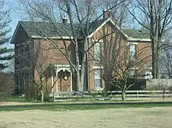 David Aikens House |
June 6, 2001 (#01000621) |
2325 Jonesville Rd., southwest of Columbus 39°10′27″N 85°55′48″W |
Columbus Township | |
| 2 | Bartholomew County Courthouse | 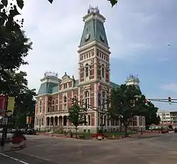 Bartholomew County Courthouse |
November 15, 1979 (#79000031) |
3rd and Washington Sts. 39°12′04″N 85°55′17″W |
Columbus | |
| 3 | Columbus City Hall | 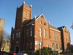 Columbus City Hall |
November 15, 1979 (#79000032) |
5th and Franklin Sts. 39°12′11″N 85°55′13″W |
Columbus | |
| 4 | Columbus Historic District | 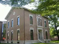 Columbus Historic District |
December 10, 1982 (#82000059) |
Roughly bounded by the former Pennsylvania railroad tracks, Chestnut, 34th, Washington, and Franklin Sts. 39°12′23″N 85°55′04″W |
Columbus | |
| 5 | Elnora Daugherty Farm | 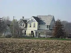 Elnora Daugherty Farm |
June 4, 1992 (#92000676) |
5541 E. 500S, south of Columbus 39°07′39″N 85°51′43″W |
Sand Creek Township | |
| 6 | James and Annetta Daugherty House and Barn | December 2, 2020 (#100005878) |
6443 South Jonesville Rd. 39°08′26″N 85°54′37″W |
Wayne Township | ||
| 7 | First Baptist Church | 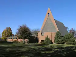 First Baptist Church |
May 16, 2000 (#00000707) |
3300 Fairlawn Dr. 39°14′01″N 85°52′20″W |
Columbus | Designed by Harry Weese |
| 8 | First Christian Church | 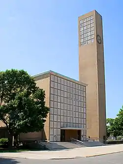 First Christian Church |
January 3, 2001 (#01000067) |
531 5th St. 39°12′11″N 85°55′08″W |
Columbus | Designed by Eliel Saarinen |
| 9 | William R. Gant Farm | 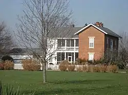 William R. Gant Farm |
September 22, 2000 (#00001134) |
5890 S175E, south of Columbus 39°08′48″N 85°52′47″W |
Sand Creek Township | |
| 10 | Haw Creek Leather Company | 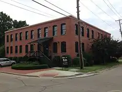 Haw Creek Leather Company |
December 17, 1998 (#98001526) |
Junction of Washington and 1st Sts. 39°11′57″N 85°55′17″W |
Columbus | |
| 11 | D.W. Heagy Farm | 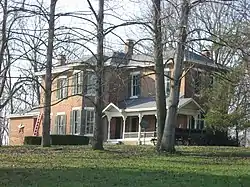 D.W. Heagy Farm |
August 14, 1998 (#98001052) |
3005 W. 200S, southwest of Columbus 39°10′14″N 85°57′23″W |
Columbus Township | |
| 12 | Hope Historic District | 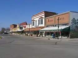 Hope Historic District |
December 19, 1991 (#91001864) |
Roughly bounded by Haw Creek, Grand St., Walnut St., and South St. 39°18′04″N 85°46′13″W |
Hope | |
| 13 | Irwin Union Bank and Trust |  Irwin Union Bank and Trust |
May 16, 2000 (#00000704) |
500 Washington St. 39°12′13″N 85°55′17″W |
Columbus | |
| 14 | James Marr House and Farm | 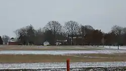 James Marr House and Farm |
October 23, 1980 (#80000052) |
Northeast of Columbus on Marr Rd. 39°15′22″N 85°52′50″W |
Columbus, Flat Rock, and German Townships | |
| 15 | Mabel McDowell Elementary School | 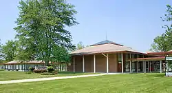 Mabel McDowell Elementary School |
January 3, 2001 (#01000068) |
2700 McKinley Ave. 39°12′07″N 85°53′31″W |
Columbus | |
| 16 | McEwen-Samuels-Marr House | 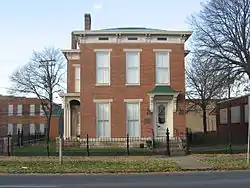 McEwen-Samuels-Marr House |
May 22, 1978 (#78000045) |
524 3rd St. 39°12′06″N 85°55′08″W |
Columbus | |
| 17 | McKinley School | 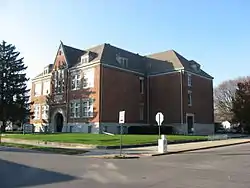 McKinley School |
August 25, 1988 (#88001221) |
17th St. and Home Ave. 39°12′57″N 85°54′44″W |
Columbus | |
| 18 | Miller House | 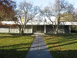 Miller House |
May 16, 2000 (#00000706) |
2760 Highland Way[6] 39°13′38″N 85°55′23″W |
Columbus | Designed by Eero Saarinen |
| 19 | New Hope Bridge | 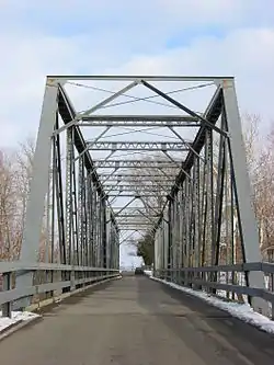 New Hope Bridge |
September 9, 1999 (#99001104) |
County Road 400N over the Flatrock River, north of Columbus 39°15′34″N 85°55′19″W |
Columbus Township | |
| 20 | Newsom-Marr Farm | 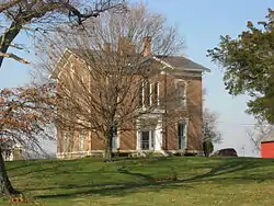 Newsom-Marr Farm |
March 20, 2002 (#02000195) |
4950 S. 150E, south of Columbus 39°09′17″N 85°53′02″W |
Sand Creek Township | |
| 21 | North Christian Church |  North Christian Church |
May 16, 2000 (#00000705) |
850 Tipton Ln. 39°13′46″N 85°54′53″W |
Columbus | |
| 22 | Pugh Ford Bridge | 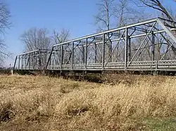 Pugh Ford Bridge |
September 9, 1999 (#99001103) |
County Road 900N over the Flatrock River, northeast of Taylorsville 39°20′01″N 85°52′16″W |
Flat Rock and German Townships | |
| 23 | The Republic | 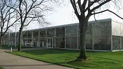 The Republic |
October 16, 2012 (#12001015) |
333 Second St. 39°12′00″N 85°55′18″W |
Columbus |
See also
| Wikimedia Commons has media related to National Register of Historic Places in Bartholomew County, Indiana. |
References
- The latitude and longitude information provided in this table was derived originally from the National Register Information System, which has been found to be fairly accurate for about 99% of listings. Some locations in this table may have been corrected to current GPS standards.
- "National Register of Historic Places: Weekly List Actions". National Park Service, United States Department of the Interior. Retrieved on February 5, 2021.
- Numbers represent an alphabetical ordering by significant words. Various colorings, defined here, differentiate National Historic Landmarks and historic districts from other NRHP buildings, structures, sites or objects.
- "National Register Information System". National Register of Historic Places. National Park Service. March 13, 2009.
- The eight-digit number below each date is the number assigned to each location in the National Register Information System database, which can be viewed by clicking the number.
- Location derived from this IUPUI website; the NRIS lists the site as "Address Restricted"
| Topics | |
|---|---|
| Lists by state |
|
| Lists by insular areas | |
| Lists by associated state | |
| Other areas | |
| Related | |
| |
Municipalities and communities of Bartholomew County, Indiana, United States | ||
|---|---|---|
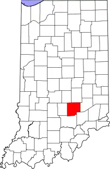
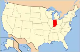
| City | Map of Indiana highlighting Bartholomew County | |
| Towns | ||
| Townships | ||
| CDP | ||
| Other unincorporated communities |
| |
| Ghost town | ||
| Footnotes | ‡This populated place also has portions in an adjacent county or counties | |
| ||