National Register of Historic Places listings in LaPorte County, Indiana
This is a list of the National Register of Historic Places listings in LaPorte County, Indiana.
This is intended to be a complete list of the properties and districts on the National Register of Historic Places in LaPorte County, Indiana, United States. Latitude and longitude coordinates are provided for many National Register properties and districts; these locations may be seen together in a map.[1]
There are 33 properties and districts listed on the National Register in the county. Another property was once listed but has been removed.
Properties and districts located in incorporated areas display the name of the municipality, while properties and districts in unincorporated areas display the name of their civil township. Properties and districts split between multiple jurisdictions display the names of all jurisdictions.
- This National Park Service list is complete through NPS recent listings posted January 29, 2021.[2]
Current listings
| [3] | Name on the Register[4] | Image | Date listed[5] | Location | City or town | Description |
|---|---|---|---|---|---|---|
| 1 | Ames Family Homestead |  Ames Family Homestead |
December 19, 2012 (#12001062) |
5332 and 5336 W150N, northwest of LaPorte 41°37′36″N 86°48′12″W |
Center Township | |
| 2 | Barker House |  Barker House |
December 7, 2001 (#01001349) |
444 Barker St. 41°41′17″N 86°52′59″W |
Michigan City | Save the Dunes offices and Barker Woods Nature Preserve (managed by Shirley Heinze Land Trust) |
| 3 | John H. Barker Mansion | 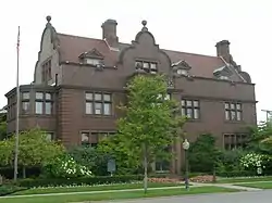 John H. Barker Mansion |
October 10, 1975 (#75000027) |
631 Washington St. 41°42′53″N 86°54′09″W |
Michigan City | Michigan City Civic Center |
| 4 | John and Isabel Burnham House | 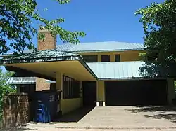 John and Isabel Burnham House |
August 1, 2013 (#13000085) |
2602 Lake Shore Dr. 41°44′56″N 86°50′58″W |
Long Beach | |
| 5 | Downtown LaPorte Historic District | 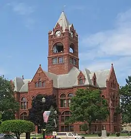 Downtown LaPorte Historic District |
September 15, 1983 (#83000039) |
Roughly bounded by State, Jackson, Maple, and Chicago Sts. 41°36′41″N 86°43′20″W |
LaPorte | |
| 6 | Elston Grove Historic District | 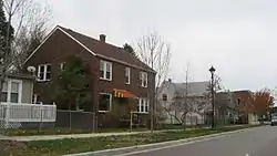 Elston Grove Historic District |
September 25, 2013 (#13000759) |
Bounded by Michigan Boulevard and 11th, Pine, and 6th Sts. 41°42′49″N 86°53′35″W |
Michigan City | |
| 7 | First Congregational Church of Michigan City | 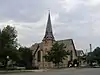 First Congregational Church of Michigan City |
December 7, 2001 (#01001343) |
531 Washington St. 41°42′57″N 86°54′11″W |
Michigan City | |
| 8 | James and Lavinia Forrester Farmstead |  James and Lavinia Forrester Farmstead |
June 12, 2017 (#100001060) |
969 Forrester Rd. 41°35′33″N 86°48′41″W |
Scipio Township | |
| 9 | Franklin Street Commercial Historic District |  Franklin Street Commercial Historic District |
December 31, 2013 (#13001013) |
Bounded by Pine, 4th, and 11th Sts., and the alley between Franklin and Washington Sts. 41°42′51″N 86°54′01″W |
Michigan City | |
| 10 | Dr. Robert and Amelia Frost House | August 21, 2020 (#100005503) |
3215 Cleveland Ave. 41°41′25″N 86°53′03″W |
Michigan City | ||
| 11 | Garrettson-Baine-Bartholomew House | 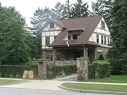 Garrettson-Baine-Bartholomew House |
December 7, 2001 (#01001340) |
2921 Franklin St. 41°41′51″N 86°53′41″W |
Michigan City | |
| 12 | John and Cynthia Garwood Farmstead |  John and Cynthia Garwood Farmstead |
June 15, 2012 (#12000334) |
5600 Small Rd., west of LaPorte 41°36′40″N 86°48′31″W |
Center Township | |
| 13 | Haskell and Barker Historic District | 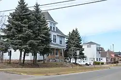 Haskell and Barker Historic District |
September 30, 2014 (#14000806) |
Washington and Wabash between 4th and Homer Sts. 41°42′38″N 86°54′04″W |
Michigan City | |
| 14 | Hoover-Timme House | 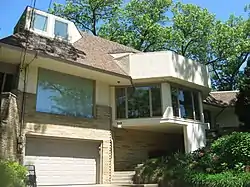 Hoover-Timme House |
August 1, 2013 (#13000086) |
2304 Hazeltine Dr. 41°44′42″N 86°51′19″W |
Long Beach | |
| 15 | Indiana and Michigan Avenues Historic District | 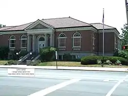 Indiana and Michigan Avenues Historic District |
September 30, 2014 (#14000807) |
Roughly Indiana and Michigan between Maple and Kingsbury Aves. 41°36′20″N 86°43′00″W |
La Porte | |
| 16 | Lowell E. and Paula G. Jackson House |  Lowell E. and Paula G. Jackson House |
August 1, 2013 (#13000087) |
2935 Ridge Rd. 41°45′07″N 86°50′24″W |
Long Beach | |
| 17 | George and Adele Jaworowski House | 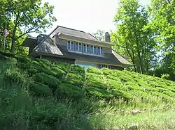 George and Adele Jaworowski House |
August 1, 2013 (#13000088) |
3501 Lake Shore Dr. in Duneland Beach 41°45′28″N 86°49′44″W |
Michigan Township | |
| 18 | Long Beach School |  Long Beach School |
September 3, 2019 (#100004366) |
2501 Oriole Trail 41°44′47″N 86°50′53″W |
Long Beach | |
| 19 | Michigan City Breakwater Light |  Michigan City Breakwater Light |
July 24, 2017 (#100001344) |
On breakwater in Lake Michigan, 0.5 miles northwest of the Michigan City harbor 41°43′47″N 86°54′51″W |
Michigan City | |
| 20 | Michigan City East Pierhead Light Tower and Elevated Walk |  Michigan City East Pierhead Light Tower and Elevated Walk |
February 17, 1988 (#88000069) |
Eastern side of the entrance to Michigan City Harbor 41°43′41″N 86°54′35″W |
Michigan City | |
| 21 | Michigan City Lighthouse | 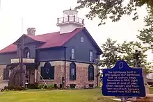 Michigan City Lighthouse |
November 5, 1974 (#74000023) |
Washington Park 41°43′22″N 86°54′22″W |
Michigan City | |
| 22 | Michigan City Post Office |  Michigan City Post Office |
June 15, 2000 (#00000675) |
126 E. 5th St. 41°43′04″N 86°54′03″W |
Michigan City | In 2010, the building was being used as a law office. |
| 23 | Francis H. Morrison House | 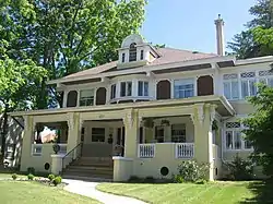 Francis H. Morrison House |
December 6, 1984 (#84000492) |
1217 Michigan Ave. 41°36′24″N 86°43′00″W |
LaPorte | |
| 24 | MUSKEGON Shipwreck Site |  MUSKEGON Shipwreck Site |
April 26, 1989 (#89000290) |
Address Restricted |
Michigan City | |
| 25 | William Orr House |  William Orr House |
March 22, 1984 (#84001063) |
4076 W. Small Rd., west of LaPorte 41°36′36″N 86°46′42″W |
Center Township | |
| 26 | Pinehurst Hall |  Pinehurst Hall |
June 3, 1976 (#76000027) |
3042 N. U.S. Route 35, northwest of LaPorte 41°39′03″N 86°45′36″W |
Center Township | |
| 27 | Pinhook Methodist Church and Cemetery | 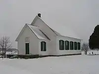 Pinhook Methodist Church and Cemetery |
September 24, 2009 (#09000759) |
8001 State Road 2, northeast of Westville 41°33′48″N 86°51′28″W |
New Durham Township | |
| 28 | Marion Ridgeway Polygonal Barn | 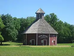 Marion Ridgeway Polygonal Barn |
May 27, 1993 (#93000464) |
U.S. Route 35 north of its junction with Crescent Dr. 41°35′25″N 86°42′09″W |
LaPorte | |
| 29 | Scott-Rumley House |  Scott-Rumley House |
December 27, 2016 (#16000905) |
211 Rose St. 41°36′44″N 86°42′51″W |
La Porte | |
| 30 | Everel S. Smith House |  Everel S. Smith House |
December 12, 1990 (#90001794) |
56 W. Jefferson St. 41°32′36″N 86°53′52″W |
Westville | |
| 31 | Tryon Farm | August 21, 2020 (#100005515) |
1400 and 1402 Tryon Rd. 41°43′29″N 86°50′30″W |
Michigan City | ||
| 32 | Washington Park |  Washington Park |
June 26, 1991 (#91000793) |
Roughly bounded by Lake Michigan, Krueger St., Trail Creek, Lakeshore Dr., Heisman Harbor Rd., and Browne Basin Rd. 41°43′34″N 86°54′03″W |
Michigan City | |
| 33 | Wynkoop-Taylor-Swanson-Sharp Farmstead |  Wynkoop-Taylor-Swanson-Sharp Farmstead |
September 18, 2017 (#100001607) |
3463 N. State Road 39, north of LaPorte 41°39′31″N 86°44′17″W |
Center Township |
Former listing
| [3] | Name on the Register | Image | Date listed | Date removed | Location | City or town | Summary |
|---|---|---|---|---|---|---|---|
| 1 | Michigan Central Railroad Engine Repair Shops | May 12, 1975 (#75000028) | August 11, 1978 | 104 N. Franklin St. |
Michigan City |
See also
| Wikimedia Commons has media related to National Register of Historic Places in LaPorte County, Indiana. |
References
- The latitude and longitude information provided in this table was derived originally from the National Register Information System, which has been found to be fairly accurate for about 99% of listings. Some locations in this table may have been corrected to current GPS standards.
- "National Register of Historic Places: Weekly List Actions". National Park Service, United States Department of the Interior. Retrieved on January 29, 2021.
- Numbers represent an alphabetical ordering by significant words. Various colorings, defined here, differentiate National Historic Landmarks and historic districts from other NRHP buildings, structures, sites or objects.
- "National Register Information System". National Register of Historic Places. National Park Service. March 13, 2009.
- The eight-digit number below each date is the number assigned to each location in the National Register Information System database, which can be viewed by clicking the number.
| Topics | |
|---|---|
| Lists by state |
|
| Lists by insular areas | |
| Lists by associated state | |
| Other areas | |
| Related | |
| |
Municipalities and communities of LaPorte County, Indiana, United States | ||
|---|---|---|
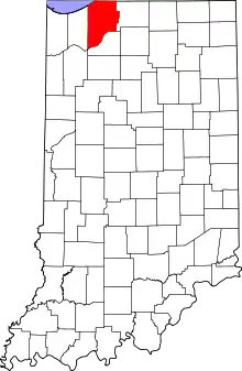
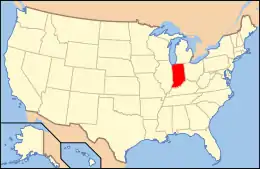
| Cities | Map of Indiana highlighting LaPorte County | |
| Towns | ||
| Townships | ||
| CDPs | ||
| Other unincorporated communities |
| |
| Footnotes | ‡This populated place also has portions in an adjacent county or counties | |
| ||