National Register of Historic Places listings in Madison County, Indiana
This is a list of the National Register of Historic Places listings in Madison County, Indiana.
This is intended to be a complete list of the properties and districts on the National Register of Historic Places in Madison County, Indiana, United States. Latitude and longitude coordinates are provided for many National Register properties and districts; these locations may be seen together in a map.[1]
There are 18 properties and districts listed on the National Register in the county. Another 3 properties were once listed but have been removed.
Properties and districts located in incorporated areas display the name of the municipality, while properties and districts in unincorporated areas display the name of their civil township. Properties and districts split between multiple jurisdictions display the names of all jurisdictions.
- This National Park Service list is complete through NPS recent listings posted January 29, 2021.[2]
Current listings
| [3] | Name on the Register[4] | Image | Date listed[5] | Location | City or town | Description |
|---|---|---|---|---|---|---|
| 1 | Anderson Bank Building | 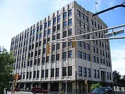 Anderson Bank Building |
August 30, 1984 (#84001078) |
931 Meridan St. 40°06′23″N 85°40′47″W |
Anderson | |
| 2 | Anderson Downtown Historic District |  Anderson Downtown Historic District |
April 19, 2006 (#06000307) |
Roughly Meridian St. from 10th to the former Conrail rail line and the first block west of 11th and 12th Sts. 40°06′13″N 85°40′47″W |
Anderson | |
| 3 | Carnegie Public Library |  Carnegie Public Library |
March 21, 1985 (#85000603) |
32 W. 10th St. 40°06′23″N 85°40′49″W |
Anderson | |
| 4 | Anderson High School Wigwam | September 4, 2018 (#100002863) |
1229 Lincoln St. 40°06′09″N 85°41′09″W |
Anderson | ||
| 4 | Central Avenue School |  Central Avenue School |
June 21, 2007 (#07000562) |
2120 Central Ave. 40°05′41″N 85°40′34″W |
Anderson | |
| 5 | Chesterfield Spiritualist Camp District |  Chesterfield Spiritualist Camp District |
July 17, 2002 (#02000192) |
200-300 blocks of Eastern, Parkview, and Western Drs. 40°07′00″N 85°35′50″W |
Chesterfield | |
| 6 | Elwood Downtown Historic District | 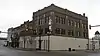 Elwood Downtown Historic District |
October 15, 2002 (#02001175) |
Roughly bounded by Duck Creek, N. A St., 16th St., and S. C St. 40°16′35″N 85°50′30″W |
Elwood | |
| 7 | Fall Creek Meeting House |  Fall Creek Meeting House |
January 2, 1997 (#96001544) |
State Road 38 southeast of Pendleton, approximately 1.5 miles southeast of its junction with U.S. Route 36 39°59′35″N 85°42′23″W |
Fall Creek Township | |
| 8 | Gruenewald House |  Gruenewald House |
October 8, 1976 (#76000028) |
626 N. Main St. 40°06′34″N 85°40′40″W |
Anderson | |
| 9 | Madison County Bridge No. 149 |  Madison County Bridge No. 149 |
December 22, 2008 (#08001212) |
Fall Creek Parkway and Huntsville Pike over Fall Creek 40°00′29″N 85°44′07″W |
Pendleton | |
| 10 | George Makepeace House | 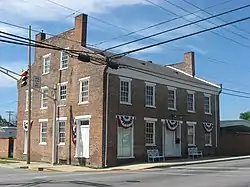 George Makepeace House |
March 21, 1985 (#85000596) |
5 W. Main St. 40°06′48″N 85°35′45″W |
Chesterfield | |
| 11 | Mounds State Park |  Mounds State Park |
January 18, 1973 (#73000022) |
3 miles east of downtown Anderson on State Road 32 40°06′01″N 85°37′19″W |
Anderson and Union Township | |
| 12 | Paramount Theater Building | 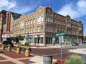 Paramount Theater Building |
August 29, 1991 (#91001165) |
1124 Meridian St. 40°06′16″N 85°40′44″W |
Anderson | |
| 13 | Pendleton Historic District | 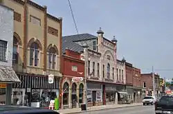 Pendleton Historic District |
May 15, 1991 (#91000788) |
Roughly bounded by Fall Creek, the Conrail right of way, and Madison and Adams Sts. 40°00′10″N 85°44′48″W |
Pendleton | |
| 14 | Joseph & Lucinda Thawley House |  Joseph & Lucinda Thawley House |
September 24, 2009 (#09000760) |
300 E. North Main St. 40°20′25″N 85°38′37″W |
Summitville | |
| 15 | Tower Hotel | 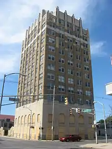 Tower Hotel |
October 10, 1997 (#97001180) |
1109 Jackson St. 40°06′18″N 85°40′51″W |
Anderson | |
| 16 | West Central Historic District | 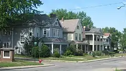 West Central Historic District |
December 6, 1984 (#84000515) |
Roughly bounded by Brown-Delaware, 10th, John, and 13th Sts. 40°06′18″N 85°41′00″W |
Anderson | |
| 17 | West Eighth Street Historic District |  West Eighth Street Historic District |
August 27, 1976 (#76000029) |
Roughly bounded by 7th, 9th, Jackson, and Henry Sts. 40°06′29″N 85°41′20″W |
Anderson |
Former listings
| [3] | Name on the Register | Image | Date listed | Date removed | Location | City or town | Summary |
|---|---|---|---|---|---|---|---|
| 1 | Elwood Passenger and Freight Depot | April 3, 1980 (#80000045) | March 5, 1984 | 16th and S. B Sts. |
Elwood | Passenger Depot torn down in June, 1983. The Freight Depot was burned in a control fire on January 5, 1990. | |
| 2 | Solomon Fussell Farm | June 4, 1992 (#92000675) | June 8, 2011 | State Road 38 east of its junction with County Road 150W 39°59′20″N 85°41′54″W |
Pendleton | ||
| 3 | Wendell L. Willkie School | May 12, 1975 (#75000029) | January 19, 1990 | 1630 Main St. 40°16′38″N 85°50′21″W |
Elwood | Newer building burned June 22, 1988; older building razed same year. |
See also
| Wikimedia Commons has media related to National Register of Historic Places in Madison County, Indiana. |
References
- The latitude and longitude information provided in this table was derived originally from the National Register Information System, which has been found to be fairly accurate for about 99% of listings. Some locations in this table may have been corrected to current GPS standards.
- "National Register of Historic Places: Weekly List Actions". National Park Service, United States Department of the Interior. Retrieved on January 29, 2021.
- Numbers represent an alphabetical ordering by significant words. Various colorings, defined here, differentiate National Historic Landmarks and historic districts from other NRHP buildings, structures, sites or objects.
- "National Register Information System". National Register of Historic Places. National Park Service. March 13, 2009.
- The eight-digit number below each date is the number assigned to each location in the National Register Information System database, which can be viewed by clicking the number.
| Topics | |
|---|---|
| Lists by state |
|
| Lists by insular areas | |
| Lists by associated state | |
| Other areas | |
| Related | |
| |
Municipalities and communities of Madison County, Indiana, United States | ||
|---|---|---|
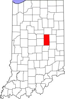
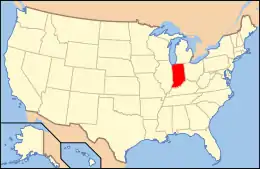
| Cities | Map of Indiana highlighting Madison County | |
| Towns | ||
| Townships | ||
| Unincorporated communities |
| |
| Footnotes | ‡This populated place also has portions in an adjacent county or counties | |
| ||
