National Register of Historic Places listings in Hamilton County, Indiana
This is a list of the National Register of Historic Places listings in Hamilton County, Indiana.
This is intended to be a complete list of the properties and districts on the National Register of Historic Places in Hamilton County, Indiana, United States. Latitude and longitude coordinates are provided for many National Register properties and districts; these locations may be seen together in a map.[1]
There are 34 properties and districts listed on the National Register in the county.
Properties and districts located in incorporated areas display the name of the municipality, while properties and districts in unincorporated areas display the name of their civil township. Properties and districts split between multiple jurisdictions display the names of all jurisdictions.
- This National Park Service list is complete through NPS recent listings posted February 5, 2021.[2]
Current listings
| [3] | Name on the Register[4] | Image | Date listed[5] | Location | City or town | Description |
|---|---|---|---|---|---|---|
| 1 | Archeological Site 12H1052 | March 17, 2015 (#15000077) |
Address Restricted |
White River Township | ||
| 2 | George Boxley Cabin |  George Boxley Cabin |
September 15, 2005 (#05001010) |
Pioneer Hill at 1st and Main Sts. 40°08′20″N 86°13′15″W |
Sheridan | |
| 3 | Carmel Monon Depot |  Carmel Monon Depot |
June 25, 2013 (#13000420) |
211 1st St., SW. 39°58′38″N 86°07′48″W |
Carmel | |
| 4 | Castor Farm Site |  Castor Farm Site |
December 8, 2008 (#08001207) |
River bottoms below the Strawtown Enclosure, northeast of Noblesville[6] 40°07′44″N 85°57′09″W |
White River Township | |
| 5 | Catherine Street Historic District |  Catherine Street Historic District |
September 16, 2001 (#01000988) |
Roughly bounded by Harrison, Clinton, the western side of 9th, and the eastern side of 10th 40°02′54″N 86°00′46″W |
Noblesville | |
| 6 | Cole-Evans House | 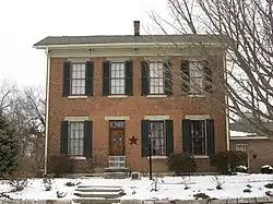 Cole-Evans House |
September 22, 2000 (#00001136) |
1012 Monument St. 40°03′04″N 86°00′43″W |
Noblesville | |
| 7 | Conner Street Historic District | 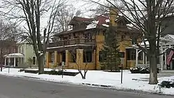 Conner Street Historic District |
March 12, 1999 (#99000296) |
Roughly both sides of Logan and Conner Sts. between 10th and 17th 40°02′46″N 86°00′29″W |
Noblesville | |
| 8 | William Conner House | 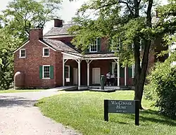 William Conner House |
February 8, 1980 (#80000038) |
13400 Allisonville Rd. 39°59′04″N 86°01′53″W |
Fishers | |
| 9 | William Houston Craig House | 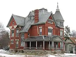 William Houston Craig House |
May 24, 1990 (#90000808) |
1250 E. Conner St. 40°02′45″N 86°00′34″W |
Noblesville | |
| 10 | Daniel Craycraft House | 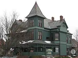 Daniel Craycraft House |
January 4, 1989 (#88003040) |
1095 E. Conner St. 40°02′43″N 86°00′39″W |
Noblesville | |
| 11 | Davenport-Bradfield House | 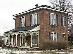 Davenport-Bradfield House |
January 18, 1985 (#85000089) |
106 E. 2nd St. 40°08′13″N 86°13′11″W |
Sheridan | |
| 12 | Hamilton County Courthouse Square | 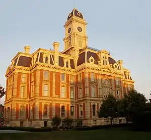 Hamilton County Courthouse Square |
May 10, 1978 (#78000033) |
Bounded by Logan, 8th, 9th, and Conner Sts. 40°02′45″N 86°00′51″W |
Noblesville | |
| 13 | Dr. Samuel Harrell House |  Dr. Samuel Harrell House |
March 1, 1984 (#84001040) |
399 N. 10th St. 40°02′56″N 86°00′44″W |
Noblesville | |
| 14 | Holliday Hydroelectric Powerhouse and Dam | 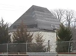 Holliday Hydroelectric Powerhouse and Dam |
June 9, 1995 (#95000706) |
Riverwood Ave. at its junction with 211th St., across the White River northeast of Noblesville 40°05′42″N 85°58′08″W |
Noblesville Township | |
| 15 | John Kinzer House |  John Kinzer House |
September 5, 1975 (#75000020) |
East of downtown Carmel on State Road 234 39°58′44″N 86°06′32″W |
Carmel | |
| 16 | Micah Newby House |  Micah Newby House |
June 20, 1986 (#86001349) |
1149 W. 116th St., west of Carmel 39°57′19″N 86°10′37″W |
Clay Township | |
| 17 | Nickel Plate Road Steam Locomotive No. 587 |  Nickel Plate Road Steam Locomotive No. 587 |
November 28, 1984 (#84000313) |
Indiana Transportation Museum 40°03′30″N 86°01′15″W |
Noblesville | |
| 18 | Noblesville Commercial Historic District | Noblesville Commercial Historic District |
December 19, 1991 (#91001862) |
Roughly bounded by Clinton, 10th, Maple, and 8th Sts. 40°02′44″N 86°00′49″W |
Noblesville | |
| 19 | Noblesville Milling Company Mill |  Noblesville Milling Company Mill |
December 7, 2001 (#01001346) |
S. 8th St. 40°02′30″N 86°00′55″W |
Noblesville | |
| 20 | Plum Prairie Residential Historic District | March 13, 2019 (#100003502) |
Roughly bounded by Vine, Walnut, 7th, South, & 5th Sts. including blk. W. to 4th between Walnut & Pleasant Sts. 40°02′25″N 86°00′58″W |
Noblesville Township | ||
| 21 | Potter's Covered Bridge | 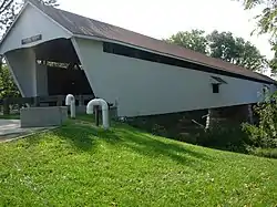 Potter's Covered Bridge |
December 19, 1991 (#91001866) |
Allisonville Rd. across the White River, north of Noblesville 40°04′21″N 86°00′02″W |
Noblesville Township | |
| 22 | Roads Hotel |  Roads Hotel |
December 30, 1987 (#87002187) |
150 E. Main St. 40°12′57″N 86°01′31″W |
Atlanta | |
| 23 | Roberts Chapel | 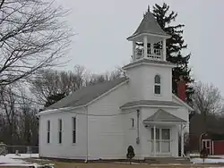 Roberts Chapel |
September 25, 1996 (#96001009) |
3102 E. 276th St., southwest of Atlanta 40°11′26″N 86°06′50″W |
Jackson Township | |
| 24 | Sheridan Downtown Commercial Historic District |  Sheridan Downtown Commercial Historic District |
September 20, 2007 (#07000979) |
Roughly includes Main St. from E. 2nd to the old Monon Railroad right-of-way 40°08′14″N 86°13′14″W |
Sheridan | |
| 25 | South 9th Street Historic District | 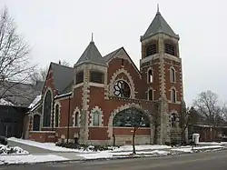 South 9th Street Historic District |
September 16, 2001 (#01000982) |
Roughly bounded by Maple, Division, 10th, and the western side of 9th St. 40°02′35″N 86°00′48″W |
Noblesville | |
| 26 | Judge Earl S. Stone House |  Judge Earl S. Stone House |
December 8, 1978 (#78000034) |
107 S. 8th St. 40°02′40″N 86°00′54″W |
Noblesville | |
| 27 | Strawtown Enclosure |  Strawtown Enclosure |
March 19, 2008 (#08000192) |
Northern side of Strawtown Ave., west of Strawtown[7] 40°07′35″N 85°57′06″W |
White River Township | |
| 28 | Taylor Ten | December 24, 2009 (#09001130) |
Address Restricted |
White River Township | ||
| 29 | Thornhurst Addition |  Thornhurst Addition |
June 24, 2010 (#10000378) |
Bounded by 650 to 742 West Main St., Thornhurst Dr. and Rogers Ct. 39°58′44″N 86°08′16″W |
Carmel | |
| 30 | Union High Academy Historic District | 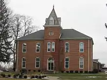 Union High Academy Historic District |
March 3, 1995 (#95000209) |
434 S. Union St. 40°02′19″N 86°07′34″W |
Westfield | |
| 31 | Micajah Walden House | May 31, 2019 (#100004042) |
3909 E. 276th St. 40°11′25″N 86°05′42″W |
Atlanta vicinity | ||
| 32 | West-Harris House |  West-Harris House |
March 23, 1999 (#99000297) |
10595 Eller Rd. 39°56′28″N 86°03′57″W |
Fishers | |
| 33 | Westfield Historic District |  Westfield Historic District |
January 31, 2019 (#100003180) |
Roughly bounded by Camilla Ct. and Penn, Walnut, and Park Sts. 40°02′34″N 86°07′40″W |
Westfield | |
| 34 | Robert L. Wilson House |  Robert L. Wilson House |
September 17, 2008 (#08000918) |
273 S. 8th St. 40°02′35″N 86°00′56″W |
Noblesville |
See also
| Wikimedia Commons has media related to National Register of Historic Places in Hamilton County, Indiana. |
References
- The latitude and longitude information provided in this table was derived originally from the National Register Information System, which has been found to be fairly accurate for about 99% of listings. Some locations in this table may have been corrected to current GPS standards.
- "National Register of Historic Places: Weekly List Actions". National Park Service, United States Department of the Interior. Retrieved on February 5, 2021.
- Numbers represent an alphabetical ordering by significant words. Various colorings, defined here, differentiate National Historic Landmarks and historic districts from other NRHP buildings, structures, sites or objects.
- "National Register Information System". National Register of Historic Places. National Park Service. March 13, 2009.
- The eight-digit number below each date is the number assigned to each location in the National Register Information System database, which can be viewed by clicking the number.
- Location derived from Geophysical Methods and the Archaeology of Late Prehistoric Indiana, Indiana University – Purdue University Fort Wayne, n.d. Accessed 2011-12-10. The NRIS lists the site as "Address Restricted".
- Location derived from coordinates; the NRIS provides coordinates but lists the property as "Address Restricted".
| Topics | |
|---|---|
| Lists by state |
|
| Lists by insular areas | |
| Lists by associated state | |
| Other areas | |
| Related | |
| |
Municipalities and communities of Hamilton County, Indiana, United States | ||
|---|---|---|
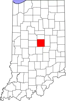
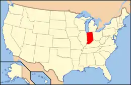
| Cities | Map of Indiana highlighting Hamilton County | |
| Towns | ||
| Townships | ||
| Unincorporated communities | ||
| Footnotes | ‡This populated place also has portions in an adjacent county or counties | |
| ||