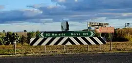
North Star, New South Wales
North Star is a small village in the Gwydir Shire, located in northern New South Wales near the Queensland border. At the 2006 census, North Star had a population of 327 people [2] in the surrounding area, with a population of around 50 in the actual village.
| North Star New South Wales | |
|---|---|
 | |
 North Star | |
| Coordinates | 28°55′57″S 150°23′29″E |
| Population | 423 (2011 census)[1] |
| Established | 1888 |
| Postcode(s) | 2408 |
| Elevation | 419 m (1,375 ft) |
| Location |
|
| LGA(s) | Gwydir Shire |
| State electorate(s) | Northern Tablelands |
| Federal Division(s) | Parkes |
History
European settlement of North Star began in around 1888, when five brothers of the Sutton family took up land holdings in the area. The surrounding lands were cultivated for grazing sheep, by 1910 the Wilby Woolshed was operational, bringing in business from surrounding districts. The first wheat crops were planted in 1908.
A post office was established in 1916, and the opening of the Boggabilla railway line in 1932 brought new services and opportunities for the town. The silo and loading facilities were constructed in 1955 and the complex was expanded in 1965.[3] North Star experienced strong population growth during this period, peaking in the 1970s but more recently has experienced decline due to falling profit margins for wheat farmers, and new technologies.[4]
Facilities
- Grain storage capabilities owned by Grain Corp, with access to the railway line.
- North Star Public School - current student enrolment is 32 pupils with 2 full-time teachers
- North Star Sporting Club
- Polo Ground
- Golf Course
- Four cement Tennis courts
- North Star Pub (Cleveland Hotel)
- Hotel rooms and bunk rooms
- Meals every day
- North Star General Store - currently the store component is not operating
- Doubles as the post office
- Caravan park
- CWA Hall
Railway
The railway arrived on 20 June 1932 with the opening of the line to Boggabilla.[5] In the 1980s, with the closure of all traffic except grain, the line was cut back to North Star which has the last silo on the line.
Following a study commissioned by the Australian Government in March 2008, the preferred route for a proposed Inland Railway corridor between Melbourne and Brisbane will see rail traffic restored north of North Star, along a new alignment in the direction of Toowoomba.[6]
Adjacent stations
- Boggabilla - terminus
- Croppa Creek
- Camurra
- Moree - junction
Website
www.northstarnsw.com was launched in November 2011. It was a community run and built website featuring a calendar of events, Speakers Corner (a page for discussing community issues and achievements), as well as information on the local P & C and CWA fundraisers and events. The CWA were involved in the creation of the website.
References
- Australian Bureau of Statistics (31 October 2012). "North Star (State Suburb)". 2011 Census QuickStats. Retrieved 8 February 2014.

- Australian Bureau of Statistics (25 October 2007). "North Star (State Suburb)". 2006 Census QuickStats. Retrieved 7 November 2009.
- "North Star". NSW Silos website. Retrieved 8 February 2014.
- "North Star Shines Program - Draft Community Strategic Plan 2005" (PDF). Gwydir Shire. Retrieved 8 February 2014.
- The Boggabilla Branch Milne, Rod Australian Railway Historical Society Bulletin, February, 1993 pp27-47
- "ARTC puts 3.6 billion price tag on inland railway". Transport and Logistics News. 5 July 2009.