Tamworth Regional Council
Tamworth Regional Council is a local government area in the New England region of New South Wales, Australia. The area under administration is located adjacent to the New England Highway and the Main North railway line. It was established in March 2004 through the amalgamation of the former City of Tamworth with surrounding shires of Barraba, Manilla, Nundle and Parry.[4]
| Tamworth Regional Council New South Wales | |||||||||||||||
|---|---|---|---|---|---|---|---|---|---|---|---|---|---|---|---|
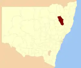 Location in New South Wales | |||||||||||||||
| Coordinates | 31°05′S 150°55′E | ||||||||||||||
| Population |
| ||||||||||||||
| • Density | 6.03126/km2 (15.62088/sq mi) | ||||||||||||||
| Established | March 2004 | ||||||||||||||
| Area | 9,892.3 km2 (3,819.4 sq mi)[3] | ||||||||||||||
| Mayor | Col Murray (Independent) | ||||||||||||||
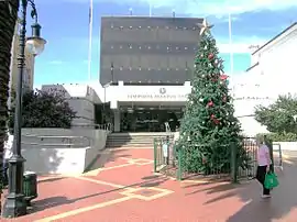
| Council seat | Tamworth | ||||||||||||||
| Region | New England | ||||||||||||||
| State electorate(s) | Tamworth | ||||||||||||||
| Federal Division(s) | New England | ||||||||||||||
 | |||||||||||||||
| Website | Tamworth Regional Council | ||||||||||||||
| |||||||||||||||
The Mayor of Tamworth Regional Council is Cr. Col Murray, an independent politician.
Towns and villages
The area includes the city of Tamworth and the towns and villages of Attunga, Barraba, Bendemeer, Dungowan, Duri, Kootingal, Limbri, Manilla, Moonbi, Niangala, Nundle, Ogunbil, Somerton, Upper Manilla, Woolbrook and the suburbs of Calala, Coledale, Daruka Estate, East Tamworth, Forest Hills, Hillvue, Kingswood, Nemingha, North Tamworth, Oxley Vale, South Tamworth, Taminda, Tamworth Central Business District, Westdale, West Tamworth.
Heritage listings
Tamworth Region has a number of heritage-listed sites, including:
- Kootingal, New England Highway: Moonby House[5]
- Manilla, Tamworth-Barraba railway: Manilla railway underbridges[6]
- Tamworth, Fitzroy Street: Tamworth Post Office[7]
- Tamworth, King George V Memorial Avenue (East): King George V Avenue of Memorial English Oaks[8]
- Tamworth, Main Northern railway: Tamworth railway station[9]
- Tamworth, Main Northern railway: Peel River railway bridge[10]
- Tamworth, Marius Street (East): Dominican Roman Catholic Convent[11]
- Tamworth, Peel Street (cnr): Tamworth Peel Barracks[12]
Demographics
At the 2016 census, there were 59,663 people in the Tamworth Regional local government area, of these 48.7 per cent were male and 51.3 per cent were female. Aboriginal and Torres Strait Islander people made up 10.1 per cent of the population, which was greater than three times higher than the national and average of 2.9 per cent. The median age of people in the Tamworth Regional Council was 40 years, which was marginally higher than the national median of 38 years. Children aged 0 – 14 years made up 20.2 per cent of the population and people aged 65 years and over made up 18.8 per cent of the population. Of people in the area aged 15 years and over, 47.6 per cent were married and 13.2 per cent were either divorced or separated.[1]
Population growth in the Tamworth Regional Council between the 2011 census and the 2016 census was 6.0 per cent. When compared with total population growth of Australia for the same period, being 8.8 per cent, population growth in the Tamworth Regional local government area was slightly lower than the national average.[1] The median weekly income for residents within the Tamworth Regional Council was significantly lower than the national average.[1]
At the 2016 census, the proportion of residents in the Tamworth Regional local government area who stated their ancestry as Australian or Anglo-Saxon exceeded 85 per cent of all residents (national average was around 60 per cent). In excess of 70% of all residents in the Tamworth Regional Council nominated a religious affiliation with Christianity at the 2016 census, which was significantly higher than the national average of approximately 60 per cent. Meanwhile, as at the census date, compared to the national average, households in the Tamworth Regional local government area had a significantly lower than average proportion (4.6 per cent) where two or more languages are spoken (national average was 26.4 per cent); and a significantly higher proportion (88.7 per cent) where English only was spoken at home (national average was 68.5 per cent).[1]
| Selected historical census data for the Tamworth Regional local government area | ||||||
|---|---|---|---|---|---|---|
| Census year | 2001 | 2006[13] | 2011[14] | 2016[1] | ||
| Population | Estimated residents on Census night | n/a | 53,590 | |||
| LGA rank in terms of size within New South Wales | 43rd | |||||
| % of New South Wales population | 0.80% | |||||
| % of Australian population | n/a | 0.27% | ||||
| Cultural and language diversity | ||||||
| Ancestry, top responses | Australian | 37.5% | ||||
| English | 31.0% | |||||
| Irish | 8.5% | |||||
| Scottish | 7.3% | |||||
| German | 3.2% | |||||
| Language, top responses (other than English) | Tagalog | n/c | ||||
| Cantonese | 0.1% | |||||
| Mandarin | 0.1% | |||||
| Filipino | 0.2% | |||||
| Cantonese | 0.2% | |||||
| German | 0.1% | |||||
| Italian | 0.1% | |||||
| Religious affiliation | ||||||
| Religious affiliation, top responses | Anglican | 38.4% | ||||
| Catholic | 26.5% | |||||
| No Religion | 9.5% | |||||
| Uniting Church | 6.3% | |||||
| Presbyterian and Reformed | 5.3% | |||||
| Median weekly incomes | ||||||
| Personal income | Median weekly personal income | A$405 | A$515 | A$633 | ||
| % of Australian median income | 86.9% | |||||
| Family income | Median weekly family income | A$1,041 | A$1,181 | A$1,446 | ||
| % of Australian median income | 88.9% | |||||
| Household income | Median weekly household income | A$818 | A$958 | A$1,180 | ||
| % of Australian median income | 79.6% | |||||
Council
Current composition and election method
Tamworth Regional Council is composed of nine Councillors elected proportionally as a single ward. All Councillors are elected for a fixed four-year term of office. The Mayor is elected by the Councillors at the first meeting of the Council. The most recent election was held on 10 September 2016, and the makeup of the Council is as follows:[15]
| Party | Councillors | |
|---|---|---|
| Independents and Unaligned | 9 | |
| Total | 9 | |
The current Council, elected in 2016, in order of election, is:[15]
| Councillor | Party | Notes | |
|---|---|---|---|
| Mark Rodda | Unaligned | ||
| Russell Webb | Unaligned | ||
| Col Murray | Independent | Mayor[16] | |
| Glen Inglis | Independent | ||
| Helen Tickle | Independent | Deputy Mayor[16] | |
| Phil Betts | Unaligned | ||
| Juanita Wilson | Independent | ||
| Jim Maxwell | Independent | ||
| Charles Impey | Independent | ||
References
- Australian Bureau of Statistics (27 June 2017). "Tamworth Regional (A)". 2016 Census QuickStats. Retrieved 23 November 2017.

- "3218.0 – Regional Population Growth, Australia, 2018-19". Australian Bureau of Statistics. 2 July 2020. Retrieved 2 July 2020. Estimated resident population (ERP) at 30 June 2019.
- "Regional Population Growth, Australia, 2009–10 - Environment/Energy". Australian Bureau of Statistics. 4 November 2011. Retrieved 28 January 2012.
- http://www.tamworth.nsw.gov.au/Council/Council-Overview/default.aspx
- "Moonby House". New South Wales State Heritage Register. Office of Environment and Heritage. H00061. Retrieved 18 May 2018.
- "Manilla railway underbridges". New South Wales State Heritage Register. Office of Environment and Heritage. H01045. Retrieved 18 May 2018.
- "Tamworth Post Office". New South Wales State Heritage Register. Office of Environment and Heritage. H01421. Retrieved 18 May 2018.
- "King George V Avenue of Memorial English Oaks". New South Wales State Heritage Register. Office of Environment and Heritage. H01922. Retrieved 18 May 2018.
- "Tamworth Railway Station, yard group and movable relics". New South Wales State Heritage Register. Office of Environment and Heritage. H01260. Retrieved 18 May 2018.
- "Tamworth rail bridge over Peel River". New South Wales State Heritage Register. Office of Environment and Heritage. H01058. Retrieved 18 May 2018.
- "Dominican Roman Catholic Convent". New South Wales State Heritage Register. Office of Environment and Heritage. H00122. Retrieved 18 May 2018.
- "Tamworth Peel Barracks". New South Wales State Heritage Register. Office of Environment and Heritage. H00550. Retrieved 18 May 2018.
- Australian Bureau of Statistics (25 October 2007). "Tamworth Regional (A)". 2006 Census QuickStats. Retrieved 24 January 2015.
- Australian Bureau of Statistics (31 October 2012). "Tamworth Regional (A)". 2011 Census QuickStats. Retrieved 23 November 2017.
- "Tamworth Regional Council: Summary of First Preference and Group Votes for each Candidate". Local Government Elections 2016. Electoral Commission of New South Wales. 19 September 2016. Retrieved 2 November 2016.
- Tamworth Regional Council (27 September 2016). "Tamworth region welcomes first female Deputy Mayor". Retrieved 2 November 2016.