Queen Victoria Sea
The Queen Victoria Sea (Russian: Море королевы Виктории, Morye Korolevy Viktorii) is a body of water in the Arctic Ocean, stretching from northeast of Svalbard to northwest Franz Josef Land. It is obstructed by ice most of the year.
| Queen Victoria Sea | |
|---|---|
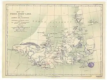 The Queen Victoria Sea in an 1898 Franz Josef Land map showing the explorations of Frederick G. Jackson | |
 Queen Victoria Sea | |
| Location | Arctic Ocean |
| Coordinates | 81°30′N 38°00′E |
| Type | Sea |
| Native name | Море королевы Виктории (Russian) |
| Basin countries | Norway and Russia |
| Max. length | 550 km (340 mi) |
| Frozen | Most of the year |
| References | [1] |
This sea is named after Queen Victoria. Russian Arctic explorer Valentin Akkuratov claimed that a branch of the Gulf Stream reached as far north as the Queen Victoria Sea.[2]
Geography
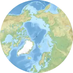
The Queen Victoria Sea is located at 81° north longitude and 38° east latitude.[3] The Arctic Ocean farther north of the sea is frozen year-round. The sea stretches as far west as the Sjuøyane in Svalbard and as far east as Rudolf Island in the Franz Josef Archipelago.
The islands of Kvitøya and Victoria Island are located at the southern limit of this Arctic sea. To the south lies the Barents Sea.
See also
References
- Geographical Dictionary of the World, p. 1510
- Белые призраки Арктики
- Queen Victoria Sea: Svalbard
External links
- На линии огня (Russian)
- Земля Санникова (Russian)
