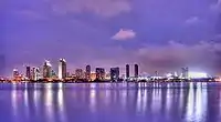
Salton Sea
The Salton Sea is a shallow, landlocked body of water that has a high concentration of salts in Riverside and Imperial counties. Located on the San Andreas Fault at the southern end of the U.S. state of California, it lies within the Salton Trough that stretches to the Gulf of California in Mexico. Over millions of years, the Colorado River has flowed into the Imperial Valley and deposited alluvium (soil) creating fertile farmland, building up the terrain and constantly moving its main (or only) river delta. For thousands of years, the river has alternately flowed into and out of the valley, alternately creating a freshwater lake, an increasingly saline lake, and a dry desert basin, depending on river flows and the balance between inflow and evaporative loss. Hundreds of archaeological sites have been found, indicating possibly long-term Native American villages and temporary camps.
| Salton Sea | |
|---|---|
 | |
 Salton Sea  Salton Sea | |
| Location | Colorado Desert Imperial and Riverside Counties, California, U.S. |
| Coordinates | 33°18′47″N 115°50′04″W |
| Type | Endorheic rift lake |
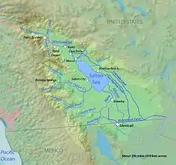
| Primary inflows | Alamo River New River Whitewater River |
| Primary outflows | None |
| Catchment area | 8,360 square miles (21,700 km2) |
| Basin countries | Mexico and United States |
| Surface area | 343 sq mi (889 km2) |
| Max. depth | 43 ft (13 m) |
| Water volume | 6,000,000 acre⋅ft (7.4 km3) |
| Surface elevation | −236 ft (−71.9 m) (below sea level) |
| Settlements | Bombay Beach, Desert Beach, Desert Shores, Salton City, Salton Sea Beach, North Shore |
| References | U.S. Geological Survey Geographic Names Information System: Salton Sea |
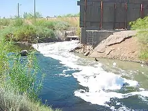
The lake was accidentally created by inflow of water from the Colorado River in 1905. Beginning in 1900, an irrigation canal was dug from the Colorado River to the old Alamo River channel to provide water to the Imperial Valley for farming. The headgates and canals suffered silt buildup, so a series of cuts were made in the bank of the Colorado River to further increase the water flow. The resulting outflow overwhelmed the third intake, "Mexican Cut", near Yuma, Arizona, and the river flowed into the Salton Basin for two years, filling what was then a dry lake bed and creating the modern sea, before repairs were completed.[1][2]
In the 1950s and into the 60s, the area became a resort destination and communities grew with hotels and vacation homes. The lake was kept full by local farmers who used generous amounts of Colorado River water and let the excess flow into the lake. Birdwatching was also popular as the wetlands were a major resting stop on the Pacific Flyway. In the 1980s, it became clear that contamination from the farm runoff promoted the outbreak and spread of diseases. Massive die-offs of the avian populations have occurred especially after the loss of several species of fish that they depend on. Dead fish would wash up on the shore as the lake became so salty that large die-offs occurred. The lake also began to shrink as local agriculture used the water more efficiently and less flowed into the lake. Tourism was drastically reduced.
In 2020, Palm Springs Life magazine summarized the ecological situation as "Salton Sea derives its fame as the biggest environmental disaster in California history".[3]
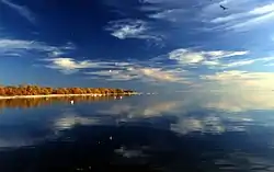
Description
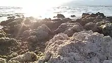
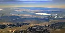
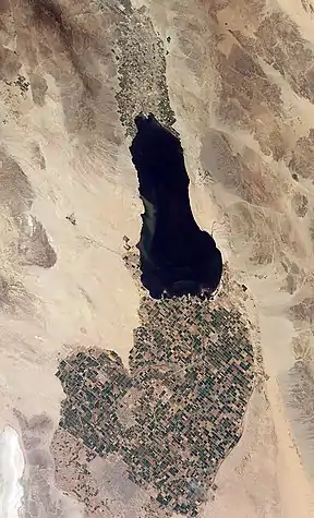
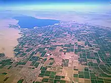
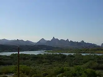
This saline, endorheic rift lake on the San Andreas Fault at the southern end of the U.S. state of California lies between, and within, the Imperial and Coachella valleys, all of which lie within the larger Salton Trough, a pull-apart basin that stretches to the Gulf of California in Mexico. The lake occupies the lowest elevations of the trough, known as the Salton Sink, where the lake surface is 236.0 ft (71.9 m) below sea level as of January 2018.[4] The deepest point of the lake is only 5 ft (1.5 m) higher than the lowest point of Death Valley.
The Salton Sea is about 15 by 35 miles (24 by 56 km) though it varies in dimensions and area with fluctuations in agricultural runoff and rainfall. The New, Whitewater, and Alamo rivers, combined with agricultural runoff, are the primary sources that feed the lake. With an estimated surface area of 343 square miles (890 km2) or 350 square miles (910 km2), the Salton Sea is the largest lake in California by surface area.[5][6][7] The average annual inflow is less than 1.2 million acre⋅ft (1.5 km3), which is enough to maintain a maximum depth of 43 feet (13 m) and a total volume of about 6 million acre⋅ft (7.4 km3). However, due to changes in water apportionments agreed upon for the Colorado River under the Quantification Settlement Agreement of 2003, the surface area of the sea is expected to decrease by 60% between 2013 and 2021.[8][9]
History
Before the modern era
The Gulf of California would extend as far north as Indio, were it not for a dam created by the Colorado River.[10] Over three million years, through all of the Pleistocene, the river's delta expanded until it cut off the northern part of the Gulf. Since then, the Colorado River has alternated between emptying into the basin, creating a freshwater lake, and emptying into the Gulf, leaving the lake to dry and turn to desert. Wave-cut shorelines at various elevations record a repeated cycle of filling and drying over hundreds of thousands of years.[11] The most recent freshwater lake was Lake Cahuilla,[11] also known as the Blake Sea[12] after American professor and geologist William Phipps Blake.[13] It covered over 2,000 square miles (5,200 km2), six times the area of the Salton Sea.[11]
Archaeological sites and radiocarbon dates indicate that the lake was filled three or four times over the last 1300 years. When full, the lake would attract Indians to its shores. Hundreds of sites have been found, some possibly long-term villages and others temporary camps. The occupants ate at least four species of fish (two of which were razorback sucker and bonytail chub), birds (particularly the coot), black-tailed jackrabbit, black-tailed cottontail rabbit, and sometimes deer and bighorn sheep. Among the plants they used were bulrush, cattail, mesquite, and saltbush. The Cahuilla people have an oral memory of the last lake, which existed in the 17th century and dried up soon after 1700 AD.[14]
Throughout the Spanish period of California's history, the area was referred to as the "Colorado Desert" after the Colorado River. In a railroad survey completed in 1855, it was called "the Valley of the Ancient Lake". On several old maps from the Library of Congress, it has been found labeled "Cahuilla Valley" (after the local Native American tribe) and "Cabazon Valley" (after a local Native American chief – Chief Cabazon). "Salt Creek" first appeared on a map in 1867 and "Salton Station" is on a railroad map from 1900, although this place had been there as a rail stop since the late 1870s.[15] Until the advent of the modern sea, the Salton Sink was the site of a major salt-mining operation.[16]
Creation of the lake
In 1900, the California Development Company began construction of irrigation canals to divert water from the Colorado River into the Salton Sink, a dry lake bed. After construction of these irrigation canals, the Salton Sink became fertile for a time, allowing farmers to plant crops.[16]
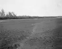
Within two years, the Imperial Canal became filled with silt from the Colorado River. Engineers tried to alleviate the blockages to no avail. In 1905, heavy rainfall and snowmelt caused the Colorado River to swell, overrunning the third intake cut into the bank of the river and sending the flood into the Alamo Canal. The resulting flood poured down the canal, and down two former dry arroyos: the New River in the west, and the Alamo River in the east, each about 60 mi (97 km) long.[17] Over about two years, these two newly created rivers carried the entire volume of the Colorado River into the Salton Sink.[18][19]
The Southern Pacific Railroad tried to stop the flooding by dumping earth into the canal's headgates area, but the effort was not fast enough, and the river eroded deeper and deeper into the dry desert sand of the Imperial Valley. A large waterfall formed as a result and began cutting rapidly upstream along the path of the Alamo Canal that now was occupied by the Colorado. This waterfall was initially 15 feet (4.6 m) high, but grew to 80 feet (24 m) high before the flow through the breach was stopped. Originally, it was feared that the waterfall would recede upstream to the true main path of the Colorado, becoming up to 100 to 300 feet (30 to 91 m) high, at which point it would be practically impossible to fix the problem.
As the basin filled, the town of Salton, a Southern Pacific Railroad siding, and Torres-Martinez Native American land were submerged. The tribe’s reservation now straddles the northern end of the lake.[20] The sudden influx of water and the lack of any drainage from the basin resulted in the formation of the Salton Sea.[21][22]
Agriculture, tourism and wildlife proliferate
In the 1920s, agriculture was boomed in the valley. The Imperial Irrigation District delivered large quantities of Colorado River water to the farmers who diverted the water that ran off the farms into the lake.[23] The district holds senior rights to water from the Colorado River according to Doctrine of Prior Appropriation which is based on whoever first put the water to beneficial use could continue to claim it.[24] In 1930, a wildlife refuge was established on some wetlands along the edge of the lake that had attracted many birds. The fish flourished in the lake and provided a source of food for massive populations of migratory birds. Bird watchers flocked to this new refuge in the middle of a desert.[23]
The continuing intermittent flooding of the Imperial Valley from the Colorado River led to the idea of the need for a desilting dam on the Colorado River for flood control. The Imperial Dam was built in 1938 to avoid the flooding that created the Salton Sea.[25]
In the 1950s and into the 60s, the area became a resort destination.[26] Hotels and yacht clubs were built on the shore along with homes and schools.[27] Resorts in communities like Bombay Beach hosted entertainers such as Frank Sinatra, The Beach Boys and Bing Crosby.[28] Yacht clubs held parties at night and golf courses provided recreation.[27] Many people came for boating activities such as water skiing and fishing as stocked fish proliferated.[29] Lakeshore communities grew as vacation homes were built.[23]
Catastrophic decline
In the 1970s, scientists issued warnings about the changes coming to the sea. The Imperial Valley has about five hundred thousand acres (200,000 ha) of farmland.[24] The agricultural runoff water is full of salts, selenium, fertilizers and nitrates.[25] As it drains through the soil, the water leaches out ancient salt deposits that also raise the salinity. The salt is transforming the lake, making it inhospitable to wildlife. As it also shrank, it became saltier than ocean water. Before the end of the decade, fish started dying off and bird populations declined. Tourism was drastically reduced and many of the resorts and associated infrastructure was abandoned. The state began to issue odor advisories as the lake began to stink.[28]
In the 1990s, the shores were littered with stinky dead fish as the lake had gotten so salty that large die-offs occurred.[29] As a congressman in 1995, the former mayor of nearby Palm Springs Sonny Bono advocated for attention to the problems. His wife and politicians took up the cause as a form of tribute to Bono after his death in a 1998 skiing accident.[30] Congress established the Sonny Bono Salton Sea Restoration Project, but repeated delays and dwindling public interest precluded any real change.[31]
In 2003, the Imperial Irrigation District signed the largest agriculture-to-urban water transfer agreement in US history. Much of its water allocation would go to communities along the California coast at a profit.[29] With a 45 year term, the Quantification Settlement Agreement was a means for the San Diego County Water Authority and other districts to obtain additional water for the growing communities they serve.[32] Local agriculture became more efficient at using water which resulted in the shoreline retreating as less run off flowed into the lake.[23] The state released an $8.9-billion proposal in 2007 that involved building a horseshoe-shaped outer lake, a berm crossing the center of the lake and an extensive system of dikes, channels and pumps. It was not implemented after state lawmakers found it too expensive.[33]
The lake continued to dry up, exposing more lake bed known as playa, and sending nearby communities clouds of toxic dust.[34] With a dense blend of ozone and particulate matter, Imperial County was known for some of the worst air quality in the country.[29] Eastern Coachella communities have disproportionately higher rates of asthma and respiratory complications because of high concentrations of contaminants in the air.[35] Ten schools in the Imperial Valley use green, yellow, and red flags signaling air quality for the many kids who have asthma. Green means they join their friends on the playground whereas red means they will stay inside all day Parents can also receive emailed alerts from the Imperial County Air Pollution Control District.[36] Lower concentrations of the wind-borne dust travels all they way into Southern California and Arizona.[37] Residents in the Los Angeles Basin, some 150 miles (240 km) away, complained about the smell when the biomass on the sea-bottom was churned by a storm drifted their way in 2012.[32][29]
Farming continues in the Imperial Valley although about 36,000 acres (15,000 ha), or about 10 percent, of Imperial Valley's arable farmland has been temporarily fallowed to meet the reductions in the water transfer agreement.[9] As of 2015, the most widely planted crop was alfalfa, followed by Bermuda-grass and Sudan grass. A third of the hay produced here was exported to China, the United Arab Emirates, Saudi Arabia, and Japan. Most of exported hay feeds dairy cows while Japan uses it for Kobe beef. Flood irrigation is typical.[24]
On January 1, 2018, 40 percent less water began flowing into the sea as the 15 year mitigation period ended per the 2003 water transfer agreement.[25] A court decision also forced the Imperial Irrigation District to end a program that had allowed it to equally distribute and cap the amount of water its members receive.[25] Although it had been shrinking for years, this began to lower the water level significantly. As the shore recedes, at least 75 square miles (190 km2) of lake bed is being exposed. Additional dust laced with industrial runoff from the surrounding farms has become wind blown as this soil dries out.[29] To reduce wind-borne dust, the district has a program known as vegetation enhancement and surface roughening which includes plowing furrows on newly exposed playa within property owned by the district.[25] Over the years, local, state and federal bodies have found minimal success dealing with the dust from the exposed playa. The state is mainly responsible as California lawmakers pledged to fix the Salton Sea in conjunction the signing of the 2003 agreement.[37]
State 2018 management plan
In February 2020, the California Natural Resources Agency finished the "Bruchard Road Dust Suppression Project" which was the first dust suppression project to be completed under a 2018 state plan.[38] The Salton Sea Management Program: Phase 1: 10 Year Plan (August 2018) addresses the exposed playa by developing dust suppression projects and habitat to improve conditions for residents and wildlife, respectively. Construction began on the 4,110-acre Species Conservation Habitat Project in January 2021 on the small delta of the New River. The $206.5 million project is building ponds and wetlands near the mouth of this highly polluted river.[39]
Ecology
Salinity
The Salton Sea has a salinity of 44 grams salt per litre of ocean water, greater than that of the Pacific Ocean (35 g/L).[40] The lack of an outflow means the Salton Sea does not have a natural stabilization system; it is very dynamic. Fluctuations in the water level caused by variations in agricultural runoff, the ancient salt deposits in the lake bed, and the relatively high salinity of the inflow feeding the sea are all causing increasing salinity. The concentration has been increasing at a rate of about 3% per year. About 3.6 tonnes of salt are deposited in the valley each year.[41] An undated report on the University of California: Imperial County website provided these specifics: "Salton Sea salinity is about 44,000 mg/L, that is approximately 4.4% salt. The amount of salts that is deposited in the Imperial Valley agricultural land with irrigation water is approximately four million tons of salts annually. To maintain crop productivities, equal amount of salts must be leached from the root zone".[40]
Fertilizer runoffs have resulted in eutrophication, with large algal blooms and elevated bacterial levels.[42] By the 1970s, the runoff which was full of salty chemicals led to a warning that the salinity of the lake would no longer sustain wildlife.[28] Both the hypersalinity and presence of contaminants in the Salton Sea triggered massive die-offs in the fish and avian populations; salt water carries less oxygen than fresh water, which was further depleted by algal blooms and by extreme temperatures during the summer period.[43]
In November 2019, an emergency was declared because of the "heavily polluted New River, which empties into the Salton Sea". Some were hoping that this would help to accelerate a restoration project which would enable the state to obtain federal funding. By January 2020, the salinity of the Salton Sea was double that of the Atlantic Ocean.[28]
Fish population
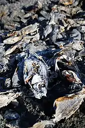
The body was initially a freshwater lake, but by the 1960s, its rising salinity had begun to jeopardize some of its species.[44] It is now too saline for most species of fish. A September 2019 report stated that twenty years earlier, "there were some 100 million fish in the Sea. Now, more than 97 percent of those fish are gone".[45] Dead fish have washed up in mass quantities on the beaches. The desert pupfish, a freshwater fish notable for its ability to withstand the rising salinity of the Salton Sea, can survive salinities ranging from freshwater to twice as salty as seawater.[46]
Introduced tilapia (hybrid Mozambique × Wami) can tolerate the high salinity levels and pollution.[47][48] As of 2014, other fresh and brackish water fish species lived in the rivers and canals that fed the Salton Sea, including redbelly tilapia, threadfin shad, carp, red shiner, channel catfish, white catfish, largemouth bass, mosquitofish, and sailfin molly.[48][49]
The California Office of Environmental Health Hazard Assessment developed a safe eating advisory for fish caught in the Salton Sea based on levels of mercury or PCBs found in local species. As of 2009, all species were considered acceptable for all populations.[50]
Avian population
The Salton Sea has been termed a "crown jewel of avian biodiversity" by Milt Friend of the Salton Sea Science Office.[51] It hosts "the most diverse and probably most significant populations of bird life in the continental United States, rivaled only by Big Bend, Texas;" over 400 species have been documented.[52] The Salton Sea is also a major resting stop on the Pacific Flyway. A December 2018 report by the National Geographic Society stated: "Nearly all of California’s population of eared grebes, for example, stop over at the lake, and at least a third of all the white pelicans living in North America ..." The report expressed concern about the reducing input of water into the Sea and the increasing salinity. "Without that extra water, the lake’s shrinking will start to accelerate—making it saltier, smaller, less welcoming to the birds that rely on it during migration".[23]
Both the hypersalinity and presence of contaminants in the Salton Sea triggered massive die-offs in the fish and avian populations and the contamination promoted the outbreak and spread of diseases such as avian cholera. In turn, the loss of several species of fish that the avian population depended on for food increased their risk of starvation, exacerbating their decline.[43] Birdwatchers in 2017 reported that most of the American white pelicans, double-crested cormorants, and eared grebes have disappeared.[53]
Vegetation
According to the A. W. Kuchler U.S. Potential natural vegetation Types, the area roughly within 3 miles (4.8 km) of the sandy shoreline of the Salton Sea would have a Saltbush / Greasewood (40) vegetation type and a Great Basin Shrubland (7) vegetation form.[54]
Climate
According to the Köppen climate classification system, the Salton Sea has a Hot desert climate (BWh). According to the United States Department of Agriculture, the Plant Hardiness zone is 9b with an average annual extreme minimum temperature of 28.5 °F (−1.9 °C).[55] The temperature of the surface water changes with the seasonally varying air temperature. Winter surface water can reach temperatures as low as 50 °F (10 °C) and summer surface water highs can reach 95 °F (35 °C).[56]
| Climate data for Salton Sea, Imperial County, CA | |||||||||||||
|---|---|---|---|---|---|---|---|---|---|---|---|---|---|
| Month | Jan | Feb | Mar | Apr | May | Jun | Jul | Aug | Sep | Oct | Nov | Dec | Year |
| Average high °F (°C) | 70.9 (21.6) |
74.5 (23.6) |
80.3 (26.8) |
86.8 (30.4) |
95.0 (35.0) |
102.9 (39.4) |
107.2 (41.8) |
106.6 (41.4) |
102.0 (38.9) |
91.5 (33.1) |
79.0 (26.1) |
69.8 (21.0) |
88.9 (31.6) |
| Average low °F (°C) | 41.7 (5.4) |
45.0 (7.2) |
50.1 (10.1) |
55.3 (12.9) |
62.4 (16.9) |
69.2 (20.7) |
76.7 (24.8) |
77.7 (25.4) |
71.3 (21.8) |
59.9 (15.5) |
48.5 (9.2) |
40.9 (4.9) |
58.3 (14.6) |
| Average precipitation inches (mm) | 0.38 (9.7) |
0.43 (11) |
0.40 (10) |
0.06 (1.5) |
0.02 (0.51) |
0.02 (0.51) |
0.09 (2.3) |
0.22 (5.6) |
0.20 (5.1) |
0.21 (5.3) |
0.15 (3.8) |
0.38 (9.7) |
2.56 (65) |
| Average relative humidity (%) | 39.6 | 37.8 | 33.7 | 28.6 | 27.3 | 24.5 | 29.6 | 32.2 | 30.6 | 30.7 | 34.6 | 38.9 | 32.3 |
| Average dew point °F (°C) | 32.0 (0.0) |
33.9 (1.1) |
35.9 (2.2) |
36.9 (2.7) |
42.2 (5.7) |
45.6 (7.6) |
55.8 (13.2) |
58.3 (14.6) |
52.1 (11.2) |
42.7 (5.9) |
35.3 (1.8) |
30.8 (−0.7) |
41.8 (5.4) |
| Source: PRISM Climate Group[57] | |||||||||||||
Geology
Earthquakes and tectonic setting
The Salton Sea and surrounding basin sits over the San Andreas Fault, San Jacinto Fault, Imperial Fault Zone, and a "stepover fault" shear zone system. Geologists have determined that previous flooding episodes from the Colorado River have been linked to earthquakes along the San Andreas Fault. Sonar and other instruments were used to map the Salton Sea's underwater faults during the study. During the period when the basin was filled by Lake Cahuilla, a much larger inland sea, earthquakes higher than magnitude 7 occurred roughly every 180 years, the last one occurring within decades of 1700. Computer models suggest the normal faults in the area are most vulnerable to deviatoric stress loading by filling in of water. Currently, a risk still exists for an earthquake of magnitude 7 to 8. Simulations also showed, in the Los Angeles area, shaking and thus damage would be more severe for a San Andreas earthquake that propagated along the fault from the south, rather than from the north. Such an earthquake also raises the risk for soil liquefaction in the Imperial Valley region.[58][59]
The effective drainage divide that separates the Salton Sea from the Gulf of California is about 9 m (30 ft) in elevation and is located near Delta, northeastern Baja California State, Mexico, south-southeast of Mexicali.[60] Past sea level rise may partially be responsible for the salinity of the lake, while potential future changes in sea levels could occur. However, other factors such as hydrothermal vents, diffusion of salt from minerals and sediment, including concentrated brine, and evaporites are another contributor to salinity, as is the recent lowering of lake levels raising the salinity, though sedimentary records show the lake surface elevation reached levels 10–12 m above world sea level in the 1500s.[61]
Volcanism
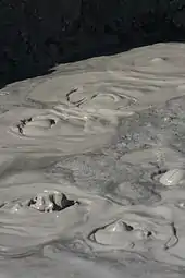
Evidence of geothermal activity is also visible. The Salton Buttes are volcanoes in the geothermal field of the same name. Mudpots and mud volcanoes are found on the eastern side of the Salton Sea.[62] The area is used for geothermal electricity generation, with plants located along the southeastern shore of the Salton Sea in Imperial County.[63][64]
Remediation efforts
Early efforts and proposals for a sea level canal
In the late 1990s, the Salton Sea Authority, a local joint powers agency, and the US Bureau of Reclamation began efforts to evaluate and develop an alternative to save the Salton Sea. A draft Environmental Impact Report/Environmental Impact Statement, which did not specify a preferred alternative, was released for public review in 2000. Since that time, the Salton Sea Authority has developed a preferred concept[65] that involves the construction of a large dam that would impound water to create a marine sea in the northern and southern parts of the sea and along the western edge.
Many other concepts have been proposed.[66] Aqua Genesis Ltd propose to bring in seawater from the Gulf of California, rapidly desalinate it at the Salton Sea tapping into geothermal heat, then sell the non-saline water. This concept would involve the construction of over 20 miles (32 km) of pipes and tunneling; amid increasing water demand, it would provide 1,000,000 acre feet (1.2 km3) of water to Southern California coastal cities each year.[67] One competing project as to the sea salt market is to pipe seawater to a wetland in Mexico, Laguna Salada for that trade.
State restoration plan
The California State Legislature, by legislation enacted in 2003 and 2004, directed the Secretary of the California Resources Agency to prepare a restoration plan for the Salton Sea ecosystem, and an accompanying Environmental Impact Report.[68] As part of this effort, the Secretary for Resources has established an advisory committee to provide recommendations to assist in the preparation of the Ecosystem Restoration Plan, including consultation throughout all stages of the alternative selection. The California Department of Water Resources and California Department of Fish and Game are leading the effort to develop a preferred alternative for the restoration of the Salton Sea ecosystem and the protection of wildlife dependent on that ecosystem.
On January 24, 2008, the California Legislative Analyst's Office released a report titled "Restoring the Salton Sea."[68] The preferred alternative outlined in the draft plan calls for spending almost $9 billion over 25 years and proposes a smaller but more manageable Salton Sea. The amount of water available for use by humans and wildlife would be reduced by 60% from 365 square miles (950 km2) to about 147 square miles (380 km2). About 52 miles (84 km) of barrier and perimeter dikes – constructed most likely out of boulders, gravel, and stone columns – would be erected, along with earthen berms to corral the water into a horseshoe shape along the northern shoreline of the sea from San Felipe Creek on the west shore to Bombay Beach on the east shore. The central portion of the sea would be allowed to evaporate almost completely and would serve as a brine sink, while the southern portion of the sea would be constructed into a saline habitat complex. Construction on the project would be completed by 2035.
During the first 15 years after the sale of the Imperial water to San Diego County, the irrigation district has been required to put water into the Salton Sea to compensate for the loss of agricultural runoff needed to replenish the sea. Since the requirement expired in 2017, the district sent a letter to the California State Water Resources Control Board in 2014 asking that the board sponsor negotiations to get the state to fulfill its obligation to stop the deterioration of the sea. Pacific Institute, an Oakland-based environmental think tank, was warning that the lack of replenishment water was leading to a "period of very rapid deterioration."[69] The rapidly shrinking sea was a "looming environmental and public health crisis".[70] With the increased shrinkage, dust storms would increase and a rotten-egg smell could reach to the coastal cities.[69]
In 2018, California's Natural Resources Agency received 11 proposals to increase waterflow to the sea in order to reduce dust and dust-borne toxins. Proposal costs ranged from $300 million to several billion dollars. No winner was selected in this phase.[71]
A July 2020 news item (written by a lobby group) discussed one method to improve the Sea "to prevent wind spreading toxic dust": refilling it with water imported from the Sea of Cortés; that would require the building of an aqueduct. (A June 9 research report however stated that the cost of "transferring water from agricultural users to the Salton Sea" would be lower and achievable using existing infrastructure).[72] The aqueduct proposal, and others, hang on the outcome of a feasibility study expected in late 2021.[73]
Communities
The U.S. Navy conducted a preliminary inspection of the Salton Sea in January 1940, and the Salton Sea Test Base (SSTB, run by Sandia Labs) was initially commissioned as the Naval Auxiliary Air Station Salton Sea, in October 1942. The SSTB, just to the southeast of Salton City, originally functioned as an operational and training base for seaplanes. Additional activities at the base included experimental testing of solid-fuel plane-launched rockets, jet-assist take-off testing, aeroballistic testing of inert atomic weapon test units at land and marine target areas, training bombing at marine targets, testing of the effects of long-term storage on atomic weapons, testing of the Project Mercury space capsule parachute landing systems, parachute training and testing, and military training exercises. The base was abandoned in 1978.[74]
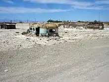
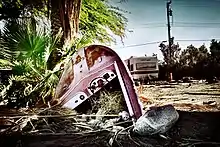
The Salton Sea had some success as a resort area, with Salton City, Salton Sea Beach, and Desert Shores, on the western shore and Desert Beach, North Shore, and Bombay Beach, built on the eastern shore in the 1950s. Due to the increasing salinity and pollution of the lake over the years from agricultural runoff and other sources, the communities substantially shrank in size, or have been abandoned. The smell of the lake, combined with the stench of the decaying fish, also contributed to the decline of the tourist industry around the Salton Sea. The US Geological Survey describes the smell as "objectionable", "noxious", "unique", and "pervasive".[75]
A 2020 article provided this comment about the settlements around the Salton Sea:[76]
Since 2011, Bombay Beach and its surrounds have been reinvented as a destination for desert art. It’s not alone in that distinction – south of the city lie the towns of Niland and Slab City, other areas that have attracted artists and led to creations like East Jesus and Salvation Mountain.
Some people are visiting the Salton Sea and the surrounding settlements to explore the abandoned structures and see the squatter settlement of Slab City. The town of Niland is 1.5 miles (2.4 km) southeast of the sea, with a population of 1,006. In late June 2020, a fire in Niland caused a great deal of damage in Niland, displacing 112 people; by that time, the estimated population had diminished to 500.[77]
The population of Bombay Beach declined for years and the buildings were rotting away, but some people had moved into the settlement. A news item in April 2018 stated that it was "enjoying a rebirth of sorts with an influx of artists, intellectuals and hipsters who have turned it into a bohemian playground".[78] The population estimate for 2020 was 415 persons, certainly higher than the official census number of 295 in 2010.[79]
Recreation
The Salton Sea State Recreation Area offers hunting, fishing, swimming, and camping to visitors on the northeastern side of the sea.
Powerboat racing
"Low barometric pressure and greater water density make the Salton Sea the fastest body of water in the world for speedboat racing," according to an article in the January–February, 1950 issue of National Motorist magazine.[80] (This statement, however, erroneously conflates low barometric pressure with low altitude, when in fact the opposite is true, and the extremely low altitude of the region provides higher barometric pressure, beneficial for internal combustion engines; "The low altitude was thought to be ideal for carburetion and there was talk that this was the 'fastest body of water in the world.'"[80] Beginning in the late 1920s, these properties have made the Salton Sea attractive as a venue for such races.[80][81]
Although these natural advantages were at first attacked as unfair by other courses, by the mid 1930s the Salton Sea racing organization was backed by the National Power Boat Association and attracting some of the best boats and drivers in the US.[80] Races were held at Desert Beach annually between 1941 and 1951 and subsequently at other beaches, ultimately on the west side of the Sea.[80]
From 1961 through 1965, the Sea hosted the Salton City 500, a marathon endurance race which attracted drivers as notable as Mickey Thompson and astronaut Gordon Cooper.[82][83][84]
After a lengthy hiatus, in 2008 racing returned when new world records were set by a sprint boat at the Salton Sea Speed Week.[81] The winner of the bathtub race of 1970 crossed the 25 miles to the east shore and back in one hour and four minutes.[80]
In popular culture
Films
- Narrated by John Waters, Plagues and Pleasures on the Salton Sea (film) (2006), by filmmakers Chris Metzler and Jeff Springer is one of the top reviewed documentaries on Rotten Tomatoes.[85] Melding high camp with stark realism the film covers the first 100 years of the history of the Salton Sea featuring rare archival photos and footage, plus interviews with the residents who call the Salton Sea home.
- A visit to the Salton Sea inspired filmmaker Curtis Harrington to make his dreamlike short film On the Edge (1949),[86] which extensively uses the bubbling mudpots on the edge of the sea.[87] In a 1971 interview, Harrington stated, "The location I used is entirely covered by water now; the sea has risen to cover it."[88]
- The film, The Monster That Challenged the World (1957), deals with gigantic prehistoric mollusks that are reawakened after residing, in suspended animation, at the bottom of the Salton Sea.
- As the sea started its decline, independent filmmakers discovered its unique landscape. In the 1990s, a trio of unusual films was shot in the Salton Sea area. In 1990 Richard Newton created Small White House,[89] a film exploring a love triangle between JFK, Jackie O., and Marilyn Monroe.
- In 1991, Nina Menkes made Queen of Diamonds, which explores the life of an alienated Las Vegas blackjack dealer. Queen of Diamonds features a wedding reception held on the beach of the Salton Sea, whose guests includes an Elvis impersonator.[90] The Entire History of the Louisiana Purchase (1998) is an early example of the pseudo-documentary. Joshua Oppenheimer's film includes some striking post-apocalyptic color sequences shot along the banks of the Salton Sea.[91]
- The film, The Salton Sea (2002), is an American crime thriller named after and partially filmed at the Salton Sea.[92]
- The New York Times described the film about some residents of the Bombay Beach, California community on the Salton Sea, Bombay Beach (2010), by Israeli-born filmmaker Alma Har'el, as a "surreal documentary".[93] The film won first prize in the feature documentary section of the Tribeca Film Festival in 2011.[94]
- The short documentary, The Useless Sea (2016), is a film focusing on the environmental challenges and the beauty surrounding the Salton Sea.[95]
- The documentary, SOS: The Salton Sea Walk (2017)[96] documents efforts to raise awareness of environmental consequences and conservation possibilities for the area.
- The American independent drama, Desert Shores (2019) was filmed at the Salton Sea and based on George McCormick's short story Salton Sea. The film is primarily set in the Desert Shores community, for which the film is named.[97]
- Miracle in the Desert: The Rise and Fall of the Salton Sea (2020) is an award-winning documentary that tells the full origin of the creation of the sea, as well as the real estate boom and bust from 1950 to 1970 while examining the exodus of people from the sea and the current environmental crisis it faces.[98]
- The 1932 MGM Sports Champions short subject, Desert Regatta, documents a powerboat race on the Salton Sea.[99]
Games
- In the video-game Grand Theft Auto V (2013), a location called the Alamo Sea is based on the Salton Sea; Sandy Shores, a town that sits on the lake's southern edge, is based on the town of Desert Shores.[100]
Music
- The video for Michael Jackson's "In the Closet" (1992) was filmed at the Salton Sea.[101]
Television
- The History Channel's 2006 episode "Engineering Disasters 18" (#13-04), from the television documentary series Modern Marvels, describes the combined manmade and natural events leading to the creation of the Salton Sea in the early 20th century, its brief popularity as a resort destination midcentury, and its subsequent decline due to high salinity and farm runoff. Impacts to Salton Sea fish and bird populations are addressed and future plans to rescue the sea are described.[102]
- National Geographic Explorer was present on June 10, 2018 to record an encounter between supporters of a flat Earth and members of the Independent Investigations Group. An experiment successfully demonstrated the curvature of the earth via the disappearance over distance of boat-based and shore-based targets.[103]
See also
- List of drying lakes
- List of lakes in California
References
- "Salton Sea, History". California Department of Water Resources. April 29, 2010. Archived from the original on January 2, 2018.
- "Salton Sea: Past and Present". DesertUSA. Retrieved March 3, 2019.
- Black, Kent (March 4, 2020). "Bombay Beach Riding Resurgence Wave With Literary Week Set". Palm Springs Life. Retrieved January 22, 2021.
- "USGS 10254005 Salton Sea NR Westmorland CA". waterdata.usgs.gov.
- "Restoration of the Salton Sea Final Report December 2007 – Chapter 1. Introduction" (PDF). U.S. Department of the Interior, Bureau of Reclamation, Lower Colorado Region. Retrieved April 3, 2014.
- Rañoa, Raoul (October 21, 2014). "Drought, drawdowns and death of the Salton Sea". Los Angeles Times. Retrieved January 22, 2021.
- Wilson, Janet; James, Ian (March 2, 2019). "Breaking impasse, feds will include Salton Sea in seven-state drought plan, IID says". Desert Sun. Retrieved March 2, 2019.
- San Diego County Water Authority (2014). "Quantification Settlement Agreement". San Diego County Water Authority. Retrieved October 14, 2014.
- Than, Ker (February 18, 2014). "Can California Farmers Save Water and the Dying Salton Sea?". National Geographic News. Retrieved May 20, 2019.
- Alles, DL (August 6, 2007). "Geology of the Salton Trough" (PDF). Biology Department. Western Washington University. Retrieved June 6, 2010.
- Singer, Eugene. "Ancient Lake Cahuilla". Excerpted from Geology of the Imperial Valley, a monograph by Eugene Singer. Archived from the original on June 1, 2009. Retrieved July 10, 2009.
- Aschmann, Homer (January 1, 1959). "The Evolution of a Wild Landscape and Its Persistence in Southern California". Annals of the Association of American Geographers. 49 (3): 34–56. JSTOR 2561246.
- Patten, Michael A.; McCaskie, Guy; Unitt, Philip (August 19, 2003). Birds of the Salton Sea: Status, Biogeography, and Ecology. University of California Press. p. 2. ISBN 9780520235939.
- Schaefer, Jerry. "Prehistoric Native American Responses to Ancient Lake Cahuilla". California Department of Fish and Wildlife. Retrieved January 23, 2021.
- Carpelan, Lars H. "History of the Salton Sea". California Department of Fish and Wildlife. Retrieved January 25, 2021.
- Laflin, P. (1995). "Chapters 1–4". The Salton Sea: California's overlooked treasure. The Periscope. Indio, California: Coachella Valley Historical Society. Retrieved February 8, 2021.
- Detailed maps, and a film of the breach (and subsequent redamming) are in Metzler, Chris and Springer, Jeff (directors) (2004). Plagues & Pleasures on the Salton Sea (Documentary). Tilapia Film.
- Laflin, P. (1995). "Chapters 5–6". The Salton Sea: California's overlooked treasure. The Periscope. Indio, California: Coachella Valley Historical Society. Retrieved February 8, 2021.
- Cory, Harry Thomas; Blake, William Phipps (1915). The Imperial Valley and the Salton Sink. San Francisco: John J. Newbegin. Retrieved January 25, 2021.
- James, Ian; Roth, Sammy (2017). "Salton Sea: Two paths for long-term fixes at California's shrinking sea". Desert Sun. USA TODAY. Retrieved February 8, 2021.
- Kennan, G (1917). The Salton Sea: An Account of Harriman's Fight With The Colorado River. New York: The Macmillan Company. Retrieved July 11, 2009.
- Larkin, EL (1907). "A Thousand Men Against A River: The Engineering Victory Over The Colorado River And The Salton Sea". The World's Work: A History of Our Time. XIII: 8606–10. Retrieved July 10, 2009.
- Borunda, Alejandra (December 28, 2018). "The West Coast's biggest bird oasis is dying. Will it be saved?". National Geographic. Retrieved January 22, 2021.
- Goodyear, Dana (May 4, 2015). "The dying sea: what will California sacrifice to survive the drought?". Letter from the Imperial Valley. The New Yorker. 91 (11): 22–27. Retrieved June 29, 2015.
- Runyon, Luke (March 21, 2019). "How A Dying Lake In California Factors Into The Colorado River's Future". KPBS Public Media. Retrieved May 20, 2019.
- Streitfeld, David (July 1, 2007). "Salton City: A land of dreams and dead fish". Los Angeles Times. Retrieved February 5, 2021.
- Morton, Ella (February 4, 2014). "Salton Sea: From Relaxing Resort to Skeleton-Filled Wasteland". Slate. ISSN 1091-2339. Retrieved January 30, 2021.
- Fendt, Lindsay (January 13, 2020). "As the Salton Sea shrinks, it leaves behind a toxic reminder of the cost of making a desert bloom". Food and Environment Reporting Network. Retrieved January 22, 2021.
- Zelenko, Michael (June 6, 2018). "Dust Rising". The Verge. Retrieved October 15, 2020.
- CNN (January 16, 1998). "Salton Sea rescue to be named for Sonny Bono". CNN. Archived from the original on January 16, 2000. Retrieved January 25, 2021.
- "Plagues and Pleasures on the Salton Sea (motion picture)". The Paley Center for Media. Retrieved February 5, 2021.
- Simon, Matt (September 14, 2012). "The Salton Sea: Death and Politics in the Great American Water Wars". Wired Magazine. Retrieved May 1, 2015.
- Roth, Sammy; James, Ian (2017). "Salton Sea: California far from solutions as Salton Sea crisis looms". Desert Sun. USA TODAY. Retrieved February 7, 2021.
- Wilson, Janet (January 31, 2021). "Imperial Valley water champion Kevin Kelley, who fought to save the Salton Sea, dies at 61". The Desert Sun. Retrieved February 5, 2021.
- Rodriguez, Olivia; Sinclair, Ryan (April 25, 2020). "Valley Voice: Salton Sea communities needed relief long before coronavirus". The Desert Sun. Retrieved October 15, 2020.
- James, Ian (2017). "Salton Sea: Dusty air and the asthma crisis at the Salton Sea". Desert Sun. USA TODAY. Retrieved February 8, 2021.
- Olalde, Mark (December 21, 2020). "Will California finally fulfill its promise to fix the Salton Sea?". High Country News. The Desert Sun, USA Today Network. Retrieved February 5, 2021.
- Olalde, Mark (February 26, 2020). "California Natural Resources Agency lays out aggressive Salton Sea mitigation goals". Desert Sun.
- Olalde, Mark (January 13, 2021). "Salton Sea habitat project breaks ground near New River delta". The Desert Sun. Retrieved February 7, 2021.
- Montazar, Ali (October 5, 2013). "Salton Sea and Salinity". Cooperative Extension: Imperial County. University of California: Agriculture and Natural Resources. Retrieved January 28, 2021.
- Barnum, Douglas A.; Bradley, Timothy; Cohen, Michael; Wilcox, Bruce; Yanega, Gregor (2017). State of the Salton Sea—A science and monitoring meeting of scientists for the Salton Sea (Report). United States Geological Survey. Open-File Report 2017–1005.
- Descloitres, Jacques (October 23, 2003). "Algal bloom in the Salton Sea, California". Visible Earth. NASA. Retrieved January 28, 2021.
- Purper, Benjamin (February 8, 2019). "Massive Bird Die-Off At Salton Sea Raises Alarms About A Coming Environmental Crisis". KVCR News. Retrieved January 29, 2021.
- Parker, Stephanie (October 9, 2019). "How the Salton Sea Became an Eco Wasteland". HowStuffWorks. Retrieved October 10, 2019.
- Cohen, Michael (September 13, 2018). "Salton Sea +20". Pacific Institute. Retrieved December 9, 2020.
- U.S. Bureau of Land Management (2016). "Appendix Q. Baseline Biology Report". Desert Renewable Energy Conservation Plan Proposed Land Use Plan Amendment and Final Environmental Impact Statement (PDF).
- Riedel, R.; B. A. Costa-Pierce (2002). "Review of the Fisheries of the Salton Sea, California, USA: Past, Present, and Future". Reviews in Fisheries Science. 10 (2): 77–112. doi:10.1080/20026491051686. S2CID 214614676.
- Lorenzi, V.; D. Schlenk (2014). "Impacts of combined salinity and temperature extremes on different strains and species of Tilapia inhabiting the watershed of the Salton Sea". North American Journal of Aquaculture. 76 (3): 211–221. doi:10.1080/15222055.2014.893471.
- U.S. Fish & Wildlife Service (2008). "Sonny Bono Salton Sea National Wildlife Refuge: Wildlife List" (PDF).
- OEHHA (March 18, 2009). "Salton Sea". Retrieved January 28, 2021.
- Vartan, Starre (August 6, 2018). "The Warning Lights Are Flashing for California's Once-Glorious Salton Sea". NRDC. Retrieved January 28, 2021.
- Morrison, Patt (September 18, 2014). "A persuasive case for saving the Salton Sea, California's biggest lake". Los Angeles Times. Retrieved January 28, 2021.
- James, Ian (2017). "Salton Sea: As the Salton Sea deteriorates, bird populations are crashing". Desert Sun. USA TODAY. Retrieved February 8, 2021.
- "U.S. Potential Natural Vegetation, Original Kuchler Types, v2.0 (Spatially Adjusted to Correct Geometric Distortions)". Data Basin. Retrieved July 11, 2019.
- "USDA Interactive Plant Hardiness Map". United States Department of Agriculture. Retrieved July 11, 2019.
- Carpelan, Lars H. (October 1958). "The Salton Sea. Physical and Chemical Characteristics1". Limnology and Oceanography. 3 (4): 373–386. doi:10.4319/lo.1958.3.4.0373.
- "PRISM Climate Group, Oregon State University". www.prism.oregonstate.edu. Retrieved July 10, 2019.
- Brothers, Daniel; Kilb, Debi; Luttrell, Karen; Driscoll, Neal; Kent, Graham (July 2011). "Loading of the San Andreas fault by flood-induced rupture of faults beneath the Salton Sea". Nature Geoscience. 4 (7): 486–492. doi:10.1038/ngeo1184.
- Ross, JE (June 26, 2011). "Flooding of Ancient Salton Sea Linked to San Andreas Earthquakes". Scripps Institution of Oceanography. University of California at San Diego. Retrieved February 8, 2021.
- Tingle, A. "Flood Maps". Firetree.net. Flood. Retrieved July 31, 2011.
- Wardlaw, GD; Valentine DL (January 2005). "Evidence for salt diffusion from sediments contributing to increasing salinity in the Salton Sea, California" (PDF). Hydrobiologia. 533 (1–3): 77–85. doi:10.1007/s10750-004-2395-8. S2CID 20454442. Archived from the original (PDF) on April 16, 2007. Retrieved July 31, 2011.
- Lynch, DK; Hudnut, KW (2008). "The Wister Mud Pot Lineament: Southeastward Extension or Abandoned Strand of the San Andreas Fault?" (PDF). Bulletin of the Seismological Society of America. 98 (4): 1720–29. Bibcode:2008BuSSA..98.1720L. doi:10.1785/0120070252.
- Roth, Sammy (October 14, 2019). "Lithium will fuel the clean energy boom. This company may have a breakthrough". Los Angeles Times. Retrieved October 17, 2019.
- Baker, David R. (November 19, 2020). "California Wants Its Imperial Valley to Be 'Lithium Valley'". Bloomberg Business. Retrieved November 19, 2020.
- "Salton Sea Unit". California Department of Water Resources. Retrieved January 25, 2021.
- "US Bureau of Reclamation – Salton Sea Project Office – Salton Sea Brochure – 1999". www.usbr.gov.
- sandiegoreader.com; San Diego Union Times: Ronald Newcomb's Salton Sea proposal
- California, State of. "Salton Sea Unit". www.water.ca.gov.
- Perry, Tony (November 21, 2014) "'Looming environmental crisis' at Salton Sea prompts plea for help" Los Angeles Times
- Perry, Tony (September 3, 2014) "'Salton Sea inaction could cause 'catastrophic change,' report says" Los Angeles Times
- Metz, Sam (April 16, 2018). "10 questions about the 11 proposals to save the Salton Sea". The Desert Sun. Retrieved January 22, 2021.
- Levers, L.; Story, S.; Schwabe, K. (June 9, 2020). "Boons or boondoggles: An assessment of the Salton Sea water importation options". California Agriculture. 74 (2): 73–79. doi:10.3733/ca.2020a0009. ISSN 0008-0845.
- Parker, Chuck; Nunez, Feliz (July 7, 2020). "Valley Voice: Importing water to save the Salton Sea can work. Let's prove and do it now". The Desert Sun. Retrieved January 22, 2021.
- "Salton Sea Test Base Site Inspection Report – sect2-1, 1995".
- Jim Setmire, ed. (September 7–8, 2000). Eutrophic Conditions at the Salton Sea (PDF). Eutrophication Workshop. Salton Sea Authority, the Salton Sea Science Office, and the U.S. Bureau of Reclamation. United States Geological Survey. Archived from the original (PDF) on December 29, 2016.
- "Bombay Beach CA, Reinvented Destination for Art". DesertUSA Newsletter. 2020. Retrieved January 22, 2021.
- Miller, Betty (July 6, 2020). "Niland: In search of a miracle". The Desert Review. Retrieved October 15, 2020.
- Carroll, Rory (April 23, 2018). "In a forgotten town by the Salton Sea, newcomers build a bohemian dream". the Guardian. Retrieved October 15, 2020.
- "Bombay Beach, California Population 2020 (Demographics, Maps, Graphs)". worldpopulationreview.com. Retrieved October 15, 2020.
- Laflin, P. "SPEEDBOATS IN THE DESERT". The Salton Sea: California's overlooked treasure. The Periscope, Coachella Valley Historical Society. Retrieved December 8, 2020.
- "Speed Record Set at 125 MPH on Salton Sea". NBC Los Angeles. KNBC. Retrieved December 8, 2020.
- Whall, Hugh. "DESERT FULL OF MOTORBOATS". Sports Illustrated Vault. Sports Illustrated. Retrieved December 8, 2020.
- "SALTON SEA MONSTERS -- Part 1". RIVER DAVES PLACE. Retrieved December 8, 2020.
- "Salton City 500 Winner - Cream Puff". Borrego Sun. Borrego Sun. Retrieved December 8, 2020.
- SOS: Plagues and Pleasures on the Salton Sea, retrieved November 7, 2020
- Harrington, Curtis (2013). Nice Guys Don't Work in Hollywood: The Adventures of an Aesthete in the Movie Business. Drag City. ISBN 978-1937112073.
- "Curtis Harrington's On the Edge". youtube.com. June 18, 2013. Retrieved April 6, 2014.
- Gow, Gordon (August 1971). "Up from the Underground: Curtis Harrington". Films and Filmmaking. 17 (11): 17.
- "Small White House (1990) – Filming Locations". IMDb.
- "Queen of Diamonds (1991) – Filming Locations". IMDb.
- "The Entire History of the Louisiana Purchase (1998) – Filming Locations". IMDb.
- "The Salton Sea". IMDb.com. October 23, 2017. Retrieved October 23, 2017.
- Holden, Stephen (October 13, 2011). "Last Resort Remains an Oasis of Dreams". The New York Times. Retrieved January 27, 2012.
- "Awards for Bombay Beach". IMDb.com. January 11, 2012. Retrieved January 27, 2012.
- "The Useless Sea". la.curbed. February 2016. Retrieved February 26, 2016.
- SOS: The Salton Sea Walk, retrieved August 20, 2019
- Desert Shores, retrieved January 15, 2019
- Brooker, Heather (September 22, 2020). "Salton Sea Documentary Sheds New Light on a Looming Environmental Disaster". NBC Los Angeles. Retrieved November 20, 2020.
- "Desert Regatta". IMDB.com. Retrieved December 8, 2020.
- Staff (January 2, 2014). "Rockstar North's Aaron Garbut on the making of Grand Theft Auto V – our game of 2013". Edge. Archived from the original on January 2, 2014. Retrieved January 2, 2014.
- Kreps, Daniel (August 14, 2014). "Vintage Michael Jackson Clips Used for New Video". Rolling Stone. Retrieved October 14, 2018.
- "Engineering Disasters 18 DVD". Archived from the original on September 22, 2013. Retrieved February 11, 2013.
- Underdown, James (2018). "The Salton Sea Flat Earth Test: When Skeptics Meet Deniers". Skeptical Inquirer. 42 (6): 14–15.
Further reading
- Greenfield S (Winter 2006). "A Lake by Mistake". Invention & Technology. 21 (3). Archived from the original on September 6, 2008.
- Setmire, James G., et al. (1993). Detailed study of water quality, bottom sediment, and biota associated with irrigation drainage in the Salton Sea area, California, 1988–90 [Water-Resources Investigations Report 93-4014]. Sacramento, Calif.: U.S. Department of the Interior, U.S. Geological Survey.
- Setmire, James G., Wolfe, John C., and Stroud, Richard K. (1990). Reconnaissance investigation of water quality, bottom sediment, and biota associated with irrigation drainage in the Salton Sea area, California, 1986–87 [Water-Resources Investigations Report 89-4102]. Sacramento, Calif.: U.S. Department of the Interior, U.S. Geological Survey.
- Sperry RL (Winter 1975). "When the Imperial Valley Fought for its Life". Journal of San Diego History. 21 (1).
- deBuys, William and Myers, Joan (1999), "Salt Dreams: Land and Water in Low-down California", University of New Mexico Press, Albuquerque, ISBN 0-8263-2126-7
- Trover, Ellen Lloyd (2018). "The Imperial Valley and the Salton Sink". Birth of the Inland Sea: How the Colorado River Created the Salton Sea. Lloyd Trover Partnership. ISBN 9780692190388
- Stevens, Joseph E. Hoover Dam. University of Oklahoma Press, 1988. details on the Salton Sea disaster
- Stringfellow, Kim Greetings from the Salton Sea: Folly and Intervention in the Southern California Landscape, 1905–2005. Columbia College Chicago Press, 2005. ISBN 978-1-935195-32-0
- Watkins, John R. "A Common Crystal" Strand Magazine, vol. 98 (London 1899); Holder, Charles F. "A Remarkable Salt Deposit" National Geographic Magazine, vol. XII, no.11 (Washington, 1901)
External links
| Wikimedia Commons has media related to Salton Sea. |
| Wikivoyage has a travel guide for Salton Sea. |
- Official Salton Sea Authority website
- U.S. Bureau of Reclamation: Salton Sea Restoration Project Office
- Salton Sea Action Committee
- Salton Basin overview, College of Sciences, San Diego State University
- Salton Sea Ecosystem Monitoring and Assessment Plan, Open-File Report 2013–1133, United States Geological Survey
- "The Salton Sea" – Photo Essay by Scott London
- National Geographic photos of the Salton Sea
- The Accidental Sea on YouTube
Colorado River system | |||||||||
|---|---|---|---|---|---|---|---|---|---|
| Jurisdictions |
|     | |||||||
| Canyons |
| ||||||||
| Natural features |
| ||||||||
| Tributaries | |||||||||
| Engineering |
| ||||||||
| Designated areas | |||||||||
| Related topics | |||||||||