Rock Flat Creek
Rock Flat Creek is a watercourse[1] that is part of the Murrumbidgee catchment within the Murray–Darling basin. It is located in the Monaro region of New South Wales, Australia.
| Rock Flat Flat, Tolbar[1] | |
|---|---|
.jpg.webp) | |
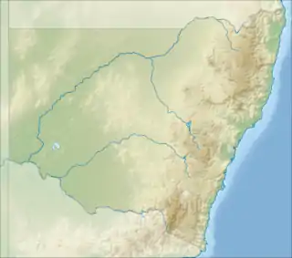 Location of the Rock Flat Creek mouth in New South Wales | |
| Location | |
| Country | Australia |
| State | New South Wales |
| Region | Snowy Mountains (IBRA), Monaro |
| LGA | Snowy Monaro |
| Physical characteristics | |
| Source | Australian Alps, Great Dividing Range |
| • location | below One Tree Hill |
| • coordinates | 36°26′5″S 149°13′10″E |
| • elevation | 1,060 m (3,480 ft) |
| Mouth | confluence with the Cooma Creek |
• location | north of Cooma |
• coordinates | 36°7′27″S 149°11′21″E |
• elevation | 719 m (2,359 ft) |
| Length | 41 km (25 mi) |
| Basin features | |
| River system | Murrumbidgee catchment, Murray–Darling basin |
| [2] | |
Course and features
The Rock Flat Creek (technically a river[1]) rises below One Tree Hill, on the lower slopes of the Snowy Mountains, part of the Great Dividing Range. The creek flows generally north by west before reaching its confluence with the Cooma Creek just upstream from that creek's confluence to form the Numeralla River (itself a tributary of the Murrumbidgee River), north of the town of Cooma. The creek descends 336 metres (1,102 ft) over its 41-kilometre (25 mi) course.[2]
The Monaro Highway crosses the creek near the locality of Milton Park.[2]
Mineral spring
Near the Monaro Highway crossing,[3] there is a mineral spring that comes to the surface, on the bank of Rock Flat Creek, about 16 km south-east of Cooma. The spring water issues from near the base of a small rocky mount composed of highly inclined beds of quartzite and the surface of the flat in the vicinity of the spring is tufaceous limestone that has been deposited there by the spring water. The flow rate of the spring is about 245-litres per hour. The spring water has a pleasant taste and is carbonated.[4] It is likely that this spring is the one referred to as Richard Bourke's Spring by the explorer Dr J. Lhotsky in 1834. Lhotsky had thought highly enough of the spring water to bring bottled samples of it with him on his return journey.[5] The water was once bottled and sold under the name 'Koomah Spa' and, in early times, it was used by local settlers to make bread and damper[6][7][8] (presumably making use of baking soda that is present in the spring water). By the late 1930s, the spring was all but forgotten.[9][10] A village of Rock Flat was planned around 1886, near the site of the spring, but there is no sign of it now except that one of its streets, Cooma Street, still appears on modern day maps.[11][12] The spring remained accessible to the public into the 1970s but is on private property and public access to it is no longer permitted.[3]
References
- "Rock Flat Creek". Geographical Names Register (GNR) of NSW. Geographical Names Board of New South Wales. Retrieved 4 January 2015.

- "Map of Rock Flat Creek, NSW". Bonzle Digital Atlas of Australia. Retrieved 4 January 2015.
- Man, Tim the Yowie (9 January 2021). "Region's secret water spring that was 'amongst the world's finest'". The Canberra Times. Retrieved 12 January 2021.
- "Mining Industries on the Monaro MINERAL SPRINGS". www.monaropioneers.com. Retrieved 19 February 2019.
- "AUSTRALIAN ALPS EXPEDITION". Sydney Gazette and New South Wales Advertiser (NSW : 1803 - 1842). 15 April 1834. p. 3. Retrieved 2 December 2020.
- "BAKING YOUR OWN". Sydney Morning Herald (NSW : 1842 - 1954). 19 June 1943. p. 7. Retrieved 2 December 2020.
- "KOOMAH SPA". Catholic Press (Sydney, NSW : 1895 - 1942). 19 December 1907. p. 21. Retrieved 2 December 2020.
- "KOOMAH SPA". Sunday Times (Sydney, NSW : 1895 - 1930). 23 August 1908. p. 24. Retrieved 2 December 2020.
- "Australian Mineral Springs". Sydney Mail (NSW : 1912 - 1938). 29 December 1937. p. 3. Retrieved 2 December 2020.
- "STRANGE BUT TRUE". Smith's Weekly (Sydney, NSW : 1919 - 1950). 8 July 1939. p. 20. Retrieved 2 December 2020.
- "Village of Rock Flat and adjoining lands [cartographic material] : Parish - Gladstone, County - Beresford, Land District - Goulburn, Shire - Monaro". Trove. Retrieved 12 January 2021.
- "Cooma St". Google maps. Retrieved 12 January 2021.
External links
- Murrumbidgee Catchment Management Authority website
- "Murrumbidgee and Lake George catchments" (map). Office of Environment and Heritage. Government of New South Wales.
- Media at Wikimedia Commons under the Category: Rock Flat Creek
Rivers of the Murrumbidgee River catchment, New South Wales and the Australian Capital Territory, Australia | |||||
|---|---|---|---|---|---|
| |||||
| |||||