Berthong Creek
The Berthong Creek, a mostly–perennial river[3] that is part of the Lachlan sub-catchment of the Murrumbidgee catchment within the Murray–Darling basin, is located in the South West Slopes, and Riverina regions of New South Wales, Australia. The Berthong Creek is only connected to the Murray Darling basin when the Bland Creek, the Lachlan and Murrumbidgee Rivers are in flood.
| Berthong Yannawah | |
|---|---|
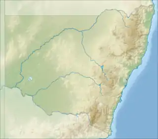 Location of the Berthong Creek mouth in New South Wales | |
| Location | |
| Country | Australia |
| State | New South Wales |
| Region | South Eastern Highlands, Riverina (IBRA), South West Slopes |
| LGAs | Cootamundra, Temora, Bland |
| Physical characteristics | |
| Source | |
| • location | west of Wombat |
| • coordinates | 34°26′18″S 148°7′40″E |
| • elevation | 444 m (1,457 ft) |
| Mouth | Bland Creek |
• location | near Grogan |
• coordinates | 34°20′7″S 147°49′29″E |
• elevation | 262 m (860 ft) |
| Length | 40 km (25 mi) |
| Basin features | |
| River system | Lachlan sub-catchment, Murray–Darling basin |
| Tributaries | |
| • left | Long Reach Creek |
| Dams | Berthong Dam |
| [1][2] | |
Course and features
The Berthong Creek (technically a river[3]) rises west of Wombat, between the towns of Stockinbingal and Young, and flows generally north by west, joined by one minor tributary, before reaching its confluence with the Bland Creek. The creek descends 182 metres (597 ft) over its 40-kilometre (25 mi) course.[1] The creek is impounded by the Berthong Dam south of Yannawah.
References
- "Map of Berthong Creek, NSW". Bonzle Digital Atlas of Australia. Retrieved 8 December 2014.
- "Our partners: local government". Lachlan Catchment Management Authority. Government of New South Wales. 2013. Retrieved 9 February 2013.
- "Berthong Creek". Geographical Names Register (GNR) of NSW. Geographical Names Board of New South Wales. Retrieved 8 December 2014.

External links
- "Lachlan River catchment" (map). Office of Environment and Heritage. Government of New South Wales.
- "Bland Creek Catchment Committee". LachLandcare Inc. Archived from the original on 11 December 2014.
- Trueman, Will (2012). True Tales of the Trout Cod: River Histories of the Murray–Darling Basin (Lachlan River catchment booklet) (PDF). Canberra: Murray–Darling Basin Authority. ISBN 978-1-921914-98-0. Archived from the original (PDF) on 25 February 2014.
Rivers of the Murrumbidgee River catchment, New South Wales and the Australian Capital Territory, Australia | |||||
|---|---|---|---|---|---|
| |||||
| |||||