Jerrara Creek
The Jerrara Creek, a watercourse[1] that is part of the Lachlan sub-catchment of the Murrumbidgee catchment within the Murray–Darling basin, is located in the South West Slopes region of New South Wales, Australia.
| Jerrara Chain of Ponds Creek[1] | |
|---|---|
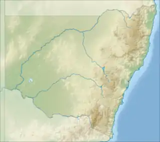 Location of the Jerrara Creek mouth in New South Wales | |
| Location | |
| Country | Australia |
| State | New South Wales |
| Region | South Eastern Highlands (IBRA), South West Slopes |
| LGA | Upper Lachlan |
| Physical characteristics | |
| Source | Great Dividing Range |
| • location | near Wheeo trigonometry station |
| • coordinates | 34°29′31″S 149°15′59″E |
| Mouth | confluence with Lachlan River |
• location | southeast of Rugby |
• coordinates | 34°26′48″S 149°7′16″E |
| Length | 21 km (13 mi) |
| Basin features | |
| River system | Lachlan sub-catchment, Murray–Darling basin |
| [2] | |
Course and features
The Jerrara Creek (technically a river[1]) rises on the slopes of the Great Dividing Range north of Gunning near the locality of Wheeo, and flows generally west before reaching its confluence with the Lachlan River southeast of Rugby. The course of the creek is approximately 21 kilometres (13 mi).[1]
References
- "Jerrara Creek". Geographical Names Register (GNR) of NSW. Geographical Names Board of New South Wales. Retrieved 29 December 2014.

- "Our partners: local government". Lachlan Catchment Management Authority. Government of New South Wales. 2013. Retrieved 29 December 2014.
External links
- "Lachlan River catchment" (map). Office of Environment and Heritage. Government of New South Wales.
- Trueman, Will (2012). True Tales of the Trout Cod: River Histories of the Murray–Darling Basin (Lachlan River catchment booklet) (PDF). Canberra: Murray–Darling Basin Authority. ISBN 978-1-921914-98-0. Archived from the original (PDF) on 25 February 2014.
Rivers of the Murrumbidgee River catchment, New South Wales and the Australian Capital Territory, Australia | |||||
|---|---|---|---|---|---|
| |||||
| |||||
This article is issued from Wikipedia. The text is licensed under Creative Commons - Attribution - Sharealike. Additional terms may apply for the media files.