Saint-Hélier, Côte-d'Or
Saint-Hélier is a commune in the Côte-d'Or department in eastern France.
Saint-Hélier | |
|---|---|
Location of Saint-Hélier 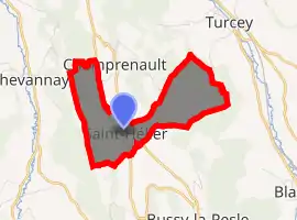
| |
 Saint-Hélier  Saint-Hélier | |
| Coordinates: 47°23′09″N 4°41′00″E | |
| Country | France |
| Region | Bourgogne-Franche-Comté |
| Department | Côte-d'Or |
| Arrondissement | Montbard |
| Canton | Semur-en-Auxois |
| Government | |
| • Mayor (2008–2014) | Serge Viennot |
| Area 1 | 3.93 km2 (1.52 sq mi) |
| Population (2017-01-01)[1] | 35 |
| • Density | 8.9/km2 (23/sq mi) |
| Time zone | UTC+01:00 (CET) |
| • Summer (DST) | UTC+02:00 (CEST) |
| INSEE/Postal code | 21552 /21690 |
| Elevation | 380–549 m (1,247–1,801 ft) (avg. 410 m or 1,350 ft) |
| 1 French Land Register data, which excludes lakes, ponds, glaciers > 1 km2 (0.386 sq mi or 247 acres) and river estuaries. | |
Population
| Year | Pop. | ±% |
|---|---|---|
| 1962 | 30 | — |
| 1968 | 33 | +10.0% |
| 1975 | 29 | −12.1% |
| 1982 | 26 | −10.3% |
| 1990 | 27 | +3.8% |
| 1999 | 25 | −7.4% |
| 2008 | 39 | +56.0% |
See also
References
- "Populations légales 2017". INSEE. Retrieved 6 January 2020.
| Wikimedia Commons has media related to Saint-Hélier (Côte-d'Or). |
| Authority control |
|---|
This article is issued from Wikipedia. The text is licensed under Creative Commons - Attribution - Sharealike. Additional terms may apply for the media files.