Sarliac-sur-l'Isle
Sarliac-sur-l'Isle is a commune in the Dordogne department in Nouvelle-Aquitaine in southwestern France.
Sarliac-sur-l'Isle | |
|---|---|
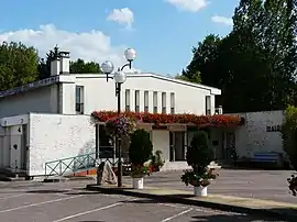 The town hall in Sarliac-sur-l'Isle | |
Location of Sarliac-sur-l'Isle 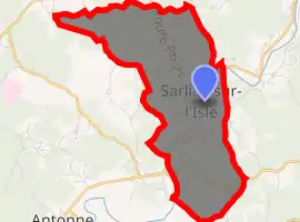
| |
 Sarliac-sur-l'Isle  Sarliac-sur-l'Isle | |
| Coordinates: 45°14′24″N 0°52′33″E | |
| Country | France |
| Region | Nouvelle-Aquitaine |
| Department | Dordogne |
| Arrondissement | Périgueux |
| Canton | Trélissac |
| Government | |
| • Mayor (2008–2014) | Alain Buffière |
| Area 1 | 9.57 km2 (3.69 sq mi) |
| Population (2017-01-01)[1] | 1,020 |
| • Density | 110/km2 (280/sq mi) |
| Time zone | UTC+01:00 (CET) |
| • Summer (DST) | UTC+02:00 (CEST) |
| INSEE/Postal code | 24521 /24420 |
| Elevation | 97–206 m (318–676 ft) (avg. 102 m or 335 ft) |
| 1 French Land Register data, which excludes lakes, ponds, glaciers > 1 km2 (0.386 sq mi or 247 acres) and river estuaries. | |
Toponymy
The name of the commune comes from that of a person of Gallo-Roman origin, Cærellius, followed by the suffix -acum, meaning "domain of Cærellius". The second part of the name, l'Isle, refers to the Isle river, which flows through the commune.[2]
History
The territory of the commune has been occupied since the Gallo-Roman era.[2]
The oldest known written mention of the location dates back to the 13th century and concerns its church under the name Sanctus Petrus de Sarlhac.[2]
During the Middle Ages (14th century), the parish of Sarliac (Sarlhac) was part of the castellany of Auberoche.[4]
On the Cassini map depicting France between 1756 and 1789, the village is identified by the name "Sarliat".[5] In 1907, the commune of Sarliac took the name Sarliac-sur-l'Isle.
Population
|
|
See also
References
- "Populations légales 2017". INSEE. Retrieved 6 January 2020.
- Chantal Tanet and Tristan Hordé (2000), Dictionnaire des noms de lieux du Périgord (in French), Éditions Fanlac, p. 389, ISBN 2-86577-215-2
- Le nom occitan des communes du Périgord sur le site du Conseil général de la Dordogne, consulté le 12 avril 2014. (in French)
- Abbé Farnier (2003), "Autour de l'abbaye de Ligueux, tome II", Le livre d'histoire-Lorisse (in French), p. 242, ISBN 2-84373-342-1 (Facsimile of the 1931 edition.)
- Sarliat on Géoportail. Accessed 17 December 2013.
| Wikimedia Commons has media related to Sarliac-sur-l'Isle. |
| Authority control |
|---|
