8th parallel south

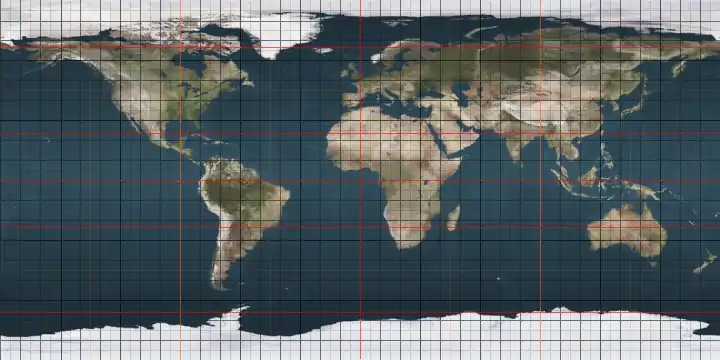
The 8th parallel south is a circle of latitude that is 8 degrees south of the Earth's equatorial plane. It crosses the Atlantic Ocean, Africa, the Indian Ocean, Southeast Asia, Australasia, the Pacific Ocean and South America.

8th parallel south

Two sections of the border between the Democratic Republic of the Congo and Angola are defined by the parallel.[1]

Around the world

Starting at the Prime Meridian and heading eastwards, the parallel 8° south passes through:

Co-ordinates Country, territory or sea Notes
8°0′S 0°0′E Atlantic Ocean
8°0′S 13°11′E  Angola
8°0′S 17°29′E  Democratic Republic of the Congo
8°0′S 18°10′E  Angola
8°0′S 18°18′E  Democratic Republic of the Congo
8°0′S 18°23′E  Democratic Republic of the Congo /  Angola border
8°0′S 18°31′E  Angola
8°0′S 18°48′E  Democratic Republic of the Congo /  Angola border
8°0′S 19°22′E  Angola
8°0′S 21°46′E  Democratic Republic of the Congo
8°0′S 30°27′E Lake Tanganyika
8°0′S 30°53′E  Tanzania
8°0′S 39°27′E Indian Ocean Passing just south of the island of Mafia,  Tanzania
8°0′S 39°45′E  Tanzania Island of Chole
8°0′S 39°48′E Indian Ocean
8°0′S 110°15′E  Indonesia Island of Java
8°0′S 114°25′E Bali Sea Passing just north of the island of Bali,  Indonesia
8°0′S 117°9′E Flores Sea Passing just north of the island of Sumbawa,  Indonesia
8°0′S 122°47′E Banda Sea Passing just north of the island of Flores,  Indonesia
Passing just north of the island of Alor,  Indonesia
8°0′S 125°43′E  Indonesia Islands of Liran and Wetar
8°0′S 125°48′E Wetar Strait Passing just north of the island of Kisar,  Indonesia
8°0′S 129°39′E  Indonesia Island of Babar
8°0′S 129°48′E Timor Sea
8°0′S 131°12′E  Indonesia Island of Yamdena
8°0′S 131°19′E Arafura Sea
8°0′S 137°50′E  Indonesia Islands of Yos Sudarso and New Guinea
8°0′S 141°1′E  Papua New Guinea Island of New Guinea
8°0′S 143°55′E Gulf of Papua
8°0′S 145°48′E  Papua New Guinea Island of New Guinea
8°0′S 147°57′E Solomon Sea
8°0′S 156°31′E  Solomon Islands Island of Ranongga
8°0′S 156°35′E Solomon Sea
8°0′S 156°56′E  Solomon Islands Island of Kolombangara
8°0′S 157°11′E Kula Gulf
8°0′S 157°23′E  Solomon Islands Island of New Georgia
8°0′S 157°33′E New Georgia Sound
8°0′S 158°53′E  Solomon Islands Santa Isabel Island
8°0′S 159°24′E Pacific Ocean Passing just south of the island of Dai,  Solomon Islands
8°0′S 178°20′E  Tuvalu Nukufetau atoll
8°0′S 178°24′E Pacific Ocean The parallel defines the northern maritime boundary of the  Cook Islands from the 167th meridian west to the 156th meridian west
8°0′S 140°43′W  French Polynesia Island of Eiao
8°0′S 140°40′W Pacific Ocean
8°0′S 79°13′W  Peru
8°0′S 73°40′W  Brazil Acre, Amazonas, Rondônia, Amazonas, Mato Grosso, Pará, Tocantins, Maranhão - for about 11 km, Tocantins, Maranhão, Piauí, Pernambuco, Paraíba, Pernambuco - passing just north of Recife
8°0′S 34°50′W Atlantic Ocean Passing just to the south of Ascension Island,  Saint Helena, Ascension and Tristan da Cunha

See also

References

  1. Brownlie, Ian (1979). African Boundaries: A Legal and Diplomatic Encyclopedia. Institute for International Affairs, Hurst and Co. pp. 489–514.


This article is issued from Wikipedia. The text is licensed under Creative Commons - Attribution - Sharealike. Additional terms may apply for the media files.