Arricau-Bordes
Arricau-Bordes (Occitan: Arricau-Bòrdas) is a commune in the Pyrénées-Atlantiques department in the Nouvelle-Aquitaine region of south-western France.
Arricau-Bordes | |
|---|---|
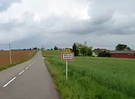 The road into Arricau-Bordes | |
Location of Arricau-Bordes 
| |
 Arricau-Bordes  Arricau-Bordes | |
| Coordinates: 43°29′39″N 0°08′01″W | |
| Country | France |
| Region | Nouvelle-Aquitaine |
| Department | Pyrénées-Atlantiques |
| Arrondissement | Pau |
| Canton | Terres des Luys et Coteaux du Vic-Bilh |
| Intercommunality | Nord-Est Béarn |
| Government | |
| • Mayor (2014-2020) | Marie-Odile Rigaud |
| Area 1 | 8.10 km2 (3.13 sq mi) |
| Population (2017-01-01)[1] | 108 |
| • Density | 13/km2 (35/sq mi) |
| Time zone | UTC+01:00 (CET) |
| • Summer (DST) | UTC+02:00 (CEST) |
| INSEE/Postal code | 64052 /64350 |
| Elevation | 140–299 m (459–981 ft) (avg. 284 m or 932 ft) |
| 1 French Land Register data, which excludes lakes, ponds, glaciers > 1 km2 (0.386 sq mi or 247 acres) and river estuaries. | |
Geography


Arricau-Bordes is located some 12 km north-west of Maubourguet and some 40 km north-east of Pau. Access to the commune is by the D13 road from Cadillon in the north passing through the heart of the commune and through the village then continuing south to Lembeye. The D298 from Aurions-Idernes forms the entire eastern border of the commune as it goes south to join the D13 north of Lembaye. The D228 comes from Séméacq-Blachon in the east and passes through the south of the commune west to Gayon. About 60% of the commune is forested mostly in a north–south belt through the centre with the rest of the commune farmland.[2]
The Lisau river flows through the heart of the commune from the Lac de Castillon just over the southern border to the Lac de Cadillon just over the northern border of the commune.[2]
Places and Hamlets
Neighbouring communes and villages
Places adjacent to Arricau-Bordes | ||||||||||
|---|---|---|---|---|---|---|---|---|---|---|
| ||||||||||
Toponymy
The commune name in béarnais is Arricau-Bordas.
According to Michel Grosclaude the name Arricau was formed from two Gascon terms: arric, meaning "ravine" or "Thalweg", and cau, meaning "sunken".[6]
Bordes comes from the Occitan borda meaning "house" or "Farm".[7]
The following table details the origins of the commune name and other names in the commune.
| Name | Spelling | Date | Source | Page | Origin | Description |
|---|---|---|---|---|---|---|
| Arricau | Arricau | 12th century | Raymond | Marca | Village | |
| Arricau | 1385 | Raymond | Census | |||
| Ricau | 14th century | Raymond | Census | |||
| Arricau-Viele | 1538 | Raymond | Reformation | |||
| Bordes | Bordas | 11th century | Raymond | Lescar | Village | |
| Bordes en Vic-Bilh | 1673 | Raymond | Reformation | |||
| Domengé | L'ostau de Domenger | 1385 | Raymond | Census | Farm | |
| Lahitole | La Fitola | 1538 | Raymond | Reformation | Hamlet | |
| Lahitolle | 1673 | Raymond | Reformation | |||
| Lafitole | 1863 | Raymond | ||||
| La Fitole | 1863 | Raymond | ||||
| Nouguès | Noguer | 1385 | Raymond | Census | Farm | |
| Saint-Martin | Saint-Martin | 1863 | Raymond | Hamlet |
Sources:
- Raymond: Topographic Dictionary of the Department of Basses-Pyrenees, 1863, on the page numbers indicated in the table. (in French)[3]
Origins:
History
Paul Raymond noted that, in 1385, Arricau and Bordes depended on the bailiwick of Lembeye and had respectively 18 and 12 fires. Arricau then had two parishes: Saint-Martin and Saint-Jacques. The fief of Bordes depended on the Viscounts of Béarn.[3]
Arricau and Bordes were merged between 1861 and 1866.[12]
Administration
List of Successive Mayors[13]
| From | To | Name | Party | Position |
|---|---|---|---|---|
| 1995 | 2008 | Jean-Paul Cassou | ||
| 2008 | 2014 | Frédéric Cerisère | ||
| 2014 | 2020 | Marie-Odile Rigaud |
(Not all data is known)
Inter-communality
The commune is part of four inter-communal structures:[14]
- the Communauté de communes du Nord-Est Béarn;
- the AEP association of Pays de Lembeye;
- the Energy association of Pyrénées-Atlantiques;
- the irrigation association of the Lees valley;
Demography
In 2017 the commune had 108 inhabitants. The population data given in the table and graph below for 1861 and earlier refer to the former commune of Arricau.
|
| |||||||||||||||||||||||||||||||||||||||||||||||||||||||||||||||||||||||||||||||||||||||||||||||||||||||||||||||
| Source: EHESS[12] and INSEE[15] | ||||||||||||||||||||||||||||||||||||||||||||||||||||||||||||||||||||||||||||||||||||||||||||||||||||||||||||||||
Economy
The commune is part of the Appellation d'origine contrôlée (AOC) zones of Madiran, Pacherenc-du-vic-bilh, and Béarn.
Culture and Heritage
Civil heritage

The commune has many sites that are registered as historical monuments:
Religious heritage
The commune has two churches that are registered as historical monuments:
See also
External links
References
- "Populations légales 2017". INSEE. Retrieved 6 January 2020.
- Google Maps
- Topographic Dictionary of the Department of Basses-Pyrenees, Paul Raymond, Imprimerie nationale, 1863, Digitised from Lyon Public Library 15 June 2011 (in French)
- Ministry of Culture, Mérimée IA00026443 Chateau of Bordes (in French)
- Géoportail, IGN (in French)
- Michel Grosclaude, Toponymic Dictionary of communes, Béarn, Edicions reclams & Édition Cairn - 2006, 416 pages, ISBN 2-35068-005-3 (in French)
- Brigitte Jobbé-Duval, Dictionary of place names - Pyrénées-Atlantiques, 2009, Archives and Culture, ISBN 978-2-35077-151-9 (in French)
- Pierre de Marca, History of Béarn
- Manuscript from the 14th century - Departmental Archives of Pyrénées-Atlantiques (in French)
- Manuscript from the 16th to 18th centuries - Departmental Archives of Pyrénées-Atlantiques (in French)
- Cartulary of the Bishop of Lescar, published in the proofs of the History of Béarn by Pierre de Marca (in French)
- Données Cassini, EHESS
- List of Mayors of France (in French)
- Intercommunality of Pyrénées-Atlantiques Archived 2014-04-24 at the Wayback Machine, Cellule informatique préfecture 64, consulted on 9 March 2012 (in French)
- Population en historique depuis 1968, INSEE
- Ministry of Culture, Mérimée PA00084317 IA00026441 Chateau of Arricau(in French)

- Ministry of Culture, Palissy PM64002098 Iron Host (in French)
- Ministry of Culture, Palissy PM64002097 Stoup (in French)
- Ministry of Culture, Palissy PM64002096 Hilarri (in French)
- Ministry of Culture, Mérimée IA00027294 Houses and Farms (in French)
- Ministry of Culture, Mérimée IA00027519 Parish Church of Saint-Jacques (in French)
- Ministry of Culture, Mérimée IA00026444 Parish Church of Saint John the Baptist (in French)
- Ministry of Culture, Palissy PM64002103 Chasuble (in French)
- Ministry of Culture, Palissy PM64002102 2 Processional Lanterns (in French)
- Ministry of Culture, Palissy PM64002101 Processional Cross (in French)
- Ministry of Culture, Palissy PM64002100 Celebrant's Chair (in French)
- Ministry of Culture, Palissy PM64002099 Altar, Altar step, and Tabernacle (in French)
| Wikimedia Commons has media related to Arricau-Bordes. |
| Authority control |
|
|---|