Baigts-de-Béarn
Baigts-de-Béarn is a commune in the Pyrénées-Atlantiques department in the Nouvelle-Aquitaine region of south-western France.
Baigts-de-Béarn | |
|---|---|
Location of Baigts-de-Béarn 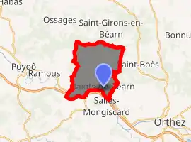
| |
 Baigts-de-Béarn  Baigts-de-Béarn | |
| Coordinates: 43°30′46″N 0°50′14″W | |
| Country | France |
| Region | Nouvelle-Aquitaine |
| Department | Pyrénées-Atlantiques |
| Arrondissement | Pau |
| Canton | Orthez et Terres des Gaves et du Sel |
| Intercommunality | Lacq-Orthez |
| Government | |
| • Mayor (2014–2020) | Guy Pemartin |
| Area 1 | 13.53 km2 (5.22 sq mi) |
| Population (2017-01-01)[1] | 876 |
| • Density | 65/km2 (170/sq mi) |
| Time zone | UTC+01:00 (CET) |
| • Summer (DST) | UTC+02:00 (CEST) |
| INSEE/Postal code | 64087 /64300 |
| Elevation | 28–167 m (92–548 ft) (avg. 111 m or 364 ft) |
| 1 French Land Register data, which excludes lakes, ponds, glaciers > 1 km2 (0.386 sq mi or 247 acres) and river estuaries. | |
The inhabitants of the commune are known as Batchois or Batchoises.[2]
Geography
Baigts-de-Béarn is located some 6 km north-west of Orthez and 23 km east of Peyrehorade. The western part of the northern border of the commune is also the departmental border between Pyrénées-Atlantiques and Landes. Access to the commune is by road D817 from Puyoô in the west which passes through the south of the commune and the village and continues south-east to Orthez. The D415 (the old Route Imperiale) branches from the D817 west of the commune and passes through the village before continuing east to Orthez. The D315 goes north from the village then east to Saint-Boès. The D915 goes north from the D315 to Saint-Girons-en-Béarn. The A64 autoroute passes through the southern tip of the commune but there is no exit with the nearest exit being Exit ![]() 7 some 3 km west of the commune. The commune is mostly farmland with scattered forests.[3]
7 some 3 km west of the commune. The commune is mostly farmland with scattered forests.[3]
The Gave de Pau forms the southern border of the commune as it flows west to join the Gave d'Oloron at Peyrehorade. Numerous streams rise in the commune and flow south to join the Gave de Pau including the Ruisseau de Montlong. The Ruisseau de Lataillade forms the northern border of the commune as it flows west and forms part of the departmental border with Landes before joining the Gave de Pau west of Puyoô. The Arriou de Bardj rises in the north of the commune and flows west then south to join the Gave de Pau east of Ramous.
Places and hamlets
- Arritor
- Balagué
- Barroumères
- Bassot
- Bellevue (château)
- Bergeras
- Bernet
- Bizens
- Bordenave
- Bourdieu
- Brana
- Brau[4]
- Capdebielle
- Cassecour
- Castéra
- Castillon[4]
- Caubraque
- Caupet
- Cossou
- Cuyoula
- Domblides
- Fayet
- Gassiou
- Gayou
- Les Glycines
- Grihou
- Hau
- Hourquebie
- Hourquérou
- Hourquet
- Hours
- Labasse[4]
- Labiste
- Laborde
- Laboudigue
- Lacabanne
- Lacarrère
- Lacrouts
- Lagouarde
- Lagourque
- Lahéouguère
- Lalanne
- Lanuque
- Latéoulère
- Laulhé
- Loustaunau
- Luns
- Martimour
- Mongay
- Mousquès
- Panaut
- Parrabéou
- Pédeboscq
- Petit
- Peyrou
- Pierroulin
- Pitche
- Planté
- Pommes
- Poublan
- Pourret
- Régis
- Rey
- Riche
- Saint-Laurent
- Sére
- Temple
- Tilhète
- Toucayré
- Touriangle (château)
Neighbouring communes and villages
Places adjacent to Baigts-de-Béarn | ||||||||||
|---|---|---|---|---|---|---|---|---|---|---|
| ||||||||||
Toponymy
The commune name in béarnais is Vaths de Bearn.
The name Baigts means "valley" in Gascon but, according to Michel Grosclaude[5] that meaning is to be avoided. According to him Baigts comes from the Gascon vaths which is derived from vallis meaning "hollow" or "depression" or from vallum meaning "palisade" or "entrenchment". In the old village there is a Rue de l'Embarrat meaning "fortified redoubt".
The following table details the origins of the commune name and other names in the commune.
| Name | Spelling | Date | Source | Page | Origin | Description |
|---|---|---|---|---|---|---|
| Baigts | Baigs | 13th century | Raymond | Fors de Béarn | Village | |
| Baigx | 1318 | Raymond | Béarn | |||
| Bags | 1343 | Raymond | Béarn | |||
| Bachs | 1505 | Raymond | Garos | |||
| Batz | 1540 | Raymond | Reformation | |||
| Vagtz | 1548 | Raymond | Reformation | |||
| Baitz | 1582 | Raymond | Alienations | |||
| Baigts | 1750 | Cassini | ||||
| Baziart | Bessiart | 1540 | Raymond | Reformation | Farm | |
| Brau | Lo Brau | 1540 | Raymond | Reformation | Farm | |
| Braü | 1863 | Raymond | ||||
| Castillon | Castelhoo-Susoo | 1385 | Raymond | Census | Fief, vassal of the Viscounts of Béarn | |
| Castilhon | 1682 | Raymond | Reformation | |||
| Labasse | La Basse | 1540 | Raymond | Reformation | Farm | |
| Lacoumayou | Cau-Mayor | 1385 | Raymond | Census | Farm | |
| La Caumayo | 1540 | Raymond | Reformation | |||
| Le Petit-Hameau | Le Petit-Hameau | 1863 | Raymond | Hamlet | ||
| Portes | Portes | 1385 | Raymond | Census | Fief, vassal of the Viscounts of Béarn and dependent on the bailiwick of Rivière-Gave | |
| Portas de Bags | 1538 | Raymond | Reformation | |||
| Turon de Castéra | Le Touron de Castéra | 1675 | Raymond | Reformation | Moor |
Sources:
- Raymond: Topographic Dictionary of the Department of Basses-Pyrenees, 1863, on the page numbers indicated in the table. (in French)[4]
- Cassini: Cassini Map from 1750[6]
Origins:
History
Paul Raymond noted on page 19 of his 1863 dictionary that the commune depended on the Diocese of Dax and was the capital of the Notary of Rivière-Gave, the name of an arch-priesthood of the diocese of Dax which gave its name to the Gave de Pau. In 1385 the commune had 59 fires.[4]
Administration
| From | To | Name | Party | Position |
|---|---|---|---|---|
| 1995 | 2014 | Christian Palette | ||
| 2014 | 2020 | Guy Pemartin |
(Not all data is known)
Inter-communality
The commune is part of three inter-communal structures:
- the Communauté de communes de Lacq-Orthez;
- the water and sanitation association of Trois Cantons;
- the Energy association of Pyrénées-Atlantiques;
Demography
In 2017 the commune had 876 inhabitants.
|
| ||||||||||||||||||||||||||||||||||||||||||||||||||||||||||||||||||||||||||||||||||||||||||||||||||||||||||||||||||
| Source: EHESS[14] and INSEE[15] | |||||||||||||||||||||||||||||||||||||||||||||||||||||||||||||||||||||||||||||||||||||||||||||||||||||||||||||||||||
Economy
In addition to an economy focused on agriculture (livestock and corn), the commune has a hydroelectric plant.
The commune is part of the appellation d'origine contrôlée (AOC) zone of Béarn.
Culture and heritage
Civil heritage
- The Chateau of Bellevue is a nursing hoem for disabled workers.
Religious heritage
- The Parish Church of Saint Vincent and Saint Bartholomew (17th century)
 is registered as an historical monument.[16]
Facilities
The commune has a primary school.
References
- "Populations légales 2017". INSEE. Retrieved 6 January 2020.
- Inhabitants of Pyrénées-Atlantiques (in French)
- Google Maps
- Topographic Dictionary of the Department of Basses-Pyrenees, Paul Raymond, Imprimerie nationale, 1863, Digitised from Lyon Public Library 15 June 2011 (in French)
- Michel Grosclaude, Toponymic Dictionary of communes, Béarn, Edicions reclams & Édition Cairn - 2006, 416 pages, ISBN 2 35068 005 3 (in French)
- Cassini Map 1750 – Baigts-de-Béarn
- Manuscript from the 14th century in the Departmental Archives of Pyrénées-Atlantiques (in French)
- Titles of the Viscounts of Béarn in the Departmental Archives of Pyrénées-Atlantiques (in French)
- Notaries of Garos in the Departmental Archives of Pyrénées-Atlantiques (in French)
- Manuscript from the 16th to 18th centuries - Departmental Archives of Pyrénées-Atlantiques (in French)
- Registers of alienations from the old Imperial Library in the Bibliothèque nationale de France (in French)
- Manuscript from the 14th century - Departmental Archives of Pyrénées-Atlantiques (in French)
- List of Mayors of France (in French)
- Des villages de Cassini aux communes d'aujourd'hui: Commune data sheet Baigts-de-Béarn, EHESS. (in French)
- Population en historique depuis 1968, INSEE
- Ministry of Culture, Mérimée IA64000622 Parish Church of Saint Vincent and Saint Bartholomew (in French)
External links
| Wikimedia Commons has media related to Baigts-de-Béarn. |
| Authority control |
|---|