Aramits
Aramits is a commune in the Pyrénées-Atlantiques department in the Nouvelle-Aquitaine region of south-western France.
Aramits | |
|---|---|
 Entry to Aramits | |
.svg.png.webp) Coat of arms | |
Location of Aramits 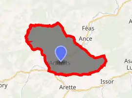
| |
 Aramits  Aramits | |
| Coordinates: 43°07′18″N 0°43′34″W | |
| Country | France |
| Region | Nouvelle-Aquitaine |
| Department | Pyrénées-Atlantiques |
| Arrondissement | Oloron-Sainte-Marie |
| Canton | Oloron-Sainte-Marie-1 |
| Intercommunality | Vallée de Barétous |
| Government | |
| • Mayor (2014–2020) | Étienne Serna |
| Area 1 | 29.55 km2 (11.41 sq mi) |
| Population (2017-01-01)[1] | 669 |
| • Density | 23/km2 (59/sq mi) |
| Time zone | UTC+01:00 (CET) |
| • Summer (DST) | UTC+02:00 (CEST) |
| INSEE/Postal code | 64029 /64570 |
| Elevation | 212–628 m (696–2,060 ft) |
| 1 French Land Register data, which excludes lakes, ponds, glaciers > 1 km2 (0.386 sq mi or 247 acres) and river estuaries. | |
The inhabitants of the commune are known as Aramitsiens or Aramitsiennes.[2][3]
Geography
Location
Aramits is located in part of the Barétous valley, the westernmost of the three main valleys of Béarn crossing the Pyrenees. It is located some 15 km south-west of Oloron-Sainte-Marie and 3 km north of Arette.
Access
Access is by the D919 road from Ance in the north-east to the village then continuing to Lanne-en-Baretous in the south-west. There are also the minor roads D659 from the village north to join the D159 on the northern border and the D133 which goes south from the village to Arette.[4]
Bus route 848 of the Inter-urban network of Pyrénées-Atlantiques, which connects La Pierre Saint-Martin (a ski resort in Arette) to Oloron-Sainte-Marie, has a stop in Aramits.
Hydrography
Located in the drainage basin of the Adour, the commune is bisected from south-west to north-east by : Le Vert a tributary of the Gave d'Oloron which gathers many tributaries of its own in the commune including the Aurone, the Lancy, the Littos, the Talou Gros, and also by the arrècs of Bugalaran, Bitole (as well its tributary the Rachet), Ibarcis, and Labaigt (and by its tributary the Audore).
The tributaries of the Joos: the Arriou de Sulu and the Bouhatéko erreka (with the Dragon) also flow through the commune.
Localities and hamlets

- Aïtzaguer
- Andillon
- Arhanchet
- Aripe
- Atchouètos
- Badet
- Balen
- Baliros
- Villa Barétous
- Bénébig
- Bernasqué
- Bigué
- Bile
- Bouenou
- Bourette[5]
- Brincou
- Fontaine Bugalaran
- Bois de Bugangue[5]
- Borde Estanguet
- Granges Cachau
- Calangué[5]
- Camou
- Capdeville
- Carquet
- Carrère
- Casabonne
- Casalet
- Casemayou
- Castera
- Chandelle
- Chicane
- Chinaberry
- Chourrout
- Coig
- Coig de Lamothe
- Couéchot
- Coustarou
- Crapuchette
- Escary
- Escoubès
- Escribasse
- Estrate
- Galard
- Garay
- La Gloriette
- Gouloume[5]
- Gourroure
- Guirail
- Hondeville
- Laborde
- Lac de Bas
- Lacazette
- Lacouère
- Lagarde
- Lahitte
- Lamothe (2 localities)
- Lanne de Haut[5]
- Lanneretonne
- Larrande
- Lartigau
- Laserre
- Laude Bousquet
- Grange Lerdou
- Lesponne
- Lhande
- Loustalot
- Loustaucaus
- Grange de Lurbet
- Mendioudou
- Ménin
- Mesplou
- Miapira
- Miramon
- Mirande
- Moncole
- Mounolou
- Les Murs
- Olivé de Haut[5]
- Olivé de Baig[5]
- Oscamou
- Grange d'Osse[5]
- Ounces
- Oyhenard
- Pastou
- Les Pernes
- Peyré
- Grange de Pradet
- Prat
- Bois de Rachet
- Pont de Rachou
- Ripaète
- Satzoury
- Serres
- Serreuille[5]
- Sottou
- Soulou[5]
- Talou
- Talou Andichou
- Talou Piarroch
- Tembla de la Loupère
- Tos de Haut
- Trébucq
- Les Trois Arbres
Neighbouring communes and villages[4] | |
|---|---|
Toponymy
The commune name in béarnais is Aràmits (according to classical norm of Occitan). For Brigitte Jobbé-Duval,[3] the origin of the name is from the Basque aran ("valley") and -itz (a locative and collective suffix) giving "place of valleys" or "confluence".[7] It would also indicate that the inhabitants were once nicknamed grenouilles (frogs) - a name for the inhabitants of wetlands).
The following table details the origins of the commune name and other names in the commune.
| Name | Spelling | Date | Source | Page | Origin | Description |
|---|---|---|---|---|---|---|
| Aramits | Aramiçs | 1270 | Raymond | Ossau | Village | |
| Aramitz en Baratons | 1376 | Raymond | Luntz | |||
| Iramitz | 1383 | Raymond | Luntz | |||
| Sent-Vinsens d'Aramitz | 1606 | Raymond | Insinuations | |||
| Aramys | 1630 | Grosclaude | Le Païs de Béarn Map | |||
| Aramits | 1750 | Cassini | ||||
| L'Arrigau | lo ariu aperat la Rigau | 1538 | Raymond | Reformation | Stream with its source in Arette and joining the Vert in Aramits | |
| L'Arrigas | 1863 | Raymond | ||||
| Basques | Basques | 1863 | Raymond | Hamlet | ||
| La Bourette | La Bourette | 1863 | Raymond | Tributary of the Vert which rises in Aramits | ||
| Le Bois de Bugangue | lo boscq de Buyangue | 1477 | Raymond | Aspe | Wood on the territory of Asasp in 1863. The Ruisseau de Bugangue, a tributary of the Mielle which rose in Asasp and Gurmençon in 1863, passed through the wood. | |
| Calangué | La Calangue | 1863 | Raymond | A Stream with its source in the Bois de Budangue and joining the Dandarou, a tributary of the Vert. | ||
| Gouloume | Goulomme | 1863 | Raymond | Wood | ||
| La Grange-d'Osse | L’Espitau d’Osse | 1385 | Raymond | Census | Farm next to the Vert belonging to Pontaut Abbey[8](Landes) and a fief of the Viscounts of Béarn depending on the bailiwick of Oloron. | |
| La Grange de Osse ab une petite gleysi | 1538 | Raymond | Reformation | |||
| Lanne de Haut | Lane | 1385 | Raymond | Census | Close to another place in Aramits which is now in the commune of Lanne-en-Barétous. It had a Lay Abbey, vassal of the Viscounts of Béarn. In 1385 it was part of the bailiwick of Oloron and had 17 fires. | |
| Lana | 1444 | Raymond | Cour Majour | |||
| Sanctus Martinus de Lanne | 1673 | Raymond | Insinuations | |||
| Lanne | 1863 | Raymond | ||||
| Olivé | Oliber | 1538 | Raymond | Reformation | Farm | |
| Serreuille | Seruilhe | 1376 | Raymond | Military | Hamlet | |
| Sarrulhe-Susoo | 1385 | Raymond | Census | |||
| Sarrulhe-Jusoo | 1385 | Raymond | Census | |||
| Soulou | Soulon | 1581 | Raymond | Reformation | Farm |
Sources:
- Raymond: Topographic Dictionary of the Department of Basses-Pyrenees, 1863, on the page numbers indicated in the table. (in French)[5]
- Grosclaude: Toponymic Dictionary of communes, Béarn, 2006 (in French)[7]
- Cassini: Cassini Map from 1750[9]
Origins:
History
Paul Raymond on page 7 of his 1863 dictionary that Aramits is the former capital of the Barétous valley and that there were two Lay Abbeys, vassals of the Viscounts of Béarn: The Abadie-Susan and Abadie-Jusan.
He further noted that in 1385 there were 52 fires at Aramits and it depended on the bailiwick of Oloron.[5]
Shortly before (in 1375), the priest of Aramits played the role of mediator in conflicts between the Navarrese and the Bearnese which gave birth to the treaty called the Junta de Roncal, leading to the yearly tribute of the three cows paid by Aramits to Isaba (Spain).
In 1790, the Canton of Aramits also included Esquiule.
On 13 March 2000 Aramits was hit by an earthquake of magnitude 4.2.
Heraldry
Arms of Aramits |
Blazon: Vert, two swords Argent saltirewise points to base surmounted by a musketeer's hat of Sable feathered in Argent. |
Administration
List of Successive Mayors[17]
| From | To | Name | Party | Position |
|---|---|---|---|---|
| 1983 | 1989 | Pierre Louis | ||
| 1989 | 2014 | Daniel Lourtau | ||
| 2014 | 2020 | Étienne Serna |
(Not all data is known)
Inter-communality
Aramits is part of five inter-communal structures:
- The Communauté de communes du Haut Béarn;
- The SIVU for Tourism in Haute-Soule and Barétous;
- The SIVU La Verna;
- The Energy Association for Pyrénées-Atlantiques;
- The Intercommunal association for study and management of the watershed of Le Vert and its tributaries.
Demography
In 2017 the commune had 669 inhabitants.
|
| ||||||||||||||||||||||||||||||||||||||||||||||||||||||||||||||||||||||||||||||||||||||||||||||||||||||||||||||||||
| Source: EHESS[18] and INSEE[19] | |||||||||||||||||||||||||||||||||||||||||||||||||||||||||||||||||||||||||||||||||||||||||||||||||||||||||||||||||||
Economy
The economy of the town is primarily oriented toward agriculture and livestock (cattle and sheep). It is part of the Appellation d'origine contrôlée (AOC) zone designation of Ossau-iraty.
Culture and Heritage

_vitrail_08.JPG.webp)
Religious heritage
The Parish church of Saint-Vincent (17th century)![]() is registered as an historical monument. It was a former Lay Abbey with the remains of a portal from the 17th century but the old church was demolished in 1880. The new Romanesque-Byzantine style church was built from 1884 to 1886.[20]
is registered as an historical monument. It was a former Lay Abbey with the remains of a portal from the 17th century but the old church was demolished in 1880. The new Romanesque-Byzantine style church was built from 1884 to 1886.[20]
Facilities
Education
The commune has a primary school.
Sports and sports facilities
Rugby Union: the Entente Aramits plays in Fédérale 2. Pierre Capdevielle played there from 1985 to 1994.
Notable people linked to the commune
- Henri d'Aramitz lived in the commune. He was the son of Charles Aramitz and a sergeant in the company of musketeers who was the inspiration for Aramis in the novels The Three Musketeers, Twenty Years After and The Vicomte de Bragelonne by Alexandre Dumas.
See also
External links
- Aramits Official web site (in French)
- Aramits on Lion1906
- Aramits on Géoportail, National Geographic Institute (IGN) website (in French)
- Aramits on the 1750 Cassini Map
References
- "Populations légales 2017". INSEE. Retrieved 6 January 2020.
- Inhabitants of Pyrénées-Atlantiques (in French)
- Brigitte Jobbé-Duval, Dictionary of place names - Pyrénées-Atlantiques, 2009, Archives and Culture, ISBN 978-2-35077-151-9 (in French)
- Google Maps
- Topographic Dictionary of the Department of Basses-Pyrenees, Paul Raymond, Imprimerie nationale, 1863, Digitised from Lyon Public Library 15 June 2011 (in French)
- Géoportail, IGN (in French)
- Michel Grosclaude, Toponymic Dictionary of communes, Béarn, Edicions reclams & Édition Cairn - 2006, 416 pages, ISBN 2-35068-005-3 (in French)
- Pontaut Abbey was founded in 1115 at Mant in Landes department.
- Cassini Map 1750 – Aramits
- Titles of Ossau in the Departmental Archives of Pyrénées-Atlantiques (in French)
- Contracts retained by Luntz, Notary of Béarn in the Departmental Archives of Pyrénées-Atlantiques (in French)
- Manuscripts from the 17th century in the Departmental Archives of Pyrénées-Atlantiques (in French)
- Titles of Aspe in the Departmental Archives of Pyrénées-Atlantiques and the Accous Town Hall (in French)
- Manuscript from the 14th century - Departmental Archives of Pyrénées-Atlantiques (in French)
- Cour Majour of Béarn, register manuscripts from the 15th century - Departmental Archives of Pyrénées-Atlantiques (in French)
- Manuscript from 1376 in the Departmental Archives of Pyrénées-Atlantiques (in French)
- List of Mayors of France
- Données Cassini, EHESS
- Population en historique depuis 1968, INSEE
- Ministry of Culture, Mérimée IA64000502 Parish church of Saint-Vincent (in French)
| Wikimedia Commons has media related to Aramits. |
| Authority control |
|---|
