Attilly
Attilly is a commune in the department of Aisne in the Hauts-de-France region of northern France.
Attilly | |
|---|---|
_mairie.JPG.webp) The Town Hall | |
Location of Attilly 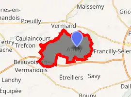
| |
 Attilly  Attilly | |
| Coordinates: 49°51′27″N 3°10′10″E | |
| Country | France |
| Region | Hauts-de-France |
| Department | Aisne |
| Arrondissement | Saint-Quentin |
| Canton | Saint-Quentin-1 |
| Intercommunality | Pays du Vermandois |
| Government | |
| • Mayor (2014-2020) | Jean-Paul Bruet |
| Area 1 | 11.81 km2 (4.56 sq mi) |
| Population (2017-01-01)[1] | 363 |
| • Density | 31/km2 (80/sq mi) |
| Time zone | UTC+01:00 (CET) |
| • Summer (DST) | UTC+02:00 (CEST) |
| INSEE/Postal code | 02029 /02490 |
| Elevation | 66–141 m (217–463 ft) (avg. 150 m or 490 ft) |
| 1 French Land Register data, which excludes lakes, ponds, glaciers > 1 km2 (0.386 sq mi or 247 acres) and river estuaries. | |
Inhabitants of the commune are traditionally referred to as "les Gens d'Attilly," or "the People of Attilly." For over 20 years, residents have debated whether their demonym should be Attillois or Attilliens; however, the Habitants website of French demonyms states that it should be Attilliens or Attilliennes[2]
Geography
Attilly is located 5 km west of Saint-Quentin just north of the A29 autoroute which passes through the south-western corner of the commune. It can be accessed by several roads: the D73 from Beauvois-en-Vermandois in the south-west to Villeveque, the D733 from Etreillers in the south going north-west to Villeveque, the D33 going north from Etreillers to Attilly village and continuing north to Marteville and Vermand, the D73 from the D1029 in the north to Marteville, and the D686 from Holnon in the east to the village. There are three villages and hamlets in the commune:[3]
- Attilly in the centre with the town hall, the school (closed), the festival hall, the church, the train station (closed), 25 cafes (all closed), and a water tower
- Marteville in the north with its cemetery, railway station (closed), castle (private) is located next to the village of Vermand
- Villeveque in the west with the villa of the Prince of Monaco, ponds for fishing, and the mill (where it is possible to learn to swim)
Much of the commune is farmland however it is partly surrounded by the Forests of Holnon and Attilly.[4]
The Omignon river passes along and forms the north-western border of the commune through Marteville and Villevèque.[5]
Neighbouring communes and villages
Places adjacent to Attilly | |
|---|---|
History
The name Attilly is derived from a word translated as "overlooking the water" and probably owes its name to its position atop a hill.[6] The origin of the name Attilly therefore probably dates back to a Roman villa. However, the region has been inhabited for much longer.[7]
Charles Poette[8] wrote a history at the beginning of the 20th century. The village was destroyed during the First World War: only a single wall was still standing at the end of the conflict on the Rue du Prozet.
Administration
List of Successive Mayors of Attilly[9]
| From | To | Name | Party | Position |
|---|---|---|---|---|
| François Vassant | ||||
| Georges Lenain | ||||
| 1983 | 2008 | Pierre Vassant | ||
| 2008 | Present | Jean-Paul Bruet | DVG |
(Not all data is known)
Population
| Year | Pop. | ±% |
|---|---|---|
| 2004 | 401 | — |
| 2006 | 403 | +0.5% |
| 2007 | 398 | −1.2% |
| 2008 | 394 | −1.0% |
| 2009 | 391 | −0.8% |
| 2010 | 384 | −1.8% |
| 2011 | 378 | −1.6% |
| 2012 | 376 | −0.5% |
| 2013 | 375 | −0.3% |
| 2014 | 373 | −0.5% |
| 2015 | 373 | +0.0% |
| 2016 | 368 | −1.3% |
Sites and Monuments
_monument_aux_morts.JPG.webp)
- The Church of Saint Martin
- The War memorial commemorating the First World War.
- Marteville Communal Cemetery, a British military cemetery managed by the Commonwealth War Graves Commission.
- A Calvary on the road between Attilly and Marteville (Vermand), another between Attilly and Holnon, and another on the road to Etreillers. There is also one at the entrance to the village from the Attilly forest which is located facing the road to Vermand not far from the church
- A Calvary or Wayside Cross on the dirt road towards Etreillers after the water tower at the top of the village.
- A Tomb on the road to Etreillers
- The Place Verte (Green Square) located on the old Roman road between Holnon and Vermand
- The ruins of a Chapel in the middle of Attilly forest where there was an old village abandoned after the First World War
- The Place du Sar (Royal Square) where 14 July is celebrated and where the hall is built
- A Dovecote next to the Rue de l'Eglise.
Picture Gallery
_city_limit_sign_and_wayside_cross.JPG.webp) Entrance to the town and a Wayside Cross
Entrance to the town and a Wayside Cross_%C3%A9glise_Saint-Martin.jpg.webp) The Church of Saint Martin
The Church of Saint Martin_Marteville_Communal_Cemetery.JPG.webp) The Marteville Communal Cemetery
The Marteville Communal Cemetery%252C_2_May_1917_Art.IWMART4880.jpg.webp) Dugouts in Attilly 2 May 1917
Dugouts in Attilly 2 May 1917_croix_de_chemin.JPG.webp) A Wayside Cross
A Wayside Cross_tour-pigeonnier.JPG.webp) The Dovecote
The Dovecote
Culture
The language spoken in Attilly is still a Picard dialect.
See also
External links
- Attilly on Lion1906
- Attilly on Géoportail, National Geographic Institute (IGN) website (in French)
- Attilly on the 1750 Cassini Map
Notes and references
Notes
References
- "Populations légales 2017". INSEE. Retrieved 6 January 2020.
- Inhabitants of Attilly (in French)
- Canton of Vermand Map (in French)
- Forests of Holnon and Attilly (in French)
- Google Maps
- History of Aisne (in French)
- Fagnart, Jean-Pierre, Industry at Federmesser in the Forests of Holnon at Attilly, Aisne, France, in a North-west European context, 1987 (in French)
- Charles Poette Book (in French)
- List of Mayors of Aisne>
| Wikimedia Commons has media related to Attilly. |
