Tergnier
Tergnier is a commune in the Aisne department in Hauts-de-France in northern France. Its location on the Canal de Saint-Quentin and the Creil–Jeumont railway (Tergnier station) supported its development as an industrial centre in the second half of the 19th century.
Tergnier | |
|---|---|
_1894.jpg.webp) Town hall | |
.svg.png.webp) Coat of arms | |
Location of Tergnier 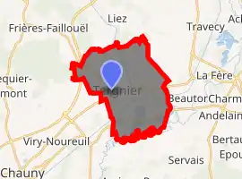
| |
 Tergnier  Tergnier | |
| Coordinates: 49°39′23″N 3°17′18″E | |
| Country | France |
| Region | Hauts-de-France |
| Department | Aisne |
| Arrondissement | Laon |
| Canton | Tergnier |
| Intercommunality | CA Chauny-Tergnier-La Fère |
| Government | |
| • Mayor (2020–2026) | Michel Carreau (PCF) |
| Area 1 | 17.98 km2 (6.94 sq mi) |
| Population (2017-01-01)[1] | 13,456 |
| • Density | 750/km2 (1,900/sq mi) |
| Time zone | UTC+01:00 (CET) |
| • Summer (DST) | UTC+02:00 (CEST) |
| INSEE/Postal code | 02738 /02700 |
| Elevation | 44–90 m (144–295 ft) (avg. 53 m or 174 ft) |
| 1 French Land Register data, which excludes lakes, ponds, glaciers > 1 km2 (0.386 sq mi or 247 acres) and river estuaries. | |
Population
|
|
See also
References
- "Populations légales 2017". INSEE. Retrieved 6 January 2020.
- "Wikiwix's cache". archive.wikiwix.com. Retrieved 2020-12-01.
| Wikimedia Commons has media related to Tergnier. |
| Authority control |
|
|---|
This article is issued from Wikipedia. The text is licensed under Creative Commons - Attribution - Sharealike. Additional terms may apply for the media files.