Manicamp
Manicamp is a commune in the Aisne department in Hauts-de-France in northern France.
Manicamp | |
|---|---|
_mairie_et_monument_aux_morts.JPG.webp) The town hall of Manicamp | |
Location of Manicamp 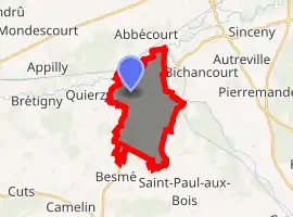
| |
 Manicamp  Manicamp | |
| Coordinates: 49°34′21″N 3°10′15″E | |
| Country | France |
| Region | Hauts-de-France |
| Department | Aisne |
| Arrondissement | Laon |
| Canton | Vic-sur-Aisne |
| Government | |
| • Mayor (2008–2014) | Patrick Orvane |
| Area 1 | 10.24 km2 (3.95 sq mi) |
| Population (2017-01-01)[1] | 307 |
| • Density | 30/km2 (78/sq mi) |
| Time zone | UTC+01:00 (CET) |
| • Summer (DST) | UTC+02:00 (CEST) |
| INSEE/Postal code | 02456 /02300 |
| Elevation | 38–69 m (125–226 ft) (avg. 38 m or 125 ft) |
| 1 French Land Register data, which excludes lakes, ponds, glaciers > 1 km2 (0.386 sq mi or 247 acres) and river estuaries. | |
Geography
The villages is located in the northwestern part of the commune, on the left bank of the river Ailette, which flows west through the northern part of the commune, then joins the Oise, which forms most of the commune's northern border.
Population
|
|
See also
References
- "Populations légales 2017". INSEE. Retrieved 6 January 2020.
| Wikimedia Commons has media related to Manicamp. |
This article is issued from Wikipedia. The text is licensed under Creative Commons - Attribution - Sharealike. Additional terms may apply for the media files.
