Barenton-Cel
Barenton-Cel is a commune in the department of Aisne in the Hauts-de-France region of northern France.
Barenton-Cel | |
|---|---|
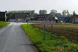 The road into Barenton-Cel | |
Location of Barenton-Cel 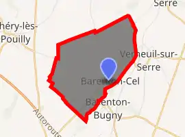
| |
 Barenton-Cel  Barenton-Cel | |
| Coordinates: 49°38′36″N 3°39′12″E | |
| Country | France |
| Region | Hauts-de-France |
| Department | Aisne |
| Arrondissement | Laon |
| Canton | Marle |
| Intercommunality | Pays de la Serre |
| Government | |
| • Mayor (2014-2020) | David Petit |
| Area 1 | 6.69 km2 (2.58 sq mi) |
| Population (2017-01-01)[1] | 114 |
| • Density | 17/km2 (44/sq mi) |
| Time zone | UTC+01:00 (CET) |
| • Summer (DST) | UTC+02:00 (CEST) |
| INSEE/Postal code | 02047 /02000 |
| Elevation | 63–106 m (207–348 ft) |
| 1 French Land Register data, which excludes lakes, ponds, glaciers > 1 km2 (0.386 sq mi or 247 acres) and river estuaries. | |
Geography
Barenton-Cel is located some 10 km north by north-east of Laon and 40 km south-east of Saint-Quentin. It can be accessed by the D547 road from Verneuil-sur-Serre in the north-east continuing southwest through the commune and the village to Aulnois-sous-Laon in the south-west. There is also the D545 road from Barenton-Bugny on the south-eastern border. The commune consists entirely of farmland with no other villages or hamlets.[2]
The Ru des Barentons stream forms the south-eastern border of the commune and flows north-east to join the Souche river in the north.[2]
Neighbouring communes and villages[2]
Places adjacent to Barenton-Cel | ||||||||||
|---|---|---|---|---|---|---|---|---|---|---|
| ||||||||||
Administration
List of Successive Mayors of Barenton-Cel[3]
| From | To | Name | Party | Position |
|---|---|---|---|---|
| 1995 | 2008 | Bernard Brazier | DVD | |
| 2008 | Present | David Petit | UMP then LR |
(Not all data is known)
Population
| Year | Pop. | ±% |
|---|---|---|
| 2006 | 148 | — |
| 2007 | 147 | −0.7% |
| 2008 | 147 | +0.0% |
| 2009 | 142 | −3.4% |
| 2010 | 136 | −4.2% |
| 2011 | 131 | −3.7% |
| 2012 | 133 | +1.5% |
| 2013 | 130 | −2.3% |
| 2014 | 126 | −3.1% |
| 2015 | 121 | −4.0% |
| 2016 | 117 | −3.3% |
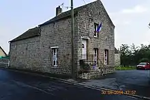
The Town Hall
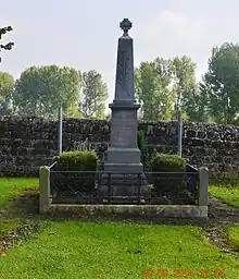
Barenton-Cel War Memorial
- Picture Gallery
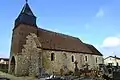 Barenton-Cel Church
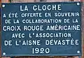 Plaque on the Church: "The Bell is given in remembrance of the collaboration of the American Red Cross with the Association of Devastated Aisne".
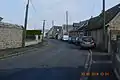 A street in Barenton-Cel
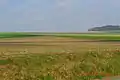 Barenton-Cel Landscape
See also
References
- "Populations légales 2017". INSEE. Retrieved 6 January 2020.
- Google Maps
- List of Mayors of France (in French)
External links
- Barenton-Cel on the old IGN website (in French)
- Bell Towers website (in French)
- 40000 Bell Towers website (in French)
- Barenton-Cel on Lion1906
- Barenton-Cel on Géoportail, National Geographic Institute (IGN) website (in French)
- Baranton Cel on the 1750 Cassini Map
| Wikimedia Commons has media related to Barenton-Cel. |
This article is issued from Wikipedia. The text is licensed under Creative Commons - Attribution - Sharealike. Additional terms may apply for the media files.