Estrées, Aisne
Estrées is a commune in the Aisne department in Hauts-de-France in northern France.
Estrées | |
|---|---|
_mairie.JPG.webp) The town hall of Estrées | |
Location of Estrées 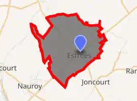
| |
 Estrées  Estrées | |
| Coordinates: 49°58′07″N 3°17′20″E | |
| Country | France |
| Region | Hauts-de-France |
| Department | Aisne |
| Arrondissement | Saint-Quentin |
| Canton | Bohain-en-Vermandois |
| Intercommunality | Pays du Vermandois |
| Government | |
| • Mayor (2008–2014) | Gérard Lempereur |
| Area 1 | 7.04 km2 (2.72 sq mi) |
| Population (2017-01-01)[1] | 412 |
| • Density | 59/km2 (150/sq mi) |
| Time zone | UTC+01:00 (CET) |
| • Summer (DST) | UTC+02:00 (CEST) |
| INSEE/Postal code | 02291 /02420 |
| Elevation | 97–149 m (318–489 ft) (avg. 136 m or 446 ft) |
| 1 French Land Register data, which excludes lakes, ponds, glaciers > 1 km2 (0.386 sq mi or 247 acres) and river estuaries. | |
In the Picard dialect, it is called Etré. It is one of many villages in the north of France bearing the name Estrées. The etymology of the name is from strata (cognate of English "street"), the word for the stone-layered Roman roads in the area (some of which turned into modern highways). Hence Estreti, village on the road which developed into Estrées.
Also known in ancient times as Strata or Estreti, history mentions an abbey in the 12th century. A parish was created there about 1189 with a priest sent from the abbey of Mont Saint Martin to buy land and help the poor. In 1777 Pierre Nicolas Leroy began manufacturing silk gauze here. Inhabitants are called Estrésiens.
Administration
| Term | Name | Party | Profession |
|---|---|---|---|
| 2001–2008 | Jean-Marie Courtois | ||
| 2008–2014 | Gérard Lempereur | ||
| Previous data not available | |||
Population
| Year | Pop. | ±% |
|---|---|---|
| 1962 | 424 | — |
| 1968 | 474 | +11.8% |
| 1975 | 401 | −15.4% |
| 1982 | 423 | +5.5% |
| 1990 | 434 | +2.6% |
| 1999 | 446 | +2.8% |
| 2008 | 407 | −8.7% |
See also
References
- "Populations légales 2017". INSEE. Retrieved 6 January 2020.
| Wikimedia Commons has media related to Estrées (Aisne). |
| Authority control |
|
|---|