Brassall, Queensland
Brassall is a suburb in the City of Ipswich, Queensland, Australia.[2] In the 2016 census, Brassall had a population of 10,898 people.[1]
| Brassall Ipswich, Queensland | |||||||||||||||
|---|---|---|---|---|---|---|---|---|---|---|---|---|---|---|---|
 Brassall | |||||||||||||||
| Coordinates | 27.5916°S 152.7352°E | ||||||||||||||
| Population | 10,898 (2016 census)[1] | ||||||||||||||
| • Density | 1,329/km2 (3,442/sq mi) | ||||||||||||||
| Postcode(s) | 4305 | ||||||||||||||
| Area | 8.2 km2 (3.2 sq mi) | ||||||||||||||
| Time zone | AEST (UTC+10:00) | ||||||||||||||
| Location |
| ||||||||||||||
| LGA(s) | City of Ipswich | ||||||||||||||
| State electorate(s) | Ipswich West | ||||||||||||||
| Federal Division(s) | Blair | ||||||||||||||
| |||||||||||||||
Geography
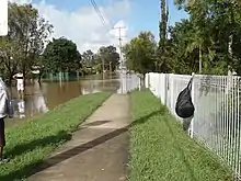
Brassall has a southern boundary partially marked by the Bremer River and a western alignment along Ironpot Creek. The northern boundary follows the Warrego Highway.[3] Brassall now incorporates part of the old suburb of Raymonds Hill.
History
The suburb name first appears on a plan drawn by surveyor James Warner on 6 October 1851; however, the origin of the suburb name is unknown.[2] It was also known as Hungry Flats, as was a stop over for bullock teams that were transporting logs from Pine Mountain to Hancocks saw mill at North Ipswich.
Brassall was a separate shire (Shire of Brassall) with its own council from March 1860 until 1 January 1917 when the area became part of the City of Ipswich.
The Brisbane Valley railway line passed through Brassall. The line opened from Ipswich to Lowood on 16 June 1884, and was extended through a number of stages until it reached Yarraman on 1 May 1913. The line closed in 1993. The disused rail corridor was used to construct the Brassall Bikepath, which is part of the Brisbane Valley Rail Trail.
Brassall Provisional School opened on 10 September 1894.[4] On 10 July 1899 it became Brassall State School.[5]
St George's Anglican Church at 30 Waterworks Road (27.5855°S 152.7540°E) was dedicated on 1923 by Archbishop Gerald Sharp. The altar was designed by the diocesan architects Atkinson and Conrad, and made by Mr L. Larsen of North Ipswich.[6] The church's closure on 15 November 1988 was approved by Assistant Bishop Ray Smith.[7]
Ipswich State High School opened on 1 July 1951.[5]
Ipswich Adventist School opened on 21 January 1968.[5]
The suburb was officially bounded and named in 1991.[8]
Since 2003, Brassall has been a key development area in the city of Ipswich. Formerly bushland and farming area leading into the West Moreton district; Brassall has been extensively developed. A new estate named "Grammar Park Estate" opened in Brassall in early 2002. It has since developed significantly with investors subdividing land. A property on Henry street was bought for over $1.5 million and has since been subdivided into over 28 house blocks. Grammar Park Estate now has over 1000 houses.
In the 2011 census, Brassall had a population of 9,245 people.[9]
In the 2016 census, Brassall had a population of 10,898 people.[1]
Heritage listings
Brassall has a number of heritage-listed sites, including
- Mihi Junction (27.5932°S 152.7536°E): Mihi Creek Complex[10]
- Parker Lane (27.593°S 152.7544°E): Klondyke Coke Ovens[11]
Education
Brassall State School is a government primary (Prep-6) school for boys and girls at Pine Mountain Road (27.5884°S 152.7483°E).[12][13] In 2018, the school had an enrolment of 811 students with 58 teachers (53 full-time equivalent) and 33 non-teaching staff (25 full-time equivalent).[14] It includes a special education program.[12][15]
Ipswich State High School is a government secondary (7-12) school for boys and girls at 1 Hunter Street (27.5910°S 152.7464°E).[12][16] In 2018, the school had an enrolment of 1554 students with 117 teachers (114 full-time equivalent) and 70 non-teaching staff (52 full-time equivalent).[14] It includes a special education program.[12][17]
Ipswich Adventist School is a private primary (Prep-6) school for boys and girls at 56 Hunter Street (27.5958°S 152.7458°E).[12][18] In 2018, the school had an enrolment of 107 students with 11 teachers (8 full-time equivalent) and 7 non-teaching staff (4 full-time equivalent).[14]
Amenities
The Ipswich City Council operates a fortnightly mobile library service which visits the shopping centre.[19]
The Islamic Society of Ipswich operate a mosque at cultural centre at 30 Waterworks Road (27.5857°S 152.7539°E) in the former St George's Anglican Church.[20]
Demographics
At the 2011 Australian Census the suburb recorded a population of 9,245.[21] Brassall is an area of Ipswich which has a higher demographic. As reported in the Australian Bureau of Statistics, Brassall's occupants hold higher levels of education than those from other suburbs. Brassall's occupants vary from retirees, young families and defence personnel.
References
- Australian Bureau of Statistics (27 June 2017). "Brassall (SSC)". 2016 Census QuickStats. Retrieved 20 October 2018.

- "Brassall – suburb in City of Ipswich (entry 45031)". Queensland Place Names. Queensland Government. Retrieved 16 May 2020.
- "Queensland Globe". State of Queensland. Retrieved 3 January 2017.
- "Opening and closing dates of Queensland Schools". Queensland Government. Retrieved 18 April 2019.
- Queensland Family History Society (2010), Queensland schools past and present (Version 1.01 ed.), Queensland Family History Society, ISBN 978-1-921171-26-0
- "Brassall Anglicans". Queensland Times. LXIV (11, 329). Queensland, Australia. 13 February 1923. p. 5. Retrieved 6 July 2020 – via National Library of Australia.
- Anglican Church of Southern Queensland. "Closed Churches". Archived from the original on 3 April 2019. Retrieved 3 July 2020.
- "Brassall (entry 45031)". Queensland Place Names. Queensland Government. Retrieved 21 June 2017.
- Australian Bureau of Statistics (31 October 2012). "Brassall (SSC)". 2011 Census QuickStats. Retrieved 2 January 2017.
- "Mihi Creek Complex (entry 700010)". Queensland Heritage Register. Queensland Heritage Council. Retrieved 9 July 2013.
- "Klondyke Coke Ovens (entry 602566)". Queensland Heritage Register. Queensland Heritage Council. Retrieved 9 July 2013.
- "State and non-state school details". Queensland Government. 9 July 2018. Archived from the original on 21 November 2018. Retrieved 21 November 2018.
- "Brassall State School". Retrieved 21 November 2018.
- "ACARA School Profile 2018". Australian Curriculum, Assessment and Reporting Authority. Retrieved 28 January 2020.
- "Brassall SS - Special Education Program". Retrieved 21 November 2018.
- "Ipswich State High School". Retrieved 21 November 2018.
- "Ipswich SHS - Special Education Program". Retrieved 21 November 2018.
- "Ipswich Adventist School". Retrieved 21 November 2018.
- "Ipswich Libraries: Mobile library schedule of stops - January to June 2018" (PDF). Ipswich City Council. Archived from the original (PDF) on 30 January 2018. Retrieved 30 January 2018.
- "Islamic Society of Ipswich Queensland". Archived from the original on 6 July 2020. Retrieved 6 July 2020.
- Australian Bureau of Statistics (31 October 2012). "Brassall (State Suburb)". 2011 Census QuickStats. Retrieved 27 June 2015.