Muirlea, Queensland
Muirlea is a rural locality in the City of Ipswich, Queensland, Australia.[2] In the 2016 census, Muirlea had a population of 190 people.[1]
| Muirlea Ipswich, Queensland | |||||||||||||||
|---|---|---|---|---|---|---|---|---|---|---|---|---|---|---|---|
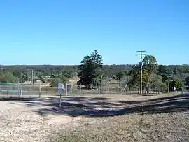 Pine Mountain Road, 2014 | |||||||||||||||
 Muirlea | |||||||||||||||
| Coordinates | 27.5686°S 152.7330°E | ||||||||||||||
| Population | 190 (2016 census)[1] | ||||||||||||||
| • Density | 27.9/km2 (72.4/sq mi) | ||||||||||||||
| Postcode(s) | 4306 | ||||||||||||||
| Area | 6.8 km2 (2.6 sq mi) | ||||||||||||||
| Time zone | AEST (UTC+10:00) | ||||||||||||||
| Location | |||||||||||||||
| LGA(s) | City of Ipswich | ||||||||||||||
| State electorate(s) | Ipswich West | ||||||||||||||
| Federal Division(s) | Blair | ||||||||||||||
| |||||||||||||||
Geography
Part of the north west boundary of the suburb is marked by the Brisbane River. The southern boundary aligns with the Warrego Highway.
History
The district was originally part of Brassall. It takes its present name from its former railway station, which in turn was named in June 1884, coined from the surname of local landowners John Muir and Andrew Muir with lea meaing pasture.[2]
References
| Wikimedia Commons has media related to Muirlea, Queensland. |
- Australian Bureau of Statistics (27 June 2017). "Muirlea (SSC)". 2016 Census QuickStats. Retrieved 20 October 2018.

- "Muirlea – locality in City of Ipswich (entry 48968)". Queensland Place Names. Queensland Government. Retrieved 16 November 2019.
- Peter Foley (20 June 2013). "Fire ants detected at Muirlea". The Queensland Times. Archived from the original on 8 August 2014. Retrieved 4 August 2014.
This article is issued from Wikipedia. The text is licensed under Creative Commons - Attribution - Sharealike. Additional terms may apply for the media files.