Woodend, Queensland
Woodend is an inner suburb of Ipswich in the City of Ipswich, Queensland, Australia.[2] At the 2016 census the population of Woodend was 1,302 people.[3]
| Woodend Ipswich, Queensland | |||||||||||||||
|---|---|---|---|---|---|---|---|---|---|---|---|---|---|---|---|
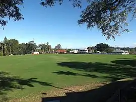 Ipswich Grammar School sports oval, 2016 | |||||||||||||||
| Population | 1,302 (2016 census)[1] | ||||||||||||||
| • Density | 1,000/km2 (2,590/sq mi) | ||||||||||||||
| Postcode(s) | 4305 | ||||||||||||||
| Area | 1.3 km2 (0.5 sq mi) | ||||||||||||||
| Location | |||||||||||||||
| LGA(s) | City of Ipswich | ||||||||||||||
| State electorate(s) | Ipswich | ||||||||||||||
| Federal Division(s) | Blair | ||||||||||||||
| |||||||||||||||
Geography
Woodend's northern and eastern border is defined by the meandering course of the Bremer River.
History
The origin of the suburb name is from the name given to the residence of Arthur Macalister, a Scottish migrant who became the second Premier of Queensland.[2]
Woodend claims a few firsts for the Ipswich area:
- In 1848 Woodend Pocket was the first coal-bearing crown land in the Ipswich area to be subdivided into small 'coal allotments
- In 1854 Englishman John Ferrett opened the first successful Ipswich coal mine in the Woodend area (The Radstock Pit)
- In 1862 John Panton grew the first cotton in Ipswich in the Woodend area
- One of Ipswich's first schools was opened by Daniel McGrath, 1847 in the Woodend area.[4]
Following its early days as coal lots, the Woodend area was mostly cleared of bush by the 1860s. Woodend became a middle class suburb with a residential heritage. Woodend became home to:
- Ipswich Grammar School, 1863
- St Mary's Convent School, established in 1863
- Saint Mary's College in 1946.[4]
At the 2016 census the population of Woodend was 1,302 people.[3]
Transport
Woodend has no train station, however it is serviced by the nearby Ipswich Station.
Education
- Saint Edmund's College
- Saint Mary's College
- St Mary's Primary
- Ipswich Grammar School, established in 1863, first school to open as a result of the Grammar Schools Act of 1860
Parks and Sports Facilities
- Woodend Park
- Smith Park
- Timothy Molony Park (Owned by Saint Mary's Catholic Parish)
Places of worship
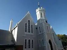
- St Mary's Catholic Church, cnr Roseberry and Elizabeth Streets
References
- Australian Bureau of Statistics (27 June 2017). "Woodend (QLD) (State Suburb)". 2016 Census QuickStats. Retrieved 29 March 2018.

- "Woodend – suburb (entry 45090)". Queensland Place Names. Queensland Government. Retrieved 23 June 2017.
- "2016 Census quick stats". Australia Bureau of Statistics. Retrieved 20 April 2018.
- "About Ipswich suburb place names". Ipswich City Council. Retrieved 20 September 2017.