Churchill, Queensland
Churchill is a suburb of Ipswich in the City of Ipswich, Queensland, Australia.[2] In the 2016 census, Churchill had a population of 1,860 people.[1]
| Churchill Ipswich, Queensland | |||||||||||||||
|---|---|---|---|---|---|---|---|---|---|---|---|---|---|---|---|
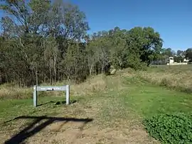 Mary Evans Reserve, 2016 | |||||||||||||||
 Churchill | |||||||||||||||
| Coordinates | 27.6355°S 152.7513°E | ||||||||||||||
| Population | 1,860 (2016 census)[1] | ||||||||||||||
| • Density | 1,090/km2 (2,830/sq mi) | ||||||||||||||
| Postcode(s) | 4305 | ||||||||||||||
| Area | 1.7 km2 (0.7 sq mi) | ||||||||||||||
| Time zone | AEST (UTC+10:00) | ||||||||||||||
| Location | |||||||||||||||
| LGA(s) | City of Ipswich | ||||||||||||||
| State electorate(s) | Ipswich | ||||||||||||||
| Federal Division(s) | Blair | ||||||||||||||
| |||||||||||||||
Geography
The western boundary is marked by the Bremer River, while the eastern boundary follows Deebing Creek.
History
Residents in the Fassifern Valley petitioned the Queensland Government to build a railway line to their district, and the first section of the Dugandan railway line was opened on 10 July 1882 as far as Harrisville. This is considered to be Queensland's first branch railway. Churchill was served by the Churchill railway station at Lobb Street (27.6356°S 152.7486°E).[3][4] The branch was extended to Dugandan on 12 September 1887.[5][6] The line from Churchill to Dugandan closed in 1964 with the remaining line being known as the Churchill branch railway.[5]
Churchill State School opened on 29 January 1923.[7]
In the 2016 census, Churchill had a population of 1,860 people.[1]
Education
Churchill State School is a government primary (Prep-6) school for boys and girls at Warwick Road (27.6426°S 152.7506°E).[8][9] In 2017, the school had an enrolment of 376 students with 29 teachers (24 full-time equivalent) and 22 non-teaching staff (14 full-time equivalent).[10] It includes a special education program.[8]
There are no secondary schools in Churchill. The nearest secondary school is Bremer State High School in the neighbouring suburb of Ipswich.[11]
References
- Australian Bureau of Statistics (27 June 2017). "Churchill (SSC)". 2016 Census QuickStats. Retrieved 20 October 2018.

- "Churchill – suburb in City of Ipswich (entry 45036)". Queensland Place Names. Queensland Government. Retrieved 26 January 2020.
- "Map 40: Two-mile series" (Map). Queensland Government. 1952. Archived from the original on 8 June 2020. Retrieved 9 June 2020.
- "Churchill – railway station in City of Ipswich (entry 7229)". Queensland Place Names. Queensland Government. Retrieved 9 June 2020.
- Kerr, John (1990). Triumph of narrow gauge : a history of Queensland Railways. Boolarong Publications. pp. 57–58, 224. ISBN 978-0-86439-102-5.
- Johnson, M.; Saunders, K. (2007). "Working The Land: An historical overview of Boonah and its northern district" (PDF). State of Queensland. Archived (PDF) from the original on 29 September 2009. Retrieved 24 October 2009.
- Queensland Family History Society (2010), Queensland schools past and present (Version 1.01 ed.), Queensland Family History Society, ISBN 978-1-921171-26-0
- "State and non-state school details". Queensland Government. 9 July 2018. Archived from the original on 21 November 2018. Retrieved 21 November 2018.
- "Churchill State School". Retrieved 21 November 2018.
- "ACARA School Profile 2017". Archived from the original on 22 November 2018. Retrieved 22 November 2018.
- "Queensland Globe". State of Queensland. Retrieved 5 March 2020.
External links
- "Churchill". Queensland Places. Centre for the Government of Queensland, University of Queensland.