Sadliers Crossing, Queensland
Sadliers Crossing is a suburb of Ipswich in the City of Ipswich, Queensland, Australia.[2] At the 2016 Australian Census the suburb recorded a population of 1,366.[1]
| Sadliers Crossing Ipswich, Queensland | |||||||||||||||
|---|---|---|---|---|---|---|---|---|---|---|---|---|---|---|---|
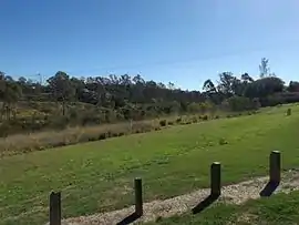 Bremer River parkland, 2016 | |||||||||||||||
 Sadliers Crossing | |||||||||||||||
| Coordinates | 27°37′S 152°45′E | ||||||||||||||
| Population | 1,366 (2016 census)[1] | ||||||||||||||
| • Density | 1,408/km2 (3,647/sq mi) | ||||||||||||||
| Postcode(s) | 4305 | ||||||||||||||
| Area | 0.97 km2 (0.4 sq mi) | ||||||||||||||
| Location | |||||||||||||||
| LGA(s) | City of Ipswich | ||||||||||||||
| State electorate(s) | Ipswich | ||||||||||||||
| Federal Division(s) | Blair | ||||||||||||||
| |||||||||||||||
History
The origin of the suburb name is from an early property owner by the name of Thomas Sadlier.[2]
At the 2016 Australian Census the suburb recorded a population of 1,366.[1]
Heritage listings
Sadliers Crossing has a number of heritage-listed sites, including:
- over Bremer River between Tallon Street, Sadliers Crossing and Dixon Street, Wulkuraka: Sadliers Crossing Railway Bridge[3]
Transport
Thomas Street Railway Station provides Queensland Rail City network services to Rosewood, Ipswich and Brisbane via Ipswich.
Education
Unlike most Queensland state schools which are named for the suburb/locality that they serve, the Queensland state primary school in Sadliers Crossing is called Blair State School in honour of Sir James Blair who was instrumental in the establishment of the school.[4]
References
- Australian Bureau of Statistics (27 June 2017). "Sadliers Crossing (State Suburb)". 2016 Census QuickStats. Retrieved 29 March 2018.

- "Sadliers Crossing – suburb (entry 45076)". Queensland Place Names. Queensland Government. Retrieved 22 June 2017.
- "Sadliers Crossing Railway Bridge (entry 602569)". Queensland Heritage Register. Queensland Heritage Council. Retrieved 9 July 2013.
- "Our School". Blair State School. Retrieved 29 October 2015.