Karrabin, Queensland
Karrabin is a locality in the City of Ipswich, Queensland, Australia.[2]
| Karrabin Ipswich, Queensland | |||||||||||||||
|---|---|---|---|---|---|---|---|---|---|---|---|---|---|---|---|
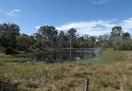 Dam along Redhill Road, 2015 | |||||||||||||||
 Karrabin | |||||||||||||||
| Coordinates | 27.6045°S 152.7099°E | ||||||||||||||
| Population | 474 (2011)[1] | ||||||||||||||
| Postcode(s) | 4306 | ||||||||||||||
| Location | |||||||||||||||
| LGA(s) | City of Ipswich | ||||||||||||||
| State electorate(s) | Ipswich West | ||||||||||||||
| Federal Division(s) | Blair | ||||||||||||||
| |||||||||||||||
Geography
The northern boundary is marked by the Warrego Highway.
History
The origin of the suburb name is from the Bundjalung Aboriginal language meaning red gum.[2]
At the 2011 census Karrabin had a population of 474 people.[1]
Demographics
In the 2011 Census the population of Karrabin was 474, 48.5% female and 51.5% male.[1] The median/average age of the Karrabin population is 39 years of age, 2 years above the Australian average. 86.9% of people living in Karrabin were born in Australia. The other top responses for country of birth were New Zealand 2.7%, England 2.1%, Germany 0.6%, Fiji 0.6%, Jamaica 0.6%. 96% of people speak English as their first language 0.6% French, 0.6% Mandarin, 0.6% Greek.[1]
Transport
Karrabin Railway Station provides Queensland Rail City network services to Rosewood, Ipswich and Brisbane via Ipswich.
Education
References
- Australian Bureau of Statistics (31 October 2012). "Karrabin (State Suburb)". 2011 Census QuickStats. Retrieved 25 September 2014.

- "Karrabin – locality (entry 45055)". Queensland Place Names. Queensland Government. Retrieved 21 June 2017.