Dinmore, Queensland
Dinmore is a suburb of the City of Ipswich, Queensland, Australia.[2] In the 2016 census, Dinmore had a population of 875 people. According to the 2016 Australian Census the Dinmore unemployment rate was 16.7%, in comparison to the Australian unemployment rate of 6.9%.[1]
| Dinmore Ipswich, Queensland | |||||||||||||||
|---|---|---|---|---|---|---|---|---|---|---|---|---|---|---|---|
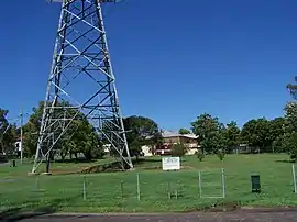 Dog park, Dinmore, 2010 | |||||||||||||||
| Population | 875 (2016 census)[1] | ||||||||||||||
| Postcode(s) | 4303 | ||||||||||||||
| Location | |||||||||||||||
| LGA(s) | City of Ipswich | ||||||||||||||
| State electorate(s) | Bundamba | ||||||||||||||
| Federal Division(s) | Blair | ||||||||||||||
| |||||||||||||||
History
The origin of the suburb name is from a village called Hope under Dinmore in Herefordshire, England.[2]
On 16 April 1887 auctioneer R.J. Cottell offered 140 suburban blocks in the Dinmore Township Estate. The estate was split by the Ipswich railway line into two sections. The section to the north of the railway line was bounded by the railway line to the south, Earl Street to the west, the Warrego Highway to the north and the River Road to the east. The section to the south of the railway line is bounded by the railway line to the north, River Road to the east, Brisbane Road to the south (to its intersection with Robert Street). The Dinmore railway station was to the immediate east of the estate.[3][4]
Dinmore State School opened on 19 January 1891. It was at 28A River Road (27.594°S 152.832°E).[5] It closed on 31 December 2009.[6][7]
In October 1901 a Methodist church was being erected at a cost of £200.[8] It opened on Saturday 9 November 1901.[9]
St Matthew's Anglican Church was dedicated circa 1915. It closed circa 1989.[10]
In the 2006 census, Dinmore had a population of 897 people.[11]
In the 2011 census, Dinmore had a population of 907 people.[12]
Geography
Dinmore is situated in the crossroads area of, and is basically bordered by, the Ipswich Motorway, the Cunningham Highway, and the Warrego Highway. Brisbane Road, the main street leading to the nearby historical centre of Ipswich, runs through the middle of Dinmore. Many of the locals call Dinmore the gateway to the city, because it is at the entrance way to Ipswich. As well as being the entrance to Brisbane from the west. Brisbane road, in Dinmore, has a few shops and restaurants, with main shopping areas in nearby Booval and Redbank. Dinmore is only minutes from the city, but still has the feel of a rural suburb, with parks and green spaces throughout.
Transport
Dinmore railway station provides access to regular Queensland Rail City network services to Brisbane, Ipswich and Rosewood via Ipswich. As well, regular bus services are available throughout. Dinmore Train station provides a hub for commuters coming from the Warrego Highway. A new car park recently built at the station allows for a substantial access point for driving commuters.
References
- Australian Bureau of Statistics (27 June 2017). "Dinmore (SSC)". 2016 Census QuickStats. Retrieved 23 October 2018.

- "Dinmore (entry 45041)". Queensland Place Names. Queensland Government. Retrieved 18 December 2016.
- "Dinmore Township Estate". 1887. hdl:10462/deriv/257038. Cite journal requires
|journal=(help) - "Advertising". Queensland Times, Ipswich Herald And General Advertiser. XXVIII (3877). Queensland, Australia. 16 April 1887. p. 8. Retrieved 26 November 2019 – via National Library of Australia.
- Chiclcott, Tanya; Vlasic, Kimberley (7 June 2013). "Full school asssets sale list". The Courier-Mail. Retrieved 30 October 2019.
- Queensland Family History Society (2010), Queensland schools past and present (Version 1.01 ed.), Queensland Family History Society, ISBN 978-1-921171-26-0
- "Opening and closing dates of Queensland Schools". Queensland Government. Retrieved 30 October 2019.
- "METHODIST SYNOD". Darling Downs Gazette. XLIII (10, 027). Queensland, Australia. 28 October 1901. p. 3. Retrieved 31 October 2020 – via National Library of Australia.
- "DINMORE NEW METHODIST CHURCH". Queensland Times, Ipswich Herald And General Advertiser. XLII (6363). Queensland, Australia. 9 November 1901. p. 4. Retrieved 31 October 2020 – via National Library of Australia.
- "Closed Anglican Churches". Anglican Church South Queensland. Archived from the original on 3 April 2019. Retrieved 29 June 2020.
- Australian Bureau of Statistics (25 October 2007). "Dinmore (SSC)". 2006 Census QuickStats. Retrieved 28 December 2016.
- Australian Bureau of Statistics (31 October 2012). "Dinmore (SSC)". 2011 Census QuickStats. Retrieved 28 December 2016.
Further reading
- Dinmore State School (1966), Diamond jubilee celebration of the Dinmore State School on Saturday, 3rd September, 1966 : 1891-1966, Dinmore State School Parents and Citizens Association
- Dinmore State School Centenary 1891-1991, Ipswich QLD West Moreton Print Production Unit, 1991