Ironbark, Queensland
Ironbark is a rural locality in the City of Ipswich, Queensland, Australia.[2] In the 2016 census, Ironbark had a population of 604 people.[1]
| Ironbark Ipswich, Queensland | |||||||||||||||
|---|---|---|---|---|---|---|---|---|---|---|---|---|---|---|---|
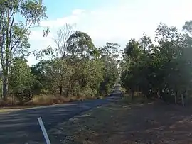 Beethams Road, 2014 | |||||||||||||||
 Ironbark | |||||||||||||||
| Coordinates | 27.5555°S 152.6750°E | ||||||||||||||
| Population | 604 (2016 census)[1] | ||||||||||||||
| • Density | 40.00/km2 (103.6/sq mi) | ||||||||||||||
| Postcode(s) | 4306 | ||||||||||||||
| Area | 15.1 km2 (5.8 sq mi) | ||||||||||||||
| Time zone | AEST (UTC+10:00) | ||||||||||||||
| Location | |||||||||||||||
| LGA(s) | City of Ipswich | ||||||||||||||
| State electorate(s) | Ipswich West | ||||||||||||||
| Federal Division(s) | Blair | ||||||||||||||
| |||||||||||||||
Geography
The eastern boundary of Ironbark is marked by the Brisbane Valley Highway and the southern boundary follows the Warrego Highway.
References
- Australian Bureau of Statistics (27 June 2017). "Ironbark (SSC)". 2016 Census QuickStats. Retrieved 20 October 2018.

- "Ironbark – locality in City of Ipswich (entry 45052)". Queensland Place Names. Queensland Government. Retrieved 16 November 2019.
This article is issued from Wikipedia. The text is licensed under Creative Commons - Attribution - Sharealike. Additional terms may apply for the media files.