Pine Mountain, Queensland
Pine Mountain is a semi-rural locality of City of Ipswich, Queensland, Australia.[2]
| Pine Mountain Ipswich, Queensland | |||||||||||||||
|---|---|---|---|---|---|---|---|---|---|---|---|---|---|---|---|
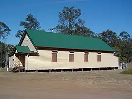 Pine Mountain Community Hall, 2014 | |||||||||||||||
| Population | 1,667 (2016 census)[1] | ||||||||||||||
| Postcode(s) | 4306 | ||||||||||||||
| LGA(s) | City of Ipswich | ||||||||||||||
| State electorate(s) | Ipswich West | ||||||||||||||
| Federal Division(s) | Blair | ||||||||||||||
| |||||||||||||||
Geography
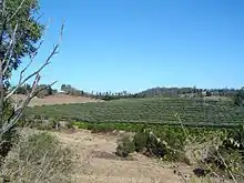
Pine Mountain is located in the Lockyer Valley. This area consists mostly of rural properties and acreages with historical farmhouses and buildings.
The mountain of the same name rises to a height of 233 metres above sea level and is located in the middle of the area. The area is bounded on the northeast by the Brisbane River and on the south by the Warrego Highway. The locality of Muirlea is considered part of the suburb of Pine Mountain. Araucaria cunninghamii, also known as the hoop pine is very common in the area.
History
The original inhabitants of the Pine Mountain area were the Ugarapul Aboriginal people. In 1824, the explorers Oxley and Cunningham mentioned meeting an elderly Aboriginal man who had been fishing with a spear near Upper Blackwall. Cunningham described his friendliness and his "open frankness of countenance" as he provided them with information regarding convenient places to cross the river and travelled with them to the foot of Pine Mountain.[3]
By the 1850s, loggers had moved into the area due to abundant timber provided by the hoop pine. Some logs were transported to Ipswich using bullock teams, while others were transported down the Brisbane River.
After tracts of land were cleared farming commenced, with the early settlers producing lucerne, maize and cotton. Orchards were started and dairying became important. A small butter factory, a school and several churches were established. Of these only the Catholic Church remains.
On Sunday 24 February 1865 a Roman Catholic chapel was opened by Bishop James Quinn.[4][5]
The Brisbane Valley railway line was established in 1884, connecting Ipswich to Lowood and passing through Pine Mountain. This line still exists but is disused.
St Peter's Anglican Church opened circa 1886. It closed circa 1962.[6]
References
- Australian Bureau of Statistics (27 June 2017). "Pine Mountain (Qld) (State Suburb)". 2016 Census QuickStats. Retrieved 19 March 2018.

- "Pine Mountain – locality (entry 49133)". Queensland Place Names. Queensland Government. Retrieved 27 June 2017.
- "Pine Mountain Then & Now" (PDF). Ipswich City Council. Archived from the original on 27 September 2011. Retrieved 13 April 2020.CS1 maint: unfit URL (link)
- "OPENING OF THE ROMAN CATHOLIC CHAPEL, PINE MOUNTAIN". Queensland Times, Ipswich Herald And General Advertiser. IV (430). Queensland, Australia. 28 February 1865. p. 3. Retrieved 11 August 2020 – via National Library of Australia.
- "PINE MOUNTAIN CHAPEL". Queensland Times, Ipswich Herald And General Advertiser. IV (431). Queensland, Australia. 4 March 1865. p. 3. Retrieved 20 November 2020 – via National Library of Australia.
- Anglican Church of Southern Queensland. "Closed Churches". Archived from the original on 3 April 2019. Retrieved 3 July 2020.
External links
| Wikimedia Commons has media related to Pine Mountain, Queensland. |