West Ipswich, Queensland
West Ipswich is a suburb of Ipswich in the City of Ipswich, Queensland, Australia. At the 2016 census, West Ipswich recorded a population of 494.[1]
| West Ipswich Ipswich, Queensland | |||||||||||||||
|---|---|---|---|---|---|---|---|---|---|---|---|---|---|---|---|
 Hooper Street, 2016 | |||||||||||||||
 West Ipswich | |||||||||||||||
| Coordinates | 27°37′S 152°45′E | ||||||||||||||
| Population | 494 (2016 census)[1] | ||||||||||||||
| • Density | 686/km2 (1,777/sq mi) | ||||||||||||||
| Postcode(s) | 4305 | ||||||||||||||
| Area | 0.72 km2 (0.3 sq mi) | ||||||||||||||
| Location | |||||||||||||||
| LGA(s) | City of Ipswich | ||||||||||||||
| State electorate(s) | Ipswich | ||||||||||||||
| Federal Division(s) | Blair | ||||||||||||||
| |||||||||||||||
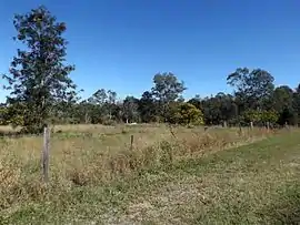
Geography
The western boundary of the suburb follows a section of the Bremer River and part of the northern boundary aligns with the Main Line railway.
History
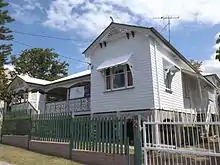
West Ipswich was earlier known as Little Ipswich when urban settlers inhabited the area in 1840s. The suburb covered various prominent places such as Brisbane Street shopping area, the showground, Denmark Hill, etc., which were transferred to the central suburb of Ipswich in 1991. It still has many old buildings that date back to 1900s.[2]
The Little Ipswich railway station was on the Dugandan railway line from 1882 to 1964 and remained on the Churchill railway line after the closure of most of the Dugandan line ni 1964.[3][4][5] It was on the south-east corner of Pound and Keogh Streets (27.6216°S 152.7504°E).[6]
At the 2016 census, West Ipswich recorded a population of 494.[1]
Heritage listings
West Ipswich has a number of heritage-listed sites, including:
- 277 Brisbane Street: City View Hotel[7]
- 1 Burnett Street: William Berry residence[8]
- 2 Burnett Street: Idavine[9]
- 6 Burnett Street: Notnel[10]
- 12 Omar Street: Ipswich West State School[11]
Education
- West Ipswich State School
References
- Australian Bureau of Statistics (27 June 2017). "West Ipswich (State Suburb)". 2016 Census QuickStats. Retrieved 29 March 2018.

- "West Ipswich". Queensland Places. University of Queensland. Retrieved 9 June 2020.
- "Little Ipswich – railway station in City of Ipswich (entry 19597)". Queensland Place Names. Queensland Government. Retrieved 9 June 2020.
- Kerr, John (1990). Triumph of narrow gauge : a history of Queensland Railways. Boolarong Publications. pp. 57–58, 224. ISBN 978-0-86439-102-5.
- "Map 40: Two-mile series" (Map). Queensland Government. 1952. Archived from the original on 8 June 2020. Retrieved 9 June 2020.
- Gregory's Street Directory of Brisbane and Suburbs and Metropolitan Road Guide (11 ed.). 1975.
- "City View Hotel (entry 600557)". Queensland Heritage Register. Queensland Heritage Council. Retrieved 9 July 2013.
- "Residence, 1 Burnett Street (c1874) (entry 600570)". Queensland Heritage Register. Queensland Heritage Council. Retrieved 9 July 2013.
- "Idavine (entry 600572)". Queensland Heritage Register. Queensland Heritage Council. Retrieved 9 July 2013.
- "Notnel (entry 600571)". Queensland Heritage Register. Queensland Heritage Council. Retrieved 9 July 2013.
- "Little Ipswich State School (entry 600606)". Queensland Heritage Register. Queensland Heritage Council. Retrieved 9 July 2013.