California Historical Landmarks in Ventura County, California
This list includes properties and districts listed on the California Historical Landmark listing in Ventura County, California. Click the "Map of all coordinates" link to the right to view a Google map of all properties and districts with latitude and longitude coordinates in the table below.
| Image | [1] | Landmark name | Location | City or town | Summary |
|---|---|---|---|---|---|
.jpg.webp) Grandma Prisbrey's Bottle Village |
939 | Grandma Prisbrey's Bottle Village | 4595 Cochran St. 34°16′44″N 118°42′14″W |
Simi Valley | |
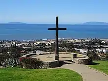 Hill of the Cross |
113 | Hill of the Cross | Grant Park 34°16′52″N 119°17′53″W |
Ventura | |
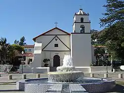 Mission San Buenaventura |
310 | Mission San Buenaventura | 210 E. Main St. 34°16′52″N 119°17′53″W |
Ventura | Also on the NRHP list as NPS-75000496 |
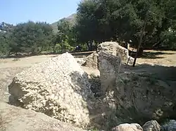
 Old Mission Reservoir |
114 | Old Mission Reservoir | Eastwood Park |
Ventura | Also on the NRHP list as NPS-75000496 |
.jpg.webp) Olivas Adobe |
115 | Olivas Adobe | 4200 Olivas Park 34°14′40″N 119°14′28″W |
Ventura | Also on the NRHP list as NPS-79000570 |
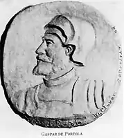 Portolà Expedition |
727 | Portolà Expedition | Santa Paula Boys Club Rec Center 34°21′21″N 119°03′03″W |
Santa Paula | On August 11, 1769, the Portolá Expedition arrived at the junction of the Arroyo Mupu and Santa Paula Creek, at a place they named the Holy Martyrs Ipolito and Cassiano. The priests of the Mission San Buenaventura here established the Asistencia Santa Paula, where they held services for the Mupu Indians. |
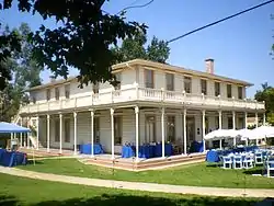
Rancho Camulos |
553 | Rancho Camulos | 5164 East Telegraph Rd. 34°24′20″N 118°45′24″W |
Piru | Also on the NRHP list as NPS-96001137 |
 Rancho Simi |
979 | Rancho Simi | 137 Strathearn Place 34°16′28″N 118°48′04″W |
Simi Valley | |
 San Buenaventura Mission Aqueduct |
114-1 | San Buenaventura Mission Aqueduct | 234 Canada Larga Rd. |
Ventura | Also on the NRHP list as NPS-75000497 |
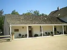
 Stagecoach Inn |
659 | Stagecoach Inn | 51 Ventu Park Rd. 34°10′41″N 118°54′41″W |
Newbury Park | Also on the NRHP list as NPS-75000495 |
 Sycamore Tree |
756 | Sycamore Tree | State Hwy 126 at Hall Rd. 34°22′44″N 118°59′23″W |
Santa Paula | Between Santa Paula and Fillmore |
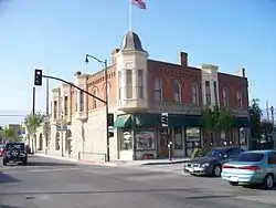 Union Oil Company Building |
996 | Union Oil Company Building | 1003 E. Main St. 34°21′15″N 119°03′32″W |
Santa Paula | Also on the NRHP list as NPS-86002619 |
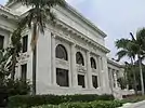 Ventura County Courthouse |
847 | Ventura County Courthouse | 501 Poli St. 34°16′57″N 119°17′32″W |
Ventura | Also on the NRHP list as NPS-71000211 |
Warring Park |
624 | Warring Park | 700 block of Orchard St. 34°25′01″N 118°47′29″W |
Piru | Portolá found Piru Indians tribe at site |
See also
| Wikimedia Commons has media related to California Historical Landmarks in Ventura County, California. |
References
- "California Historical Landmarks By County". Ohp.parks.ca.gov. Retrieved 2019-04-03.
| Lists by county |
|  |
|---|---|---|
| Lists by city |
| |
| Other lists | ||
This article is issued from Wikipedia. The text is licensed under Creative Commons - Attribution - Sharealike. Additional terms may apply for the media files.